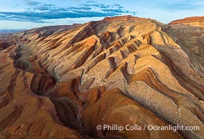
Aerial Photo of Raplee Ridge near Mexican Hat, Utah. Raplee Ridge is a spectacular series of multicolored triangular flatirons near the San Juan River. Often called "the Raplee Anticline" the geologic structure is in fact better described as a monocline, according to the Utah Geological Survey.
Location: Mexican Hat, Utah
Image ID: 39489
Location: Mexican Hat, Utah
Image ID: 39489
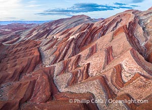
Aerial Photo of Raplee Ridge near Mexican Hat, Utah. Raplee Ridge is a spectacular series of multicolored triangular flatirons near the San Juan River. Often called "the Raplee Anticline" the geologic structure is in fact better described as a monocline, according to the Utah Geological Survey.
Location: Mexican Hat, Utah
Image ID: 39490
Location: Mexican Hat, Utah
Image ID: 39490
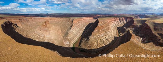
Goosenecks on the San Juan River near Lime Ridge, Utah. Deep canyons formed by the San Juan River near Mexican Hat are seen in this aerial panoramic photo.
Location: Mexican Hat, Utah
Image ID: 39487
Panorama dimensions: 4625 x 11971
Location: Mexican Hat, Utah
Image ID: 39487
Panorama dimensions: 4625 x 11971
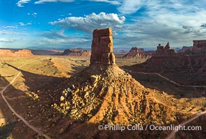
Castle Butte at Sunset in the Valley of the Gods, Utah. Aerial photo.
Location: Valley of the Gods, Mexican Hat, Utah
Image ID: 39488
Location: Valley of the Gods, Mexican Hat, Utah
Image ID: 39488
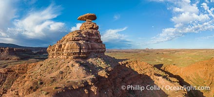
Aerial Photo of Mexican Hat Rock, Utah. The capstone of Mexican Hat Rock is 60 feet wide by 12 feet high and has two climbing routes.
Location: Mexican Hat, Utah
Image ID: 39491
Location: Mexican Hat, Utah
Image ID: 39491
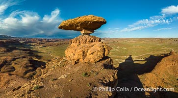
Aerial Photo of Mexican Hat Rock, Utah. The capstone of Mexican Hat Rock is 60 feet wide by 12 feet high and has two climbing routes.
Location: Mexican Hat, Utah
Image ID: 39492
Panorama dimensions: 4916 x 8923
Location: Mexican Hat, Utah
Image ID: 39492
Panorama dimensions: 4916 x 8923