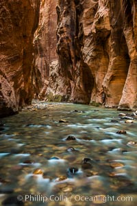
The Virgin River Narrows, where the Virgin River has carved deep, narrow canyons through the Zion National Park sandstone, creating one of the finest hikes in the world.
Location: Virgin River Narrows, Zion National Park, Utah
Image ID: 28580
Location: Virgin River Narrows, Zion National Park, Utah
Image ID: 28580
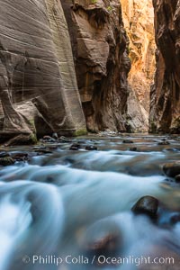
The Virgin River Narrows, where the Virgin River has carved deep, narrow canyons through the Zion National Park sandstone, creating one of the finest hikes in the world.
Location: Virgin River Narrows, Zion National Park, Utah
Image ID: 28581
Location: Virgin River Narrows, Zion National Park, Utah
Image ID: 28581
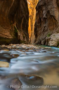
The Virgin River Narrows, where the Virgin River has carved deep, narrow canyons through the Zion National Park sandstone, creating one of the finest hikes in the world.
Location: Virgin River Narrows, Zion National Park, Utah
Image ID: 28582
Location: Virgin River Narrows, Zion National Park, Utah
Image ID: 28582
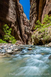
The Virgin River Narrows, where the Virgin River has carved deep, narrow canyons through the Zion National Park sandstone, creating one of the finest hikes in the world.
Location: Virgin River Narrows, Zion National Park, Utah
Image ID: 28584
Location: Virgin River Narrows, Zion National Park, Utah
Image ID: 28584
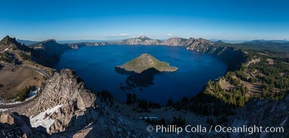
Panorama of Crater Lake from Watchman Lookout Station, panoramic picture. The Watchman Lookout Station No. 168 is one of two fire lookout towers in Crater Lake National Park in southern Oregon. For many years, National Park Service personnel used the lookout to watch for wildfires during the summer months. It is also a popular hiking destination because it offers an excellent view of Crater Lake and the surrounding area.
Location: Crater Lake National Park, Oregon
Image ID: 28632
Panorama dimensions: 8130 x 16987
Location: Crater Lake National Park, Oregon
Image ID: 28632
Panorama dimensions: 8130 x 16987
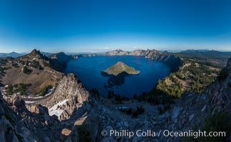
Panorama of Crater Lake from Watchman Lookout Station, panoramic picture. The Watchman Lookout Station No. 168 is one of two fire lookout towers in Crater Lake National Park in southern Oregon. For many years, National Park Service personnel used the lookout to watch for wildfires during the summer months. It is also a popular hiking destination because it offers an excellent view of Crater Lake and the surrounding area.
Location: Crater Lake National Park, Oregon
Image ID: 28634
Panorama dimensions: 7866 x 12754
Location: Crater Lake National Park, Oregon
Image ID: 28634
Panorama dimensions: 7866 x 12754
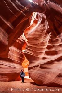
A hiker admiring the striated walls and dramatic light within Antelope Canyon, a deep narrow slot canyon formed by water and wind erosion.
Location: Navajo Tribal Lands, Page, Arizona
Image ID: 17996
Location: Navajo Tribal Lands, Page, Arizona
Image ID: 17996
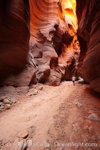
Hiker in Buckskin Gulch. A hiker considers the towering walls and narrow passageway of Buckskin Gulch, a dramatic slot canyon forged by centuries of erosion through sandstone. Buckskin Gulch is the worlds longest accessible slot canyon, running from the Paria River toward the Colorado River. Flash flooding is a serious danger in the narrows where there is no escape.
Location: Buckskin Gulch, Paria Canyon-Vermilion Cliffs Wilderness, Arizona
Image ID: 20710
Location: Buckskin Gulch, Paria Canyon-Vermilion Cliffs Wilderness, Arizona
Image ID: 20710
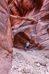
Suspended log in Buckskin Gulch. A hiker considers a heavy log stuck between the narrow walls of Buckskin Gulch, placed there by a flash flood some time in the past. Buckskin Gulch is the world's longest accessible slot canyon, forged by centuries of erosion through sandstone. Flash flooding is a serious danger in the narrows where there is no escape.
Location: Buckskin Gulch, Paria Canyon-Vermilion Cliffs Wilderness, Arizona
Image ID: 20717
Location: Buckskin Gulch, Paria Canyon-Vermilion Cliffs Wilderness, Arizona
Image ID: 20717
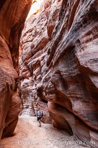
Hiker in Buckskin Gulch. A hiker considers the towering walls and narrow passageway of Buckskin Gulch, a dramatic slot canyon forged by centuries of erosion through sandstone. Buckskin Gulch is the worlds longest accessible slot canyon, running from the Paria River toward the Colorado River. Flash flooding is a serious danger in the narrows where there is no escape.
Location: Buckskin Gulch, Paria Canyon-Vermilion Cliffs Wilderness, Arizona
Image ID: 20772
Location: Buckskin Gulch, Paria Canyon-Vermilion Cliffs Wilderness, Arizona
Image ID: 20772
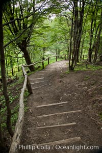
Hiking path through trees, Tierra del Fuego National Park, Argentina.
Location: Tierra del Fuego National Park, Ushuaia, Argentina
Image ID: 23609
Location: Tierra del Fuego National Park, Ushuaia, Argentina
Image ID: 23609
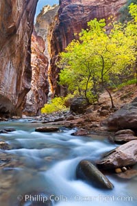
Yellow cottonwood trees in autumn, fall colors in the Virgin River Narrows in Zion National Park.
Location: Virgin River Narrows, Zion National Park, Utah
Image ID: 26088
Location: Virgin River Narrows, Zion National Park, Utah
Image ID: 26088
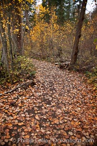
Hiking trail, trees, autumn leaves.
Location: Adams River, Roderick Haig-Brown Provincial Park, British Columbia, Canada
Image ID: 26187
Location: Adams River, Roderick Haig-Brown Provincial Park, British Columbia, Canada
Image ID: 26187
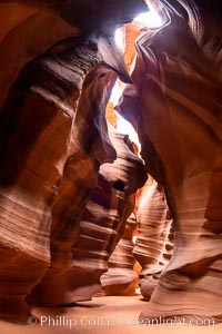
Upper Antelope Canyon, a spectacular slot canyon near Page, Arizona.
Location: Navajo Tribal Lands, Page, Arizona
Image ID: 36041
Location: Navajo Tribal Lands, Page, Arizona
Image ID: 36041
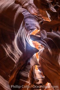
Upper Antelope Canyon, a spectacular slot canyon near Page, Arizona.
Location: Navajo Tribal Lands, Page, Arizona
Image ID: 36042
Location: Navajo Tribal Lands, Page, Arizona
Image ID: 36042
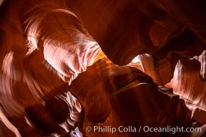
Upper Antelope Canyon, a spectacular slot canyon near Page, Arizona.
Location: Navajo Tribal Lands, Page, Arizona
Image ID: 36043
Location: Navajo Tribal Lands, Page, Arizona
Image ID: 36043
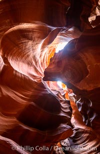
Upper Antelope Canyon, a spectacular slot canyon near Page, Arizona.
Location: Navajo Tribal Lands, Page, Arizona
Image ID: 36044
Location: Navajo Tribal Lands, Page, Arizona
Image ID: 36044
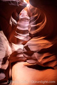
Upper Antelope Canyon, a spectacular slot canyon near Page, Arizona.
Location: Navajo Tribal Lands, Page, Arizona
Image ID: 36045
Location: Navajo Tribal Lands, Page, Arizona
Image ID: 36045
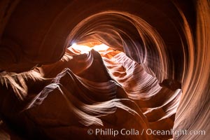
Upper Antelope Canyon, a spectacular slot canyon near Page, Arizona.
Location: Navajo Tribal Lands, Page, Arizona
Image ID: 36046
Location: Navajo Tribal Lands, Page, Arizona
Image ID: 36046
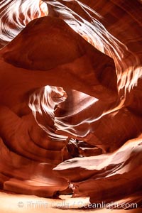
Upper Antelope Canyon, a spectacular slot canyon near Page, Arizona.
Location: Navajo Tribal Lands, Page, Arizona
Image ID: 36047
Location: Navajo Tribal Lands, Page, Arizona
Image ID: 36047
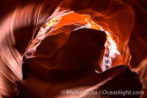
Upper Antelope Canyon, a spectacular slot canyon near Page, Arizona.
Location: Navajo Tribal Lands, Page, Arizona
Image ID: 36048
Location: Navajo Tribal Lands, Page, Arizona
Image ID: 36048
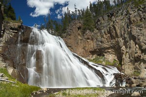
Gibbon Falls drops 80 feet through a deep canyon formed by the Gibbon River. Although visible from the road above, the best vantage point for viewing the falls is by hiking up the river itself.
Location: Gibbon River, Yellowstone National Park, Wyoming
Image ID: 13270
Location: Gibbon River, Yellowstone National Park, Wyoming
Image ID: 13270
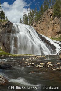
Gibbon Falls drops 80 feet through a deep canyon formed by the Gibbon River. Although visible from the road above, the best vantage point for viewing the falls is by hiking up the river itself.
Location: Gibbon River, Yellowstone National Park, Wyoming
Image ID: 13271
Location: Gibbon River, Yellowstone National Park, Wyoming
Image ID: 13271
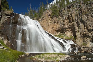
Gibbon Falls drops 80 feet through a deep canyon formed by the Gibbon River. Although visible from the road above, the best vantage point for viewing the falls is by hiking up the river itself.
Location: Gibbon River, Yellowstone National Park, Wyoming
Image ID: 13272
Location: Gibbon River, Yellowstone National Park, Wyoming
Image ID: 13272
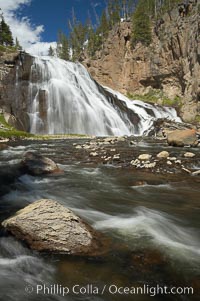
Gibbon Falls drops 80 feet through a deep canyon formed by the Gibbon River. Although visible from the road above, the best vantage point for viewing the falls is by hiking up the river itself.
Location: Gibbon River, Yellowstone National Park, Wyoming
Image ID: 13273
Location: Gibbon River, Yellowstone National Park, Wyoming
Image ID: 13273
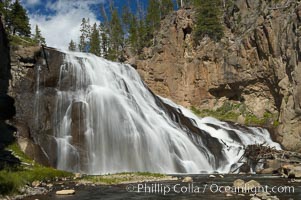
Gibbon Falls drops 80 feet through a deep canyon formed by the Gibbon River. Although visible from the road above, the best vantage point for viewing the falls is by hiking up the river itself.
Location: Gibbon River, Yellowstone National Park, Wyoming
Image ID: 13274
Location: Gibbon River, Yellowstone National Park, Wyoming
Image ID: 13274
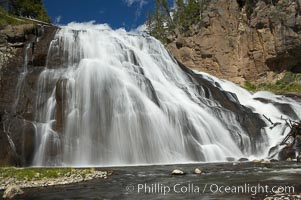
Gibbon Falls drops 80 feet through a deep canyon formed by the Gibbon River. Although visible from the road above, the best vantage point for viewing the falls is by hiking up the river itself.
Location: Gibbon River, Yellowstone National Park, Wyoming
Image ID: 13276
Location: Gibbon River, Yellowstone National Park, Wyoming
Image ID: 13276
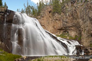
Gibbon Falls drops 80 feet through a deep canyon formed by the Gibbon River. Although visible from the road above, the best vantage point for viewing the falls is by hiking up the river itself.
Location: Gibbon River, Yellowstone National Park, Wyoming
Image ID: 13277
Location: Gibbon River, Yellowstone National Park, Wyoming
Image ID: 13277
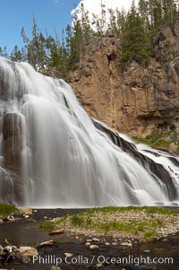
Gibbon Falls drops 80 feet through a deep canyon formed by the Gibbon River. Although visible from the road above, the best vantage point for viewing the falls is by hiking up the river itself.
Location: Gibbon River, Yellowstone National Park, Wyoming
Image ID: 13278
Location: Gibbon River, Yellowstone National Park, Wyoming
Image ID: 13278
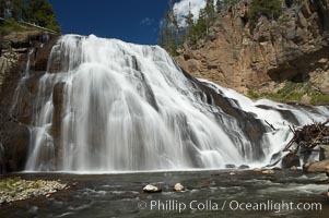
Gibbon Falls drops 80 feet through a deep canyon formed by the Gibbon River. Although visible from the road above, the best vantage point for viewing the falls is by hiking up the river itself.
Location: Gibbon River, Yellowstone National Park, Wyoming
Image ID: 13279
Location: Gibbon River, Yellowstone National Park, Wyoming
Image ID: 13279