Panoramic Aerial Photo of San Diego Coronado Bay Bridge.
Location: San Diego, California
Image ID: 30789
Panorama dimensions: 7503 x 14441
Location: San Diego, California
Image ID: 30789
Panorama dimensions: 7503 x 14441
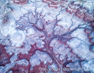
Pre-Dawn over the Tree of Eons, Utah. The Tree of Eons is a spectacular geologic sight near the San Rafael Swell. Erosion has cut a "tree" through red, blue, purple and white layers of the Chinle formation. The Tree of Eons is a superb example of dendritic erosion and to really appreciate the complex fractal-like details it must be observed from above. Photographed here in the soft, predawn light, it takes on magenta, red and purple hues just before the sun reaches it. Aerial panoramic photograph.
Location: Utah
Image ID: 38027
Location: Utah
Image ID: 38027
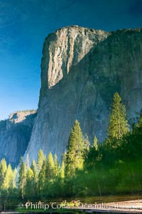
El Capitan reflection mirrored in the Merced River, Yosemite National Park.
Location: Yosemite National Park, California
Image ID: 36351
Location: Yosemite National Park, California
Image ID: 36351
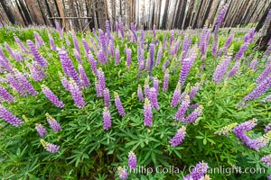
Lupine bloom in burned area after a forest fire, near Wawona, Yosemite National Park.
Location: Yosemite National Park, California
Image ID: 36366
Location: Yosemite National Park, California
Image ID: 36366
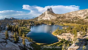
Cathedral Peak and Upper Cathedral Lake at Sunset, Yosemite National Park.
Location: Yosemite National Park, California
Image ID: 36419
Panorama dimensions: 7800 x 13628
Location: Yosemite National Park, California
Image ID: 36419
Panorama dimensions: 7800 x 13628
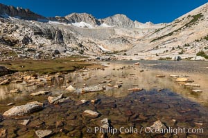
Mount Conness (12,589') over Lower Conness Lake, Hoover Wilderness.
Location: Conness Lakes Basin, Hoover Wilderness, California
Image ID: 36424
Location: Conness Lakes Basin, Hoover Wilderness, California
Image ID: 36424
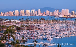
San Diego City Skyline at Sunset, viewed from Point Loma, Shelter Island Yacht Club in the foreground, San Diego Bay, Mount San Miguel (right) and Lyons Peak (left) in distance.
Location: San Diego, California
Image ID: 36748
Location: San Diego, California
Image ID: 36748
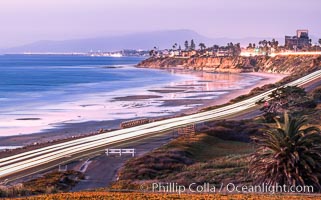
Carlsbad Coast Highway Sunset, from Terramar and North Ponto to Oceanside and Camp Pendleton. The smoke stack that marked the old Encina Power Plant was removed in 2021. Oceanside Pier is seen beautifully lit in the distance. Rising in the distance is San Onofre Mountain (1722') topped by a tall signal tower, one of the southern peaks in the Santa Ana Mountains.
Location: Carlsbad, California
Image ID: 37479
Location: Carlsbad, California
Image ID: 37479
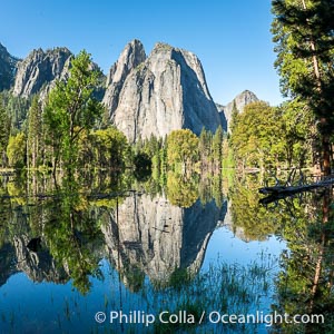
Cathedral Rocks reflected in a meadow flooded by the Merced River, historical snowmelt following record snowfall floods Yosemite Valley in May 2023.
Location: Yosemite National Park, California
Image ID: 39375
Location: Yosemite National Park, California
Image ID: 39375
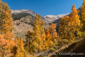
Aspens show fall colors in Mineral King Valley, part of Sequoia National Park in the southern Sierra Nevada, California.
Location: Mineral King, Sequoia National Park, California
Image ID: 32298
Location: Mineral King, Sequoia National Park, California
Image ID: 32298

Sunset at San Clemente Island, south end showing Pyramid Head. Panoramic photo.
Location: San Clemente Island, California
Image ID: 38500
Panorama dimensions: 4489 x 35871
Location: San Clemente Island, California
Image ID: 38500
Panorama dimensions: 4489 x 35871

Sunrise on Medano Beach, on the coast of Cabo San Lucas, Mexico.
Location: Cabo San Lucas, Baja California, Mexico
Image ID: 28948
Panorama dimensions: 4368 x 16027
Location: Cabo San Lucas, Baja California, Mexico
Image ID: 28948
Panorama dimensions: 4368 x 16027
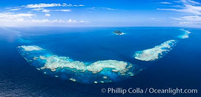
Aerial View of Namena Marine Reserve and Coral Reefs, Namena Island, Fiji.
Location: Namena Marine Reserve, Namena Island, Fiji
Image ID: 34686
Panorama dimensions: 5617 x 11605
Location: Namena Marine Reserve, Namena Island, Fiji
Image ID: 34686
Panorama dimensions: 5617 x 11605
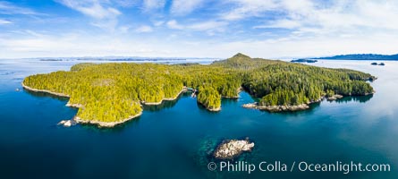
Hurst Island and Gods Pocket Provincial Park, aerial photo.
Location: British Columbia, Canada
Image ID: 35285
Panorama dimensions: 6271 x 13942
Location: British Columbia, Canada
Image ID: 35285
Panorama dimensions: 6271 x 13942

A large herd of African elephants, composed of at least two familial groups, gathers at sunset to graze and socialize, Amboseli National Park.
Species: African elephant, Loxodonta africana
Location: Amboseli National Park, Kenya
Image ID: 39595
Panorama dimensions: 5803 x 20555
Species: African elephant, Loxodonta africana
Location: Amboseli National Park, Kenya
Image ID: 39595
Panorama dimensions: 5803 x 20555

Browning Pass and Balaklava Island, location of the best cold water diving in the world, aerial panoramic photo.
Location: British Columbia, Canada
Image ID: 34472
Panorama dimensions: 4106 x 13744
Location: British Columbia, Canada
Image ID: 34472
Panorama dimensions: 4106 x 13744
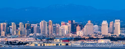
San Diego City Skyline at Sunset, viewed from Point Loma, panoramic photograph.
Location: San Diego, California
Image ID: 36762
Panorama dimensions: 5455 x 13702
Location: San Diego, California
Image ID: 36762
Panorama dimensions: 5455 x 13702

Carlsbad Coast at Sunset, Terramar and the Oceanside Pier, with Camp Pendleton and the San Onofre power plant in the distance on this incredibly clean and crisp evening view. Rising in the distance is San Onofre Mountain (1722') topped by a tall signal tower, one of the southern peaks in the Santa Ana Mountains.
Location: Carlsbad, California
Image ID: 37482
Panorama dimensions: 1106 x 3500
Location: Carlsbad, California
Image ID: 37482
Panorama dimensions: 1106 x 3500
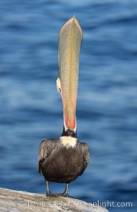
Spectacular Brown Pelican Head Throw Display. This California brown pelican extends its head and bill up and back, stretching its neck and pouch in a behavior known as a head throw or bill throw. Adult winter breeding plumage. Pelican yoga, High Mountain pose, Tadasan.
Species: Brown Pelican, Pelecanus occidentalis, Pelecanus occidentalis californicus
Location: La Jolla, California
Image ID: 38691
Species: Brown Pelican, Pelecanus occidentalis, Pelecanus occidentalis californicus
Location: La Jolla, California
Image ID: 38691
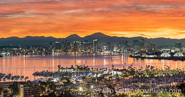
Spectacular Sunrise over San Diego Bay and Downtown San Diego. Mount San Miguel and Mount Lyons in the distance. Shelter Island in the foreground. Viewed from Point Loma.
Image ID: 38892
Panorama dimensions: 8187 x 15600
Image ID: 38892
Panorama dimensions: 8187 x 15600

Hotel Del Coronado and Coronado Island City Skyline, viewed from Point Loma, panoramic photograph.
Location: San Diego, California
Image ID: 30202
Panorama dimensions: 5494 x 21430
Location: San Diego, California
Image ID: 30202
Panorama dimensions: 5494 x 21430
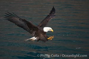
Bald eagle in flight spreads its wings and raises its talons as it prepares to grasp a fish out of the water.
Species: Bald eagle, Haliaeetus leucocephalus, Haliaeetus leucocephalus washingtoniensis
Location: Kenai Peninsula, Alaska
Image ID: 22593
Species: Bald eagle, Haliaeetus leucocephalus, Haliaeetus leucocephalus washingtoniensis
Location: Kenai Peninsula, Alaska
Image ID: 22593
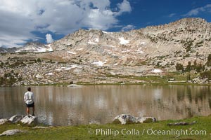
Hiker views Vogelsang Lake, and Vogelsang Peak (11516') at sunrise in Yosemite's High Sierra.
Location: Yosemite National Park, California
Image ID: 23201
Location: Yosemite National Park, California
Image ID: 23201
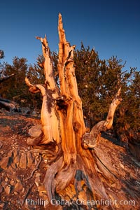
Ancient bristlecone pine tree, rising above the arid, dolomite-rich slopes of the Schulman Grove in the White Mountains at an elevation of 9500 above sea level, along the Methuselah Walk. The oldest bristlecone pines in the world are found in the Schulman Grove, some of them over 4700 years old. Ancient Bristlecone Pine Forest.
Species: Bristlecone pine, Pinus longaeva
Location: White Mountains, Inyo National Forest, California
Image ID: 23233
Species: Bristlecone pine, Pinus longaeva
Location: White Mountains, Inyo National Forest, California
Image ID: 23233
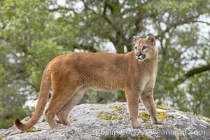
Mountain lion, Sierra Nevada foothills, Mariposa, California.
Species: Mountain lion, Puma concolor
Image ID: 15791
Species: Mountain lion, Puma concolor
Image ID: 15791
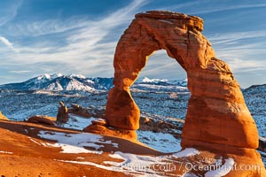
Delicate Arch, dusted with snow, at sunset, with the snow-covered La Sal mountains in the distance. Delicate Arch stands 45 feet high, with a span of 33 feet, atop of bowl of slickrock sandstone.
Location: Delicate Arch, Arches National Park, Utah
Image ID: 18104
Location: Delicate Arch, Arches National Park, Utah
Image ID: 18104

Panorama of the Teton Range reflected in the still waters of Schwabacher Landing, a sidewater of the Snake River.
Location: Grand Teton National Park, Wyoming
Image ID: 19129
Panorama dimensions: 3104 x 27272
Location: Grand Teton National Park, Wyoming
Image ID: 19129
Panorama dimensions: 3104 x 27272
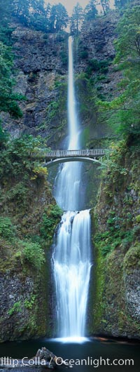
Multnomah Falls. Plummeting 620 feet from its origins on Larch Mountain, Multnomah Falls is the second highest year-round waterfall in the United States. Nearly two million visitors a year come to see this ancient waterfall making it Oregon's number one public destination.
Location: Multnomah Falls, Columbia River Gorge National Scenic Area, Oregon
Image ID: 19313
Panorama dimensions: 12453 x 4705
Location: Multnomah Falls, Columbia River Gorge National Scenic Area, Oregon
Image ID: 19313
Panorama dimensions: 12453 x 4705

Panorama of the Wave. The Wave is a sweeping, dramatic display of eroded sandstone, forged by eons of water and wind erosion, laying bare striations formed from compacted sand dunes over millenia. This panoramic picture is formed from thirteen individual photographs.
Location: North Coyote Buttes, Paria Canyon-Vermilion Cliffs Wilderness, Arizona
Image ID: 20700
Panorama dimensions: 4661 x 25458
Location: North Coyote Buttes, Paria Canyon-Vermilion Cliffs Wilderness, Arizona
Image ID: 20700
Panorama dimensions: 4661 x 25458
