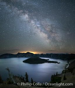
Milky Way and stars over Crater Lake at night. Panorama of Crater Lake and Wizard Island at night, Crater Lake National Park.
Location: Crater Lake National Park, Oregon
Image ID: 28643
Location: Crater Lake National Park, Oregon
Image ID: 28643
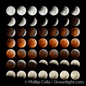
Lunar eclipse sequence. While the moon lies in the full shadow of the earth (umbra) it receives only faint, red-tinged light refracted through the Earth's atmosphere. As the moon passes into the penumbra it receives increasing amounts of direct sunlight, eventually leaving the shadow of the Earth altogether. October 8, 2014.
Image ID: 29411
Panorama dimensions: 8000 x 8000
Image ID: 29411
Panorama dimensions: 8000 x 8000
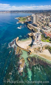
Childrens Pool Reef Exposed at Extreme Low Tide, Aerial View, La Jolla, California. Aerial panoramic photograph.
Location: La Jolla, California
Image ID: 37942
Location: La Jolla, California
Image ID: 37942
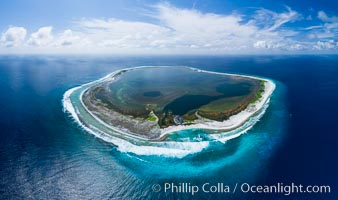
Aerial panorama of Clipperton Island, showing the entire atoll. Clipperton Island, a minor territory of France also known as Ile de la Passion, is a small (2.3 sq mi) but spectacular coral atoll in the eastern Pacific. By permit HC / 1485 / CAB (France).
Location: Clipperton Island, France
Image ID: 32835
Panorama dimensions: 5523 x 9328
Location: Clipperton Island, France
Image ID: 32835
Panorama dimensions: 5523 x 9328

San Diego Bay and Skyline at sunset, viewed from Point Loma, panoramic photograph.
Location: San Diego, California
Image ID: 30211
Panorama dimensions: 5081 x 21550
Location: San Diego, California
Image ID: 30211
Panorama dimensions: 5081 x 21550

San Diego city skyline, showing the buildings of downtown San Diego rising above San Diego Harbor, viewed from Point Loma at sunset, with mountains of the Cleveland National Forest rising in the distance. A panoramic photograph, composite of six separate images. Mount San Miguel is on right and Lyons Peak to the left.
Location: San Diego, California
Image ID: 22252
Panorama dimensions: 3144 x 16621
Location: San Diego, California
Image ID: 22252
Panorama dimensions: 3144 x 16621
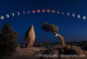
Lunar Eclipse and blood red moon sequence, over Juniper and Standing Rock, composite image, Joshua Tree National Park, April 14/15 2014.
Image ID: 29204
Image ID: 29204

Steller Sea Lions atop Norris Rocks, Hornby Island and Vancouver Island, panoramic photo.
Species: Steller sea lion, Eumetopias jubatus
Location: British Columbia, Canada
Image ID: 34468
Panorama dimensions: 4590 x 10283
Species: Steller sea lion, Eumetopias jubatus
Location: British Columbia, Canada
Image ID: 34468
Panorama dimensions: 4590 x 10283

San Diego Sheraton Hotel on San Diego Bay, at dawn.
Location: San Diego, California
Image ID: 37637
Panorama dimensions: 6696 x 24935
Location: San Diego, California
Image ID: 37637
Panorama dimensions: 6696 x 24935
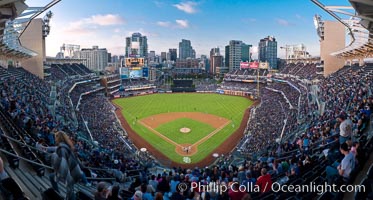
Petco Park, home of the San Diego Padres professional baseball team, overlooking downtown San Diego at dusk.
Location: San Diego, California
Image ID: 27049
Panorama dimensions: 3615 x 6741
Location: San Diego, California
Image ID: 27049
Panorama dimensions: 3615 x 6741
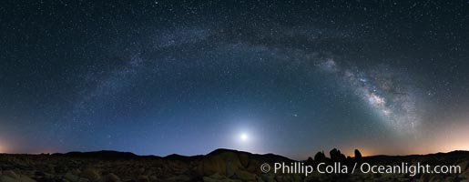
Joshua Tree National Park, Milky Way and Moon, Shooting Star, Comet Panstarrs, Impending Dawn.
Location: Joshua Tree National Park, California
Image ID: 28408
Panorama dimensions: 4205 x 10821
Location: Joshua Tree National Park, California
Image ID: 28408
Panorama dimensions: 4205 x 10821
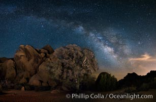
Live Oak and Milky Way, rocks and stars, Joshua Tree National Park at night.
Location: Joshua Tree National Park, California
Image ID: 28417
Panorama dimensions: 4848 x 7431
Location: Joshua Tree National Park, California
Image ID: 28417
Panorama dimensions: 4848 x 7431
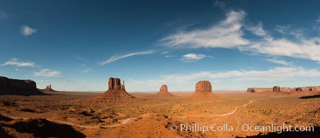
Monument Valley panorama.
Location: Monument Valley, Arizona
Image ID: 28597
Panorama dimensions: 6429 x 14925
Location: Monument Valley, Arizona
Image ID: 28597
Panorama dimensions: 6429 x 14925
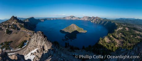
Panorama of Crater Lake from Watchman Lookout Station, panoramic picture. The Watchman Lookout Station No. 168 is one of two fire lookout towers in Crater Lake National Park in southern Oregon. For many years, National Park Service personnel used the lookout to watch for wildfires during the summer months. It is also a popular hiking destination because it offers an excellent view of Crater Lake and the surrounding area.
Location: Crater Lake National Park, Oregon
Image ID: 28633
Panorama dimensions: 4885 x 11229
Location: Crater Lake National Park, Oregon
Image ID: 28633
Panorama dimensions: 4885 x 11229
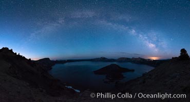
Milky Way and stars over Crater Lake at night. Panorama of Crater Lake and Wizard Island at night, Crater Lake National Park.
Location: Crater Lake National Park, Oregon
Image ID: 28635
Panorama dimensions: 6635 x 12270
Location: Crater Lake National Park, Oregon
Image ID: 28635
Panorama dimensions: 6635 x 12270

Aerial Panoramic Photo of Point La Jolla and La Jolla Cove, Boomer Beach, Scripps Park. Panoramic aerial photograph of La Jolla Cove and Scripps Parks (center), with La Jolla’s Mount Soledad rising above, La Jolla Shores and La Jolla Caves to the left and the La Jolla Coast with Children’s Pool (Casa Cove) to the right. The undersea reefs of Boomer Beach are seen through the clear, calm ocean waters. This extremely high resolution panorama will print 50″ high by 130″ long with no interpolation.
Location: La Jolla, California
Image ID: 30773
Panorama dimensions: 7744 x 20541
Location: La Jolla, California
Image ID: 30773
Panorama dimensions: 7744 x 20541
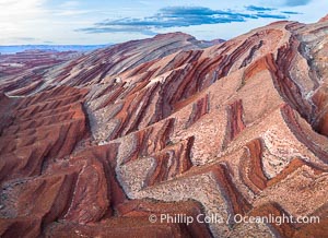
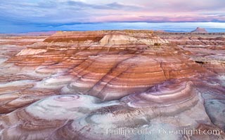
Aerial Photo of Raplee Ridge near Mexican Hat, Utah. Raplee Ridge is a spectacular series of multicolored triangular flatirons near the San Juan River. Often called "the Raplee Anticline" the geologic structure is in fact better described as a monocline, according to the Utah Geological Survey.
Location: Mexican Hat, Utah
Image ID: 39490
Location: Mexican Hat, Utah
Image ID: 39490
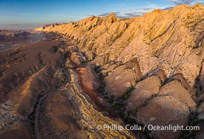
Aerial photo of the San Rafael Reef at dawn. A fold in the Earth's crust leads to this inclined section of the San Rafael Reef, at the eastern edge of the San Rafael Swell. Clearly seen are the characteristic triangular flatiron erosion patterns that typical this formation. The colors seen here arise primarily from Navajo and Wingate sandstone.
Location: Utah
Image ID: 39784
Location: Utah
Image ID: 39784

Panoramic photo of San Diego embarcadero, showing the San Diego Marriott Hotel and Marina (center), Roy's Restaurant (center) and Manchester Grand Hyatt Hotel (left) viewed from the San Diego Embarcadero Marine Park.
Location: San Diego, California
Image ID: 26568
Panorama dimensions: 4706 x 9454
Location: San Diego, California
Image ID: 26568
Panorama dimensions: 4706 x 9454
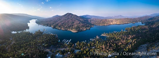
Bass Lake, Aerial Panoramic Photo.
Location: Bass Lake, California
Image ID: 38216
Panorama dimensions: 4947 x 13389
Location: Bass Lake, California
Image ID: 38216
Panorama dimensions: 4947 x 13389
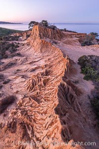
Broken Hill in soft pre-dawn light, overlooking the Pacific Ocean and Torrey Pines State Reserve.
Location: Torrey Pines State Reserve, San Diego, California
Image ID: 36565
Location: Torrey Pines State Reserve, San Diego, California
Image ID: 36565

Earth Shadow over the Pacific, Torrey Pines, California.
Location: Torrey Pines State Reserve, San Diego, California
Image ID: 36566
Panorama dimensions: 4487 x 13160
Location: Torrey Pines State Reserve, San Diego, California
Image ID: 36566
Panorama dimensions: 4487 x 13160

San Diego City Skyline at Sunset, viewed from Point Loma, panoramic photograph.
Location: San Diego, California
Image ID: 36633
Panorama dimensions: 5531 x 26407
Location: San Diego, California
Image ID: 36633
Panorama dimensions: 5531 x 26407

Full Moon Rises over the San Diego City Skyline and Mount Laguna, viewed from Point Loma, panoramic photograph.
Location: San Diego, California
Image ID: 36635
Panorama dimensions: 5258 x 15796
Location: San Diego, California
Image ID: 36635
Panorama dimensions: 5258 x 15796
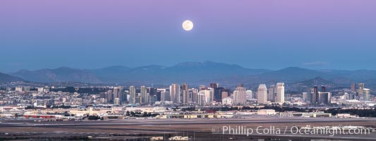
Full Moon Rises over the San Diego City Skyline and Mount Laguna, viewed from Point Loma, panoramic photograph.
Location: San Diego, California
Image ID: 36636
Panorama dimensions: 5432 x 14480
Location: San Diego, California
Image ID: 36636
Panorama dimensions: 5432 x 14480

San Diego City Skyline at Sunset, viewed from Point Loma, panoramic photograph.
Location: San Diego, California
Image ID: 36637
Panorama dimensions: 4988 x 25798
Location: San Diego, California
Image ID: 36637
Panorama dimensions: 4988 x 25798
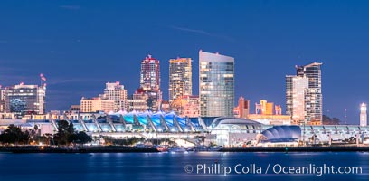
San Diego City Skyline at Sunset, viewed from Point Loma, panoramic photograph.
Location: San Diego, California
Image ID: 36643
Panorama dimensions: 4820 x 9841
Location: San Diego, California
Image ID: 36643
Panorama dimensions: 4820 x 9841

San Diego City Skyline at Sunset, viewed from Point Loma, panoramic photograph.
Location: San Diego, California
Image ID: 36644
Location: San Diego, California
Image ID: 36644
