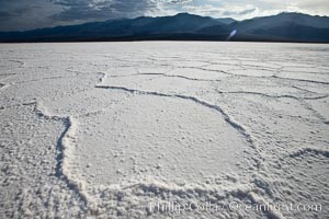
Salt polygons. After winter flooding, the salt on the Badwater Basin playa dries into geometric polygonal shapes.
Location: Badwater, Death Valley National Park, California
Image ID: 25305
Location: Badwater, Death Valley National Park, California
Image ID: 25305

Burrowing owl (Western North American race hypugaea). This 10-inch-tall burrowing owl is standing besides its burrow. These burrows are usually created by squirrels, prairie dogs, or other rodents and even turtles, and only rarely dug by the owl itself.
Species: Burrowing owl, Athene cunicularia, Athene cunicularia hypugaea
Location: Salton Sea, Imperial County, California
Image ID: 22477
Species: Burrowing owl, Athene cunicularia, Athene cunicularia hypugaea
Location: Salton Sea, Imperial County, California
Image ID: 22477
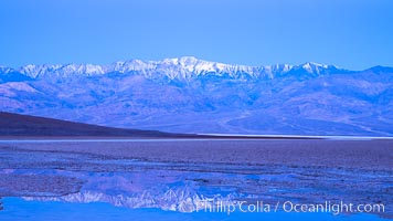
Sunrise lights Telescope Peak as it rises over the salt flats of Badwater, Death Valley. At 11,049 feet, Telescope Peak is the highest peak in the Panamint Range as well as the highest point in Death Valley National Park. At 282 feet below sea level, Badwater is the lowest point in North America.
Location: Badwater, Death Valley National Park, California
Image ID: 20549
Location: Badwater, Death Valley National Park, California
Image ID: 20549
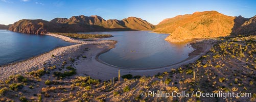
Salt Lake on Isla Espiritu Santo, Baja California, aerial view.
Location: Baja California, Mexico
Image ID: 37333
Panorama dimensions: 4367 x 10950
Location: Baja California, Mexico
Image ID: 37333
Panorama dimensions: 4367 x 10950
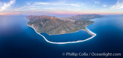
Natural Salt Lake on Isla San Jose, Aerial View, Sea of Cortez.
Location: Baja California, Mexico
Image ID: 37338
Panorama dimensions: 6028 x 12651
Location: Baja California, Mexico
Image ID: 37338
Panorama dimensions: 6028 x 12651
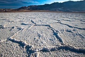
Devils Golf Course, California. Evaporated salt has formed into gnarled, complex crystalline shapes in on the salt pan of Death Valley National Park, one of the largest salt pans in the world. The shapes are constantly evolving as occasional floods submerge the salt concretions before receding and depositing more salt.
Location: Devils Golf Course, Death Valley National Park, California
Image ID: 15582
Location: Devils Golf Course, Death Valley National Park, California
Image ID: 15582
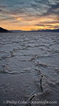
Salt polygons. After winter flooding, the salt on the Badwater Basin playa dries into geometric polygonal shapes.
Location: Badwater, Death Valley National Park, California
Image ID: 27635
Location: Badwater, Death Valley National Park, California
Image ID: 27635
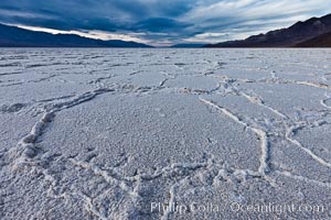
Salt polygons. After winter flooding, the salt on the Badwater Basin playa dries into geometric polygonal shapes.
Location: Badwater, Death Valley National Park, California
Image ID: 27632
Location: Badwater, Death Valley National Park, California
Image ID: 27632
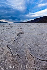
Salt polygons. After winter flooding, the salt on the Badwater Basin playa dries into geometric polygonal shapes.
Location: Badwater, Death Valley National Park, California
Image ID: 27633
Location: Badwater, Death Valley National Park, California
Image ID: 27633
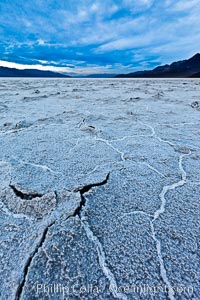
Salt polygons. After winter flooding, the salt on the Badwater Basin playa dries into geometric polygonal shapes.
Location: Badwater, Death Valley National Park, California
Image ID: 27634
Location: Badwater, Death Valley National Park, California
Image ID: 27634

Burrowing owl (Western North American race hypugaea). This 10-inch-tall burrowing owl is standing besides its burrow. These burrows are usually created by squirrels, prairie dogs, or other rodents and even turtles, and only rarely dug by the owl itself.
Species: Burrowing owl, Athene cunicularia, Athene cunicularia hypugaea
Location: Salton Sea, Imperial County, California
Image ID: 22478
Species: Burrowing owl, Athene cunicularia, Athene cunicularia hypugaea
Location: Salton Sea, Imperial County, California
Image ID: 22478
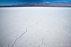
Badwater, California. Badwater, at 282 feet below sea level, is the lowest point in North America. 9000 square miles of watershed drain into the Badwater basin, to dry and form huge white salt flats.
Location: Badwater, Death Valley National Park, California
Image ID: 15579
Location: Badwater, Death Valley National Park, California
Image ID: 15579
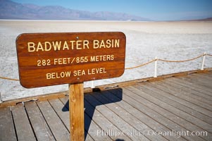
Badwater, California. Badwater, at 282 feet below sea level, is the lowest point in North America. 9000 square miles of watershed drain into the Badwater basin, to dry and form huge white salt flats.
Location: Badwater, Death Valley National Park, California
Image ID: 15580
Location: Badwater, Death Valley National Park, California
Image ID: 15580
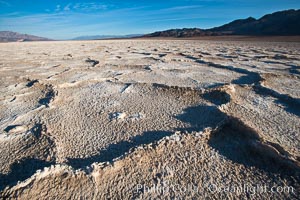
Devils Golf Course, California. Evaporated salt has formed into gnarled, complex crystalline shapes in on the salt pan of Death Valley National Park, one of the largest salt pans in the world. The shapes are constantly evolving as occasional floods submerge the salt concretions before receding and depositing more salt.
Location: Devils Golf Course, Death Valley National Park, California
Image ID: 15583
Location: Devils Golf Course, Death Valley National Park, California
Image ID: 15583
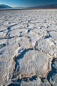
Devils Golf Course, California. Evaporated salt has formed into gnarled, complex crystalline shapes in on the salt pan of Death Valley National Park, one of the largest salt pans in the world. The shapes are constantly evolving as occasional floods submerge the salt concretions before receding and depositing more salt.
Location: Devils Golf Course, Death Valley National Park, California
Image ID: 15597
Location: Devils Golf Course, Death Valley National Park, California
Image ID: 15597
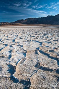
Devils Golf Course, California. Evaporated salt has formed into gnarled, complex crystalline shapes in on the salt pan of Death Valley National Park, one of the largest salt pans in the world. The shapes are constantly evolving as occasional floods submerge the salt concretions before receding and depositing more salt.
Location: Devils Golf Course, Death Valley National Park, California
Image ID: 15614
Location: Devils Golf Course, Death Valley National Park, California
Image ID: 15614
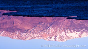
Sunrise lights Telescope Peak as it rises over the salt flats of Badwater, Death Valley. At 11,049 feet, Telescope Peak is the highest peak in the Panamint Range as well as the highest point in Death Valley National Park. At 282 feet below sea level, Badwater is the lowest point in North America.
Location: Badwater, Death Valley National Park, California
Image ID: 20550
Location: Badwater, Death Valley National Park, California
Image ID: 20550
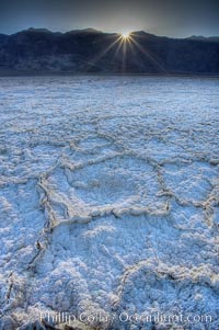
Devils Golf Course. Evaporated salt has formed into gnarled, complex crystalline shapes on the salt pan of Death Valley National Park, one of the largest salt pans in the world. The shapes are constantly evolving as occasional floods submerge the salt concretions before receding and depositing more salt.
Location: Devils Golf Course, Death Valley National Park, California
Image ID: 20552
Location: Devils Golf Course, Death Valley National Park, California
Image ID: 20552
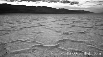
Salt polygons. After winter flooding, the salt on the Badwater Basin playa dries into geometric polygonal shapes.
Location: Badwater, Death Valley National Park, California
Image ID: 25299
Location: Badwater, Death Valley National Park, California
Image ID: 25299
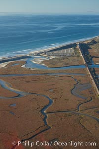
Los Penasquitos Marsh, seen from above along the coast south of Del Mar, where it exchanges fresh and salt water iwith the Pacific Ocean along Torrey Pines State Beach.
Location: San Diego, California
Image ID: 22309
Location: San Diego, California
Image ID: 22309
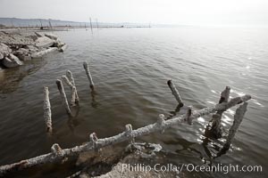
Bombay Beach, lies alongside and below the flood level of the Salton Sea, so that it floods occasionally when the Salton Sea rises. A part of Bombay Beach is composed of derelict old trailer homes, shacks and wharfs, slowly sinking in the mud and salt.
Location: Salton Sea, Imperial County, California
Image ID: 22487
Location: Salton Sea, Imperial County, California
Image ID: 22487
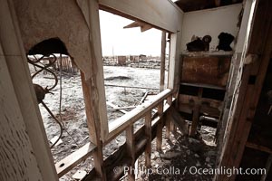
Bombay Beach, lies alongside and below the flood level of the Salton Sea, so that it floods occasionally when the Salton Sea rises. A part of Bombay Beach is composed of derelict old trailer homes, shacks and wharfs, slowly sinking in the mud and salt.
Location: Salton Sea, Imperial County, California
Image ID: 22488
Location: Salton Sea, Imperial County, California
Image ID: 22488
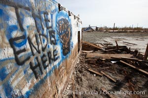
Bombay Beach, lies alongside and below the flood level of the Salton Sea, so that it floods occasionally when the Salton Sea rises. A part of Bombay Beach is composed of derelict old trailer homes, shacks and wharfs, slowly sinking in the mud and salt.
Location: Salton Sea, Imperial County, California
Image ID: 22489
Location: Salton Sea, Imperial County, California
Image ID: 22489
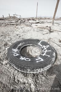
Bombay Beach, lies alongside and below the flood level of the Salton Sea, so that it floods occasionally when the Salton Sea rises. A part of Bombay Beach is composed of derelict old trailer homes, shacks and wharfs, slowly sinking in the mud and salt.
Location: Salton Sea, Imperial County, California
Image ID: 22490
Location: Salton Sea, Imperial County, California
Image ID: 22490
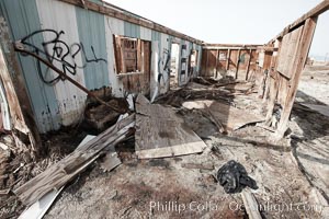
Bombay Beach, lies alongside and below the flood level of the Salton Sea, so that it floods occasionally when the Salton Sea rises. A part of Bombay Beach is composed of derelict old trailer homes, shacks and wharfs, slowly sinking in the mud and salt.
Location: Salton Sea, Imperial County, California
Image ID: 22491
Location: Salton Sea, Imperial County, California
Image ID: 22491
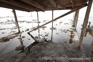
Bombay Beach, lies alongside and below the flood level of the Salton Sea, so that it floods occasionally when the Salton Sea rises. A part of Bombay Beach is composed of derelict old trailer homes, shacks and wharfs, slowly sinking in the mud and salt.
Location: Salton Sea, Imperial County, California
Image ID: 22492
Location: Salton Sea, Imperial County, California
Image ID: 22492
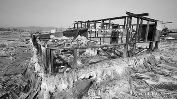
Bombay Beach, lies alongside and below the flood level of the Salton Sea, so that it floods occasionally when the Salton Sea rises. A part of Bombay Beach is composed of derelict old trailer homes, shacks and wharfs, slowly sinking in the mud and salt.
Location: Salton Sea, Imperial County, California
Image ID: 22493
Location: Salton Sea, Imperial County, California
Image ID: 22493
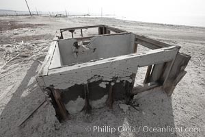
Bombay Beach, lies alongside and below the flood level of the Salton Sea, so that it floods occasionally when the Salton Sea rises. A part of Bombay Beach is composed of derelict old trailer homes, shacks and wharfs, slowly sinking in the mud and salt.
Location: Salton Sea, Imperial County, California
Image ID: 22494
Location: Salton Sea, Imperial County, California
Image ID: 22494
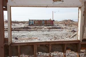
Bombay Beach, lies alongside and below the flood level of the Salton Sea, so that it floods occasionally when the Salton Sea rises. A part of Bombay Beach is composed of derelict old trailer homes, shacks and wharfs, slowly sinking in the mud and salt.
Location: Salton Sea, Imperial County, California
Image ID: 22495
Location: Salton Sea, Imperial County, California
Image ID: 22495
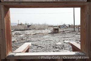
Bombay Beach, lies alongside and below the flood level of the Salton Sea, so that it floods occasionally when the Salton Sea rises. A part of Bombay Beach is composed of derelict old trailer homes, shacks and wharfs, slowly sinking in the mud and salt.
Location: Salton Sea, Imperial County, California
Image ID: 22496
Location: Salton Sea, Imperial County, California
Image ID: 22496