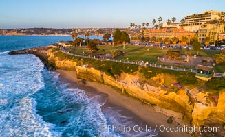
Aerial Photo of Point La Jolla and Scripps Park, La Jolla Coastline.
Location: La Jolla, California
Image ID: 38083
Location: La Jolla, California
Image ID: 38083
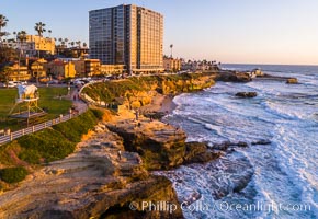
Aerial Photo of Point La Jolla and Scripps Park, La Jolla Coastline.
Location: La Jolla, California
Image ID: 38143
Location: La Jolla, California
Image ID: 38143
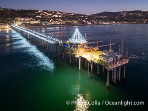
Holiday Christmas Lights on Scripps Pier, Scripps Institution of Oceanography, sunset, aerial.
Location: La Jolla, California
Image ID: 39880
Location: La Jolla, California
Image ID: 39880

Scripps Pier, predawn abstract study of pier pilings and moving water.
Location: Scripps Institution of Oceanography, La Jolla, California
Image ID: 26340
Location: Scripps Institution of Oceanography, La Jolla, California
Image ID: 26340
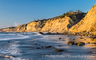
Black's Beach sea cliffs, sunset, looking north from Scripps Pier with Torrey Pines State Reserve in the distance.
Location: La Jolla, California
Image ID: 29165
Location: La Jolla, California
Image ID: 29165

Aerial Panorama of La Jolla, University City, showing (from left) University of California at San Diego, University City, Scripps Institution of Oceanography, La Jolla Shores, Point La Jolla, Mount Soledad, in the background some of the mountains to the east of San Diego. The highest peak in the center of the panoram is Cuyamaca Peak (6512') while the rocky peak directly in front of it is El Cajon Mountain (3675').
Image ID: 29098
Panorama dimensions: 3881 x 20864
Image ID: 29098
Panorama dimensions: 3881 x 20864
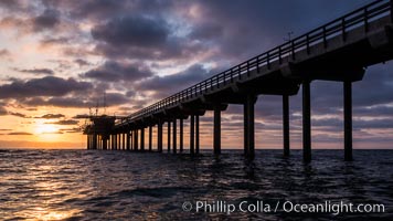
Scripps Pier, Surfer's view from among the waves. Research pier at Scripps Institution of Oceanography SIO, sunset.
Location: Scripps Institution of Oceanography, La Jolla, California
Image ID: 30147
Location: Scripps Institution of Oceanography, La Jolla, California
Image ID: 30147

Brown pelican in flight. The wingspan of the brown pelican is over 7 feet wide. The California race of the brown pelican holds endangered species status. In winter months, breeding adults assume a dramatic plumage.
Species: Brown Pelican, Pelecanus occidentalis, Pelecanus occidentalis californicus
Location: La Jolla, California
Image ID: 20053
Species: Brown Pelican, Pelecanus occidentalis, Pelecanus occidentalis californicus
Location: La Jolla, California
Image ID: 20053
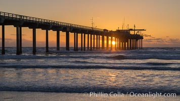
Scripps Pier at sunset.
Location: Scripps Institution of Oceanography, La Jolla, California
Image ID: 29171
Location: Scripps Institution of Oceanography, La Jolla, California
Image ID: 29171
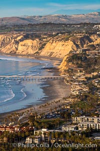
La Jolla Shores Coastline and Scripps Pier, Blacks Beach and Torrey Pines, aerial photo, sunset.
Location: La Jolla, California
Image ID: 36671
Location: La Jolla, California
Image ID: 36671
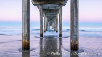
Scripps Institution of Oceanography Pier and Belt of Venus in pre-dawn light. The Earth's shadow appears as the blue just above the horizon.
Location: Scripps Institution of Oceanography, La Jolla, California
Image ID: 37697
Location: Scripps Institution of Oceanography, La Jolla, California
Image ID: 37697
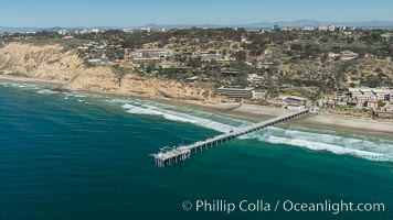
Aerial Photo of San Diego Scripps Coastal SMCA. Scripps Institution of Oceanography Research Pier.
Location: Scripps Institution of Oceanography, La Jolla, California
Image ID: 30627
Location: Scripps Institution of Oceanography, La Jolla, California
Image ID: 30627

Scripps Pier and moving water, pre-dawn light, La Jolla.
Location: La Jolla, California
Image ID: 30181
Location: La Jolla, California
Image ID: 30181
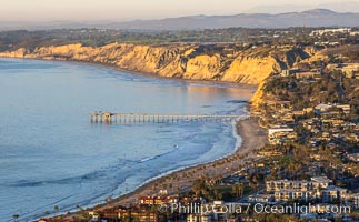
La Jolla Shores Coastline and Scripps Pier, Blacks Beach and Torrey Pines, aerial photo, sunset.
Location: La Jolla, California
Image ID: 37485
Location: La Jolla, California
Image ID: 37485
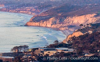
La Jolla Shores Coastline and Scripps Pier, Blacks Beach and Torrey Pines, from Mount Soledad, sunset.
Location: La Jolla, California
Image ID: 37494
Location: La Jolla, California
Image ID: 37494
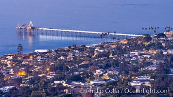
Scripps Pier and Christmas Lights from Mount Soledad.
Location: La Jolla, California
Image ID: 37495
Location: La Jolla, California
Image ID: 37495
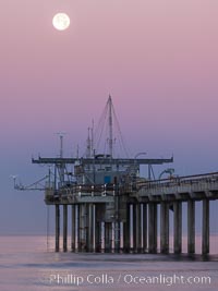
Full Moon Setting Over SIO Pier in the moments just before sunrise, Scripps Institution of Oceanography.
Location: Scripps Institution of Oceanography, La Jolla, California
Image ID: 37507
Location: Scripps Institution of Oceanography, La Jolla, California
Image ID: 37507
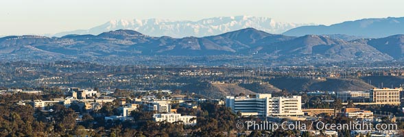
Snow-covered Mount San Gorgonio, seen beyond Double Peak Park in San Marcos, viewed from Mount Soledad in La Jolla, on an exceptionally clear winter day. Double Peak is about 20 miles away while the San Bernardino Mountains are about 90 miles distant. In the foreground are UCSD (University of California at San Diego, left), Veterans Administration Hospital (center) and Scripps La Jolla Medical Center (right).
Image ID: 37589
Panorama dimensions: 5467 x 16110
Image ID: 37589
Panorama dimensions: 5467 x 16110

Snow-covered Mount San Gorgonio,viewed from Double Peak Park in San Marcos, on an exceptionally clear winter day.
Image ID: 37598
Panorama dimensions: 7282 x 26267
Image ID: 37598
Panorama dimensions: 7282 x 26267
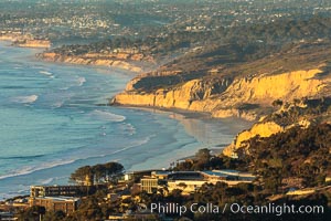
La Jolla Shores Coastline and Scripps Pier, aerial photo, sunset.
Location: La Jolla, California
Image ID: 36655
Panorama dimensions: 5672 x 8508
Location: La Jolla, California
Image ID: 36655
Panorama dimensions: 5672 x 8508
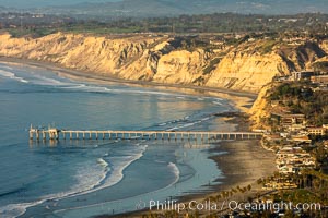
La Jolla Shores Coastline and Scripps Pier, Blacks Beach and Torrey Pines, aerial photo, sunset.
Location: La Jolla, California
Image ID: 36668
Panorama dimensions: 5698 x 8547
Location: La Jolla, California
Image ID: 36668
Panorama dimensions: 5698 x 8547

Scripps Pier and Blacks Beach, Sunset, Panorama. The Gold Coast of La Jolla basks in warm serene light as the sun sets over the Pacific Ocean.
Location: La Jolla, California
Image ID: 36674
Panorama dimensions: 8699 x 28127
Location: La Jolla, California
Image ID: 36674
Panorama dimensions: 8699 x 28127
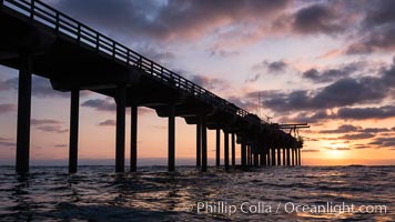
Scripps Pier, Surfer's view from among the waves. Research pier at Scripps Institution of Oceanography SIO, sunset.
Location: Scripps Institution of Oceanography, La Jolla, California
Image ID: 30148
Location: Scripps Institution of Oceanography, La Jolla, California
Image ID: 30148
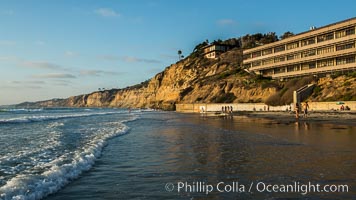
Black's Beach sea cliffs, sunset, looking north from Scripps Pier with Torrey Pines State Reserve in the distance.
Location: Scripps Institution of Oceanography, La Jolla, California
Image ID: 30153
Location: Scripps Institution of Oceanography, La Jolla, California
Image ID: 30153
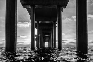
Scripps Pier, Surfer's view from among the waves. Research pier at Scripps Institution of Oceanography SIO, sunset.
Location: Scripps Institution of Oceanography, La Jolla, California
Image ID: 30156
Location: Scripps Institution of Oceanography, La Jolla, California
Image ID: 30156
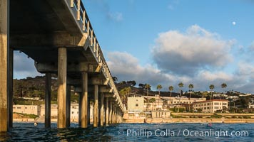
Scripps Pier, Surfer's view from among the waves. Research pier at Scripps Institution of Oceanography SIO, sunset.
Location: Scripps Institution of Oceanography, La Jolla, California
Image ID: 30159
Location: Scripps Institution of Oceanography, La Jolla, California
Image ID: 30159
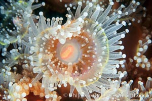
Polyp of a strawberry anemone (club-tipped anemone, more correctly a corallimorph).
Species: Strawberry anemone, Corynactis californica
Location: Scripps Canyon, La Jolla, California
Image ID: 00597
Species: Strawberry anemone, Corynactis californica
Location: Scripps Canyon, La Jolla, California
Image ID: 00597
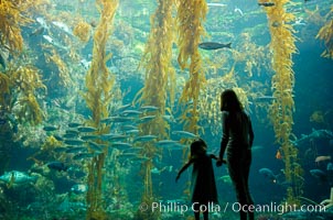
A parent and child admire the fascinating kelp forest tank at the Birch Aquarium at Scripps Institution of Oceanography, San Diego, California.
Species: Giant kelp, Macrocystis pyrifera
Image ID: 10308
Species: Giant kelp, Macrocystis pyrifera
Image ID: 10308
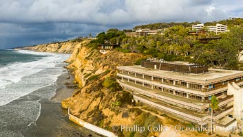
Scripps Institution of Oceanography and Blacks Beach Aerial Photo. Torrey Pines State Reserve in the distance.
Location: Scripps Institution of Oceanography, La Jolla, California
Image ID: 38039
Location: Scripps Institution of Oceanography, La Jolla, California
Image ID: 38039
