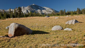
Mammoth Peak (12,117') rises above grassy meadows and granite boulders near Tioga Pass.
Location: Yosemite National Park, California
Image ID: 25786
Location: Yosemite National Park, California
Image ID: 25786
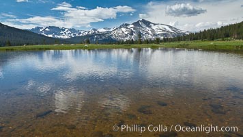
Mammoth Peak in the Yosemite High Country, reflected in small tarn pond, viewed from meadows near Tioga Pass.
Location: Yosemite National Park, California
Image ID: 26982
Location: Yosemite National Park, California
Image ID: 26982
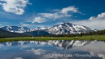
Mammoth Peak in the Yosemite High Country, reflected in small tarn pond, viewed from meadows near Tioga Pass.
Location: Yosemite National Park, California
Image ID: 26994
Location: Yosemite National Park, California
Image ID: 26994
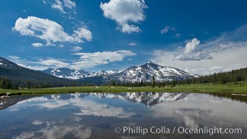
Mammoth Peak in the Yosemite High Country, reflected in small tarn pond, viewed from meadows near Tioga Pass.
Location: Yosemite National Park, California
Image ID: 26995
Location: Yosemite National Park, California
Image ID: 26995
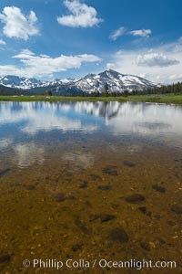
Mammoth Peak in the Yosemite High Country, reflected in small tarn pond, viewed from meadows near Tioga Pass.
Location: Yosemite National Park, California
Image ID: 26996
Location: Yosemite National Park, California
Image ID: 26996
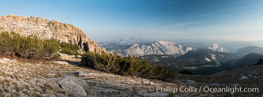
Northeast summit, "false summit", of Mount Hoffmann with Half Dome and Clouds Rest in the distance, Yosemite National Park.
Location: Mount Hoffmann, Yosemite National Park, California
Image ID: 31199
Panorama dimensions: 6177 x 16649
Location: Mount Hoffmann, Yosemite National Park, California
Image ID: 31199
Panorama dimensions: 6177 x 16649
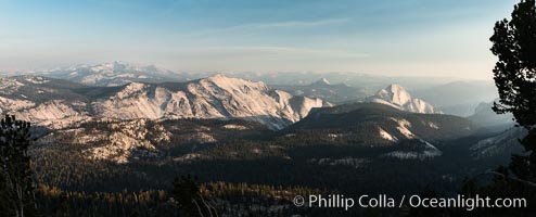
Half Dome and Cloud's Rest from Summit of Mount Hoffmann, sunset, panorama.
Location: Mount Hoffmann, Yosemite National Park, California
Image ID: 31201
Panorama dimensions: 6849 x 16926
Location: Mount Hoffmann, Yosemite National Park, California
Image ID: 31201
Panorama dimensions: 6849 x 16926
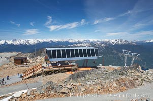
Lift station at the summit of Whistler Mountain.
Location: Whistler, British Columbia, Canada
Image ID: 21013
Location: Whistler, British Columbia, Canada
Image ID: 21013
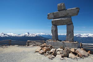
Ilanaaq, the logo of the 2010 Winter Olympics in Vancouver, is formed of stone in the Inukshuk-style of traditional Inuit sculpture. This one is located on the summit of Whistler Mountain.
Location: Whistler, British Columbia, Canada
Image ID: 21014
Location: Whistler, British Columbia, Canada
Image ID: 21014
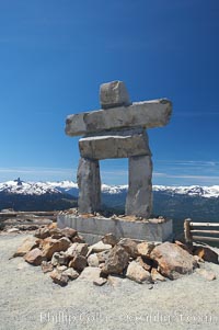
Ilanaaq, the logo of the 2010 Winter Olympics in Vancouver, is formed of stone in the Inukshuk-style of traditional Inuit sculpture. This one is located on the summit of Whistler Mountain.
Location: Whistler, British Columbia, Canada
Image ID: 21015
Location: Whistler, British Columbia, Canada
Image ID: 21015
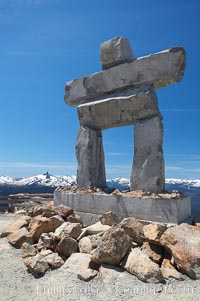
Ilanaaq, the logo of the 2010 Winter Olympics in Vancouver, is formed of stone in the Inukshuk-style of traditional Inuit sculpture. This one is located on the summit of Whistler Mountain.
Location: Whistler, British Columbia, Canada
Image ID: 21016
Location: Whistler, British Columbia, Canada
Image ID: 21016
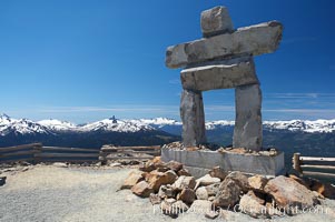
Ilanaaq, the logo of the 2010 Winter Olympics in Vancouver, is formed of stone in the Inukshuk-style of traditional Inuit sculpture. This one is located on the summit of Whistler Mountain.
Location: Whistler, British Columbia, Canada
Image ID: 21017
Location: Whistler, British Columbia, Canada
Image ID: 21017
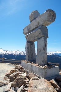
Ilanaaq, the logo of the 2010 Winter Olympics in Vancouver, is formed of stone in the Inukshuk-style of traditional Inuit sculpture. This one is located on the summit of Whistler Mountain.
Location: Whistler, British Columbia, Canada
Image ID: 21019
Location: Whistler, British Columbia, Canada
Image ID: 21019
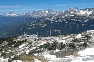
Gondola station viewed from the summit of Whistler Mountain, with Blackcomb Mountain in the distance on the right.
Location: Whistler, British Columbia, Canada
Image ID: 21020
Location: Whistler, British Columbia, Canada
Image ID: 21020
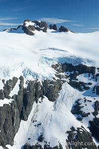
Glaciers on the summit of Mariner Mountain, on the west coast of Vancouver Island, British Columbia, Canada, part of Strathcona Provincial Park, located 36 km (22 mi) north of Tofino. It is 1,771 m (5,810 ft) high and is snow covered year-round.
Location: Mariner Mountain, Strathcona Provincial Park, British Columbia, Canada
Image ID: 21086
Location: Mariner Mountain, Strathcona Provincial Park, British Columbia, Canada
Image ID: 21086
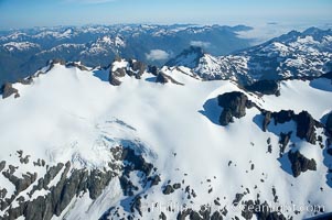
Glaciers on the summit of Mariner Mountain, on the west coast of Vancouver Island, British Columbia, Canada, part of Strathcona Provincial Park, located 36 km (22 mi) north of Tofino. It is 1,771 m (5,810 ft) high and is snow covered year-round.
Location: Mariner Mountain, Strathcona Provincial Park, British Columbia, Canada
Image ID: 21090
Location: Mariner Mountain, Strathcona Provincial Park, British Columbia, Canada
Image ID: 21090
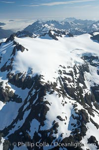
Glaciers on the summit of Mariner Mountain, on the west coast of Vancouver Island, British Columbia, Canada, part of Strathcona Provincial Park, located 36 km (22 mi) north of Tofino. It is 1,771 m (5,810 ft) high and is snow covered year-round.
Location: Mariner Mountain, Strathcona Provincial Park, British Columbia, Canada
Image ID: 21091
Location: Mariner Mountain, Strathcona Provincial Park, British Columbia, Canada
Image ID: 21091
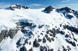
Glaciers on the summit of Mariner Mountain, on the west coast of Vancouver Island, British Columbia, Canada, part of Strathcona Provincial Park, located 36 km (22 mi) north of Tofino. It is 1,771 m (5,810 ft) high and is snow covered year-round.
Location: Mariner Mountain, Strathcona Provincial Park, British Columbia, Canada
Image ID: 21119
Location: Mariner Mountain, Strathcona Provincial Park, British Columbia, Canada
Image ID: 21119
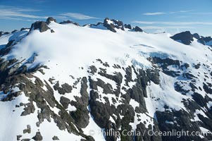
Glaciers on the summit of Mariner Mountain, on the west coast of Vancouver Island, British Columbia, Canada, part of Strathcona Provincial Park, located 36 km (22 mi) north of Tofino. It is 1,771 m (5,810 ft) high and is snow covered year-round.
Location: Mariner Mountain, Strathcona Provincial Park, British Columbia, Canada
Image ID: 21120
Location: Mariner Mountain, Strathcona Provincial Park, British Columbia, Canada
Image ID: 21120
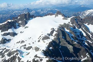
Glaciers on the summit of Mariner Mountain, on the west coast of Vancouver Island, British Columbia, Canada, part of Strathcona Provincial Park, located 36 km (22 mi) north of Tofino. It is 1,771 m (5,810 ft) high and is snow covered year-round.
Location: Mariner Mountain, Strathcona Provincial Park, British Columbia, Canada
Image ID: 21122
Location: Mariner Mountain, Strathcona Provincial Park, British Columbia, Canada
Image ID: 21122
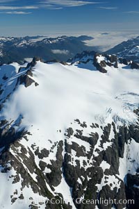
Glaciers on the summit of Mariner Mountain, on the west coast of Vancouver Island, British Columbia, Canada, part of Strathcona Provincial Park, located 36 km (22 mi) north of Tofino. It is 1,771 m (5,810 ft) high and is snow covered year-round.
Location: Mariner Mountain, Strathcona Provincial Park, British Columbia, Canada
Image ID: 21124
Location: Mariner Mountain, Strathcona Provincial Park, British Columbia, Canada
Image ID: 21124
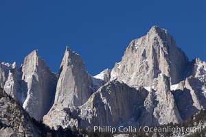
Mt. Whitney is the highest point in the contiguous United States with an elevation of 14,505 feet (4,421 m). It lies along the crest of the Sierra Nevada mountain range. Composed of the Sierra Nevada batholith granite formation, its eastern side (seen here) is quite steep. It is climbed by hundreds of hikers each year.
Image ID: 21760
Image ID: 21760
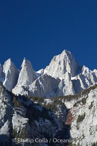
Mt. Whitney is the highest point in the contiguous United States with an elevation of 14,505 feet (4,421 m). It lies along the crest of the Sierra Nevada mountain range. Composed of the Sierra Nevada batholith granite formation, its eastern side (seen here) is quite steep. It is climbed by hundreds of hikers each year.
Image ID: 21770
Image ID: 21770
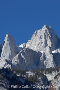
Mt. Whitney is the highest point in the contiguous United States with an elevation of 14,505 feet (4,421 m). It lies along the crest of the Sierra Nevada mountain range. Composed of the Sierra Nevada batholith granite formation, its eastern side (seen here) is quite steep. It is climbed by hundreds of hikers each year.
Image ID: 21771
Image ID: 21771
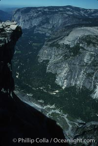
View from summit of Half Dome.
Location: Half Dome, Yosemite National Park, California
Image ID: 03458
Location: Half Dome, Yosemite National Park, California
Image ID: 03458
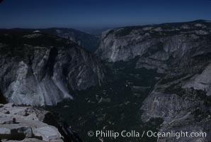
View from summit of Half Dome.
Location: Half Dome, Yosemite National Park, California
Image ID: 03459
Location: Half Dome, Yosemite National Park, California
Image ID: 03459
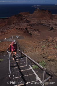
Stairs leading to summit of Bartolome.
Location: Bartolome Island, Galapagos Islands, Ecuador
Image ID: 05578
Location: Bartolome Island, Galapagos Islands, Ecuador
Image ID: 05578
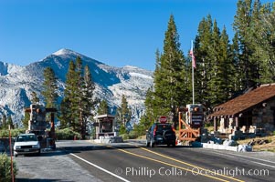
A car enters the stunning High Sierra entrance to Yosemite National Park at the summit of Tioga Pass. Mammoth Peak is seen in the background. A lucky park ranger, whose office is perhaps more beautiful than any other in the world, greets each car as it passes through. Tuolumne Meadows area of Yosemite National Park.
Location: Tioga Pass, Yosemite National Park, California
Image ID: 09978
Location: Tioga Pass, Yosemite National Park, California
Image ID: 09978
