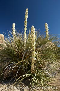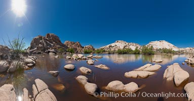
Barker Dam, Joshua Tree National Park. Barker Dam, also known as the Big Horn Dam, is a water-storage facility located in Joshua Tree National Park in California. The dam was constructed by early cattlemen and ranchers. It is situated between Queen Valley and the Wonderland of Rocks near the Wall Street Mill and is a gathering place for desert wildlife.
Location: Joshua Tree National Park, California
Image ID: 26731
Panorama dimensions: 5645 x 10823
Location: Joshua Tree National Park, California
Image ID: 26731
Panorama dimensions: 5645 x 10823
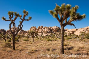
Joshua trees, a species of yucca common in the lower Colorado desert and upper Mojave desert ecosystems.
Species: Joshua tree, Yucca brevifolia
Location: Joshua Tree National Park, California
Image ID: 26732
Species: Joshua tree, Yucca brevifolia
Location: Joshua Tree National Park, California
Image ID: 26732
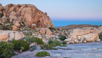
Sunset and Earth Shadow, Jumbo Rocks, Joshua Tree National Park.
Location: Joshua Tree National Park, California
Image ID: 26723
Location: Joshua Tree National Park, California
Image ID: 26723
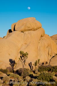
Joshua trees, a species of yucca common in the lower Colorado desert and upper Mojave desert ecosystems.
Species: Joshua tree, Yucca brevifolia
Location: Joshua Tree National Park, California
Image ID: 26724
Species: Joshua tree, Yucca brevifolia
Location: Joshua Tree National Park, California
Image ID: 26724
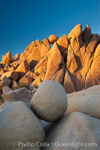
Boulders and sunset in Joshua Tree National Park. The warm sunlight gently lights unusual boulder formations at Jumbo Rocks in Joshua Tree National Park, California.
Location: Joshua Tree National Park, California
Image ID: 26733
Location: Joshua Tree National Park, California
Image ID: 26733
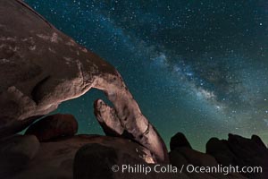
The Milky Way galaxy arcs over Arch Rock on a clear evening in Joshua Tree National Park.
Location: Joshua Tree National Park, California
Image ID: 26793
Location: Joshua Tree National Park, California
Image ID: 26793
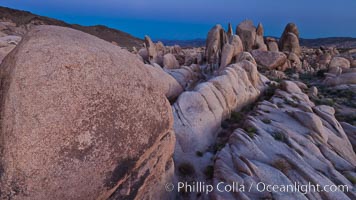
Ancient granite boulders at Joshua Tree National park, at sunset.
Location: Joshua Tree National Park, California
Image ID: 26795
Location: Joshua Tree National Park, California
Image ID: 26795
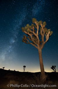
The Milky Way Galaxy shines in the night sky with a Joshua Tree silhouetted in the foreground.
Location: Joshua Tree National Park, California
Image ID: 27806
Location: Joshua Tree National Park, California
Image ID: 27806
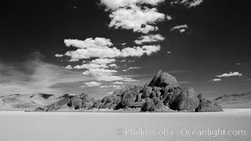
The Grandstand, standing above dried mud flats, on the Racetrack Playa in Death Valley.
Location: Racetrack Playa, Death Valley National Park, California
Image ID: 25318
Location: Racetrack Playa, Death Valley National Park, California
Image ID: 25318
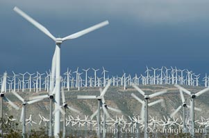
Wind turbines provide electricity to Palm Springs and the Coachella Valley. San Gorgonio pass, San Bernardino mountains.
Location: San Gorgonio Pass, Palm Springs, California
Image ID: 06856
Location: San Gorgonio Pass, Palm Springs, California
Image ID: 06856
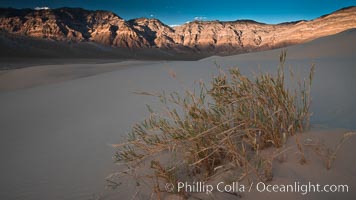
Eureka dune grass, and rare and federally endangered species of grass endemic to the Eureka Valley and Eureka Sand Dunes. The Last Chance mountains, lit by sunset, as visible in the distance. Swallenia alexandrae, a perennial grass, grows only in the southern portion of Eureka Valley Sand Dunes, in Inyo County, California.
Species: Eureka dunegrass, Eureka valley dune grass, Swallenia alexandrae
Location: Eureka Dunes, Death Valley National Park, California
Image ID: 25248
Species: Eureka dunegrass, Eureka valley dune grass, Swallenia alexandrae
Location: Eureka Dunes, Death Valley National Park, California
Image ID: 25248
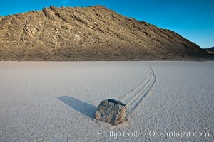
A sliding rock of the Racetrack Playa. The sliding rocks, or sailing stones, move across the mud flats of the Racetrack Playa, leaving trails behind in the mud. The explanation for their movement is not known with certainty, but many believe wind pushes the rocks over wet and perhaps icy mud in winter.
Location: Racetrack Playa, Death Valley National Park, California
Image ID: 25266
Location: Racetrack Playa, Death Valley National Park, California
Image ID: 25266
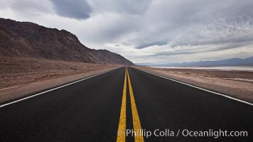
Lonely road, Death Valley.
Location: Badwater, Death Valley National Park, California
Image ID: 25292
Location: Badwater, Death Valley National Park, California
Image ID: 25292
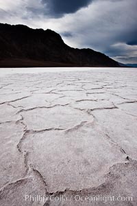
Salt polygons. After winter flooding, the salt on the Badwater Basin playa dries into geometric polygonal shapes.
Location: Badwater, Death Valley National Park, California
Image ID: 25293
Location: Badwater, Death Valley National Park, California
Image ID: 25293
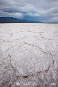
Salt polygons. After winter flooding, the salt on the Badwater Basin playa dries into geometric polygonal shapes.
Location: Badwater, Death Valley National Park, California
Image ID: 25294
Location: Badwater, Death Valley National Park, California
Image ID: 25294
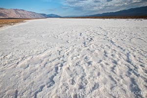
A river of salt flows across Death Valley, toward the lowest point in the United States at Badwater.
Location: Badwater, Death Valley National Park, California
Image ID: 25300
Location: Badwater, Death Valley National Park, California
Image ID: 25300
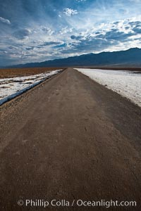
West Side Road cuts across the Badwater Basin.
Location: Badwater, Death Valley National Park, California
Image ID: 25301
Location: Badwater, Death Valley National Park, California
Image ID: 25301
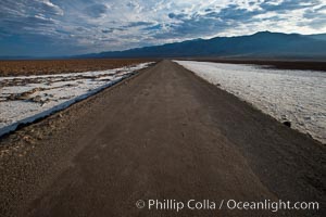
West Side Road cuts across the Badwater Basin.
Location: Badwater, Death Valley National Park, California
Image ID: 25302
Location: Badwater, Death Valley National Park, California
Image ID: 25302
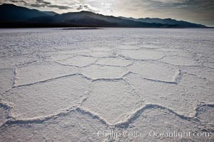
Salt polygons. After winter flooding, the salt on the Badwater Basin playa dries into geometric polygonal shapes.
Location: Badwater, Death Valley National Park, California
Image ID: 25303
Location: Badwater, Death Valley National Park, California
Image ID: 25303
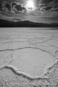
Salt polygons. After winter flooding, the salt on the Badwater Basin playa dries into geometric polygonal shapes.
Location: Badwater, Death Valley National Park, California
Image ID: 25304
Location: Badwater, Death Valley National Park, California
Image ID: 25304
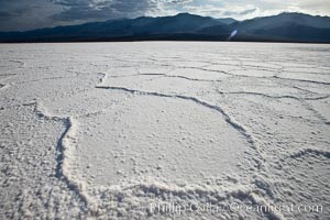
Salt polygons. After winter flooding, the salt on the Badwater Basin playa dries into geometric polygonal shapes.
Location: Badwater, Death Valley National Park, California
Image ID: 25305
Location: Badwater, Death Valley National Park, California
Image ID: 25305
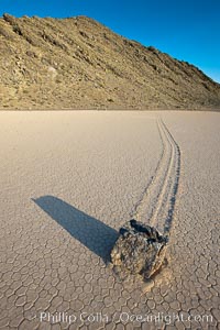
Sailing stone on the Death Valley Racetrack playa. The sliding rocks, or sailing stones, move across the mud flats of the Racetrack Playa, leaving trails behind in the mud. The explanation for their movement is not known with certainty, but many believe wind pushes the rocks over wet and perhaps icy mud in winter.
Location: Racetrack Playa, Death Valley National Park, California
Image ID: 25328
Location: Racetrack Playa, Death Valley National Park, California
Image ID: 25328
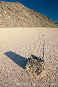
A sliding rock of the Racetrack Playa. The sliding rocks, or sailing stones, move across the mud flats of the Racetrack Playa, leaving trails behind in the mud. The explanation for their movement is not known with certainty, but many believe wind pushes the rocks over wet and perhaps icy mud in winter.
Location: Racetrack Playa, Death Valley National Park, California
Image ID: 25330
Location: Racetrack Playa, Death Valley National Park, California
Image ID: 25330
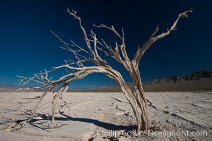
Dried tree and barren, arid mud flats, Eureka Valley.
Location: Eureka Valley, Death Valley National Park, California
Image ID: 25337
Location: Eureka Valley, Death Valley National Park, California
Image ID: 25337
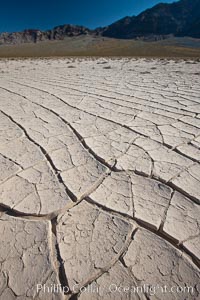
Dried mud, arid land, Eureka Valley.
Location: Eureka Valley, Death Valley National Park, California
Image ID: 25338
Location: Eureka Valley, Death Valley National Park, California
Image ID: 25338
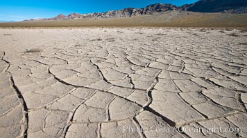
Dried mud, arid land, Eureka Valley.
Location: Eureka Valley, Death Valley National Park, California
Image ID: 25339
Location: Eureka Valley, Death Valley National Park, California
Image ID: 25339
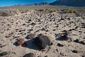
Volcanic debris, small lava rocks scattered about the Eureka Valley.
Location: Eureka Valley, Death Valley National Park, California
Image ID: 25340
Location: Eureka Valley, Death Valley National Park, California
Image ID: 25340
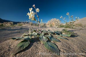
Spring wildflower blooms on the Eureka sand dunes.
Location: Eureka Dunes, Death Valley National Park, California
Image ID: 25342
Location: Eureka Dunes, Death Valley National Park, California
Image ID: 25342
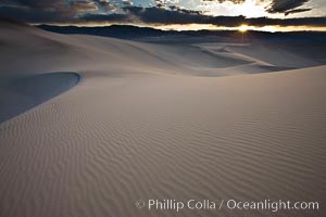
Sunset on the Eureka Dunes. The Eureka Valley Sand Dunes are California's tallest sand dunes, and one of the tallest in the United States. Rising 680' above the floor of the Eureka Valley, the Eureka sand dunes are home to several endangered species, as well as "singing sand" that makes strange sounds when it shifts. Located in the remote northern portion of Death Valley National Park, the Eureka Dunes see very few visitors.
Location: Eureka Dunes, Death Valley National Park, California
Image ID: 25356
Location: Eureka Dunes, Death Valley National Park, California
Image ID: 25356
