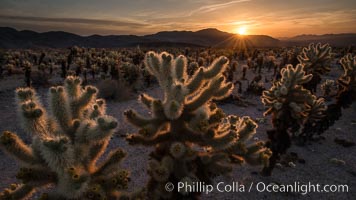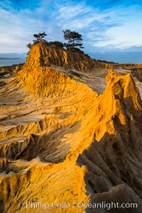
Torrey Pines State Reserve, Broken Hill at Dawn.
Location: Torrey Pines State Reserve, San Diego, California
Image ID: 29178
Location: Torrey Pines State Reserve, San Diego, California
Image ID: 29178
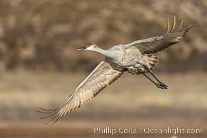
Sandhill crane spreads its broad wings as it takes flight in early morning light. This sandhill crane is among thousands present in Bosque del Apache National Wildlife Refuge, stopping here during its winter migration.
Species: Sandhill crane, Grus canadensis
Location: Bosque del Apache National Wildlife Refuge, Socorro, New Mexico
Image ID: 38713
Species: Sandhill crane, Grus canadensis
Location: Bosque del Apache National Wildlife Refuge, Socorro, New Mexico
Image ID: 38713
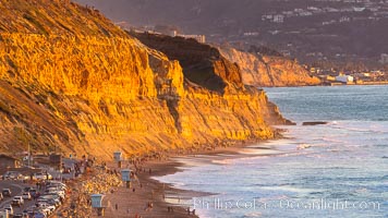
Torrey Pines State Beach at Sunset, La Jolla, Mount Soledad and Blacks Beach in the distance.
Location: Torrey Pines State Reserve, San Diego, California
Image ID: 35061
Location: Torrey Pines State Reserve, San Diego, California
Image ID: 35061
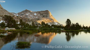
Vogelsang Peak (11516') at sunset, reflected in a small creek near Vogelsang High Sierra Camp in Yosemite's high country.
Location: Yosemite National Park, California
Image ID: 23202
Location: Yosemite National Park, California
Image ID: 23202
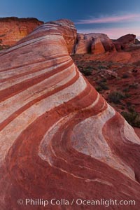
The Fire Wave, a beautiful sandstone formation exhibiting dramatic striations, striped layers in the geologic historical record.
Location: Valley of Fire State Park, Nevada
Image ID: 26473
Location: Valley of Fire State Park, Nevada
Image ID: 26473
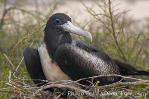
Magnificent frigatebird, adult female on nest.
Species: Magnificent frigatebird, Fregata magnificens
Location: North Seymour Island, Galapagos Islands, Ecuador
Image ID: 16726
Species: Magnificent frigatebird, Fregata magnificens
Location: North Seymour Island, Galapagos Islands, Ecuador
Image ID: 16726
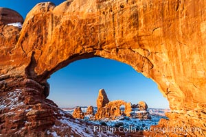
Turret Arch through North Window, winter, sunrise.
Location: North Window, Arches National Park, Utah
Image ID: 18120
Location: North Window, Arches National Park, Utah
Image ID: 18120

Self portrait at sunrise, panorama of Crater Lake. Crater Lake is the six-mile wide lake inside the collapsed caldera of volcanic Mount Mazama. Crater Lake is the deepest lake in the United States and the seventh-deepest in the world. Its maximum recorded depth is 1996 feet (608m). It lies at an altitude of 6178 feet (1880m).
Location: Crater Lake National Park, Oregon
Image ID: 19130
Panorama dimensions: 2726 x 9677
Location: Crater Lake National Park, Oregon
Image ID: 19130
Panorama dimensions: 2726 x 9677
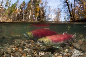
A sockeye salmon swims in the shallows of the Adams River, with the surrounding forest visible in this split-level over-under photograph.
Species: Sockeye salmon, Oncorhynchus nerka
Location: Adams River, Roderick Haig-Brown Provincial Park, British Columbia, Canada
Image ID: 26144
Species: Sockeye salmon, Oncorhynchus nerka
Location: Adams River, Roderick Haig-Brown Provincial Park, British Columbia, Canada
Image ID: 26144
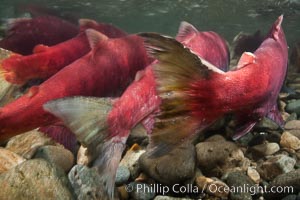
Sockeye salmon, migrating upstream in the Adams River to return to the spot where they were hatched four years earlier, where they will spawn, lay eggs and die.
Species: Sockeye salmon, Oncorhynchus nerka
Location: Adams River, Roderick Haig-Brown Provincial Park, British Columbia, Canada
Image ID: 26149
Species: Sockeye salmon, Oncorhynchus nerka
Location: Adams River, Roderick Haig-Brown Provincial Park, British Columbia, Canada
Image ID: 26149
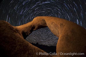
Mobius Arch in the Alabama Hills, seen here at night with swirling star trails formed in the sky above due to a long time exposure.
Location: Alabama Hills Recreational Area, California
Image ID: 27681
Location: Alabama Hills Recreational Area, California
Image ID: 27681
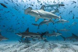
Hammerhead sharks, schooling over sand, Darwin Island, Galapagos.
Species: Scalloped hammerhead shark, Sphyrna lewini
Location: Darwin Island, Galapagos Islands, Ecuador
Image ID: 16255
Species: Scalloped hammerhead shark, Sphyrna lewini
Location: Darwin Island, Galapagos Islands, Ecuador
Image ID: 16255
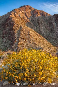
Brittlebush blooms in spring, Palm Canyon, Anza Borrego Desert State Park.
Species: Brittlebush, Encelia farinosa
Location: Anza-Borrego Desert State Park, Borrego Springs, California
Image ID: 24304
Species: Brittlebush, Encelia farinosa
Location: Anza-Borrego Desert State Park, Borrego Springs, California
Image ID: 24304
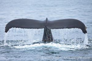
Water falling from the fluke (tail) of a humpback whale as the whale dives to forage for food in the Santa Barbara Channel.
Species: Humpback whale, Megaptera novaeangliae
Location: Santa Rosa Island, California
Image ID: 27029
Species: Humpback whale, Megaptera novaeangliae
Location: Santa Rosa Island, California
Image ID: 27029
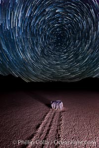
Racetrack sailing stone and star trails. A sliding rock of the Racetrack Playa. The sliding rocks, or sailing stones, move across the mud flats of the Racetrack Playa, leaving trails behind in the mud. The explanation for their movement is not known with certainty, but many believe wind pushes the rocks over wet and perhaps icy mud in winter.
Location: Racetrack Playa, Death Valley National Park, California
Image ID: 27671
Location: Racetrack Playa, Death Valley National Park, California
Image ID: 27671
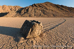
Sailing stone on the Racetrack Playa. The sliding rocks, or sailing stones, move across the mud flats of the Racetrack Playa, leaving trails behind in the mud. The explanation for their movement is not known with certainty, but many believe wind pushes the rocks over wet and perhaps icy mud in winter.
Location: Racetrack Playa, Death Valley National Park, California
Image ID: 27689
Location: Racetrack Playa, Death Valley National Park, California
Image ID: 27689

Sunset at Dead Horse Point Overlook, with the Colorado River flowing 2,000 feet below. 300 million years of erosion has carved the expansive canyons, cliffs and walls below and surrounding Deadhorse Point.
Location: Dead Horse Point State Park, Utah
Image ID: 27823
Panorama dimensions: 5303 x 17695
Location: Dead Horse Point State Park, Utah
Image ID: 27823
Panorama dimensions: 5303 x 17695
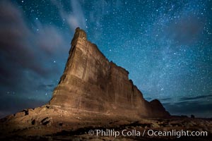
Stars over the Tower of Babel, starry night, Arches National Park, Utah.
Location: Arches National Park, Utah
Image ID: 27847
Location: Arches National Park, Utah
Image ID: 27847
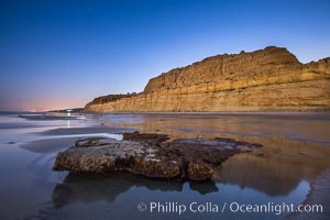
Torrey Pines Cliffs lit at night by a full moon, low tide reflections.
Location: Torrey Pines State Reserve, San Diego, California
Image ID: 28461
Location: Torrey Pines State Reserve, San Diego, California
Image ID: 28461
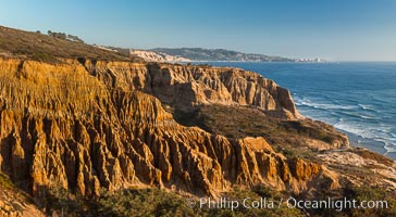
Torrey Pines Cliffs and Pacific Ocean, Razor Point view to La Jolla, San Diego, California.
Location: Torrey Pines State Reserve, San Diego, California
Image ID: 28487
Location: Torrey Pines State Reserve, San Diego, California
Image ID: 28487
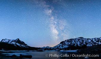
Milky Way over Tioga Lake, Yosemite National Park.
Location: Tioga Lake, Yosemite National Park, California
Image ID: 28521
Location: Tioga Lake, Yosemite National Park, California
Image ID: 28521
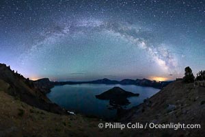
Milky Way and stars over Crater Lake at night. Panorama of Crater Lake and Wizard Island at night, Crater Lake National Park.
Location: Crater Lake National Park, Oregon
Image ID: 28640
Panorama dimensions: 5244 x 9702
Location: Crater Lake National Park, Oregon
Image ID: 28640
Panorama dimensions: 5244 x 9702
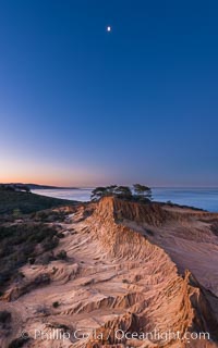
Quarter Moon over Broken Hill, Torrey Pines State Reserve.
Location: Torrey Pines State Reserve, San Diego, California
Image ID: 28366
Location: Torrey Pines State Reserve, San Diego, California
Image ID: 28366
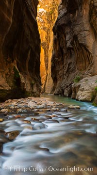
The Virgin River Narrows, where the Virgin River has carved deep, narrow canyons through the Zion National Park sandstone, creating one of the finest hikes in the world.
Location: Virgin River Narrows, Zion National Park, Utah
Image ID: 28583
Location: Virgin River Narrows, Zion National Park, Utah
Image ID: 28583
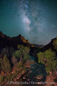
Milky Way over the Watchman, Zion National Park. The Milky Way galaxy rises in the night sky above the the Watchman.
Location: Zion National Park, Utah
Image ID: 28590
Location: Zion National Park, Utah
Image ID: 28590
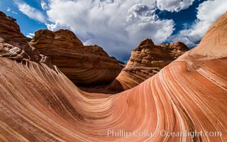
The Wave in the North Coyote Buttes, an area of fantastic eroded sandstone featuring beautiful swirls, wild colors, countless striations, and bizarre shapes set amidst the dramatic surrounding North Coyote Buttes of Arizona and Utah. The sandstone formations of the North Coyote Buttes, including the Wave, date from the Jurassic period. Managed by the Bureau of Land Management, the Wave is located in the Paria Canyon-Vermilion Cliffs Wilderness and is accessible on foot by permit only.
Location: North Coyote Buttes, Paria Canyon-Vermilion Cliffs Wilderness, Arizona
Image ID: 28601
Location: North Coyote Buttes, Paria Canyon-Vermilion Cliffs Wilderness, Arizona
Image ID: 28601
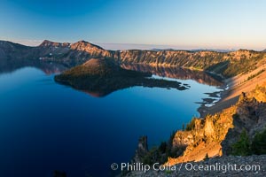
Crater Lake and Wizard Island at sunrise.
Location: Crater Lake National Park, Oregon
Image ID: 28669
Location: Crater Lake National Park, Oregon
Image ID: 28669
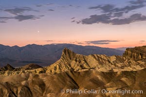
Venus sets over Manley Beacon and the Panamint Mountains, viewed from Zabriskie Point, landscape lit by a full moon, evening, stars.
Location: Zabriskie Point, Death Valley National Park, California
Image ID: 28677
Location: Zabriskie Point, Death Valley National Park, California
Image ID: 28677
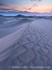
Mesquite Dunes sunrise, dawn, clouds and morning sky, sand dunes.
Location: Stovepipe Wells, Death Valley National Park, California
Image ID: 28680
Location: Stovepipe Wells, Death Valley National Park, California
Image ID: 28680
