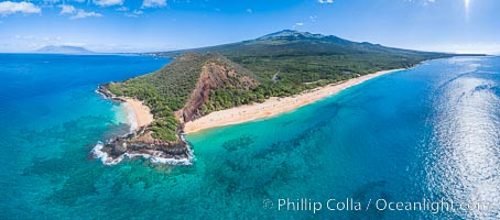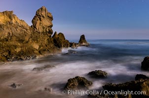
Little Corona Beach, at night under a full moon, waves lit by moonlight.
Location: Newport Beach, California
Image ID: 28866
Location: Newport Beach, California
Image ID: 28866
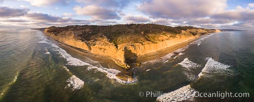
Flat Rock and Torrey Pines Seacliffs at Sunset, aerial photo.
Location: Torrey Pines State Reserve, San Diego, California
Image ID: 38227
Location: Torrey Pines State Reserve, San Diego, California
Image ID: 38227
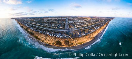
South Carlsbad State Beach and campground, aerial photo.
Location: Carlsbad, California
Image ID: 38228
Panorama dimensions: 4357 x 9642
Location: Carlsbad, California
Image ID: 38228
Panorama dimensions: 4357 x 9642
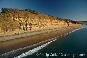
Torrey Pines seacliffs, rising up to 300 feet above the ocean, stretch from Del Mar to La Jolla. On the mesa atop the bluffs are found Torrey pine trees, one of the rare species of pines in the world.
Location: Torrey Pines State Reserve, San Diego, California
Image ID: 22285
Location: Torrey Pines State Reserve, San Diego, California
Image ID: 22285
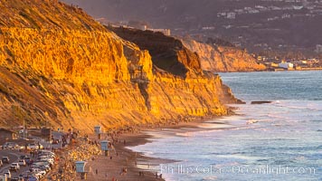
Torrey Pines State Beach at Sunset, La Jolla, Mount Soledad and Blacks Beach in the distance.
Location: Torrey Pines State Reserve, San Diego, California
Image ID: 35061
Location: Torrey Pines State Reserve, San Diego, California
Image ID: 35061
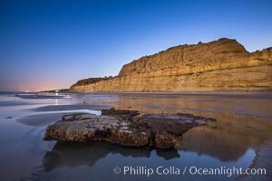
Torrey Pines Cliffs lit at night by a full moon, low tide reflections.
Location: Torrey Pines State Reserve, San Diego, California
Image ID: 28461
Location: Torrey Pines State Reserve, San Diego, California
Image ID: 28461
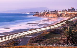
Carlsbad Coast Highway Sunset, from Terramar and North Ponto to Oceanside and Camp Pendleton. The smoke stack that marked the old Encina Power Plant was removed in 2021. Oceanside Pier is seen beautifully lit in the distance. Rising in the distance is San Onofre Mountain (1722') topped by a tall signal tower, one of the southern peaks in the Santa Ana Mountains.
Location: Carlsbad, California
Image ID: 37479
Location: Carlsbad, California
Image ID: 37479
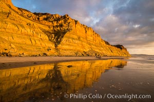
Torrey Pines cliffs and storm clouds at sunset.
Location: Torrey Pines State Reserve, San Diego, California
Image ID: 29102
Location: Torrey Pines State Reserve, San Diego, California
Image ID: 29102
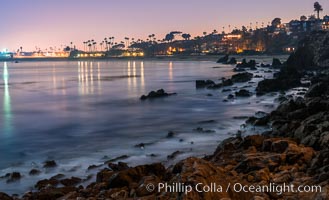
Big Corona Beach, aka Corona del Mar State Beach, at night lit by full moon, Newport Beach.
Location: Newport Beach, California
Image ID: 28865
Location: Newport Beach, California
Image ID: 28865
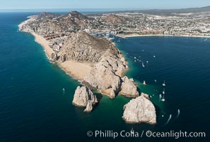
Aerial photograph of Land's End and the Arch, Cabo San Lucas, Mexico.
Location: Cabo San Lucas, Baja California, Mexico
Image ID: 28893
Location: Cabo San Lucas, Baja California, Mexico
Image ID: 28893
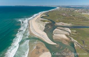
Aerial Photo of Tijuana River Mouth SMCA. Tijuana River Mouth State Marine Conservation Area borders Imperial Beach and the Mexican Border.
Location: Imperial Beach, California
Image ID: 30660
Location: Imperial Beach, California
Image ID: 30660

Carlsbad Coast at Sunset, Terramar and the Oceanside Pier, with Camp Pendleton and the San Onofre power plant in the distance on this incredibly clean and crisp evening view. Rising in the distance is San Onofre Mountain (1722') topped by a tall signal tower, one of the southern peaks in the Santa Ana Mountains.
Location: Carlsbad, California
Image ID: 37482
Panorama dimensions: 1106 x 3500
Location: Carlsbad, California
Image ID: 37482
Panorama dimensions: 1106 x 3500

Sunset over Flat Rock on Torrey Pines State Beach.
Location: Torrey Pines State Reserve, San Diego, California
Image ID: 29105
Panorama dimensions: 3831 x 12302
Location: Torrey Pines State Reserve, San Diego, California
Image ID: 29105
Panorama dimensions: 3831 x 12302
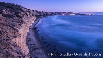
Torrey Pines cliffs at sunset.
Location: Torrey Pines State Reserve, San Diego, California
Image ID: 29112
Location: Torrey Pines State Reserve, San Diego, California
Image ID: 29112
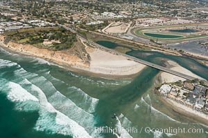
Aerial photo of San Dieguito Lagoon and Dog Beach. San Dieguito Lagoon State Marine Conservation Area (SMCA) is a marine protected area near Del Mar in San Diego County.
Location: Del Mar, California
Image ID: 30604
Location: Del Mar, California
Image ID: 30604
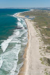
Aerial Photo of Tijuana River Mouth SMCA. Tijuana River Mouth State Marine Conservation Area borders Imperial Beach and the Mexican Border.
Location: Imperial Beach, California
Image ID: 30649
Location: Imperial Beach, California
Image ID: 30649
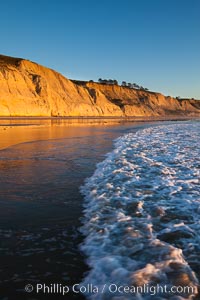
Torrey Pines State Beach, sandstone cliffs rise above the beach at Torrey Pines State Reserve.
Location: Torrey Pines State Reserve, San Diego, California
Image ID: 27248
Location: Torrey Pines State Reserve, San Diego, California
Image ID: 27248
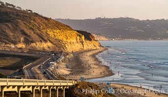
Torrey Pines State Beach at Sunset, La Jolla, Mount Soledad and Blacks Beach in the distance.
Location: Torrey Pines State Reserve, San Diego, California
Image ID: 35846
Location: Torrey Pines State Reserve, San Diego, California
Image ID: 35846
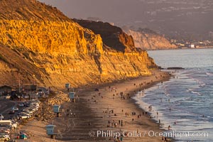
Torrey Pines State Beach at Sunset, La Jolla, Mount Soledad and Blacks Beach in the distance.
Location: Torrey Pines State Reserve, San Diego, California
Image ID: 35848
Location: Torrey Pines State Reserve, San Diego, California
Image ID: 35848
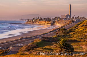
Carlsbad Coast Highway Sunset, Terramar and North Ponto to Oceanside with Camp Pendleton in the distance. Rising in the distance is San Onofre Mountain (1722') topped by a tall signal tower, one of the southern peaks in the Santa Ana Mountains.
Location: Carlsbad, California
Image ID: 35902
Location: Carlsbad, California
Image ID: 35902
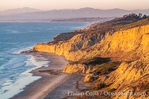
Torrey Pines sea cliffs at sunset, Flat Rock at low tide, looking north.
Location: Blacks Beach, La Jolla, California
Image ID: 36556
Location: Blacks Beach, La Jolla, California
Image ID: 36556
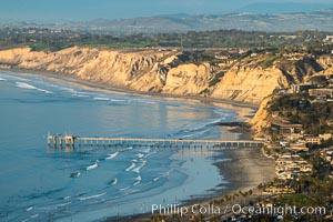
La Jolla Shores Coastline and Scripps Pier, Blacks Beach and Torrey Pines Golf Course and State Reserve, aerial photo, sunset. The Gold Coast of La Jolla basks in the warm waning light of a winter afternoon.
Location: La Jolla, California
Image ID: 36669
Location: La Jolla, California
Image ID: 36669
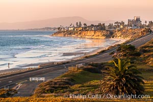
Carlsbad Coast Highway Sunset, Terramar and North Ponto to Oceanside with Camp Pendleton in the distance. Rising in the distance is San Onofre Mountain (1722') topped by a tall signal tower, one of the southern peaks in the Santa Ana Mountains.
Location: Carlsbad, California
Image ID: 37478
Location: Carlsbad, California
Image ID: 37478
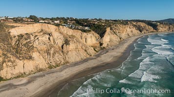
Aerial Photo of San Diego Scripps Coastal SMCA. Blacks Beach and Torrey Pines State Reserve.
Location: La Jolla, California
Image ID: 30736
Location: La Jolla, California
Image ID: 30736
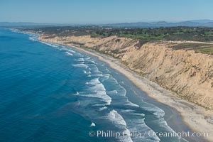
Aerial Photo of San Diego Scripps Coastal SMCA. Blacks Beach and Torrey Pines State Reserve.
Location: La Jolla, California
Image ID: 30622
Location: La Jolla, California
Image ID: 30622
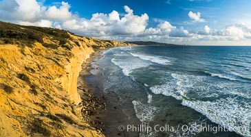
Torrey Pines cliffs.
Location: Torrey Pines State Reserve, San Diego, California
Image ID: 29133
Panorama dimensions: 4995 x 9126
Location: Torrey Pines State Reserve, San Diego, California
Image ID: 29133
Panorama dimensions: 4995 x 9126
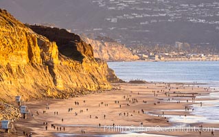
Torrey Pines State Beach on the extreme low King Tide, people walking on the beach, sunset light and La Jolla in the distance.
Location: Torrey Pines State Reserve, San Diego, California
Image ID: 37601
Location: Torrey Pines State Reserve, San Diego, California
Image ID: 37601
