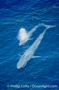
Two blue whales, a mother and her calf, swim through the open ocean in this aerial photograph. The calf is blowing (spouting, exhaling) with a powerful column of spray. The blue whale is the largest animal ever to live on Earth.
Species: Blue whale, Balaenoptera musculus
Location: San Diego, California
Image ID: 02304
Species: Blue whale, Balaenoptera musculus
Location: San Diego, California
Image ID: 02304
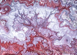
The Tree of Eons, a spectacular dendritic formation in the Bentonite Hills of Utah. Fantastic colorful sedimentary patterns, ancient Bentonite layers are exposed through erosion in the Utah Badlands. The Bentonite Hills are composed of the Brushy Basin shale member of the Morrison Formation. This layer was formed during Jurassic times when mud, silt, fine sand, and volcanic ash were deposited in swamps and lakes. Photographed just before sunrise with soft pre-dawn illumination. Aerial panoramic photograph.
Location: Utah
Image ID: 37951
Panorama dimensions: 11000 x 15000
Location: Utah
Image ID: 37951
Panorama dimensions: 11000 x 15000
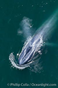
Enormous blue whale, exhaling as it surfaces from a dive, aerial photo. The blue whale is the largest animal ever to have lived on Earth, exceeding 100' in length and 200 tons in weight.
Species: Blue whale, Balaenoptera musculus
Location: Redondo Beach, California
Image ID: 25950
Species: Blue whale, Balaenoptera musculus
Location: Redondo Beach, California
Image ID: 25950

Aerial View of Namena Marine Reserve and Coral Reefs, Namena Island, Fiji.
Location: Namena Marine Reserve, Namena Island, Fiji
Image ID: 34680
Panorama dimensions: 4800 x 16200
Location: Namena Marine Reserve, Namena Island, Fiji
Image ID: 34680
Panorama dimensions: 4800 x 16200
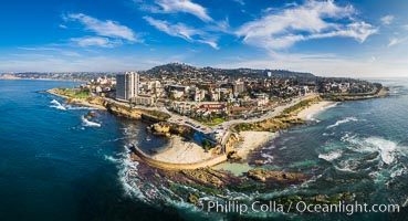
Childrens Pool Reef Exposed at Extreme Low Tide, La Jolla, California. Aerial panoramic photograph.
Location: La Jolla, California
Image ID: 37946
Panorama dimensions: 6176 x 11395
Location: La Jolla, California
Image ID: 37946
Panorama dimensions: 6176 x 11395
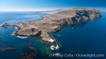
San Clemente Island Pyramid Head, the distinctive pyramid shaped southern end of the island. San Clemente Island Pyramid Head, showing geologic terracing, underwater reefs and giant kelp forests.
Location: San Clemente Island, California
Image ID: 26003
Location: San Clemente Island, California
Image ID: 26003
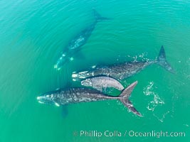
Mother and calf southern right whales are seen here as part of a larger courtship group, with adult males interested in mating with the mother. The calf has no choice but to stay by her mother's side during the courting activities.
Species: Southern Right Whale, Eubalaena australis
Location: Puerto Piramides, Chubut, Argentina
Image ID: 38381
Species: Southern Right Whale, Eubalaena australis
Location: Puerto Piramides, Chubut, Argentina
Image ID: 38381
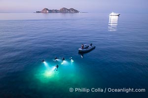
SCUBA Divers at Night, Isla de la Guarda Island, aerial photo, Sea of Cortez. Dive boat Rocio del Mar is seen in the distance. Night diving is scary so I stay on the big boat and fly my drone.
Location: Isla Angel de la Guarda, Baja California, Mexico
Image ID: 40372
Location: Isla Angel de la Guarda, Baja California, Mexico
Image ID: 40372
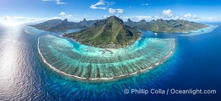
Barrier Reef around Moorea Island, French Polynesia. Cook's Bay to the left, Opunohu Bay to the right. The outer reef slope is seen adjacent to deep blue oceanic water with white waves breaking against the reef edge. Next, a wide shallow reef flat occurs dotted with coral bommies. Inside of that, a shallow protected lagoon is formed against the island. Tall, rugged, eroded mountains are seen hinting at the age of the ancient volcano that originally formed the island and that is now sinking back down, leaving the encircling reef behind.
Location: Moorea, French Polynesia, France
Image ID: 40676
Panorama dimensions: 5501 x 11925
Location: Moorea, French Polynesia, France
Image ID: 40676
Panorama dimensions: 5501 x 11925
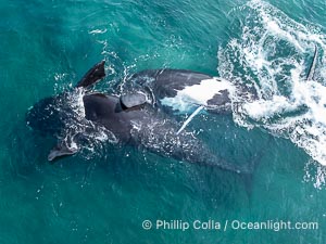
Copulating Southern Right Whales, aerial photo. The male is upside down (belly up) and trying to copulate with the female who is also belly up and being evasive of the male. By permission of the Government of Argentina, Chubut, permit # 51 / 2025-SsCyA.
Species: Southern Right Whale, Eubalaena australis
Location: Puerto Piramides, Chubut, Argentina
Image ID: 41185
Species: Southern Right Whale, Eubalaena australis
Location: Puerto Piramides, Chubut, Argentina
Image ID: 41185
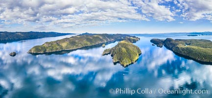
Browning Pass aerial photo, with Nigei Island (left) and Balackava Island (right).
Location: British Columbia, Canada
Image ID: 35252
Panorama dimensions: 6038 x 13074
Location: British Columbia, Canada
Image ID: 35252
Panorama dimensions: 6038 x 13074
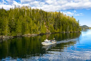
Dive Boat Hurst Island, Browning Pass, Canada, aerial photo.
Location: British Columbia, Canada
Image ID: 35253
Location: British Columbia, Canada
Image ID: 35253
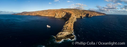
Cabo Pearce on Socorro Island, aerial photo, Revillagigedos Islands, Mexico.
Location: Socorro Island (Islas Revillagigedos), Baja California, Mexico
Image ID: 32905
Panorama dimensions: 4282 x 11583
Location: Socorro Island (Islas Revillagigedos), Baja California, Mexico
Image ID: 32905
Panorama dimensions: 4282 x 11583
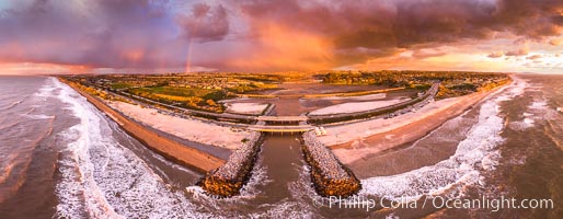
Batiquitos Lagoon and Ponto, stormy sunset, aerial panoramic photograph.
Location: Carlsbad, California
Image ID: 37944
Panorama dimensions: 6058 x 15573
Location: Carlsbad, California
Image ID: 37944
Panorama dimensions: 6058 x 15573
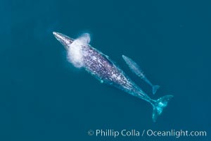
Mother and calf gray whale, aerial photo, embryonic folds visible on the very young calf.
Species: Gray whale, Eschrichtius robustus
Image ID: 37973
Species: Gray whale, Eschrichtius robustus
Image ID: 37973
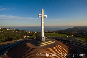
Sunrise over The Mount Soledad Cross, a landmark in La Jolla, California. The Mount Soledad Cross is a 29-foot-tall cross erected in 1954. Aerial photo.
Location: La Jolla, California
Image ID: 38096
Location: La Jolla, California
Image ID: 38096
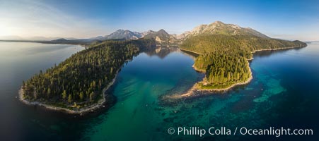
Emerald Bay Lake Tahoe, aerial panoramic photo of the mouth of the bay, early morning.
Location: Lake Tahoe, California
Image ID: 38130
Panorama dimensions: 4417 x 9952
Location: Lake Tahoe, California
Image ID: 38130
Panorama dimensions: 4417 x 9952
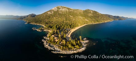
Sand Harbor Lake Tahoe at sunset, aerial photo.
Location: Lake Tahoe, Nevada
Image ID: 38131
Panorama dimensions: 4080 x 9028
Location: Lake Tahoe, Nevada
Image ID: 38131
Panorama dimensions: 4080 x 9028
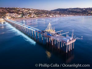
Scripps Pier and Christmas Lights during holiday season, night exposure, La Jolla Coastline, Aerial view.
Location: Scripps Institution of Oceanography, La Jolla, California
Image ID: 38181
Location: Scripps Institution of Oceanography, La Jolla, California
Image ID: 38181
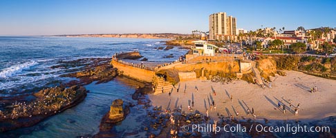
South Casa Cove and Childrens Pool sea wall, with tourist crowds at sunset on a low tide, La Jolla.
Location: La Jolla, California
Image ID: 38188
Location: La Jolla, California
Image ID: 38188
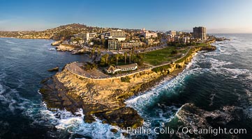
Aerial Panoramic Photo of Point La Jolla at sunset, La Jolla and Mount Soledad. People enjoying the sunset on the sea wall looking at sea lions on the rocks.
Location: La Jolla, California
Image ID: 38207
Panorama dimensions: 5354 x 9669
Location: La Jolla, California
Image ID: 38207
Panorama dimensions: 5354 x 9669
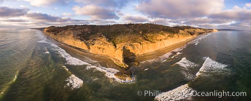
Flat Rock and Torrey Pines Seacliffs at Sunset, aerial photo.
Location: Torrey Pines State Reserve, San Diego, California
Image ID: 38227
Location: Torrey Pines State Reserve, San Diego, California
Image ID: 38227
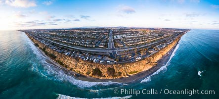
South Carlsbad State Beach and campground, aerial photo.
Location: Carlsbad, California
Image ID: 38228
Panorama dimensions: 4357 x 9642
Location: Carlsbad, California
Image ID: 38228
Panorama dimensions: 4357 x 9642
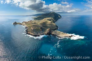
San Clemente Island aerial photo, Pyramid Head and Balanced Rock (China Hat) at the southern end of the island. San Clemente Island Pyramid Head, the distinctive pyramid shaped southern end of the island, exhibits distinctive geologic terracing, underwater reefs and giant kelp forests.
Location: San Clemente Island, California
Image ID: 38483
Location: San Clemente Island, California
Image ID: 38483
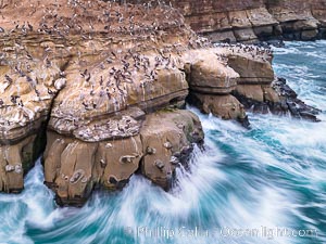
Brown Pelicans on Goldfish Point in La Jolla, time exposure blurs the large waves, aerial photograph. In the summer we used to jump off the cliff (the "Clam") in front of the twin cave entrances seen at middle-right.
Species: Brown Pelican, Pelecanus occidentalis, Pelecanus occidentalis californicus
Location: La Jolla, California
Image ID: 38865
Species: Brown Pelican, Pelecanus occidentalis, Pelecanus occidentalis californicus
Location: La Jolla, California
Image ID: 38865
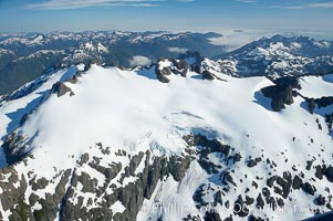
Mariner Mountain, on the west coast of Vancouver Island, British Columbia, Canada, part of Strathcona Provincial Park, located 36 km (22 mi) north of Tofino. It is 1,771 m (5,810 ft) high, snow covered year-round and home to several glaciers.
Location: Mariner Mountain, Strathcona Provincial Park, British Columbia, Canada
Image ID: 21072
Location: Mariner Mountain, Strathcona Provincial Park, British Columbia, Canada
Image ID: 21072
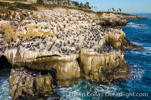
Brown Pelicans gather in large numbers on coastal cliffs, Goldfish Point near the Clam in La Jolla. Aerial photograph.
Species: Brown Pelican, Pelecanus occidentalis, Pelecanus occidentalis californicus
Location: La Jolla, California
Image ID: 37954
Species: Brown Pelican, Pelecanus occidentalis, Pelecanus occidentalis californicus
Location: La Jolla, California
Image ID: 37954
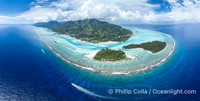
Barrier Reef around Moorea Island, French Polynesia. Motu Tiahura (left) and Motu Fareone (right) are the small islands in the foreground. The outer reef slope is seen adjacent to deep blue oceanic water with white waves breaking against the reef edge. Next, a wide shallow reef flat occurs dotted with coral bommies. Inside of that, a shallow protected lagoon is formed against the island. Tall, rugged, eroded mountains are seen hinting at the age of the ancient volcano that originally formed the island and that is now sinking back down, leaving the encircling reef behind.
Location: Moorea, French Polynesia, France
Image ID: 40614
Panorama dimensions: 5717 x 11305
Location: Moorea, French Polynesia, France
Image ID: 40614
Panorama dimensions: 5717 x 11305
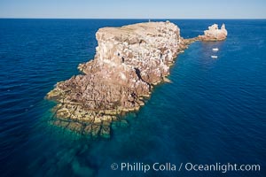
Los Islotes, famous for its friendly colony of California sea lions, part of Archipelago Espiritu Santo, Sea of Cortez, Aerial Photo.
Location: Baja California, Mexico
Image ID: 32397
Location: Baja California, Mexico
Image ID: 32397
