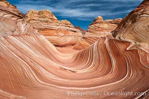
The Wave, an area of fantastic eroded sandstone featuring beautiful swirls, wild colors, countless striations, and bizarre shapes set amidst the dramatic surrounding North Coyote Buttes of Arizona and Utah. The sandstone formations of the North Coyote Buttes, including the Wave, date from the Jurassic period. Managed by the Bureau of Land Management, the Wave is located in the Paria Canyon-Vermilion Cliffs Wilderness and is accessible on foot by permit only.
Location: North Coyote Buttes, Paria Canyon-Vermilion Cliffs Wilderness, Arizona
Image ID: 20605
Location: North Coyote Buttes, Paria Canyon-Vermilion Cliffs Wilderness, Arizona
Image ID: 20605
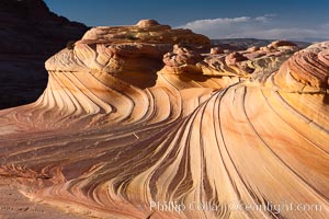
The Second Wave at Sunset, North Coyote Buttes. The Second Wave, a curiously-shaped sandstone swirl, takes on rich warm tones and dramatic shadowed textures at sunset. Set in the North Coyote Buttes of Arizona and Utah, the Second Wave is characterized by striations revealing layers of sedimentary deposits, a visible historical record depicting eons of submarine geology.
Location: North Coyote Buttes, Paria Canyon-Vermilion Cliffs Wilderness, Arizona
Image ID: 20606
Location: North Coyote Buttes, Paria Canyon-Vermilion Cliffs Wilderness, Arizona
Image ID: 20606
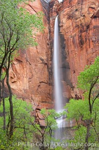
Waterfall at Temple of Sinawava during peak flow following spring rainstorm. Zion Canyon.
Location: Temple of Sinawava, Zion National Park, Utah
Image ID: 12450
Location: Temple of Sinawava, Zion National Park, Utah
Image ID: 12450
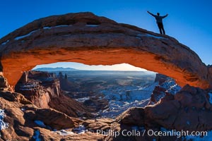
Extended High Mountain pose, Utthita Tadasana, sunrise on Mesa Arch, Utah. A lone hiker greets the dawning sun from atop Mesa Arch.
Location: Island in the Sky, Canyonlands National Park, Utah
Image ID: 18036
Location: Island in the Sky, Canyonlands National Park, Utah
Image ID: 18036
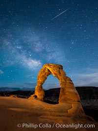
Milky Way and Shooting Star over Delicate Arch, as stars cover the night sky.
Location: Arches National Park, Utah
Image ID: 27854
Location: Arches National Park, Utah
Image ID: 27854
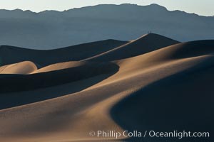
Tiny hikers atop Sand Dunes in Death Valley National Park, California. Near Stovepipe Wells lies a region of sand dunes, some of them hundreds of feet tall.
Location: Stovepipe Wells, Death Valley National Park, California
Image ID: 15577
Location: Stovepipe Wells, Death Valley National Park, California
Image ID: 15577
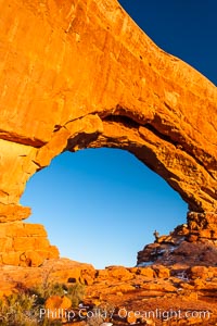
Hiker in North Window, sunset, western face. North Window is a natural sandstone arch 90 feet wide and 48 feet high.
Location: North Window, Arches National Park, Utah
Image ID: 18159
Location: North Window, Arches National Park, Utah
Image ID: 18159
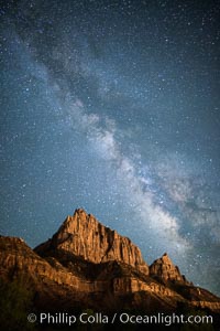
Milky Way over the Watchman, Zion National Park. The Milky Way galaxy rises in the night sky above the the Watchman.
Location: Zion National Park, Utah
Image ID: 28586
Location: Zion National Park, Utah
Image ID: 28586
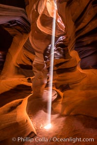
Light Beam in Upper Antelope Slot Canyon. Thin shafts of light briefly penetrate the convoluted narrows of Upper Antelope Slot Canyon, sending piercing beams through the sandstone maze to the sand floor below.
Location: Navajo Tribal Lands, Page, Arizona
Image ID: 28570
Location: Navajo Tribal Lands, Page, Arizona
Image ID: 28570
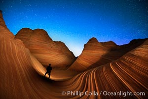
The Wave at Night, under a clear night sky full of stars. Photographer is illuminating the striated rocks with a small handheld light. The Wave, an area of fantastic eroded sandstone featuring beautiful swirls, wild colors, countless striations, and bizarre shapes is set amidst the dramatic surrounding North Coyote Buttes of Arizona and Utah. The sandstone formations of the North Coyote Buttes, including the Wave, date from the Jurassic period. Managed by the Bureau of Land Management, the Wave is located in the Paria Canyon-Vermilion Cliffs Wilderness and is accessible on foot by permit only.
Location: North Coyote Buttes, Paria Canyon-Vermilion Cliffs Wilderness, Arizona
Image ID: 28620
Location: North Coyote Buttes, Paria Canyon-Vermilion Cliffs Wilderness, Arizona
Image ID: 28620
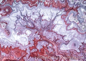
The Tree of Eons, a spectacular dendritic formation in the Bentonite Hills of Utah. Fantastic colorful sedimentary patterns, ancient Bentonite layers are exposed through erosion in the Utah Badlands. The Bentonite Hills are composed of the Brushy Basin shale member of the Morrison Formation. This layer was formed during Jurassic times when mud, silt, fine sand, and volcanic ash were deposited in swamps and lakes. Photographed just before sunrise with soft pre-dawn illumination. Aerial panoramic photograph.
Location: Utah
Image ID: 37951
Panorama dimensions: 11000 x 15000
Location: Utah
Image ID: 37951
Panorama dimensions: 11000 x 15000
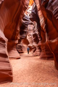
A hiker admiring the striated walls and dramatic light within Antelope Canyon, a deep narrow slot canyon formed by water and wind erosion.
Location: Navajo Tribal Lands, Page, Arizona
Image ID: 17993
Location: Navajo Tribal Lands, Page, Arizona
Image ID: 17993
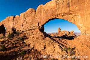
Tracy greets the dawn, with Turret Arch in the distance viewed through North Window at Sunrise.
Location: North Window, Arches National Park, Utah
Image ID: 37860
Location: North Window, Arches National Park, Utah
Image ID: 37860
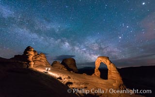
Light Painting and the Milky Way and Stars over Delicate Arch, at night, Arches National Park, Utah.
Location: Delicate Arch, Arches National Park, Utah
Image ID: 29288
Location: Delicate Arch, Arches National Park, Utah
Image ID: 29288
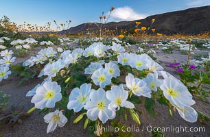
Dune Evening Primrose bloom in Anza Borrego Desert State Park, during the 2017 Superbloom.
Species: Dune evening primrose, Oenothera deltoides
Location: Anza-Borrego Desert State Park, Borrego Springs, California
Image ID: 33186
Species: Dune evening primrose, Oenothera deltoides
Location: Anza-Borrego Desert State Park, Borrego Springs, California
Image ID: 33186
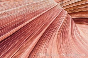
The Wave, an area of fantastic eroded sandstone featuring beautiful swirls, wild colors, countless striations, and bizarre shapes set amidst the dramatic surrounding North Coyote Buttes of Arizona and Utah. The sandstone formations of the North Coyote Buttes, including the Wave, date from the Jurassic period. Managed by the Bureau of Land Management, the Wave is located in the Paria Canyon-Vermilion Cliffs Wilderness and is accessible on foot by permit only.
Location: North Coyote Buttes, Paria Canyon-Vermilion Cliffs Wilderness, Arizona
Image ID: 20607
Location: North Coyote Buttes, Paria Canyon-Vermilion Cliffs Wilderness, Arizona
Image ID: 20607
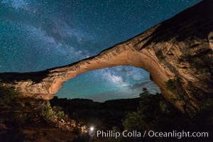
Owachomo Bridge and Milky Way. Owachomo Bridge, a natural stone bridge standing 106' high and spanning 130' wide,stretches across a canyon with the Milky Way crossing the night sky.
Location: Owachomo Bridge, Natural Bridges National Monument, Utah
Image ID: 28541
Location: Owachomo Bridge, Natural Bridges National Monument, Utah
Image ID: 28541
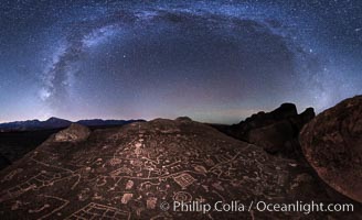
The Milky Way at Night over Sky Rock, panorama, spherical projection. Sky Rock petroglyphs near Bishop, California. Hidden atop an enormous boulder in the Volcanic Tablelands lies Sky Rock, a set of petroglyphs that face the sky. These superb examples of native American petroglyph artwork are thought to be Paiute in origin, but little is known about them.
Location: Bishop, California
Image ID: 28799
Panorama dimensions: 8511 x 13962
Location: Bishop, California
Image ID: 28799
Panorama dimensions: 8511 x 13962
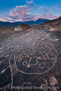
Sky Rock petroglyphs near Bishop, California, sunrise light just touching clouds and the Sierra Nevada. Hidden atop an enormous boulder in the Volcanic Tablelands lies Sky Rock, a set of petroglyphs that face the sky. These superb examples of native American petroglyph artwork are thought to be Paiute in origin, but little is known about them.
Location: Bishop, California
Image ID: 26979
Location: Bishop, California
Image ID: 26979
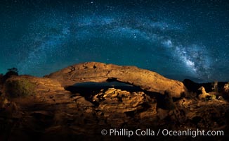
Panorama of the Milky Way over Mesa Arch.
Location: Mesa Arch, Canyonlands National Park, Utah
Image ID: 27824
Panorama dimensions: 4790 x 7815
Location: Mesa Arch, Canyonlands National Park, Utah
Image ID: 27824
Panorama dimensions: 4790 x 7815
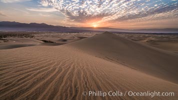
Mesquite Dunes sunrise, dawn, clouds and morning sky, sand dunes.
Location: Stovepipe Wells, Death Valley National Park, California
Image ID: 28689
Location: Stovepipe Wells, Death Valley National Park, California
Image ID: 28689
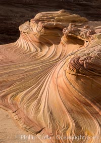
The Second Wave at Sunset, Vermillion Cliffs. The Second Wave, a curiously-shaped sandstone swirl, takes on rich warm tones and dramatic shadowed textures at sunset. Set in the North Coyote Buttes of Arizona and Utah, the Second Wave is characterized by striations revealing layers of sedimentary deposits, a visible historical record depicting eons of submarine geology.
Location: North Coyote Buttes, Paria Canyon-Vermilion Cliffs Wilderness, Arizona
Image ID: 28613
Location: North Coyote Buttes, Paria Canyon-Vermilion Cliffs Wilderness, Arizona
Image ID: 28613
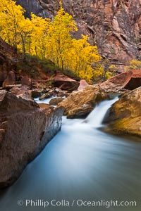
The Virgin River flows by autumn cottonwood trees, part of the Virgin River Narrows. This is a fantastic hike in fall with the comfortable temperatures, beautiful fall colors and light crowds.
Location: Virgin River Narrows, Zion National Park, Utah
Image ID: 26096
Location: Virgin River Narrows, Zion National Park, Utah
Image ID: 26096
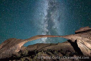
Landscape Arch and Milky Way, stars rise over the arch at night.
Location: Arches National Park, Utah
Image ID: 27868
Location: Arches National Park, Utah
Image ID: 27868
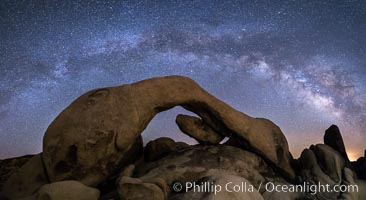
Milky Way at Night over Arch Rock, Joshua Tree National Park.
Location: Joshua Tree National Park, California
Image ID: 30220
Panorama dimensions: 4709 x 9140
Location: Joshua Tree National Park, California
Image ID: 30220
Panorama dimensions: 4709 x 9140
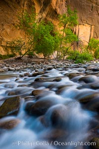
The Virgin River Narrows, where the Virgin River has carved deep, narrow canyons through the Zion National Park sandstone, creating one of the finest hikes in the world.
Location: Virgin River Narrows, Zion National Park, Utah
Image ID: 28575
Location: Virgin River Narrows, Zion National Park, Utah
Image ID: 28575
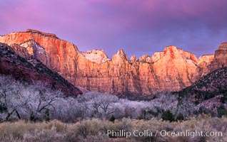
West Temple, The Sundial and the Altar of Sacrifice illuminated by soft alpenglow, about 20 minutes before sunrise.
Location: Zion National Park, Utah
Image ID: 37788
Location: Zion National Park, Utah
Image ID: 37788
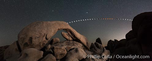
Lunar Eclipse and blood red moon sequence over Arch Rock, planet Mars above the moon, composite image, Joshua Tree National Park, April 14/15 2014.
Image ID: 29201
Panorama dimensions: 5835 x 14655
Image ID: 29201
Panorama dimensions: 5835 x 14655
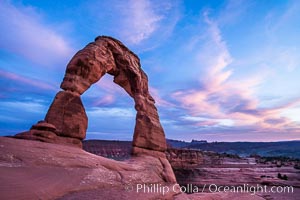
Delicate Arch at Sunset, Arches National Park.
Location: Delicate Arch, Arches National Park, Utah
Image ID: 29283
Location: Delicate Arch, Arches National Park, Utah
Image ID: 29283
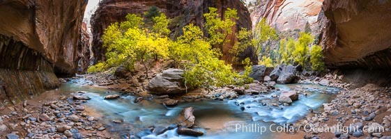
Fall Colors in the Virgin River Narrows, Zion National Park, Utah.
Location: Virgin River Narrows, Zion National Park, Utah
Image ID: 32634
Panorama dimensions: 5145 x 14424
Location: Virgin River Narrows, Zion National Park, Utah
Image ID: 32634
Panorama dimensions: 5145 x 14424