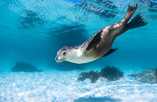
Australian Sea Lion Underwater, Grindal Island. Australian sea lions are the only endemic pinniped in Australia, and are found along the coastlines and islands of south and west Australia.
Species: Australian Sea Lion, Neophoca cinearea
Location: Grindal Island, South Australia
Image ID: 39155
Species: Australian Sea Lion, Neophoca cinearea
Location: Grindal Island, South Australia
Image ID: 39155

Australian Sea Lion Underwater, Grindal Island. Australian sea lions are the only endemic pinniped in Australia, and are found along the coastlines and islands of south and west Australia.
Species: Australian Sea Lion, Neophoca cinearea
Location: Grindal Island, South Australia
Image ID: 39156
Species: Australian Sea Lion, Neophoca cinearea
Location: Grindal Island, South Australia
Image ID: 39156
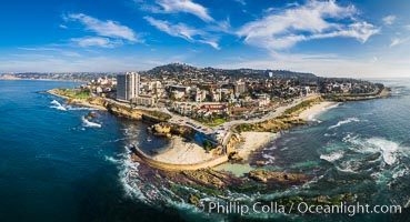
Childrens Pool Reef Exposed at Extreme Low Tide, La Jolla, California. Aerial panoramic photograph.
Location: La Jolla, California
Image ID: 37946
Panorama dimensions: 6176 x 11395
Location: La Jolla, California
Image ID: 37946
Panorama dimensions: 6176 x 11395
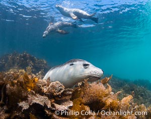
Australian Sea Lions in Kelp, Grindal Island. Australian sea lions are the only endemic pinniped in Australia, and are found along the coastlines and islands of south and west Australia.
Species: Australian Sea Lion, Neophoca cinearea
Location: Grindal Island, South Australia
Image ID: 39163
Species: Australian Sea Lion, Neophoca cinearea
Location: Grindal Island, South Australia
Image ID: 39163

Australian Sea Lion Underwater, Grindal Island. Australian sea lions are the only endemic pinniped in Australia, and are found along the coastlines and islands of south and west Australia.
Species: Australian Sea Lion, Neophoca cinearea
Location: Grindal Island, South Australia
Image ID: 39164
Species: Australian Sea Lion, Neophoca cinearea
Location: Grindal Island, South Australia
Image ID: 39164

A northern elephant seal hovers underwater over a rocky bottom along the coastline of Guadalupe Island.
Species: Elephant seal, Mirounga angustirostris
Location: Guadalupe Island (Isla Guadalupe), Baja California, Mexico
Image ID: 03505
Species: Elephant seal, Mirounga angustirostris
Location: Guadalupe Island (Isla Guadalupe), Baja California, Mexico
Image ID: 03505
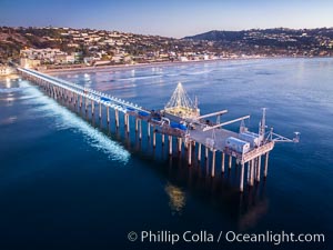
Scripps Pier and Christmas Lights during holiday season, night exposure, La Jolla Coastline, Aerial view.
Location: Scripps Institution of Oceanography, La Jolla, California
Image ID: 38181
Location: Scripps Institution of Oceanography, La Jolla, California
Image ID: 38181
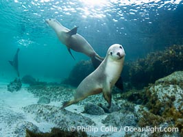
Australian Sea Lions, Grindal Island. Australian sea lions are the only endemic pinniped in Australia, and are found along the coastlines and islands of south and west Australia.
Species: Australian Sea Lion, Neophoca cinearea
Location: Grindal Island, South Australia
Image ID: 39157
Species: Australian Sea Lion, Neophoca cinearea
Location: Grindal Island, South Australia
Image ID: 39157
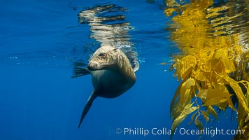
California sea lion on drift kelp paddy, underwater. This adult female California sea lion was hanging out underneath a paddy of drift kelp, well offshore the coastline of San Diego.
Species: California sea lion, Zalophus californianus
Location: San Diego, California
Image ID: 38532
Species: California sea lion, Zalophus californianus
Location: San Diego, California
Image ID: 38532

Guadalupe fur seal pup sits on brown rocks along the coastline of Guadalupe Island.
Species: Guadalupe fur seal, Arctocephalus townsendi
Location: Guadalupe Island (Isla Guadalupe), Baja California, Mexico
Image ID: 02441
Species: Guadalupe fur seal, Arctocephalus townsendi
Location: Guadalupe Island (Isla Guadalupe), Baja California, Mexico
Image ID: 02441
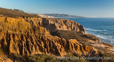
Torrey Pines Cliffs and Pacific Ocean, Razor Point view to La Jolla, San Diego, California.
Location: Torrey Pines State Reserve, San Diego, California
Image ID: 28487
Location: Torrey Pines State Reserve, San Diego, California
Image ID: 28487

Guadalupe Island at sunrise, panorama. Volcanic coastline south of Pilot Rock and Spanish Cove, near El Faro lighthouse.
Location: Guadalupe Island (Isla Guadalupe), Baja California, Mexico
Image ID: 28758
Panorama dimensions: 4224 x 25926
Location: Guadalupe Island (Isla Guadalupe), Baja California, Mexico
Image ID: 28758
Panorama dimensions: 4224 x 25926
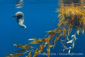
California sea lion resting alongside a drift kelp paddy, underwater. This adult female California sea lion was hanging out underneath a paddy of drift kelp, well offshore the coastline of San Diego.
Species: California sea lion, Zalophus californianus
Location: San Diego, California
Image ID: 38535
Species: California sea lion, Zalophus californianus
Location: San Diego, California
Image ID: 38535
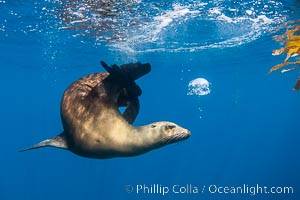
California sea lion on drift kelp paddy, underwater. This adult female California sea lion was hanging out underneath a paddy of drift kelp, well offshore the coastline of San Diego.
Species: California sea lion, Zalophus californianus
Location: San Diego, California
Image ID: 38540
Species: California sea lion, Zalophus californianus
Location: San Diego, California
Image ID: 38540
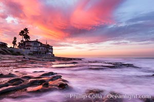
A fiery sunrise explodes over the La Jolla coastline.
Location: La Jolla, California
Image ID: 28871
Location: La Jolla, California
Image ID: 28871
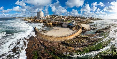
Children's Pool Reef Exposed at Extreme Low King Tide, La Jolla, California. Aerial panoramic photograph.
Location: La Jolla, California
Image ID: 40717
Panorama dimensions: 6423 x 12735
Location: La Jolla, California
Image ID: 40717
Panorama dimensions: 6423 x 12735
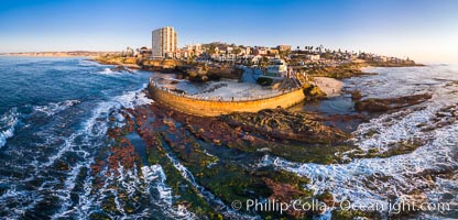
Childrens Pool and La Jolla coastline at sunset, aerial panorama, showing underwater reef exposed at King Low Tide.
Location: La Jolla, California
Image ID: 37977
Panorama dimensions: 5653 x 11765
Location: La Jolla, California
Image ID: 37977
Panorama dimensions: 5653 x 11765
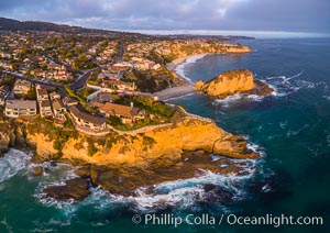
Laguna Beach Coastline including Views South to Three Arch Bay, Aerial Photo.
Location: Laguna Beach, California
Image ID: 38082
Location: Laguna Beach, California
Image ID: 38082
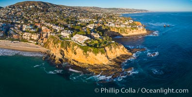
Laguna Beach Coastline, north of Crescent Point, Aerial Photo.
Location: Laguna Beach, California
Image ID: 38150
Location: Laguna Beach, California
Image ID: 38150
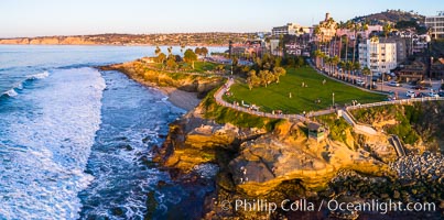
Aerial Photo of Point La Jolla and Scripps Park, La Jolla Coastline.
Location: La Jolla, California
Image ID: 38152
Location: La Jolla, California
Image ID: 38152
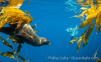
California sea lion watches an ocean sunfish, Mola mola, on drift kelp paddy, underwater. This adult female California sea lion was hanging out underneath a paddy of drift kelp, well offshore the coastline of San Diego.
Species: Ocean sunfish, California sea lion, Mola mola, Zalophus californianus
Location: San Diego, California
Image ID: 38536
Species: Ocean sunfish, California sea lion, Mola mola, Zalophus californianus
Location: San Diego, California
Image ID: 38536
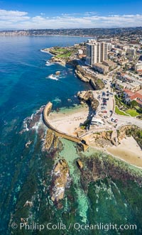
Childrens Pool Reef Exposed at Extreme Low Tide, Aerial View, La Jolla, California. Aerial panoramic photograph.
Location: La Jolla, California
Image ID: 37942
Location: La Jolla, California
Image ID: 37942
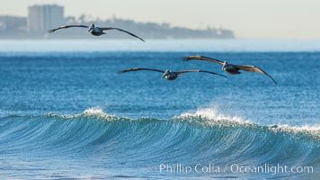
California Pelican flying on a wave, riding the updraft from the wave, La Jolla coastline in the distant background.
Species: Brown Pelican, Pelecanus occidentalis, Pelecanus occidentalis californicus
Image ID: 30262
Species: Brown Pelican, Pelecanus occidentalis, Pelecanus occidentalis californicus
Image ID: 30262
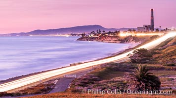
Sunset on Terra Mar and the Carlsbad coastline, looking north to Oceanside, Camp Pendleton and San Onofre. The Oceanside Pier, lit up at night, is seen further up the coast. Rising in the distance is San Onofre Mountain (1722') topped by a tall signal tower, one of the southern peaks in the Santa Ana Mountains.
Image ID: 36117
Image ID: 36117
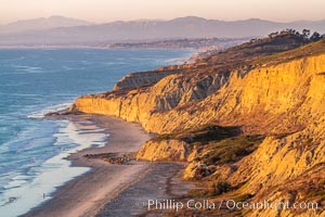
Torrey Pines sea cliffs at sunset, Flat Rock at low tide, looking north.
Location: Blacks Beach, La Jolla, California
Image ID: 36556
Location: Blacks Beach, La Jolla, California
Image ID: 36556
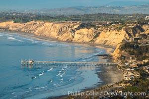
La Jolla Shores Coastline and Scripps Pier, Blacks Beach and Torrey Pines Golf Course and State Reserve, aerial photo, sunset. The Gold Coast of La Jolla basks in the warm waning light of a winter afternoon.
Location: La Jolla, California
Image ID: 36669
Location: La Jolla, California
Image ID: 36669
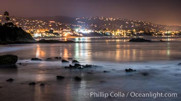
Laguna Beach coastline at night, lit by a full moon.
Location: Laguna Beach, California
Image ID: 28863
Location: Laguna Beach, California
Image ID: 28863
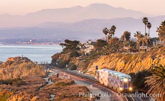
Sunset on the Del Mar Bluffs and Train Tracks, with North County coastline. The highest peaks in the distance are Santiago Peak and Modjeska Peak, the pair commonly known as Saddleback.
Location: Del Mar, California
Image ID: 37604
Location: Del Mar, California
Image ID: 37604
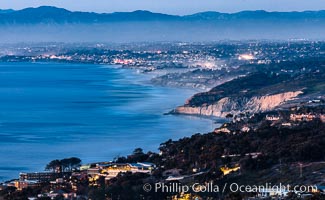
North County Coastline at Dusk, viewed from Mount Soledad.
Location: La Jolla, California
Image ID: 36660
Panorama dimensions: 5291 x 8592
Location: La Jolla, California
Image ID: 36660
Panorama dimensions: 5291 x 8592
