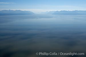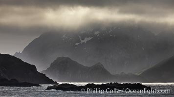
South Georgia Island coastline, showing the island's characteristic rugged topography. 56% of the island is covered by 161 glaciers, which have created numerous large bays and inlets that provide excellent habitat for marine animals and seabirds. Mountains meet the sea in steep-sided seacliffs covered with sparse vegetation. The highest point on South Georgia Island is Mt. Paget at 2,915m.
Location: South Georgia Island
Image ID: 24317
Location: South Georgia Island
Image ID: 24317

Del Mar beach and homes at sunset, dog beach and San Dieguito lagoon inlet, panoramic photo.
Location: Del Mar, California
Image ID: 30492
Panorama dimensions: 7029 x 28531
Location: Del Mar, California
Image ID: 30492
Panorama dimensions: 7029 x 28531
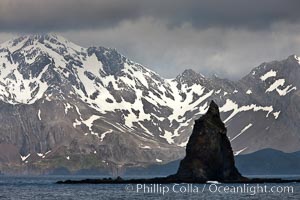
South Georgia Island coastline, showing the island's characteristic rugged topography. 56% of the island is covered by 161 glaciers, which have created numerous large bays and inlets that provide excellent habitat for marine animals and seabirds. Mountains meet the sea in steep-sided seacliffs covered with sparse vegetation. The highest point on South Georgia Island is Mt. Paget at 2,915m.
Location: South Georgia Island
Image ID: 24321
Location: South Georgia Island
Image ID: 24321
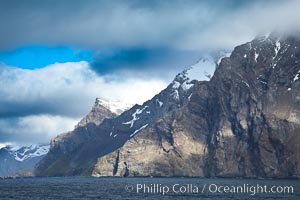
South Georgia Island coastline, showing the island's characteristic rugged topography. 56% of the island is covered by 161 glaciers, which have created numerous large bays and inlets that provide excellent habitat for marine animals and seabirds. Mountains meet the sea in steep-sided seacliffs covered with sparse vegetation. The highest point on South Georgia Island is Mt. Paget at 2,915m.
Location: South Georgia Island
Image ID: 24322
Location: South Georgia Island
Image ID: 24322
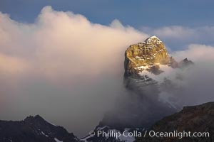
South Georgia Island, spire and sunset clouds, showing the island's characteristic rugged topography. 56% of the island is covered by 161 glaciers, which have created numerous large bays and inlets that provide excellent habitat for marine animals and seabirds. Mountains meet the sea in steep-sided seacliffs covered with sparse vegetation. The highest point on South Georgia Island is Mt. Paget at 2,915m.
Location: Right Whale Bay, South Georgia Island
Image ID: 24328
Location: Right Whale Bay, South Georgia Island
Image ID: 24328
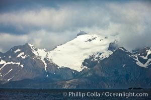
South Georgia Island coastline, showing the island's characteristic rugged topography. 56% of the island is covered by 161 glaciers, which have created numerous large bays and inlets that provide excellent habitat for marine animals and seabirds. Mountains meet the sea in steep-sided seacliffs covered with sparse vegetation. The highest point on South Georgia Island is Mt. Paget at 2,915m.
Location: South Georgia Island
Image ID: 24342
Location: South Georgia Island
Image ID: 24342
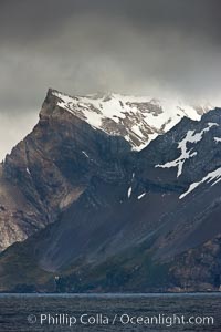
South Georgia Island coastline, showing the island's characteristic rugged topography. 56% of the island is covered by 161 glaciers, which have created numerous large bays and inlets that provide excellent habitat for marine animals and seabirds. Mountains meet the sea in steep-sided seacliffs covered with sparse vegetation. The highest point on South Georgia Island is Mt. Paget at 2,915m.
Location: South Georgia Island
Image ID: 24343
Location: South Georgia Island
Image ID: 24343
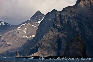
South Georgia Island coastline, showing the island's characteristic rugged topography. 56% of the island is covered by 161 glaciers, which have created numerous large bays and inlets that provide excellent habitat for marine animals and seabirds. Mountains meet the sea in steep-sided seacliffs covered with sparse vegetation. The highest point on South Georgia Island is Mt. Paget at 2,915m.
Location: South Georgia Island
Image ID: 24359
Location: South Georgia Island
Image ID: 24359
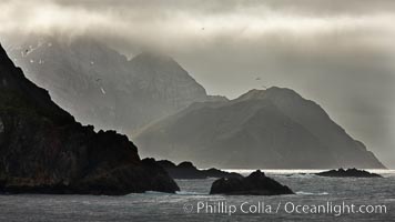
South Georgia Island coastline, showing the island's characteristic rugged topography. 56% of the island is covered by 161 glaciers, which have created numerous large bays and inlets that provide excellent habitat for marine animals and seabirds. Mountains meet the sea in steep-sided seacliffs covered with sparse vegetation. The highest point on South Georgia Island is Mt. Paget at 2,915m.
Location: South Georgia Island
Image ID: 24363
Location: South Georgia Island
Image ID: 24363
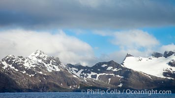
South Georgia Island coastline, showing the island's characteristic rugged topography. 56% of the island is covered by 161 glaciers, which have created numerous large bays and inlets that provide excellent habitat for marine animals and seabirds. Mountains meet the sea in steep-sided seacliffs covered with sparse vegetation. The highest point on South Georgia Island is Mt. Paget at 2,915m.
Location: South Georgia Island
Image ID: 24338
Location: South Georgia Island
Image ID: 24338
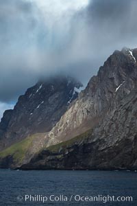
South Georgia Island coastline, showing the island's characteristic rugged topography. 56% of the island is covered by 161 glaciers, which have created numerous large bays and inlets that provide excellent habitat for marine animals and seabirds. Mountains meet the sea in steep-sided seacliffs covered with sparse vegetation. The highest point on South Georgia Island is Mt. Paget at 2,915m.
Location: South Georgia Island
Image ID: 24360
Location: South Georgia Island
Image ID: 24360
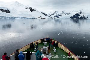
Approaching Neko Harbor. Neko Harbor is an inlet on the Antarctic Peninsula on Andvord Bay.
Location: Neko Harbor, Antarctic Peninsula, Antarctica
Image ID: 25678
Location: Neko Harbor, Antarctic Peninsula, Antarctica
Image ID: 25678
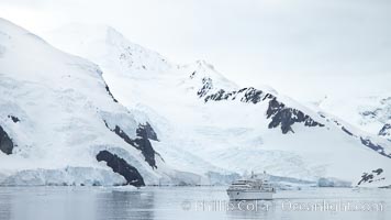
Approaching Neko Harbor. Neko Harbor is an inlet on the Antarctic Peninsula on Andvord Bay.
Location: Neko Harbor, Antarctic Peninsula, Antarctica
Image ID: 25679
Location: Neko Harbor, Antarctic Peninsula, Antarctica
Image ID: 25679
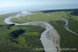
Johnson River, side waters and tidal sloughs, flowing among sedge grass meadows before emptying into Cook Inlet.
Location: Johnson River, Lake Clark National Park, Alaska
Image ID: 19063
Location: Johnson River, Lake Clark National Park, Alaska
Image ID: 19063
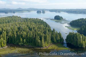
Lemmens Inlet viewed from Meares Island, with Tofino in the distance, aerial photo, on the west coast of Vancouver Island.
Location: Tofino, British Columbia, Canada
Image ID: 21074
Location: Tofino, British Columbia, Canada
Image ID: 21074
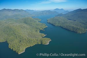
Obstruction Island (left) and Flores Island (right), Shelter Inlet section of Clayoquot Sound, aerial photo, near Tofino on the west coast of Vancouver Island.
Location: Tofino, British Columbia, Canada
Image ID: 21084
Location: Tofino, British Columbia, Canada
Image ID: 21084
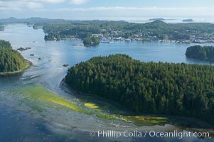
Lemmens Inlet viewed from Meares Island, with Tofino in the distance, aerial photo, on the west coast of Vancouver Island.
Location: Tofino, British Columbia, Canada
Image ID: 21096
Location: Tofino, British Columbia, Canada
Image ID: 21096
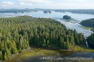
Lemmens Inlet viewed from Meares Island, with Tofino in the distance, aerial photo, on the west coast of Vancouver Island.
Location: Tofino, British Columbia, Canada
Image ID: 21111
Location: Tofino, British Columbia, Canada
Image ID: 21111
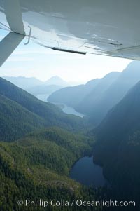
Shelter Inlet of Clayoquot Sound (distance) and small lake (foreground), amid the coastal mountains of western Vancouver Island, aerial photo.
Location: Megin Lake, British Columbia, Canada
Image ID: 21118
Location: Megin Lake, British Columbia, Canada
Image ID: 21118
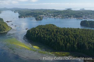
Lemmens Inlet viewed from Meares Island, with Tofino in the distance, aerial photo, on the west coast of Vancouver Island.
Location: Tofino, British Columbia, Canada
Image ID: 21127
Location: Tofino, British Columbia, Canada
Image ID: 21127
