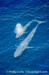
Two blue whales, a mother and her calf, swim through the open ocean in this aerial photograph. The calf is blowing (spouting, exhaling) with a powerful column of spray. The blue whale is the largest animal ever to live on Earth.
Species: Blue whale, Balaenoptera musculus
Location: San Diego, California
Image ID: 02304
Species: Blue whale, Balaenoptera musculus
Location: San Diego, California
Image ID: 02304

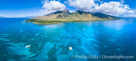
Aerial View of Namena Marine Reserve and Coral Reefs, Namena Island, Fiji.
Location: Namena Marine Reserve, Namena Island, Fiji
Image ID: 34680
Panorama dimensions: 4800 x 16200
Location: Namena Marine Reserve, Namena Island, Fiji
Image ID: 34680
Panorama dimensions: 4800 x 16200
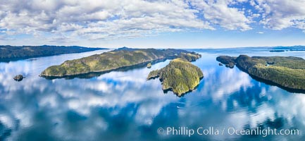
Browning Pass aerial photo, with Nigei Island (left) and Balackava Island (right).
Location: British Columbia, Canada
Image ID: 35252
Panorama dimensions: 6038 x 13074
Location: British Columbia, Canada
Image ID: 35252
Panorama dimensions: 6038 x 13074
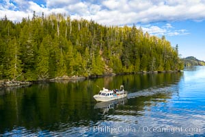
Dive Boat Hurst Island, Browning Pass, Canada, aerial photo.
Location: British Columbia, Canada
Image ID: 35253
Location: British Columbia, Canada
Image ID: 35253
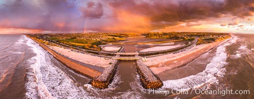
Batiquitos Lagoon and Ponto, stormy sunset, aerial panoramic photograph.
Location: Carlsbad, California
Image ID: 37944
Panorama dimensions: 6058 x 15573
Location: Carlsbad, California
Image ID: 37944
Panorama dimensions: 6058 x 15573
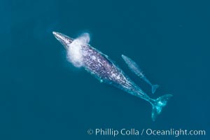
Mother and calf gray whale, aerial photo, embryonic folds visible on the very young calf.
Species: Gray whale, Eschrichtius robustus
Image ID: 37973
Species: Gray whale, Eschrichtius robustus
Image ID: 37973
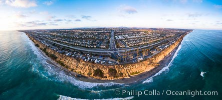
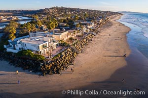
South Carlsbad State Beach and campground, aerial photo.
Location: Carlsbad, California
Image ID: 38228
Panorama dimensions: 4357 x 9642
Location: Carlsbad, California
Image ID: 38228
Panorama dimensions: 4357 x 9642
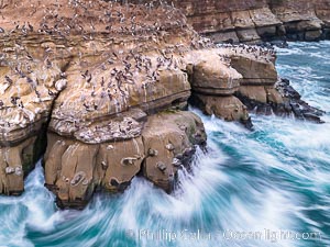
Brown Pelicans on Goldfish Point in La Jolla, time exposure blurs the large waves, aerial photograph. In the summer we used to jump off the cliff (the "Clam") in front of the twin cave entrances seen at middle-right.
Species: Brown Pelican, Pelecanus occidentalis, Pelecanus occidentalis californicus
Location: La Jolla, California
Image ID: 38865
Species: Brown Pelican, Pelecanus occidentalis, Pelecanus occidentalis californicus
Location: La Jolla, California
Image ID: 38865
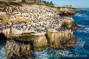
Brown Pelicans gather in large numbers on coastal cliffs, Goldfish Point near the Clam in La Jolla. Aerial photograph.
Species: Brown Pelican, Pelecanus occidentalis, Pelecanus occidentalis californicus
Location: La Jolla, California
Image ID: 37954
Species: Brown Pelican, Pelecanus occidentalis, Pelecanus occidentalis californicus
Location: La Jolla, California
Image ID: 37954
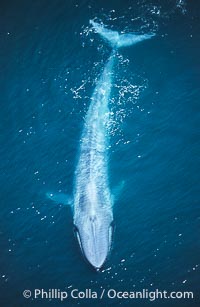
A huge blue whale swims through the open ocean in this aerial photograph. The blue whale is the largest animal ever to live on Earth.
Species: Blue whale, Balaenoptera musculus
Image ID: 02169
Species: Blue whale, Balaenoptera musculus
Image ID: 02169
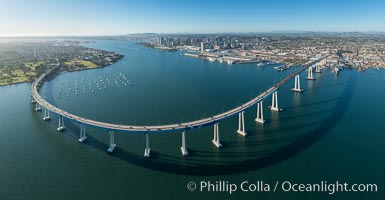
Panoramic Aerial Photo of San Diego Coronado Bay Bridge.
Location: San Diego, California
Image ID: 30789
Panorama dimensions: 7503 x 14441
Location: San Diego, California
Image ID: 30789
Panorama dimensions: 7503 x 14441
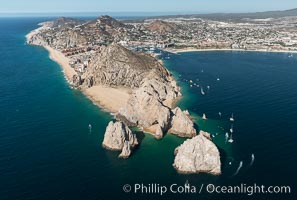
Aerial photograph of Land's End and the Arch, Cabo San Lucas, Mexico.
Location: Cabo San Lucas, Baja California, Mexico
Image ID: 28893
Location: Cabo San Lucas, Baja California, Mexico
Image ID: 28893
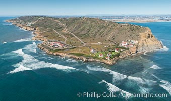
Aerial Photo of Cabrillo State Marine Reserve, Point Loma, San Diego.
Location: San Diego, California
Image ID: 30641
Location: San Diego, California
Image ID: 30641
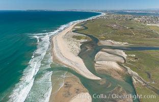
Aerial Photo of Tijuana River Mouth SMCA. Tijuana River Mouth State Marine Conservation Area borders Imperial Beach and the Mexican Border.
Location: Imperial Beach, California
Image ID: 30660
Location: Imperial Beach, California
Image ID: 30660
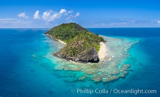
Aerial View of Namena Island, Fiji.
Location: Namena Marine Reserve, Namena Island, Fiji
Image ID: 34685
Location: Namena Marine Reserve, Namena Island, Fiji
Image ID: 34685
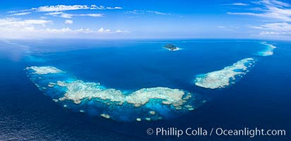
Aerial View of Namena Marine Reserve and Coral Reefs, Namena Island, Fiji.
Location: Namena Marine Reserve, Namena Island, Fiji
Image ID: 34686
Panorama dimensions: 5617 x 11605
Location: Namena Marine Reserve, Namena Island, Fiji
Image ID: 34686
Panorama dimensions: 5617 x 11605
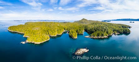
Hurst Island and Gods Pocket Provincial Park, aerial photo.
Location: British Columbia, Canada
Image ID: 35285
Panorama dimensions: 6271 x 13942
Location: British Columbia, Canada
Image ID: 35285
Panorama dimensions: 6271 x 13942
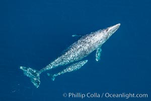
Aerial photo of gray whale calf and mother. This baby gray whale was born during the southern migration, far to the north of the Mexican lagoons of Baja California where most gray whale births take place.
Species: Gray whale, Eschrichtius robustus
Location: San Clemente, California
Image ID: 29017
Species: Gray whale, Eschrichtius robustus
Location: San Clemente, California
Image ID: 29017
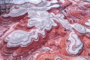
Fantastic colorful sedimentary patterns of Bentonite layers, seen as striations exposed in the Utah Badlands. The Bentonite Hills are composed of the Brushy Basin shale member of the Morrison Formation formed during Jurassic times when mud, silt, fine sand, and volcanic ash were deposited in swamps and lakes into layers, now revealed through erosion. Aerial photograph.
Location: Utah
Image ID: 37947
Location: Utah
Image ID: 37947
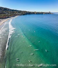
Surfers at La Jolla Shores Beach, aerial photo.
Image ID: 37952
Image ID: 37952
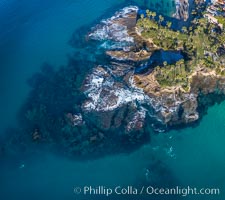
Twin Points and Shaws Cove Reef visible in aerial photo, showing underwater terrain of the famous scuba diving location.
Location: Laguna Beach, California
Image ID: 37960
Location: Laguna Beach, California
Image ID: 37960
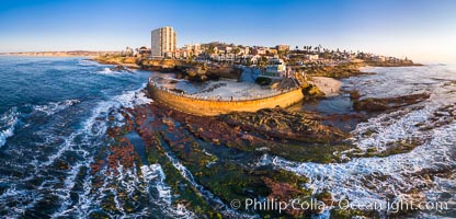
Childrens Pool and La Jolla coastline at sunset, aerial panorama, showing underwater reef exposed at King Low Tide.
Location: La Jolla, California
Image ID: 37977
Panorama dimensions: 5653 x 11765
Location: La Jolla, California
Image ID: 37977
Panorama dimensions: 5653 x 11765
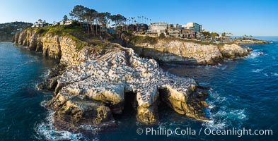
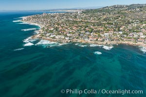
Goldfish Point and La Jolla Caves aerial photograph, La Jolla.
Location: La Jolla, California
Image ID: 38034
Panorama dimensions: 5612 x 11025
Location: La Jolla, California
Image ID: 38034
Panorama dimensions: 5612 x 11025
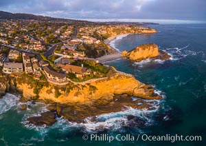
Laguna Beach Coastline including Views South to Three Arch Bay, Aerial Photo.
Location: Laguna Beach, California
Image ID: 38082
Location: Laguna Beach, California
Image ID: 38082
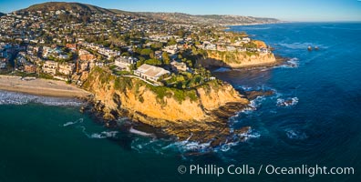
Laguna Beach Coastline, north of Crescent Point, Aerial Photo.
Location: Laguna Beach, California
Image ID: 38150
Location: Laguna Beach, California
Image ID: 38150
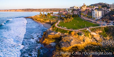
Aerial Photo of Point La Jolla and Scripps Park, La Jolla Coastline.
Location: La Jolla, California
Image ID: 38152
Location: La Jolla, California
Image ID: 38152
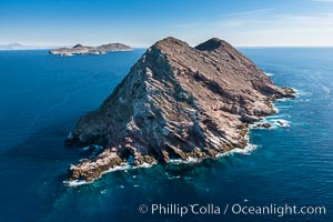
North Coronado Island, Mexico, northern point looking south with Middle and South Islands in the distance, aerial photograph.
Location: Coronado Islands (Islas Coronado), Baja California, Mexico
Image ID: 29052
Location: Coronado Islands (Islas Coronado), Baja California, Mexico
Image ID: 29052
