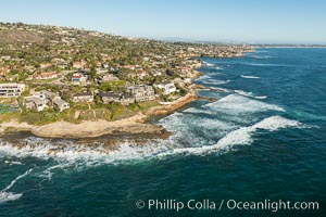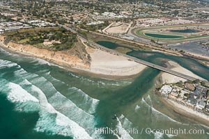
Aerial photo of San Dieguito Lagoon and Dog Beach. San Dieguito Lagoon State Marine Conservation Area (SMCA) is a marine protected area near Del Mar in San Diego County.
Location: Del Mar, California
Image ID: 30604
Location: Del Mar, California
Image ID: 30604
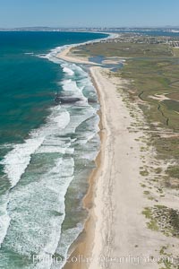
Aerial Photo of Tijuana River Mouth SMCA. Tijuana River Mouth State Marine Conservation Area borders Imperial Beach and the Mexican Border.
Location: Imperial Beach, California
Image ID: 30649
Location: Imperial Beach, California
Image ID: 30649
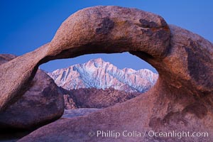
Mobius Arch at sunrise, framing snow dusted Lone Pine Peak and the Sierra Nevada Range in the background. Also known as Galen's Arch, Mobius Arch is found in the Alabama Hills Recreational Area near Lone Pine.
Location: Alabama Hills Recreational Area, California
Image ID: 27627
Location: Alabama Hills Recreational Area, California
Image ID: 27627
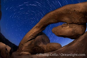
Star trails and Arch Rock. Polaris, the North Star, is at the center of the circular arc star trails as they pass above this natural stone archway in Joshua Tree National Park.
Location: Alabama Hills Recreational Area, California
Image ID: 27709
Location: Alabama Hills Recreational Area, California
Image ID: 27709
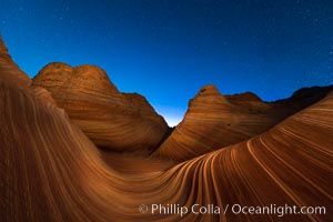
The Wave at Night, under a clear night sky full of stars. The Wave, an area of fantastic eroded sandstone featuring beautiful swirls, wild colors, countless striations, and bizarre shapes set amidst the dramatic surrounding North Coyote Buttes of Arizona and Utah. The sandstone formations of the North Coyote Buttes, including the Wave, date from the Jurassic period. Managed by the Bureau of Land Management, the Wave is located in the Paria Canyon-Vermilion Cliffs Wilderness and is accessible on foot by permit only.
Location: North Coyote Buttes, Paria Canyon-Vermilion Cliffs Wilderness, Arizona
Image ID: 28621
Location: North Coyote Buttes, Paria Canyon-Vermilion Cliffs Wilderness, Arizona
Image ID: 28621
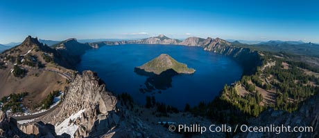
Panorama of Crater Lake from Watchman Lookout Station, panoramic picture. The Watchman Lookout Station No. 168 is one of two fire lookout towers in Crater Lake National Park in southern Oregon. For many years, National Park Service personnel used the lookout to watch for wildfires during the summer months. It is also a popular hiking destination because it offers an excellent view of Crater Lake and the surrounding area.
Location: Crater Lake National Park, Oregon
Image ID: 28633
Panorama dimensions: 4885 x 11229
Location: Crater Lake National Park, Oregon
Image ID: 28633
Panorama dimensions: 4885 x 11229
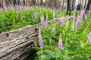
Lupine bloom in burned area after a forest fire, near Wawona, Yosemite National Park.
Location: Yosemite National Park, California
Image ID: 36367
Location: Yosemite National Park, California
Image ID: 36367
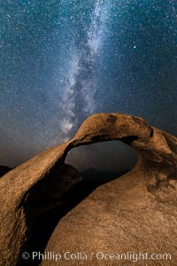
Milky Way galaxy over Mobius Arch at night, Alabama Hills.
Location: Alabama Hills Recreational Area, California
Image ID: 29409
Location: Alabama Hills Recreational Area, California
Image ID: 29409
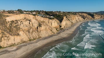
Aerial Photo of San Diego Scripps Coastal SMCA. Blacks Beach and Torrey Pines State Reserve.
Location: La Jolla, California
Image ID: 30736
Location: La Jolla, California
Image ID: 30736
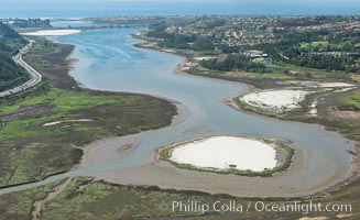
Aerial photo of Batiquitos Lagoon, Carlsbad. The Batiquitos Lagoon is a coastal wetland in southern Carlsbad, California. Part of the lagoon is designated as the Batiquitos Lagoon State Marine Conservation Area, run by the California Department of Fish and Game as a nature reserve.
Location: Carlsbad, Callifornia
Image ID: 30563
Location: Carlsbad, Callifornia
Image ID: 30563
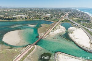
Aerial photo of Batiquitos Lagoon, Carlsbad. The Batiquitos Lagoon is a coastal wetland in southern Carlsbad, California. Part of the lagoon is designated as the Batiquitos Lagoon State Marine Conservation Area, run by the California Department of Fish and Game as a nature reserve.
Location: Carlsbad, Callifornia
Image ID: 30569
Location: Carlsbad, Callifornia
Image ID: 30569
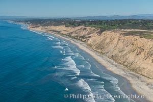
Aerial Photo of San Diego Scripps Coastal SMCA. Blacks Beach and Torrey Pines State Reserve.
Location: La Jolla, California
Image ID: 30622
Location: La Jolla, California
Image ID: 30622
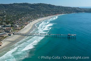
Aerial Photo of San Diego Scripps Coastal SMCA. Scripps Institution of Oceanography Research Pier.
Location: Scripps Institution of Oceanography, La Jolla, California
Image ID: 30626
Location: Scripps Institution of Oceanography, La Jolla, California
Image ID: 30626
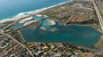
Aerial photo of Batiquitos Lagoon, Carlsbad. The Batiquitos Lagoon is a coastal wetland in southern Carlsbad, California. Part of the lagoon is designated as the Batiquitos Lagoon State Marine Conservation Area, run by the California Department of Fish and Game as a nature reserve.
Location: Carlsbad, Callifornia
Image ID: 30665
Location: Carlsbad, Callifornia
Image ID: 30665
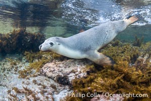
Australian Sea Lion Underwater, Grindal Island. Australian sea lions are the only endemic pinniped in Australia, and are found along the coastlines and islands of south and west Australia.
Species: Australian Sea Lion, Neophoca cinearea
Location: Grindal Island, South Australia
Image ID: 39158
Species: Australian Sea Lion, Neophoca cinearea
Location: Grindal Island, South Australia
Image ID: 39158
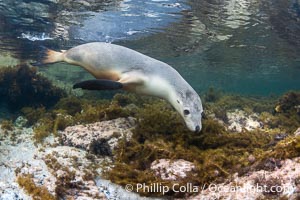
Australian Sea Lion Underwater, Grindal Island. Australian sea lions are the only endemic pinniped in Australia, and are found along the coastlines and islands of south and west Australia.
Species: Australian Sea Lion, Neophoca cinearea
Location: Grindal Island, South Australia
Image ID: 39159
Species: Australian Sea Lion, Neophoca cinearea
Location: Grindal Island, South Australia
Image ID: 39159
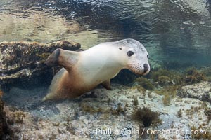
Australian Sea Lion Underwater, Grindal Island. Australian sea lions are the only endemic pinniped in Australia, and are found along the coastlines and islands of south and west Australia.
Species: Australian Sea Lion, Neophoca cinearea
Location: Grindal Island, South Australia
Image ID: 39160
Species: Australian Sea Lion, Neophoca cinearea
Location: Grindal Island, South Australia
Image ID: 39160
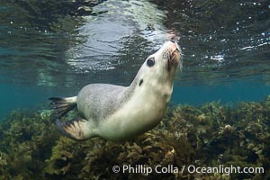
Australian Sea Lion Underwater, Grindal Island. Australian sea lions are the only endemic pinniped in Australia, and are found along the coastlines and islands of south and west Australia.
Species: Australian Sea Lion, Neophoca cinearea
Location: Grindal Island, South Australia
Image ID: 39161
Species: Australian Sea Lion, Neophoca cinearea
Location: Grindal Island, South Australia
Image ID: 39161
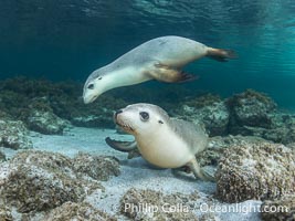
Australian Sea Lions in Kelp, Grindal Island. Australian sea lions are the only endemic pinniped in Australia, and are found along the coastlines and islands of south and west Australia.
Species: Australian Sea Lion, Neophoca cinearea
Location: Grindal Island, South Australia
Image ID: 39162
Species: Australian Sea Lion, Neophoca cinearea
Location: Grindal Island, South Australia
Image ID: 39162
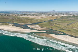
Aerial Photo of Tijuana River Mouth SMCA. Tijuana River Mouth State Marine Conservation Area borders Imperial Beach and the Mexican Border.
Location: Imperial Beach, California
Image ID: 30648
Location: Imperial Beach, California
Image ID: 30648
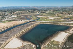
Aerial photo of San Dieguito Lagoon State Marine Conservation Area. San Dieguito Lagoon State Marine Conservation Area (SMCA) is a marine protected area near Del Mar in San Diego County.
Location: Del Mar, California
Image ID: 30607
Location: Del Mar, California
Image ID: 30607
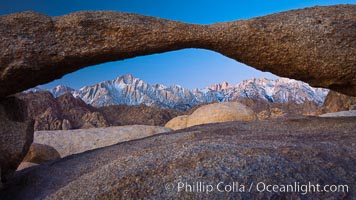
Mount Whitney and Lone Pine Peak are framed by Lathe Arch in the Alabama Hills at sunrise, California.
Location: Alabama Hills Recreational Area, California
Image ID: 27624
Location: Alabama Hills Recreational Area, California
Image ID: 27624
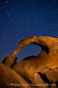
Mobius Arch and stars at night, Alabama Hills, California.
Location: Alabama Hills Recreational Area, California
Image ID: 27672
Location: Alabama Hills Recreational Area, California
Image ID: 27672
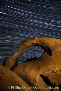
Mobius Arch in the Alabama Hills, seen here at night with swirling star trails formed in the sky above due to a long time exposure.
Location: Alabama Hills Recreational Area, California
Image ID: 27673
Location: Alabama Hills Recreational Area, California
Image ID: 27673
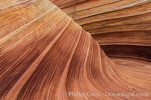
The Wave in the North Coyote Buttes, an area of fantastic eroded sandstone featuring beautiful swirls, wild colors, countless striations, and bizarre shapes set amidst the dramatic surrounding North Coyote Buttes of Arizona and Utah. The sandstone formations of the North Coyote Buttes, including the Wave, date from the Jurassic period. Managed by the Bureau of Land Management, the Wave is located in the Paria Canyon-Vermilion Cliffs Wilderness and is accessible on foot by permit only.
Location: North Coyote Buttes, Paria Canyon-Vermilion Cliffs Wilderness, Arizona
Image ID: 28602
Location: North Coyote Buttes, Paria Canyon-Vermilion Cliffs Wilderness, Arizona
Image ID: 28602
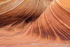
The Wave in the North Coyote Buttes, an area of fantastic eroded sandstone featuring beautiful swirls, wild colors, countless striations, and bizarre shapes set amidst the dramatic surrounding North Coyote Buttes of Arizona and Utah. The sandstone formations of the North Coyote Buttes, including the Wave, date from the Jurassic period. Managed by the Bureau of Land Management, the Wave is located in the Paria Canyon-Vermilion Cliffs Wilderness and is accessible on foot by permit only.
Location: North Coyote Buttes, Paria Canyon-Vermilion Cliffs Wilderness, Arizona
Image ID: 28603
Location: North Coyote Buttes, Paria Canyon-Vermilion Cliffs Wilderness, Arizona
Image ID: 28603
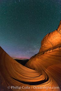
The Wave at Night, under a clear night sky full of stars. The Wave, an area of fantastic eroded sandstone featuring beautiful swirls, wild colors, countless striations, and bizarre shapes set amidst the dramatic surrounding North Coyote Buttes of Arizona and Utah. The sandstone formations of the North Coyote Buttes, including the Wave, date from the Jurassic period. Managed by the Bureau of Land Management, the Wave is located in the Paria Canyon-Vermilion Cliffs Wilderness and is accessible on foot by permit only.
Location: North Coyote Buttes, Paria Canyon-Vermilion Cliffs Wilderness, Arizona
Image ID: 28623
Location: North Coyote Buttes, Paria Canyon-Vermilion Cliffs Wilderness, Arizona
Image ID: 28623
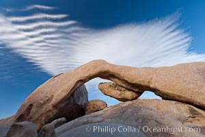
Arch Rock in Joshua Tree National Park. A natural stone arch in the White Tank area of Joshua Tree N.P.
Location: Joshua Tree National Park, California
Image ID: 26748
Location: Joshua Tree National Park, California
Image ID: 26748
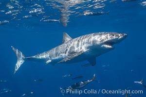
A great white shark swims through the clear waters of Isla Guadalupe, far offshore of the Pacific Coast of Mexico's Baja California. Guadalupe Island is host to a concentration of large great white sharks, which visit the island to feed on pinnipeds and use it as a staging area before journeying farther into the Pacific ocean.
Species: Great white shark, Carcharodon carcharias
Location: Guadalupe Island (Isla Guadalupe), Baja California, Mexico
Image ID: 19453
Species: Great white shark, Carcharodon carcharias
Location: Guadalupe Island (Isla Guadalupe), Baja California, Mexico
Image ID: 19453
