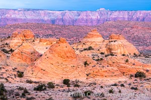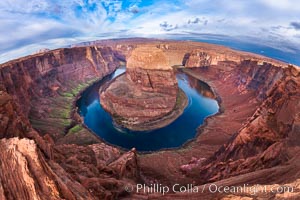
Horseshoe Bend. The Colorado River makes a 180-degree turn at Horseshoe Bend. Here the river has eroded the Navajo sandstone for eons, digging a canyon 1100-feet deep.
Location: Horseshoe Bend, Page, Arizona
Image ID: 26602
Location: Horseshoe Bend, Page, Arizona
Image ID: 26602
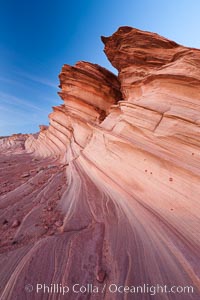
The Great Wall, Navajo Tribal Lands, Arizona. Sandstone "fins", eroded striations that depict how sandstone -- ancient compressed sand -- was laid down in layers over time. Now exposed, the layer erode at different rates, forming delicate "fins" that stretch for long distances.
Location: Navajo Tribal Lands, Page, Arizona
Image ID: 26643
Location: Navajo Tribal Lands, Page, Arizona
Image ID: 26643
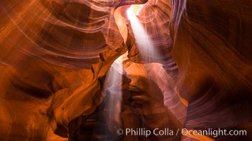
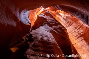
Light Beam in Upper Antelope Slot Canyon. Thin shafts of light briefly penetrate the convoluted narrows of Upper Antelope Slot Canyon, sending piercing beams through the sandstone maze to the sand floor below.
Location: Navajo Tribal Lands, Page, Arizona
Image ID: 28564
Location: Navajo Tribal Lands, Page, Arizona
Image ID: 28564
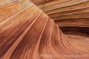
The Wave in the North Coyote Buttes, an area of fantastic eroded sandstone featuring beautiful swirls, wild colors, countless striations, and bizarre shapes set amidst the dramatic surrounding North Coyote Buttes of Arizona and Utah. The sandstone formations of the North Coyote Buttes, including the Wave, date from the Jurassic period. Managed by the Bureau of Land Management, the Wave is located in the Paria Canyon-Vermilion Cliffs Wilderness and is accessible on foot by permit only.
Location: North Coyote Buttes, Paria Canyon-Vermilion Cliffs Wilderness, Arizona
Image ID: 28602
Location: North Coyote Buttes, Paria Canyon-Vermilion Cliffs Wilderness, Arizona
Image ID: 28602
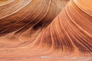
The Wave in the North Coyote Buttes, an area of fantastic eroded sandstone featuring beautiful swirls, wild colors, countless striations, and bizarre shapes set amidst the dramatic surrounding North Coyote Buttes of Arizona and Utah. The sandstone formations of the North Coyote Buttes, including the Wave, date from the Jurassic period. Managed by the Bureau of Land Management, the Wave is located in the Paria Canyon-Vermilion Cliffs Wilderness and is accessible on foot by permit only.
Location: North Coyote Buttes, Paria Canyon-Vermilion Cliffs Wilderness, Arizona
Image ID: 28603
Location: North Coyote Buttes, Paria Canyon-Vermilion Cliffs Wilderness, Arizona
Image ID: 28603
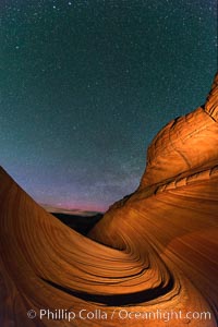
The Wave at Night, under a clear night sky full of stars. The Wave, an area of fantastic eroded sandstone featuring beautiful swirls, wild colors, countless striations, and bizarre shapes set amidst the dramatic surrounding North Coyote Buttes of Arizona and Utah. The sandstone formations of the North Coyote Buttes, including the Wave, date from the Jurassic period. Managed by the Bureau of Land Management, the Wave is located in the Paria Canyon-Vermilion Cliffs Wilderness and is accessible on foot by permit only.
Location: North Coyote Buttes, Paria Canyon-Vermilion Cliffs Wilderness, Arizona
Image ID: 28623
Location: North Coyote Buttes, Paria Canyon-Vermilion Cliffs Wilderness, Arizona
Image ID: 28623
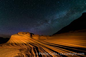
The Second Wave at Night. The Second Wave, a spectacular sandstone formation in the North Coyote Buttes, lies under a sky full of stars.
Location: North Coyote Buttes, Paria Canyon-Vermilion Cliffs Wilderness, Arizona
Image ID: 28628
Location: North Coyote Buttes, Paria Canyon-Vermilion Cliffs Wilderness, Arizona
Image ID: 28628
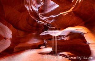
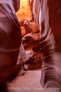
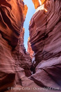
Upper Antelope Canyon, a deep, narrow and spectacular slot canyon lying on Navajo Tribal lands near Page, Arizona.
Location: Navajo Tribal Lands, Page, Arizona
Image ID: 35934
Location: Navajo Tribal Lands, Page, Arizona
Image ID: 35934
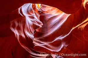
Upper Antelope Canyon, a deep, narrow and spectacular slot canyon lying on Navajo Tribal lands near Page, Arizona.
Location: Navajo Tribal Lands, Page, Arizona
Image ID: 35935
Location: Navajo Tribal Lands, Page, Arizona
Image ID: 35935
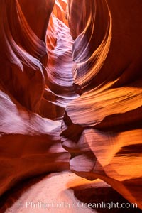
Upper Antelope Canyon, a deep, narrow and spectacular slot canyon lying on Navajo Tribal lands near Page, Arizona.
Location: Navajo Tribal Lands, Page, Arizona
Image ID: 35932
Location: Navajo Tribal Lands, Page, Arizona
Image ID: 35932
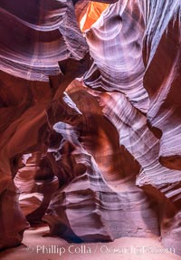
Upper Antelope Canyon, a deep, narrow and spectacular slot canyon lying on Navajo Tribal lands near Page, Arizona.
Location: Navajo Tribal Lands, Page, Arizona
Image ID: 35933
Location: Navajo Tribal Lands, Page, Arizona
Image ID: 35933
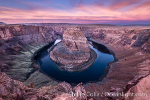
Spectacular Horseshoe Bend sunrise. The Colorado River makes a 180-degree turn at Horseshoe Bend. Here the river has eroded the Navajo sandstone for eons, digging a canyon 1100-feet deep.
Location: Horseshoe Bend, Page, Arizona
Image ID: 35941
Location: Horseshoe Bend, Page, Arizona
Image ID: 35941
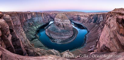
Predawn light on Horseshoe Bend. The Colorado River makes a 180-degree turn at Horseshoe Bend. Here the river has eroded the Navajo sandstone for eons, digging a canyon 1100-feet deep.
Location: Horseshoe Bend, Page, Arizona
Image ID: 36005
Panorama dimensions: 5468 x 11169
Location: Horseshoe Bend, Page, Arizona
Image ID: 36005
Panorama dimensions: 5468 x 11169
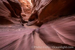
Owl Canyon, a beautiful slot canyon that is part of the larger Antelope Canyon system. Page, Arizona.
Location: Navajo Tribal Lands, Page, Arizona
Image ID: 36028
Location: Navajo Tribal Lands, Page, Arizona
Image ID: 36028
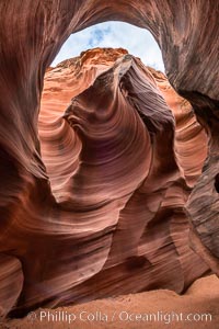
Rattlesnake Canyon, a beautiful slot canyon that is part of the larger Antelope Canyon system. Page, Arizona.
Location: Navajo Tribal Lands, Page, Arizona
Image ID: 36034
Location: Navajo Tribal Lands, Page, Arizona
Image ID: 36034
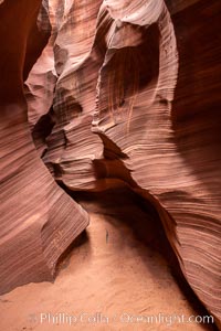
Rattlesnake Canyon, a beautiful slot canyon that is part of the larger Antelope Canyon system. Page, Arizona.
Location: Navajo Tribal Lands, Page, Arizona
Image ID: 36038
Location: Navajo Tribal Lands, Page, Arizona
Image ID: 36038
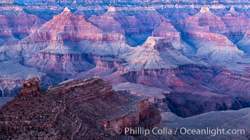
Grand Canyon at dusk, sunset, viewed from Grandeur Point on the south rim of Grand Canyon National Park.
Location: Grand Canyon National Park, Arizona
Image ID: 37753
Location: Grand Canyon National Park, Arizona
Image ID: 37753
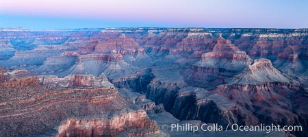
Grand Canyon at sunrise viewed from Yavapai Point on the south rim of Grand Canyon National Park.
Location: Grand Canyon National Park, Arizona
Image ID: 37757
Panorama dimensions: 5136 x 11568
Location: Grand Canyon National Park, Arizona
Image ID: 37757
Panorama dimensions: 5136 x 11568
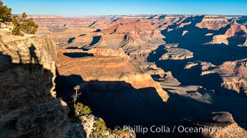
Grand Canyon at sunrise viewed from Yavapai Point on the south rim of Grand Canyon National Park.
Location: Grand Canyon National Park, Arizona
Image ID: 37760
Location: Grand Canyon National Park, Arizona
Image ID: 37760
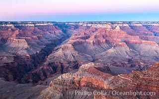
Belt of Venus over Grand Canyon at dusk, sunset, viewed from Mather Point on the south rim of Grand Canyon National Park. The Belt of Venus, or anti-twilight arch, is the shadow of the earth cast upon the atmosphere just above the horizon, and occurs a few minutes before sunrise or after sunset.
Location: Grand Canyon National Park, Arizona
Image ID: 37761
Location: Grand Canyon National Park, Arizona
Image ID: 37761
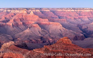
Grand Canyon at dusk, sunset, viewed from Mather Point on the south rim of Grand Canyon National Park.
Location: Grand Canyon National Park, Arizona
Image ID: 37762
Location: Grand Canyon National Park, Arizona
Image ID: 37762
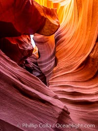
Lower Antelope Canyon, a deep, narrow and spectacular slot canyon lying on Navajo Tribal lands near Page, Arizona.
Location: Navajo Tribal Lands, Page, Arizona
Image ID: 37767
Location: Navajo Tribal Lands, Page, Arizona
Image ID: 37767
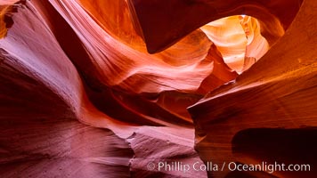
Lower Antelope Canyon, a deep, narrow and spectacular slot canyon lying on Navajo Tribal lands near Page, Arizona.
Location: Navajo Tribal Lands, Page, Arizona
Image ID: 37768
Location: Navajo Tribal Lands, Page, Arizona
Image ID: 37768
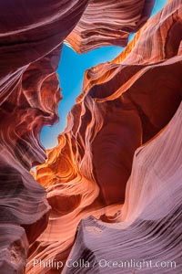
Lower Antelope Canyon, a deep, narrow and spectacular slot canyon lying on Navajo Tribal lands near Page, Arizona.
Location: Navajo Tribal Lands, Page, Arizona
Image ID: 37773
Location: Navajo Tribal Lands, Page, Arizona
Image ID: 37773
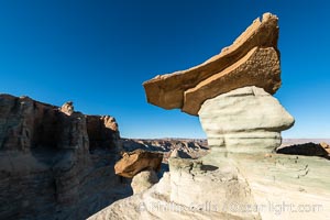
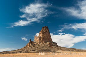
Pedestal rock, or hoodoo, at Stud Horse Point. These hoodoos form when erosion occurs around but not underneath a more resistant caprock that sits atop of the hoodoo spire. Stud Horse Point is a spectacular viewpoint on a mesa overlooking the Arizona / Utah border.
Location: Page, Arizona
Image ID: 37778
Location: Page, Arizona
Image ID: 37778
