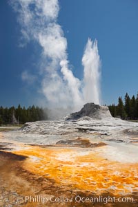
Castle Geyser erupts with the colorful bacteria mats of Tortoise Shell Spring in the foreground. Castle Geyser reaches 60 to 90 feet in height and lasts 20 minutes. While Castle Geyser has a 12 foot sinter cone that took 5,000 to 15,000 years to form, it is in fact situated atop geyserite terraces that themselves may have taken 200,000 years to form, making it likely the oldest active geyser in the park. Upper Geyser Basin.
Location: Upper Geyser Basin, Yellowstone National Park, Wyoming
Image ID: 13426
Location: Upper Geyser Basin, Yellowstone National Park, Wyoming
Image ID: 13426
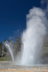
Grand Geyser erupts (right) with a simultaneous eruption from Vent Geyser (left). Grand Geyser is a fountain-type geyser reaching 200 feet in height and lasting up to 12 minutes. Grand Geyser is considered the tallest predictable geyser in the world, erupting about every 12 hours. It is often accompanied by burst or eruptions from Vent Geyser and Turban Geyser just to its left. Upper Geyser Basin.
Location: Upper Geyser Basin, Yellowstone National Park, Wyoming
Image ID: 13457
Location: Upper Geyser Basin, Yellowstone National Park, Wyoming
Image ID: 13457
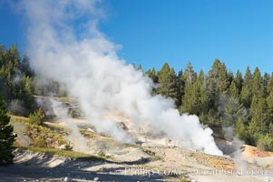
Ledge Geyser, vents releasing steam, in the Porcelain Basin area of Norris Geyser Basin.
Location: Norris Geyser Basin, Yellowstone National Park, Wyoming
Image ID: 13484
Location: Norris Geyser Basin, Yellowstone National Park, Wyoming
Image ID: 13484
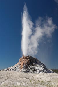
White Dome Geyser rises to a height of 30 feet or more, and typically erupts with an interval of 15 to 30 minutes. It is located along Firehole Lake Drive.
Location: Lower Geyser Basin, Yellowstone National Park, Wyoming
Image ID: 13540
Location: Lower Geyser Basin, Yellowstone National Park, Wyoming
Image ID: 13540
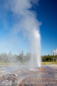
Pink Cone Geyser erupts. Pink Cone Geyser reaches 30 feet in height, and has highly variable interval and duration. It is a cone-type geyser and its cone has a pinkish tint due to manganese oxide in it. Firehole Lake Drive, Lower Geyser Basin, Yellowstone Park.
Location: Lower Geyser Basin, Yellowstone National Park, Wyoming
Image ID: 13551
Location: Lower Geyser Basin, Yellowstone National Park, Wyoming
Image ID: 13551
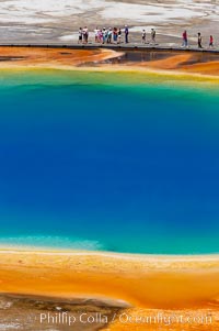
Grand Prismatic Spring displays a stunning rainbow of colors created by species of thermophilac (heat-loving) bacteria that thrive in narrow temperature ranges. The blue water in the center is too hot to support any bacterial life, while the outer orange rings are the coolest water. Grand Prismatic Spring is the largest spring in the United States and the third-largest in the world. Midway Geyser Basin.
Location: Midway Geyser Basin, Yellowstone National Park, Wyoming
Image ID: 13573
Location: Midway Geyser Basin, Yellowstone National Park, Wyoming
Image ID: 13573
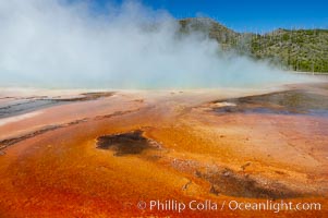
Grand Prismatic Spring displays brilliant colors along its edges, created by species of thermophilac (heat-loving) bacteria that thrive in narrow temperature ranges. The outer orange and red regions are the coolest water in the spring, where the overflow runs off. Midway Geyser Basin.
Location: Midway Geyser Basin, Yellowstone National Park, Wyoming
Image ID: 13587
Location: Midway Geyser Basin, Yellowstone National Park, Wyoming
Image ID: 13587
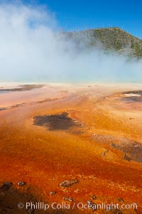
Grand Prismatic Spring displays brilliant colors along its edges, created by species of thermophilac (heat-loving) bacteria that thrive in narrow temperature ranges. The outer orange and red regions are the coolest water in the spring, where the overflow runs off. Midway Geyser Basin.
Location: Midway Geyser Basin, Yellowstone National Park, Wyoming
Image ID: 13591
Location: Midway Geyser Basin, Yellowstone National Park, Wyoming
Image ID: 13591
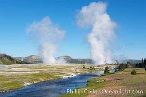
Steam rises above the Midway Geyser Basin, largely from Grand Prismatic Spring and Excelsior Geyser. The Firehole River flows by.
Location: Midway Geyser Basin, Yellowstone National Park, Wyoming
Image ID: 13605
Location: Midway Geyser Basin, Yellowstone National Park, Wyoming
Image ID: 13605
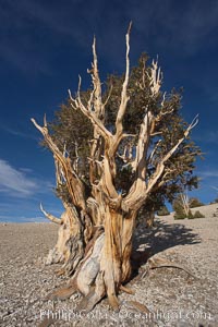
Bristlecone pine rising above the arid, dolomite-rich slopes of the White Mountains at 11000-foot elevation. Patriarch Grove, Ancient Bristlecone Pine Forest.
Species: Bristlecone pine, Pinus longaeva
Location: White Mountains, Inyo National Forest, California
Image ID: 17476
Species: Bristlecone pine, Pinus longaeva
Location: White Mountains, Inyo National Forest, California
Image ID: 17476
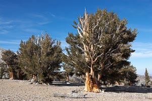
Bristlecone pines rising above the arid, dolomite-rich slopes of the White Mountains at 11000-foot elevation. Patriarch Grove, Ancient Bristlecone Pine Forest.
Species: Bristlecone pine, Pinus longaeva
Location: White Mountains, Inyo National Forest, California
Image ID: 17478
Species: Bristlecone pine, Pinus longaeva
Location: White Mountains, Inyo National Forest, California
Image ID: 17478
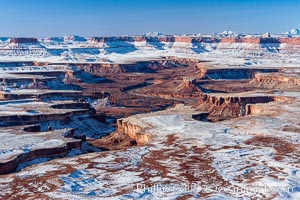
Soda Springs Basin in Canyonlands National Park, snow covered mesas and canyons, with the Green River far below, not far from its confluence with the Colorado River. Island in the Sky.
Location: Canyonlands National Park, Utah
Image ID: 18093
Location: Canyonlands National Park, Utah
Image ID: 18093
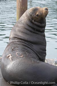
A bull sea lion shows a brand burned into its hide by the Oregon Department of Fish and Wildlife, to monitor it from season to season as it travels between California, Oregon and Washington. Some California sea lions, such as this one C-704, prey upon migrating salmon that gather in the downstream waters and fish ladders of Bonneville Dam on the Columbia River. The "C" in its brand denotes Columbia River. These sea lions also form bachelor colonies that haul out on public docks in Astoria's East Mooring Basin and elsewhere, where they can damage or even sink docks.
Species: California sea lion, Zalophus californianus
Location: Columbia River, Astoria, Oregon
Image ID: 19419
Species: California sea lion, Zalophus californianus
Location: Columbia River, Astoria, Oregon
Image ID: 19419
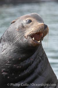
Sea lion head profile, showing small external ear, prominant forehead typical of adult males, whiskers. This sea lion is hauled out on public docks in Astoria's East Mooring Basin. This bachelor colony of adult males takes up residence for several weeks in late summer on public docks in Astoria after having fed upon migrating salmon in the Columbia River. The sea lions can damage or even sink docks and some critics feel that they cost the city money in the form of lost dock fees.
Species: California sea lion, Zalophus californianus
Location: Columbia River, Astoria, Oregon
Image ID: 19420
Species: California sea lion, Zalophus californianus
Location: Columbia River, Astoria, Oregon
Image ID: 19420
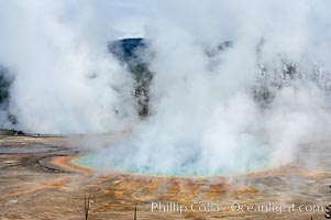
Grand Prismatic Spring steams in cold winter air.
Location: Midway Geyser Basin, Yellowstone National Park, Wyoming
Image ID: 19593
Location: Midway Geyser Basin, Yellowstone National Park, Wyoming
Image ID: 19593
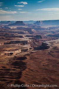
Soda Springs Basin from Green River Overlook, Island in the Sky, Canyonlands National Park, Utah.
Location: Canyonlands National Park, Utah
Image ID: 27840
Location: Canyonlands National Park, Utah
Image ID: 27840
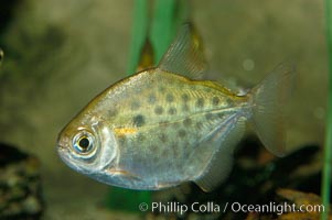
Silver dollar, a freshwater fish native to the Amazon and Paraguay river basins of South America.
Species: Silver dollar fish, Metynnis hypsauchen
Image ID: 09329
Species: Silver dollar fish, Metynnis hypsauchen
Image ID: 09329
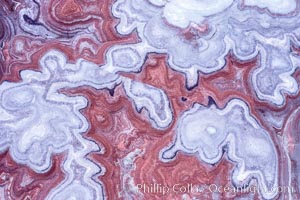
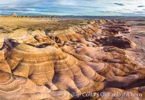
Fantastic colorful sedimentary patterns, Bentonite layers are seen as striations exposed in the Utah Badlands, part of the Brushy Basin shale member of the Morrison Formation. This layer was formed during Jurassic times when mud, silt, fine sand, and volcanic ash were deposited in swamps and lakes. Aerial photograph.
Location: Utah
Image ID: 38019
Location: Utah
Image ID: 38019
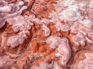
Fantastic colorful sedimentary patterns of Bentonite layers, seen as striations exposed in the Utah Badlands. The Bentonite Hills are composed of the Brushy Basin shale member of the Morrison Formation formed during Jurassic times when mud, silt, fine sand, and volcanic ash were deposited in swamps and lakes into layers, now revealed through erosion. Aerial photograph.
Location: Utah
Image ID: 38067
Location: Utah
Image ID: 38067
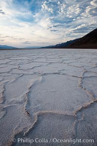
Salt polygons. After winter flooding, the salt on the Badwater Basin playa dries into geometric polygonal shapes.
Location: Badwater, Death Valley National Park, California
Image ID: 25259
Location: Badwater, Death Valley National Park, California
Image ID: 25259
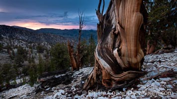
Sunset over Patriarch Grove and White Mountains. An ancient bristlecone pine tree at sunset.
Location: White Mountains, Inyo National Forest, California
Image ID: 26981
Location: White Mountains, Inyo National Forest, California
Image ID: 26981
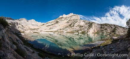
North Peak (12242'), Conness Lake and green glacial meltwater, Hoover Wilderness.
Location: Conness Lakes Basin, Hoover Wilderness, California
Image ID: 31059
Panorama dimensions: 6071 x 13284
Location: Conness Lakes Basin, Hoover Wilderness, California
Image ID: 31059
Panorama dimensions: 6071 x 13284
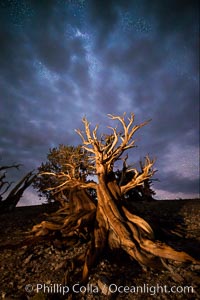
Ancient Bristlecone Pine Tree at night, stars and the Milky Way galaxy visible in the evening sky, near Patriarch Grove.
Species: Ancient bristlecone pine, Pinus longaeva
Location: Ancient Bristlecone Pine Forest, White Mountains, Inyo National Forest, California
Image ID: 28785
Species: Ancient bristlecone pine, Pinus longaeva
Location: Ancient Bristlecone Pine Forest, White Mountains, Inyo National Forest, California
Image ID: 28785
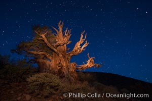
Stars and the Milky Way rise above ancient bristlecone pine trees, in the White Mountains at an elevation of 10,000' above sea level. These are some of the oldest trees in the world, reaching 4000 years in age.
Species: Bristlecone pine, Pinus longaeva
Location: Ancient Bristlecone Pine Forest, White Mountains, Inyo National Forest, California
Image ID: 27777
Species: Bristlecone pine, Pinus longaeva
Location: Ancient Bristlecone Pine Forest, White Mountains, Inyo National Forest, California
Image ID: 27777
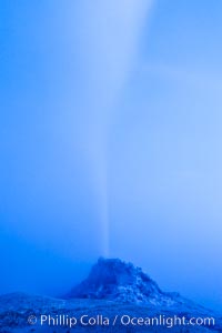
White Dome Geyser, rises to a height of 30 feet or more, and typically erupts with an interval of 15 to 30 minutes. It is located along Firehole Lake Drive.
Location: Lower Geyser Basin, Yellowstone National Park, Wyoming
Image ID: 26949
Location: Lower Geyser Basin, Yellowstone National Park, Wyoming
Image ID: 26949
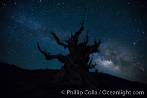
Stars and the Milky Way rise above ancient bristlecone pine trees, in the White Mountains at an elevation of 10,000' above sea level. These are some of the oldest trees in the world, reaching 4000 years in age.
Species: Bristlecone pine, Pinus longaeva
Location: Ancient Bristlecone Pine Forest, White Mountains, Inyo National Forest, California
Image ID: 27781
Species: Bristlecone pine, Pinus longaeva
Location: Ancient Bristlecone Pine Forest, White Mountains, Inyo National Forest, California
Image ID: 27781
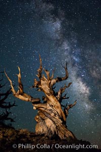
Stars and the Milky Way rise above ancient bristlecone pine trees, in the White Mountains at an elevation of 10,000' above sea level. These are some of the oldest trees in the world, reaching 4000 years in age.
Species: Bristlecone pine, Pinus longaeva
Location: Ancient Bristlecone Pine Forest, White Mountains, Inyo National Forest, California
Image ID: 27785
Species: Bristlecone pine, Pinus longaeva
Location: Ancient Bristlecone Pine Forest, White Mountains, Inyo National Forest, California
Image ID: 27785
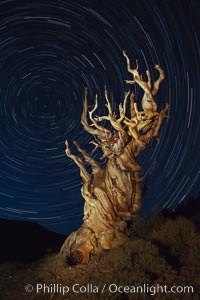
Stars trails above ancient bristlecone pine trees, in the White Mountains at an elevation of 10,000' above sea level. These are some of the oldest trees in the world, reaching 4000 years in age.
Species: Bristlecone pine, Pinus longaeva
Location: Ancient Bristlecone Pine Forest, White Mountains, Inyo National Forest, California
Image ID: 27794
Species: Bristlecone pine, Pinus longaeva
Location: Ancient Bristlecone Pine Forest, White Mountains, Inyo National Forest, California
Image ID: 27794
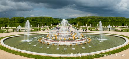
Bassin de Latone, Basin of Leto, Chateau de Versailles, Paris.
Location: Chateau de Versailles, Paris, France
Image ID: 35621
Panorama dimensions: 4820 x 10547
Location: Chateau de Versailles, Paris, France
Image ID: 35621
Panorama dimensions: 4820 x 10547
