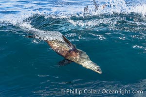
California sea lion bodysurfing at La Jolla Cove and Boomer Beach in La Jolla.
Species: California sea lion, Zalophus californianus
Image ID: 37572
Species: California sea lion, Zalophus californianus
Image ID: 37572
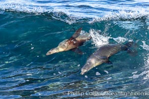
Two Bodysurfing Sea Lions Side by Side. California sea lion (Zalophus californianus) is surfing extreme shorebreak at Boomer Beach, Point La Jolla. The original bodysurfer.
Species: California Sea Lion, Zalophus californianus
Location: La Jolla, California
Image ID: 37750
Species: California Sea Lion, Zalophus californianus
Location: La Jolla, California
Image ID: 37750
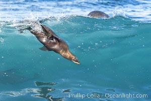
California sea lion bodysurfing in La Jolla, surfing huge waves close to shore at Boomer Beach.
Species: California Sea Lion, Zalophus californianus
Location: La Jolla, California
Image ID: 38971
Species: California Sea Lion, Zalophus californianus
Location: La Jolla, California
Image ID: 38971
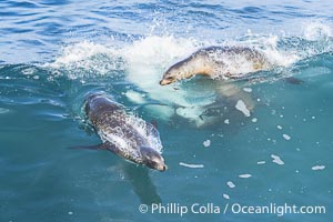
California sea lions bodysurfing and leaping out of the water, in La Jolla at Boomer Beach.
Location: La Jolla, California
Image ID: 38988
Location: La Jolla, California
Image ID: 38988
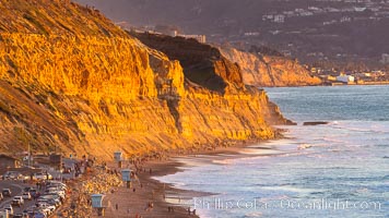
Torrey Pines State Beach at Sunset, La Jolla, Mount Soledad and Blacks Beach in the distance.
Location: Torrey Pines State Reserve, San Diego, California
Image ID: 35061
Location: Torrey Pines State Reserve, San Diego, California
Image ID: 35061
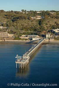
SIO Pier, Scripps Pier, La Jolla. The Scripps Institution of Oceanography research pier is 1090 feet long and was built of reinforced concrete in 1988, replacing the original wooden pier built in 1915. The Scripps Pier is home to a variety of sensing equipment above and below water that collects various oceanographic data. The Scripps research diving facility is located at the foot of the pier. Fresh seawater is pumped from the pier to the many tanks and facilities of SIO, including the Birch Aquarium. The Scripps Pier is named in honor of Ellen Browning Scripps, the most significant donor and benefactor of the Institution.
Location: Scripps Institution of Oceanography, La Jolla, California
Image ID: 22286
Location: Scripps Institution of Oceanography, La Jolla, California
Image ID: 22286
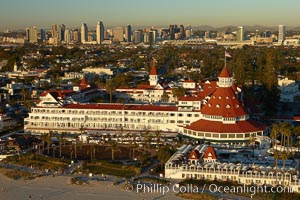
Hotel del Coronado, known affectionately as the Hotel Del. It was once the largest hotel in the world, and is one of the few remaining wooden Victorian beach resorts. It sits on the beach on Coronado Island, seen here with downtown San Diego in the distance. It is widely considered to be one of Americas most beautiful and classic hotels. Built in 1888, it was designated a National Historic Landmark in 1977.
Location: San Diego, California
Image ID: 22287
Location: San Diego, California
Image ID: 22287
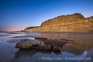
Torrey Pines Cliffs lit at night by a full moon, low tide reflections.
Location: Torrey Pines State Reserve, San Diego, California
Image ID: 28461
Location: Torrey Pines State Reserve, San Diego, California
Image ID: 28461
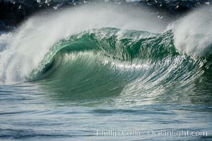
A large, powerful wave breaks with offshore winds at the Wedge in Newport Beach.
Location: The Wedge, Newport Beach, California
Image ID: 18706
Location: The Wedge, Newport Beach, California
Image ID: 18706
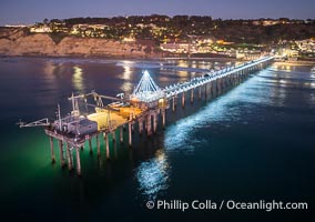
Holiday Christmas Lights on Scripps Pier, Blacks Beach and Scripps Institution of Oceanography, sunset, aerial.
Location: La Jolla, California
Image ID: 39879
Location: La Jolla, California
Image ID: 39879
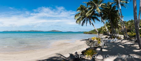
Wananavu Beach Resort, Viti Levu Island, Fiji.
Location: Wananavu, Raki Raki, Viti Levu Island, Fiji
Image ID: 31860
Panorama dimensions: 3994 x 9165
Location: Wananavu, Raki Raki, Viti Levu Island, Fiji
Image ID: 31860
Panorama dimensions: 3994 x 9165
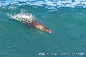
California sea lion bodysurfing Boomer Beach in La Jolla.
Species: California sea lion, Zalophus californianus
Location: La Jolla, California
Image ID: 38943
Species: California sea lion, Zalophus californianus
Location: La Jolla, California
Image ID: 38943
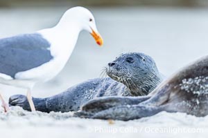
Newborn harbor seal pup watches a Western seagull approach. The gull is trying to pick at placenta on the sandy beach as the seal pup, born just moments before, watches and tries to understand what is going on. Within an hour of being born, this pup had learned to nurse and had entered the ocean for its first swim.
Species: Pacific harbor seal, Phoca vitulina richardsi
Location: La Jolla, California
Image ID: 39076
Species: Pacific harbor seal, Phoca vitulina richardsi
Location: La Jolla, California
Image ID: 39076
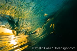
Sunrise breaking wave at the Wedge, dawn surf.
Location: The Wedge, Newport Beach, California
Image ID: 27978
Location: The Wedge, Newport Beach, California
Image ID: 27978
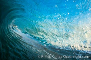
Breaking wave, morning, barrel shaped surf, California.
Location: The Wedge, Newport Beach, California
Image ID: 27982
Location: The Wedge, Newport Beach, California
Image ID: 27982
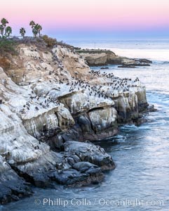
Point La Jolla at dawn. Pelicans, cormorants, sea birds, waves and sea cliffs.
Species: Brown Pelican, Pelecanus occidentalis, Pelecanus occidentalis californicus
Location: La Jolla, California
Image ID: 37473
Species: Brown Pelican, Pelecanus occidentalis, Pelecanus occidentalis californicus
Location: La Jolla, California
Image ID: 37473
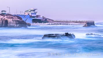
The Children's Pool, also known as Casa Cove, in pre-dawn light, La Jolla. Seal Rock in the foreground.
Location: La Jolla, California
Image ID: 37475
Location: La Jolla, California
Image ID: 37475
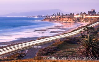
Carlsbad Coast Highway Sunset, from Terramar and North Ponto to Oceanside and Camp Pendleton. The smoke stack that marked the old Encina Power Plant was removed in 2021. Oceanside Pier is seen beautifully lit in the distance. Rising in the distance is San Onofre Mountain (1722') topped by a tall signal tower, one of the southern peaks in the Santa Ana Mountains.
Location: Carlsbad, California
Image ID: 37479
Location: Carlsbad, California
Image ID: 37479
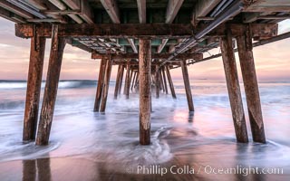
Waves break on the Imperial Beach Pier pilings, at dawn with colorful sunrise clouds over the ocean.
Location: Imperial Beach, California
Image ID: 37706
Location: Imperial Beach, California
Image ID: 37706
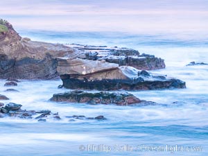
La Jolla Cove and Point La Jolla at Dawn, waves blur into abstract white, pre-sunrise soft light.
Location: La Jolla, California
Image ID: 38917
Location: La Jolla, California
Image ID: 38917
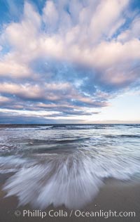
Hospital Point, La Jolla, dawn, sunrise light and approaching storm clouds.
Location: La Jolla, California
Image ID: 28851
Location: La Jolla, California
Image ID: 28851
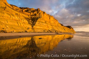
Torrey Pines cliffs and storm clouds at sunset.
Location: Torrey Pines State Reserve, San Diego, California
Image ID: 29102
Location: Torrey Pines State Reserve, San Diego, California
Image ID: 29102
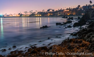
Big Corona Beach, aka Corona del Mar State Beach, at night lit by full moon, Newport Beach.
Location: Newport Beach, California
Image ID: 28865
Location: Newport Beach, California
Image ID: 28865
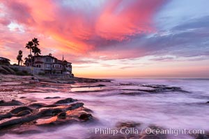
A fiery sunrise explodes over the La Jolla coastline.
Location: La Jolla, California
Image ID: 28871
Location: La Jolla, California
Image ID: 28871
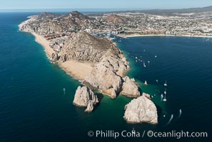
Aerial photograph of Land's End and the Arch, Cabo San Lucas, Mexico.
Location: Cabo San Lucas, Baja California, Mexico
Image ID: 28893
Location: Cabo San Lucas, Baja California, Mexico
Image ID: 28893

Sunrise on Medano Beach, on the coast of Cabo San Lucas, Mexico.
Location: Cabo San Lucas, Baja California, Mexico
Image ID: 28948
Panorama dimensions: 4368 x 16027
Location: Cabo San Lucas, Baja California, Mexico
Image ID: 28948
Panorama dimensions: 4368 x 16027
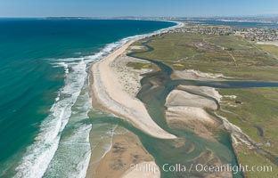
Aerial Photo of Tijuana River Mouth SMCA. Tijuana River Mouth State Marine Conservation Area borders Imperial Beach and the Mexican Border.
Location: Imperial Beach, California
Image ID: 30660
Location: Imperial Beach, California
Image ID: 30660
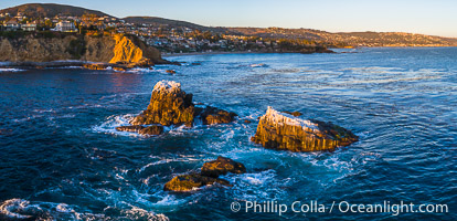
Seal Rocks at Sunset, Panoramic Aerial Photo, Laguna Beach, California.
Image ID: 34040
Image ID: 34040
