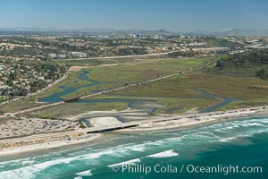
Aerial photo of Los Penasquitos Lagoon. Los Peñasquitos Marsh Natural Preserve and Lagoon is a coastal marsh in San Diego County, California, USA situated at the northern edge of the City of San Diego, forming the natural border with Del Mar, California.
Image ID: 30619
Image ID: 30619
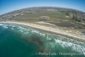
Aerial Photo of San Elijo Lagoon and Cardiff Reef beach. San Elijo Lagoon Ecological Reserve is one of the largest remaining coastal wetlands in San Diego County, California, on the border of Encinitas, Solana Beach and Rancho Santa Fe.
Location: Encinitas, California
Image ID: 30582
Location: Encinitas, California
Image ID: 30582
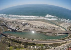
Aerial Photo of San Elijo Lagoon and Cardiff Reef beach. San Elijo Lagoon Ecological Reserve is one of the largest remaining coastal wetlands in San Diego County, California, on the border of Encinitas, Solana Beach and Rancho Santa Fe.
Location: Encinitas, California
Image ID: 30594
Location: Encinitas, California
Image ID: 30594
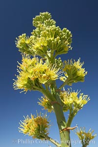
Desert agave, also known as the Century Plant, blooms in spring in Anza-Borrego Desert State Park. Desert agave is the only agave species to be found on the rocky slopes and flats bordering the Coachella Valley. It occurs over a wide range of elevations from 500 to over 4,000. It is called century plant in reference to the amount of time it takes it to bloom. This can be anywhere from 5 to 20 years. They send up towering flower stalks that can approach 15 feet in height. Sending up this tremendous display attracts a variety of pollinators including bats, hummingbirds, bees, moths and other insects and nectar-eating birds.
Species: Desert agave, Agave deserti
Image ID: 11551
Species: Desert agave, Agave deserti
Image ID: 11551
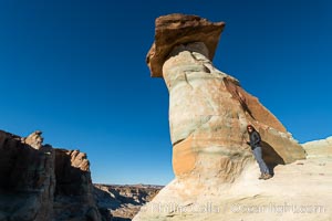
Pedestal rock, or hoodoo, at Stud Horse Point. These hoodoos form when erosion occurs around but not underneath a more resistant caprock that sits atop of the hoodoo spire. Stud Horse Point is a spectacular viewpoint on a mesa overlooking the Arizona / Utah border.
Location: Page, Arizona
Image ID: 37777
Location: Page, Arizona
Image ID: 37777
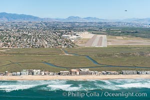
Aerial Photo of Tijuana River Mouth SMCA. Tijuana River Mouth State Marine Conservation Area borders Imperial Beach and the Mexican Border.
Location: Imperial Beach, California
Image ID: 30644
Location: Imperial Beach, California
Image ID: 30644
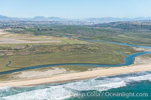
Aerial Photo of Tijuana River Mouth SMCA. Tijuana River Mouth State Marine Conservation Area borders Imperial Beach and the Mexican Border.
Location: Imperial Beach, California
Image ID: 30645
Location: Imperial Beach, California
Image ID: 30645
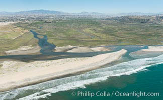
Aerial Photo of Tijuana River Mouth SMCA. Tijuana River Mouth State Marine Conservation Area borders Imperial Beach and the Mexican Border.
Location: Imperial Beach, California
Image ID: 30646
Location: Imperial Beach, California
Image ID: 30646
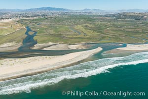
Aerial Photo of Tijuana River Mouth SMCA. Tijuana River Mouth State Marine Conservation Area borders Imperial Beach and the Mexican Border.
Location: Imperial Beach, California
Image ID: 30647
Location: Imperial Beach, California
Image ID: 30647
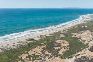
Aerial Photo of Tijuana River Mouth SMCA. Tijuana River Mouth State Marine Conservation Area borders Imperial Beach and the Mexican Border.
Location: Imperial Beach, California
Image ID: 30650
Location: Imperial Beach, California
Image ID: 30650
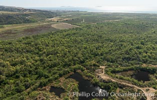
Aerial Photo of Tijuana River Mouth SMCA. Tijuana River Mouth State Marine Conservation Area borders Imperial Beach and the Mexican Border.
Location: Imperial Beach, California
Image ID: 30651
Location: Imperial Beach, California
Image ID: 30651
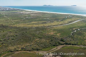
Aerial Photo of Tijuana River Mouth SMCA. Tijuana River Mouth State Marine Conservation Area borders Imperial Beach and the Mexican Border.
Location: Imperial Beach, California
Image ID: 30652
Location: Imperial Beach, California
Image ID: 30652
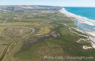
Aerial Photo of Tijuana River Mouth SMCA. Tijuana River Mouth State Marine Conservation Area borders Imperial Beach and the Mexican Border.
Location: Imperial Beach, California
Image ID: 30653
Location: Imperial Beach, California
Image ID: 30653
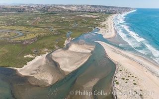
Aerial Photo of Tijuana River Mouth SMCA. Tijuana River Mouth State Marine Conservation Area borders Imperial Beach and the Mexican Border.
Location: Imperial Beach, California
Image ID: 30654
Location: Imperial Beach, California
Image ID: 30654
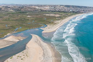
Aerial Photo of Tijuana River Mouth SMCA. Tijuana River Mouth State Marine Conservation Area borders Imperial Beach and the Mexican Border.
Location: Imperial Beach, California
Image ID: 30655
Location: Imperial Beach, California
Image ID: 30655
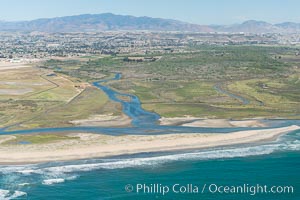
Aerial Photo of Tijuana River Mouth SMCA. Tijuana River Mouth State Marine Conservation Area borders Imperial Beach and the Mexican Border.
Location: Imperial Beach, California
Image ID: 30656
Location: Imperial Beach, California
Image ID: 30656
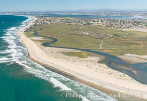
Aerial Photo of Tijuana River Mouth SMCA. Tijuana River Mouth State Marine Conservation Area borders Imperial Beach and the Mexican Border.
Location: Imperial Beach, California
Image ID: 30658
Location: Imperial Beach, California
Image ID: 30658
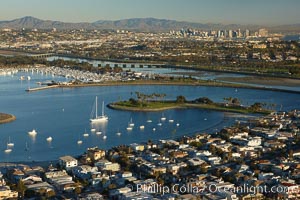
Mission Bay is the largest man-made aquatic park in the country. It spans 4,235 acres and is split nearly evenly between land and water. It is situated between the communities of Pacific Beach, Mission Beach, Bay Park and bordered on the south by the San Diego River channel. Once named "False Bay" by Juan Cabrillo in 1542, the tidelands were dredged in the 1940's creating the basins and islands of what is now Mission Bay.
Location: San Diego, California
Image ID: 22324
Location: San Diego, California
Image ID: 22324
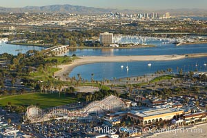
Mission Bay, is the largest man-made aquatic park in the country. It spans 4,235 acres and is split nearly evenly between land and water. It is situated between the communities of Pacific Beach, Mission Beach, Bay Park and bordered on the south by the San Diego River channel. Once named "False Bay" by Juan Cabrillo in 1542, the tidelands were dredged in the 1940's creating the basins and islands of what is now Mission Bay.
Location: San Diego, California
Image ID: 22381
Location: San Diego, California
Image ID: 22381
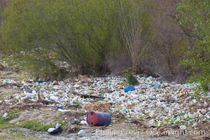
Pollution accumulates in the Tijuana River Valley following winter storms which flush the trash from Tijuana in Mexico across the border into the United States.
Location: Imperial Beach, San Diego, California
Image ID: 22544
Location: Imperial Beach, San Diego, California
Image ID: 22544
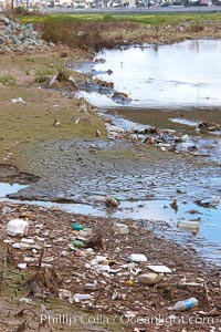
Pollution accumulates in the Tijuana River Valley following winter storms which flush the trash from Tijuana in Mexico across the border into the United States.
Location: Imperial Beach, San Diego, California
Image ID: 22545
Location: Imperial Beach, San Diego, California
Image ID: 22545
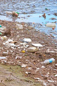
Pollution accumulates in the Tijuana River Valley following winter storms which flush the trash from Tijuana in Mexico across the border into the United States.
Location: Imperial Beach, San Diego, California
Image ID: 22546
Location: Imperial Beach, San Diego, California
Image ID: 22546
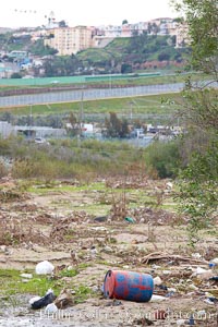
Pollution accumulates in the Tijuana River Valley following winter storms which flush the trash from Tijuana in Mexico across the border into the United States.
Location: Imperial Beach, San Diego, California
Image ID: 22547
Location: Imperial Beach, San Diego, California
Image ID: 22547
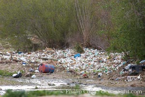
Pollution accumulates in the Tijuana River Valley following winter storms which flush the trash from Tijuana in Mexico across the border into the United States.
Location: Imperial Beach, San Diego, California
Image ID: 22548
Location: Imperial Beach, San Diego, California
Image ID: 22548
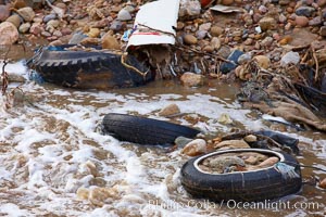
Pollution accumulates in the Tijuana River Valley following winter storms which flush the trash from Tijuana in Mexico across the border into the United States.
Location: Imperial Beach, San Diego, California
Image ID: 22549
Location: Imperial Beach, San Diego, California
Image ID: 22549
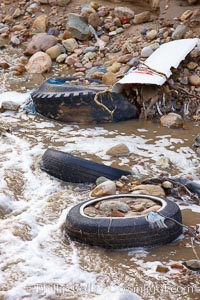
Pollution accumulates in the Tijuana River Valley following winter storms which flush the trash from Tijuana in Mexico across the border into the United States.
Location: Imperial Beach, San Diego, California
Image ID: 22550
Location: Imperial Beach, San Diego, California
Image ID: 22550
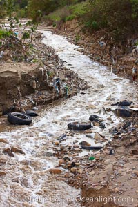
Pollution accumulates in the Tijuana River Valley following winter storms which flush the trash from Tijuana in Mexico across the border into the United States.
Location: Imperial Beach, San Diego, California
Image ID: 22551
Location: Imperial Beach, San Diego, California
Image ID: 22551
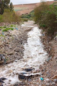
Pollution accumulates in the Tijuana River Valley following winter storms which flush the trash from Tijuana in Mexico across the border into the United States.
Location: Imperial Beach, San Diego, California
Image ID: 22552
Location: Imperial Beach, San Diego, California
Image ID: 22552
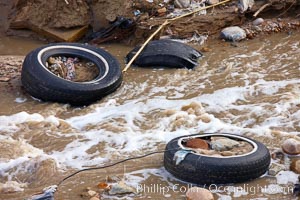
Pollution accumulates in the Tijuana River Valley following winter storms which flush the trash from Tijuana in Mexico across the border into the United States.
Location: Imperial Beach, San Diego, California
Image ID: 22553
Location: Imperial Beach, San Diego, California
Image ID: 22553
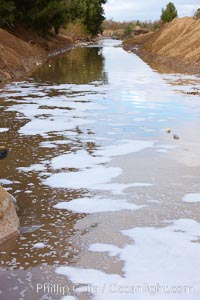
Pollution accumulates in the Tijuana River Valley following winter storms which flush the trash from Tijuana in Mexico across the border into the United States.
Location: Imperial Beach, San Diego, California
Image ID: 22554
Location: Imperial Beach, San Diego, California
Image ID: 22554