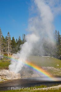
A rainbow appears in the spray of Riverside Geyser as it erupts over the Firehole River. Riverside is a very predictable geyser. Its eruptions last 30 minutes, reach heights of 75 feet and are usually spaced about 6 hours apart. Upper Geyser Basin.
Location: Upper Geyser Basin, Yellowstone National Park, Wyoming
Image ID: 13367
Location: Upper Geyser Basin, Yellowstone National Park, Wyoming
Image ID: 13367
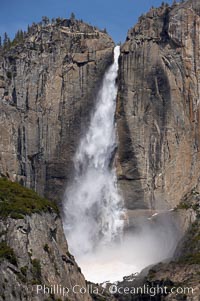
Upper Yosemite Falls near peak flow in spring. Yosemite Falls, at 2425 feet tall (730m) is the tallest waterfall in North America and fifth tallest in the world. Yosemite Valley.
Location: Yosemite Falls, Yosemite National Park, California
Image ID: 16066
Location: Yosemite Falls, Yosemite National Park, California
Image ID: 16066
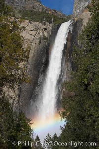
Bridalveil Falls with a rainbow forming in its spray, dropping 620 into Yosemite Valley, displaying peak water flow in spring months from deep snowpack and warm weather melt. Yosemite Valley.
Location: Bridalveil Falls, Yosemite National Park, California
Image ID: 16160
Location: Bridalveil Falls, Yosemite National Park, California
Image ID: 16160
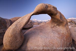
Mobius Arch at sunrise, with Mount Whitney (the tallest peak in the continental United States), Lone Pine Peak and snow-covered Sierra Nevada Range framed within the arch. Mobius Arch is a 17-foot-wide natural rock arch in the scenic Alabama Hills Recreational Area near Lone Pine, California.
Location: Alabama Hills Recreational Area, California
Image ID: 21729
Location: Alabama Hills Recreational Area, California
Image ID: 21729
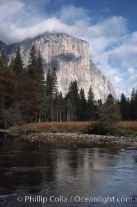
El Capitan and Merced River, Yosemite Valley.
Location: El Capitan, Yosemite National Park, California
Image ID: 05413
Location: El Capitan, Yosemite National Park, California
Image ID: 05413

San Diego city skyline, showing the buildings of downtown San Diego rising above San Diego Harbor, viewed from Point Loma at sunset, with mountains of the Cleveland National Forest rising in the distance. A panoramic photograph, composite of six separate images. Mount San Miguel is on right and Lyons Peak to the left.
Location: San Diego, California
Image ID: 22252
Panorama dimensions: 3144 x 16621
Location: San Diego, California
Image ID: 22252
Panorama dimensions: 3144 x 16621
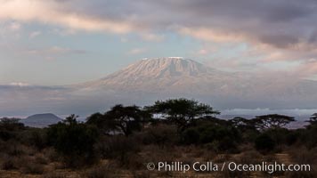
Mount Kilimanjaro, Tanzania, viewed from Amboseli National Park, Kenya.
Location: Amboseli National Park, Kenya
Image ID: 29540
Location: Amboseli National Park, Kenya
Image ID: 29540
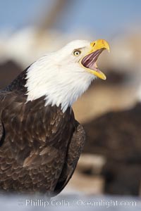
Bald eagle, appears to be calling vocalizing, actually is swallowing a fish, a bit of which is just visible in the eagles mouth.
Species: Bald eagle, Haliaeetus leucocephalus, Haliaeetus leucocephalus washingtoniensis
Location: Kachemak Bay, Homer, Alaska
Image ID: 22603
Species: Bald eagle, Haliaeetus leucocephalus, Haliaeetus leucocephalus washingtoniensis
Location: Kachemak Bay, Homer, Alaska
Image ID: 22603
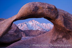
Mobius Arch at sunrise, framing snow dusted Lone Pine Peak and the Sierra Nevada Range in the background. Also known as Galen's Arch, Mobius Arch is found in the Alabama Hills Recreational Area near Lone Pine.
Location: Alabama Hills Recreational Area, California
Image ID: 27627
Location: Alabama Hills Recreational Area, California
Image ID: 27627
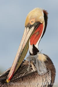
A California brown pelican entangled in a plastic bag which is wrapped around its neck. This unfortunate pelican probably became entangled in the bag by mistaking the floating plastic for food and diving on it, spearing it in such a way that the bag has lodged around the pelican's neck. Plastic bags kill and injure untold numbers of marine animals each year.
Species: Brown Pelican, Pelecanus occidentalis, Pelecanus occidentalis californicus
Location: La Jolla, California
Image ID: 22562
Species: Brown Pelican, Pelecanus occidentalis, Pelecanus occidentalis californicus
Location: La Jolla, California
Image ID: 22562
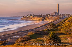
Carlsbad Coast Highway Sunset, Terramar and North Ponto to Oceanside with Camp Pendleton in the distance. Rising in the distance is San Onofre Mountain (1722') topped by a tall signal tower, one of the southern peaks in the Santa Ana Mountains.
Location: Carlsbad, California
Image ID: 35902
Location: Carlsbad, California
Image ID: 35902
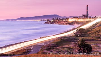
Sunset on Terra Mar and the Carlsbad coastline, looking north to Oceanside, Camp Pendleton and San Onofre. The Oceanside Pier, lit up at night, is seen further up the coast. Rising in the distance is San Onofre Mountain (1722') topped by a tall signal tower, one of the southern peaks in the Santa Ana Mountains.
Image ID: 36117
Image ID: 36117
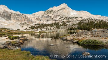
Greenstone Lake and North Peak, Hoover Wilderness.
Location: 20 Lakes Basin, Hoover Wilderness, California
Image ID: 36420
Location: 20 Lakes Basin, Hoover Wilderness, California
Image ID: 36420
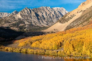
Paiute Peak, Aspen Trees and North Lake, fal colors, Bishop Creek Canyon.
Species: Quaking aspen, Populus tremuloides
Location: Bishop Creek Canyon, Sierra Nevada Mountains, California
Image ID: 36435
Species: Quaking aspen, Populus tremuloides
Location: Bishop Creek Canyon, Sierra Nevada Mountains, California
Image ID: 36435
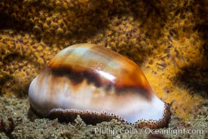
Chestnut cowrie with mantle withdrawn, in front of golden gorgonian.
Species: Chestnut Cowrie, Date Cowrie, Cypraea spadicea
Location: San Diego, California
Image ID: 37289
Species: Chestnut Cowrie, Date Cowrie, Cypraea spadicea
Location: San Diego, California
Image ID: 37289
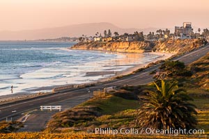
Carlsbad Coast Highway Sunset, Terramar and North Ponto to Oceanside with Camp Pendleton in the distance. Rising in the distance is San Onofre Mountain (1722') topped by a tall signal tower, one of the southern peaks in the Santa Ana Mountains.
Location: Carlsbad, California
Image ID: 37478
Location: Carlsbad, California
Image ID: 37478
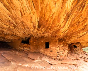
House on Fire Ruin in Mule Canyon, Utah. Part of the Bears Ears National Monument, House on Fire Ruin is an ancestral Puebloan ruin that appears to burst into flames when reflected sunlight hits the ceiling above the ruin.
Location: Bears Ears National Monument, Utah
Image ID: 39373
Location: Bears Ears National Monument, Utah
Image ID: 39373
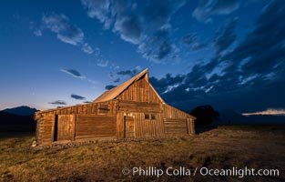
T.A. Moulton Barn and Teton Range at dusk, Grand Teton National Park.
Image ID: 32314
Image ID: 32314
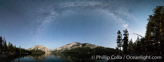
Milky Way over Tenaya Lake, Polly Dome (left), Tenaya Peak (center), Yosemite National Park.
Location: Yosemite National Park, California
Image ID: 31185
Panorama dimensions: 5342 x 13966
Location: Yosemite National Park, California
Image ID: 31185
Panorama dimensions: 5342 x 13966
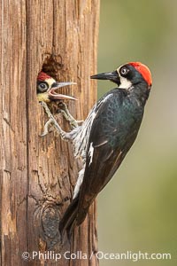
Acorn Woodpecker Adult Feeding Chick at the Nest, Lake Hodges.
Location: Lake Hodges, San Diego, California
Image ID: 39396
Location: Lake Hodges, San Diego, California
Image ID: 39396
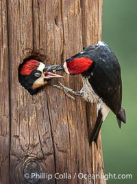
Acorn Woodpecker Adult Feeding Chick at Nest.
Location: Lake Hodges, San Diego, California
Image ID: 39413
Location: Lake Hodges, San Diego, California
Image ID: 39413
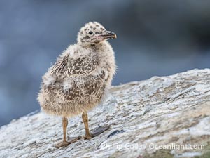
Western Gull Chick on Sea Cliff over the Ocean, Larus occidentalis, La Jolla Cove.
Species: Western gull, Larus occidentalis
Location: La Jolla, California
Image ID: 39517
Species: Western gull, Larus occidentalis
Location: La Jolla, California
Image ID: 39517
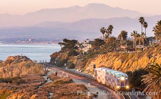
Sunset on the Del Mar Bluffs and Train Tracks, with North County coastline. The highest peaks in the distance are Santiago Peak and Modjeska Peak, the pair commonly known as Saddleback.
Location: Del Mar, California
Image ID: 37604
Location: Del Mar, California
Image ID: 37604
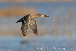
Northern Shoveler in flight, Bosque del Apache.
Species: Northern Shoveler, Anas clypeata
Location: Bosque del Apache National Wildlife Refuge, Socorro, New Mexico
Image ID: 38721
Species: Northern Shoveler, Anas clypeata
Location: Bosque del Apache National Wildlife Refuge, Socorro, New Mexico
Image ID: 38721
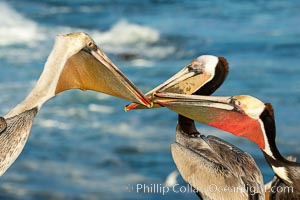
Three California brown pelicans mock jousting, displaying vividly-colored throat skin and mating plumage. Two display full breeding plumage with brown hind-neck, the third appears to be sub-adult. Note also these three display yellow, orange and the more-typical red throat coloration.
Species: Brown Pelican, Pelecanus occidentalis, Pelecanus occidentalis californicus
Location: La Jolla, California
Image ID: 36725
Species: Brown Pelican, Pelecanus occidentalis, Pelecanus occidentalis californicus
Location: La Jolla, California
Image ID: 36725

Panoramic view from Vogelsang Pass (10685') in Yosemite's high country, looking south. A hiker appears twice in this curious panoramic photo, enjoying the spectacular view. Visible on the left are Parson's Peak (12147'), Gallison Lake and Bernice Lake, while Vogelsang Peak (11516') rises to the right.
Location: Yosemite National Park, California
Image ID: 23210
Panorama dimensions: 4512 x 17738
Location: Yosemite National Park, California
Image ID: 23210
Panorama dimensions: 4512 x 17738
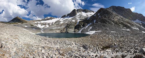
Panorama of Nameless Lake (10709'), surrounded by glacier-sculpted granite peaks of the Cathedral Range, near Vogelsang High Sierra Camp.
Location: Yosemite National Park, California
Image ID: 23211
Panorama dimensions: 3756 x 9102
Location: Yosemite National Park, California
Image ID: 23211
Panorama dimensions: 3756 x 9102

San Diego harbor skyline, late afternoon, storm clouds and mountains, Lyons Peak in the distance.
Location: San Diego, California
Image ID: 15672
Location: San Diego, California
Image ID: 15672
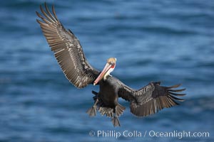
Brown pelican spreads its enormous wings to slow before landing on seaside cliffs. Brown pelicans appear awkward but in fact are superb and efficient fliers, ranging far over the ocean in search of fish to dive upon. They typically nest on offshore islands and inaccessible ocean cliffs. The California race of the brown pelican holds endangered species status. In winter months, breeding adults assume a dramatic plumage.
Species: Brown Pelican, Pelecanus occidentalis, Pelecanus occidentalis californicus
Location: La Jolla, California
Image ID: 20017
Species: Brown Pelican, Pelecanus occidentalis, Pelecanus occidentalis californicus
Location: La Jolla, California
Image ID: 20017
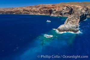
Cabo Pearce on Socorro Island, aerial photo, Revillagigedos Islands, Mexico.
Location: Socorro Island (Islas Revillagigedos), Baja California, Mexico
Image ID: 32909
Location: Socorro Island (Islas Revillagigedos), Baja California, Mexico
Image ID: 32909