Panorama of Vogelsang basin, surrounding Vogelsang Lake in Yosemite's High Sierra, viewed from near Vogelsang Pass (10685'). Left is Vogelsang Peak (11516'), Choo-choo Ridge is in the distant middle, and the western flank of Fletcher Peak is to the right.
Location: Yosemite National Park, California
Image ID: 23217
Panorama dimensions: 2945 x 13845
Location: Yosemite National Park, California
Image ID: 23217
Panorama dimensions: 2945 x 13845

Aerial Panorama of La Jolla, University City, showing (from left) University of California at San Diego, University City, Scripps Institution of Oceanography, La Jolla Shores, Point La Jolla, Mount Soledad, in the background some of the mountains to the east of San Diego. The highest peak in the center of the panoram is Cuyamaca Peak (6512') while the rocky peak directly in front of it is El Cajon Mountain (3675').
Image ID: 29098
Panorama dimensions: 3881 x 20864
Image ID: 29098
Panorama dimensions: 3881 x 20864
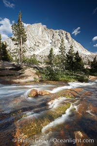
Fletcher Peak (10319') at sunset, viewed from Vogelsang High Sierra Camp in Yosemite's high country.
Location: Yosemite National Park, California
Image ID: 23248
Location: Yosemite National Park, California
Image ID: 23248
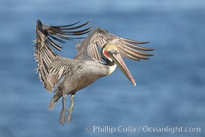
Brown pelican spreads its enormous wings to slow before landing on seaside cliffs. Brown pelicans appear awkward but in fact are superb and efficient fliers, ranging far over the ocean in search of fish to dive upon. They typically nest on offshore islands and inaccessible ocean cliffs. The California race of the brown pelican holds endangered species status. In winter months, breeding adults assume a dramatic plumage.
Species: Brown Pelican, Pelecanus occidentalis, Pelecanus occidentalis californicus
Location: La Jolla, California
Image ID: 20014
Species: Brown Pelican, Pelecanus occidentalis, Pelecanus occidentalis californicus
Location: La Jolla, California
Image ID: 20014
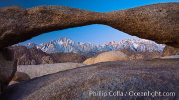
Mount Whitney and Lone Pine Peak are framed by Lathe Arch in the Alabama Hills at sunrise, California.
Location: Alabama Hills Recreational Area, California
Image ID: 27624
Location: Alabama Hills Recreational Area, California
Image ID: 27624
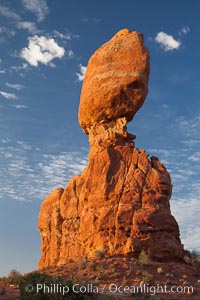
Balanced Rock, a narrow sandstone tower, appears poised to topple.
Location: Balanced Rock, Arches National Park, Utah
Image ID: 27839
Location: Balanced Rock, Arches National Park, Utah
Image ID: 27839
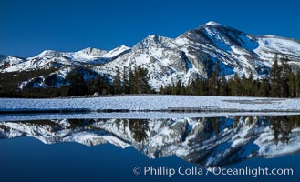
Mammoth Peak over Tuolumne Meadows, Tioga Pass, Yosemite National Park.
Location: Yosemite National Park, California
Image ID: 28514
Location: Yosemite National Park, California
Image ID: 28514
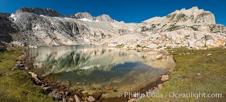
Mount Conness and North Peak over middle Conness Lake, Hoover Wilderness.
Location: Conness Lakes Basin, Hoover Wilderness, California
Image ID: 36426
Panorama dimensions: 7023 x 15489
Location: Conness Lakes Basin, Hoover Wilderness, California
Image ID: 36426
Panorama dimensions: 7023 x 15489
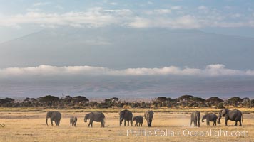
African elephants below Mount Kilimanjaro, Amboseli National Park, Kenya.
Species: African elephant, Loxodonta africana
Location: Amboseli National Park, Kenya
Image ID: 29603
Species: African elephant, Loxodonta africana
Location: Amboseli National Park, Kenya
Image ID: 29603
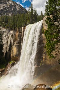
Vernal Falls at peak flow in late spring, viewed from the Mist Trail.
Location: Vernal Falls, Yosemite National Park, California
Image ID: 34539
Panorama dimensions: 8256 x 5504
Location: Vernal Falls, Yosemite National Park, California
Image ID: 34539
Panorama dimensions: 8256 x 5504
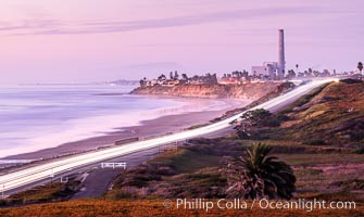
Carlsbad Coast Highway Sunset, Terramar and North Ponto to Oceanside with Camp Pendleton in the distance. San Onofre Mountain (1722'), one of the southern peaks in the Santa Ana Mountains, can just barely be seen in the distance.
Location: Carlsbad, California
Image ID: 35904
Location: Carlsbad, California
Image ID: 35904
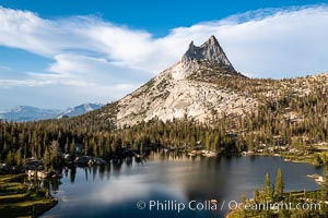
Cathedral Peak and Upper Cathedral Lake at Sunset, Yosemite National Park.
Location: Yosemite National Park, California
Image ID: 36418
Location: Yosemite National Park, California
Image ID: 36418
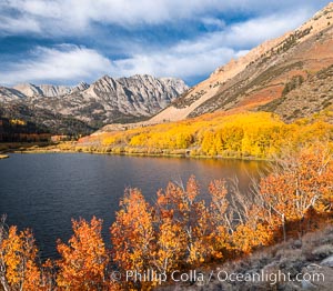
Paiute Peak, Aspen Trees and North Lake, fal colors, Bishop Creek Canyon.
Species: Quaking aspen, Populus tremuloides
Location: Bishop Creek Canyon, Sierra Nevada Mountains, California
Image ID: 36436
Species: Quaking aspen, Populus tremuloides
Location: Bishop Creek Canyon, Sierra Nevada Mountains, California
Image ID: 36436
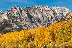
Turning aspen trees and Paiute Peak, Bishop Creek Canyon, Eastern Sierra Nevada.
Species: Quaking aspen, Populus tremuloides
Location: Bishop Creek Canyon, Sierra Nevada Mountains, California
Image ID: 36438
Species: Quaking aspen, Populus tremuloides
Location: Bishop Creek Canyon, Sierra Nevada Mountains, California
Image ID: 36438
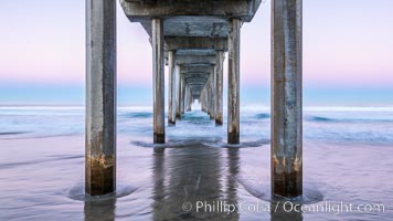
Scripps Institution of Oceanography Pier and Belt of Venus in pre-dawn light. The Earth's shadow appears as the blue just above the horizon.
Location: Scripps Institution of Oceanography, La Jolla, California
Image ID: 37697
Location: Scripps Institution of Oceanography, La Jolla, California
Image ID: 37697
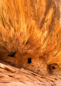
House on Fire Ruin in Mule Canyon, Utah. Part of the Bears Ears National Monument, House on Fire Ruin is an ancestral Puebloan ruin that appears to burst into flames when reflected sunlight hits the ceiling above the ruin.
Location: Bears Ears National Monument, Utah
Image ID: 39372
Location: Bears Ears National Monument, Utah
Image ID: 39372
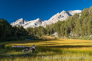
Meadow and Sierra Nevada peak Bear Creek Spire at sunrise, Little Lakes Valley, John Muir Wilderness, Inyo National Forest.
Location: Little Lakes Valley, Inyo National Forest, California
Image ID: 31176
Location: Little Lakes Valley, Inyo National Forest, California
Image ID: 31176
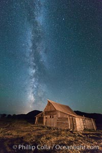
Milky Way over T.A. Moulton Barn, Grand Teton National Park.
Image ID: 32316
Image ID: 32316

Chestnut cowry.
Species: Chestnut cowrie, Date cowrie, Cypraea spadicea
Location: San Diego, California
Image ID: 34206
Species: Chestnut cowrie, Date cowrie, Cypraea spadicea
Location: San Diego, California
Image ID: 34206
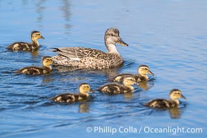
Mallard mother and ducklings, San Elijo Lagoon, Encinitas.
Location: San Elijo Lagoon, Encinitas, California
Image ID: 39345
Location: San Elijo Lagoon, Encinitas, California
Image ID: 39345
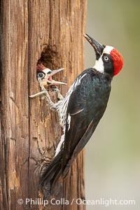
Acorn Woodpecker Adult and Chick at the Nest, Lake Hodges.
Location: Lake Hodges, San Diego, California
Image ID: 39398
Location: Lake Hodges, San Diego, California
Image ID: 39398
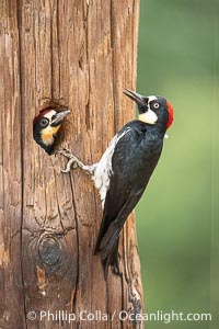
Acorn Woodpecker Adult and Chick at the Nest, Lake Hodges.
Location: Lake Hodges, San Diego, California
Image ID: 39399
Location: Lake Hodges, San Diego, California
Image ID: 39399
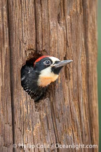
Acorn Woodpecker Chick Peeks out of Nest Hole.
Location: Lake Hodges, San Diego, California
Image ID: 39412
Location: Lake Hodges, San Diego, California
Image ID: 39412
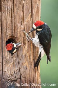
Acorn Woodpecker Adult Feeding Chick at Nest.
Location: Lake Hodges, San Diego, California
Image ID: 39414
Location: Lake Hodges, San Diego, California
Image ID: 39414
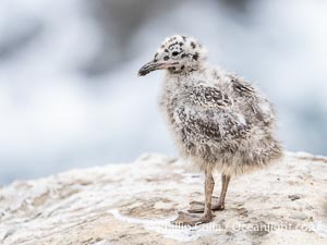
Western Gull Chick on Sea Cliff over the Ocean, Larus occidentalis, La Jolla Cove.
Species: Western gull, Larus occidentalis
Location: La Jolla, California
Image ID: 39501
Species: Western gull, Larus occidentalis
Location: La Jolla, California
Image ID: 39501

Western Gull Chick Portrait, Larus occidentalis, La Jolla Cove.
Species: Western gull, Larus occidentalis
Location: La Jolla, California
Image ID: 39511
Species: Western gull, Larus occidentalis
Location: La Jolla, California
Image ID: 39511
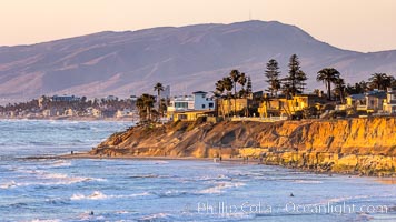
Terramar Sunset, viewed from North Ponto with Oceanside and Camp Pendleton in the distance. Rising in the distance is San Onofre Mountain (1722') topped by a tall signal tower, one of the southern peaks in the Santa Ana Mountains.
Location: Carlsbad, California
Image ID: 36743
Location: Carlsbad, California
Image ID: 36743

San Diego City Skyline at Sunset, viewed from Point Loma, Shelter Island Yacht Club in the foreground, San Diego Bay, Mount San Miguel (right) and Lyons Peak (left) in distance, panoramic photograph.
Location: San Diego, California
Image ID: 36750
Panorama dimensions: 7506 x 14829
Location: San Diego, California
Image ID: 36750
Panorama dimensions: 7506 x 14829
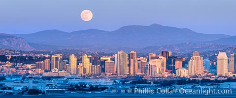
Full Moon Rises over San Diego City Skyline, viewed from Point Loma, panoramic photograph. The mountains east of San Diego can be clearly seen when the air is cold, dry and clear as it is in this photo. Mount Laguna is the peak rising in the distance.
Location: San Diego, California
Image ID: 37501
Location: San Diego, California
Image ID: 37501
