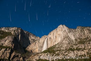
Yosemite Falls and star trails, at night, viewed from Cook's Meadow, illuminated by the light of the full moon.
Location: Yosemite Falls, Yosemite National Park, California
Image ID: 27734
Location: Yosemite Falls, Yosemite National Park, California
Image ID: 27734
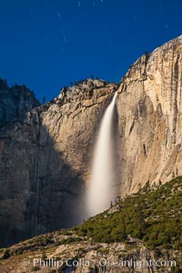
Yosemite Falls and star trails, at night, viewed from Cook's Meadow, illuminated by the light of the full moon.
Location: Yosemite Falls, Yosemite National Park, California
Image ID: 27754
Location: Yosemite Falls, Yosemite National Park, California
Image ID: 27754
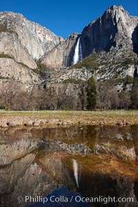
Yosemite Falls reflected in springtime pond, Cook's Meadow.
Location: Yosemite Falls, Yosemite National Park, California
Image ID: 22748
Location: Yosemite Falls, Yosemite National Park, California
Image ID: 22748
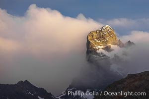
South Georgia Island, spire and sunset clouds, showing the island's characteristic rugged topography. 56% of the island is covered by 161 glaciers, which have created numerous large bays and inlets that provide excellent habitat for marine animals and seabirds. Mountains meet the sea in steep-sided seacliffs covered with sparse vegetation. The highest point on South Georgia Island is Mt. Paget at 2,915m.
Location: Right Whale Bay, South Georgia Island
Image ID: 24328
Location: Right Whale Bay, South Georgia Island
Image ID: 24328
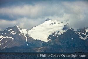
South Georgia Island coastline, showing the island's characteristic rugged topography. 56% of the island is covered by 161 glaciers, which have created numerous large bays and inlets that provide excellent habitat for marine animals and seabirds. Mountains meet the sea in steep-sided seacliffs covered with sparse vegetation. The highest point on South Georgia Island is Mt. Paget at 2,915m.
Location: South Georgia Island
Image ID: 24342
Location: South Georgia Island
Image ID: 24342
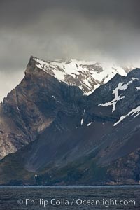
South Georgia Island coastline, showing the island's characteristic rugged topography. 56% of the island is covered by 161 glaciers, which have created numerous large bays and inlets that provide excellent habitat for marine animals and seabirds. Mountains meet the sea in steep-sided seacliffs covered with sparse vegetation. The highest point on South Georgia Island is Mt. Paget at 2,915m.
Location: South Georgia Island
Image ID: 24343
Location: South Georgia Island
Image ID: 24343
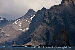
South Georgia Island coastline, showing the island's characteristic rugged topography. 56% of the island is covered by 161 glaciers, which have created numerous large bays and inlets that provide excellent habitat for marine animals and seabirds. Mountains meet the sea in steep-sided seacliffs covered with sparse vegetation. The highest point on South Georgia Island is Mt. Paget at 2,915m.
Location: South Georgia Island
Image ID: 24359
Location: South Georgia Island
Image ID: 24359
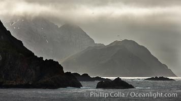
South Georgia Island coastline, showing the island's characteristic rugged topography. 56% of the island is covered by 161 glaciers, which have created numerous large bays and inlets that provide excellent habitat for marine animals and seabirds. Mountains meet the sea in steep-sided seacliffs covered with sparse vegetation. The highest point on South Georgia Island is Mt. Paget at 2,915m.
Location: South Georgia Island
Image ID: 24363
Location: South Georgia Island
Image ID: 24363
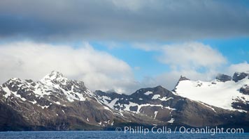
South Georgia Island coastline, showing the island's characteristic rugged topography. 56% of the island is covered by 161 glaciers, which have created numerous large bays and inlets that provide excellent habitat for marine animals and seabirds. Mountains meet the sea in steep-sided seacliffs covered with sparse vegetation. The highest point on South Georgia Island is Mt. Paget at 2,915m.
Location: South Georgia Island
Image ID: 24338
Location: South Georgia Island
Image ID: 24338
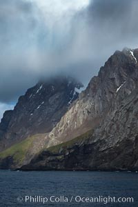
South Georgia Island coastline, showing the island's characteristic rugged topography. 56% of the island is covered by 161 glaciers, which have created numerous large bays and inlets that provide excellent habitat for marine animals and seabirds. Mountains meet the sea in steep-sided seacliffs covered with sparse vegetation. The highest point on South Georgia Island is Mt. Paget at 2,915m.
Location: South Georgia Island
Image ID: 24360
Location: South Georgia Island
Image ID: 24360
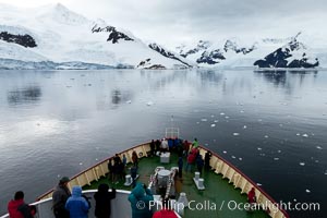
Approaching Neko Harbor. Neko Harbor is an inlet on the Antarctic Peninsula on Andvord Bay.
Location: Neko Harbor, Antarctic Peninsula, Antarctica
Image ID: 25678
Location: Neko Harbor, Antarctic Peninsula, Antarctica
Image ID: 25678
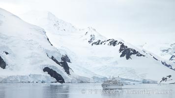
Approaching Neko Harbor. Neko Harbor is an inlet on the Antarctic Peninsula on Andvord Bay.
Location: Neko Harbor, Antarctic Peninsula, Antarctica
Image ID: 25679
Location: Neko Harbor, Antarctic Peninsula, Antarctica
Image ID: 25679
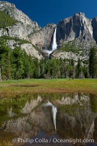
Yosemite Falls reflected in flooded meadow. The Merced River floods its banks in spring, forming beautiful reflections of Yosemite Falls.
Location: Yosemite National Park, California
Image ID: 26890
Location: Yosemite National Park, California
Image ID: 26890
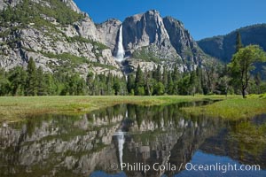
Yosemite Falls reflected in flooded meadow. The Merced River floods its banks in spring, forming beautiful reflections of Yosemite Falls.
Location: Yosemite National Park, California
Image ID: 26892
Location: Yosemite National Park, California
Image ID: 26892
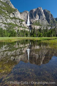
Yosemite Falls reflected in flooded meadow. The Merced River floods its banks in spring, forming beautiful reflections of Yosemite Falls.
Location: Yosemite National Park, California
Image ID: 26893
Location: Yosemite National Park, California
Image ID: 26893
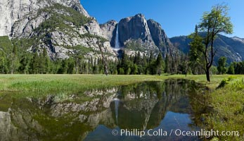
Yosemite Falls reflected in flooded meadow. The Merced River floods its banks in spring, forming beautiful reflections of Yosemite Falls.
Location: Yosemite National Park, California
Image ID: 26897
Panorama dimensions: 5371 x 9328
Location: Yosemite National Park, California
Image ID: 26897
Panorama dimensions: 5371 x 9328
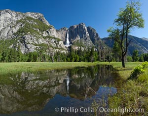
Yosemite Falls reflected in flooded meadow. The Merced River floods its banks in spring, forming beautiful reflections of Yosemite Falls.
Location: Yosemite National Park, California
Image ID: 26898
Panorama dimensions: 5217 x 6670
Location: Yosemite National Park, California
Image ID: 26898
Panorama dimensions: 5217 x 6670
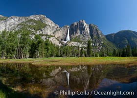
Yosemite Falls reflected in flooded meadow. The Merced River floods its banks in spring, forming beautiful reflections of Yosemite Falls.
Location: Yosemite National Park, California
Image ID: 26900
Panorama dimensions: 4961 x 6942
Location: Yosemite National Park, California
Image ID: 26900
Panorama dimensions: 4961 x 6942
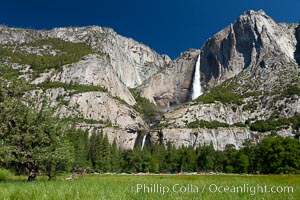
Yosemite Falls viewed from Cooks Meadow, spring.
Location: Yosemite National Park, California
Image ID: 26903
Location: Yosemite National Park, California
Image ID: 26903
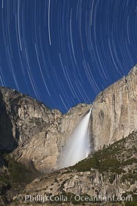
Yosemite Falls and star trails, at night, viewed from Cook's Meadow, illuminated by the light of the full moon.
Location: Yosemite Falls, Yosemite National Park, California
Image ID: 27731
Location: Yosemite Falls, Yosemite National Park, California
Image ID: 27731
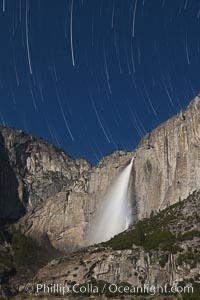
Yosemite Falls and star trails, at night, viewed from Cook's Meadow, illuminated by the light of the full moon.
Location: Yosemite Falls, Yosemite National Park, California
Image ID: 27732
Location: Yosemite Falls, Yosemite National Park, California
Image ID: 27732
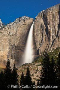
Yosemite Falls in peak flow, viewed from Cook's meadow, spring.
Location: Yosemite Falls, Yosemite National Park, California
Image ID: 27749
Location: Yosemite Falls, Yosemite National Park, California
Image ID: 27749
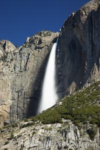
Yosemite Falls in peak flow, viewed from Cook's meadow, spring.
Location: Yosemite Falls, Yosemite National Park, California
Image ID: 27757
Location: Yosemite Falls, Yosemite National Park, California
Image ID: 27757
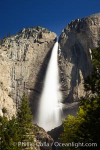
Yosemite Falls in peak flow, viewed from Cook's meadow, spring.
Location: Yosemite Falls, Yosemite National Park, California
Image ID: 27758
Location: Yosemite Falls, Yosemite National Park, California
Image ID: 27758
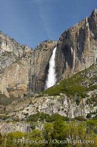
Yosemite Falls at peak flow in late spring, viewed from Cooks Meadow.
Location: Yosemite Falls, Yosemite National Park, California
Image ID: 12633
Location: Yosemite Falls, Yosemite National Park, California
Image ID: 12633
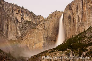
Upper Yosemite Falls by moonlight, viewed from Cooks Meadow. A very faint lunar rainbow (moonbow) can be seen to the left of Yosemite Falls, where the moon illuminates the spray of the falls. Yosemite Valley.
Location: Yosemite Falls, Yosemite National Park, California
Image ID: 16097
Location: Yosemite Falls, Yosemite National Park, California
Image ID: 16097
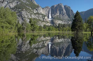
Yosemite Falls is reflected in a springtime pool in flooded Cooks Meadow, Yosemite Valley.
Location: Yosemite Falls, Yosemite National Park, California
Image ID: 16137
Location: Yosemite Falls, Yosemite National Park, California
Image ID: 16137
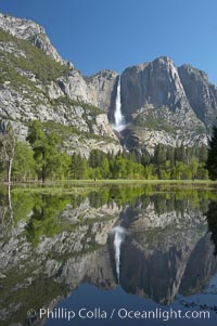
Yosemite Falls is reflected in a springtime pool in flooded Cooks Meadow, Yosemite Valley.
Location: Yosemite Falls, Yosemite National Park, California
Image ID: 16142
Location: Yosemite Falls, Yosemite National Park, California
Image ID: 16142
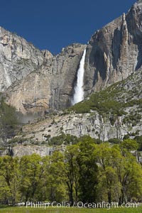
Yosemite Falls rises above Cooks Meadow. The 2425 falls, the tallest in North America, is at peak flow during a warm-weather springtime melt of Sierra snowpack. Yosemite Valley.
Location: Yosemite Falls, Yosemite National Park, California
Image ID: 16147
Location: Yosemite Falls, Yosemite National Park, California
Image ID: 16147
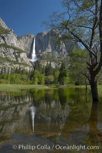
Yosemite Falls is reflected in a springtime pool in flooded Cooks Meadow, Yosemite Valley.
Location: Yosemite Falls, Yosemite National Park, California
Image ID: 16149
Location: Yosemite Falls, Yosemite National Park, California
Image ID: 16149