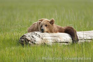
Lazy grizzly bear naps on a log, surrounding by the grass sedge grass that is typical of the coastal region of Lake Clark National Park.
Species: Brown bear, Ursus arctos
Location: Lake Clark National Park, Alaska
Image ID: 19160
Species: Brown bear, Ursus arctos
Location: Lake Clark National Park, Alaska
Image ID: 19160
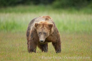
Full grown, mature male coastal brown bear boar (grizzly bear) in sedge grass meadows.
Species: Brown bear, Ursus arctos
Location: Lake Clark National Park, Alaska
Image ID: 19161
Species: Brown bear, Ursus arctos
Location: Lake Clark National Park, Alaska
Image ID: 19161
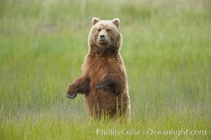
A brown bear mother (sow) stands in tall sedge grass to look for other approaching bears that may be a threat to her cubs.
Species: Brown bear, Ursus arctos
Location: Lake Clark National Park, Alaska
Image ID: 19162
Species: Brown bear, Ursus arctos
Location: Lake Clark National Park, Alaska
Image ID: 19162
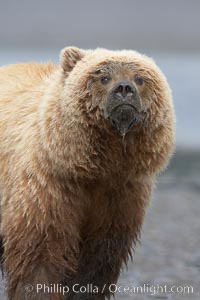
Coastal brown bear on sand flats at low tide.
Species: Brown bear, Ursus arctos
Location: Lake Clark National Park, Alaska
Image ID: 19163
Species: Brown bear, Ursus arctos
Location: Lake Clark National Park, Alaska
Image ID: 19163
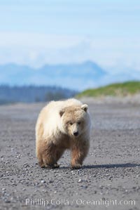
Juvenile female coastal brown bear walks on beach.
Species: Brown bear, Ursus arctos
Location: Lake Clark National Park, Alaska
Image ID: 19164
Species: Brown bear, Ursus arctos
Location: Lake Clark National Park, Alaska
Image ID: 19164
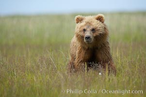
Coastal brown bear cub, one and a half years old, near Johnson River. This cub will remain with its mother for about another six months, and will be on its own next year.
Species: Brown bear, Ursus arctos
Location: Johnson River, Lake Clark National Park, Alaska
Image ID: 19199
Species: Brown bear, Ursus arctos
Location: Johnson River, Lake Clark National Park, Alaska
Image ID: 19199
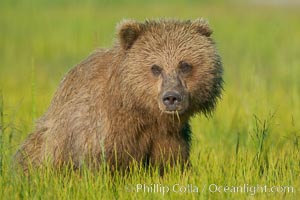
Coastal brown bear in sedge grass meadow.
Species: Brown bear, Ursus arctos
Location: Lake Clark National Park, Alaska
Image ID: 19223
Species: Brown bear, Ursus arctos
Location: Lake Clark National Park, Alaska
Image ID: 19223
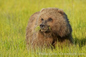
Young brown bear grazes in tall sedge grass. Brown bears can consume 30 lbs of sedge grass daily, waiting weeks until spawning salmon fill the rivers.
Species: Brown bear, Ursus arctos
Location: Lake Clark National Park, Alaska
Image ID: 19244
Species: Brown bear, Ursus arctos
Location: Lake Clark National Park, Alaska
Image ID: 19244

Monument Valley panorama, a composite of twelve individual photographs.
Location: Monument Valley, Arizona
Image ID: 20901
Panorama dimensions: 3303 x 30000
Location: Monument Valley, Arizona
Image ID: 20901
Panorama dimensions: 3303 x 30000
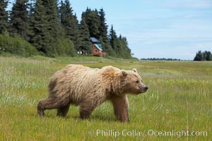
Coastal brown bear (grizzly bear) walks sedge grass meadow near Silver Salmon Creek.
Species: Brown bear, Ursus arctos
Location: Lake Clark National Park, Alaska
Image ID: 19145
Species: Brown bear, Ursus arctos
Location: Lake Clark National Park, Alaska
Image ID: 19145
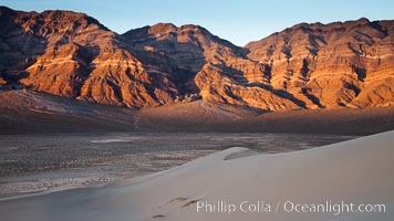
Sunset on the Last Chance Mountain Range, seen from Eureka Valley Sand Dunes.
Location: Eureka Dunes, Death Valley National Park, California
Image ID: 25238
Location: Eureka Dunes, Death Valley National Park, California
Image ID: 25238
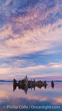
Mono Lake sunset, tufa and clouds reflected in the still waters of Mono Lake.
Location: Mono Lake, California
Image ID: 26977
Location: Mono Lake, California
Image ID: 26977
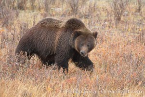
Grizzly bear in Yellowstone National Park in autumn, fall, walking through brown grasses.
Species: Grizzly bear, Ursus arctos horribilis
Location: Lamar Valley, Yellowstone National Park, Wyoming
Image ID: 19614
Species: Grizzly bear, Ursus arctos horribilis
Location: Lamar Valley, Yellowstone National Park, Wyoming
Image ID: 19614
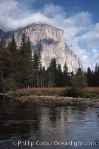
El Capitan and Merced River, Yosemite Valley.
Location: El Capitan, Yosemite National Park, California
Image ID: 05413
Location: El Capitan, Yosemite National Park, California
Image ID: 05413
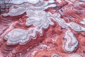
Fantastic colorful sedimentary patterns of Bentonite layers, seen as striations exposed in the Utah Badlands. The Bentonite Hills are composed of the Brushy Basin shale member of the Morrison Formation formed during Jurassic times when mud, silt, fine sand, and volcanic ash were deposited in swamps and lakes into layers, now revealed through erosion. Aerial photograph.
Location: Utah
Image ID: 37947
Location: Utah
Image ID: 37947
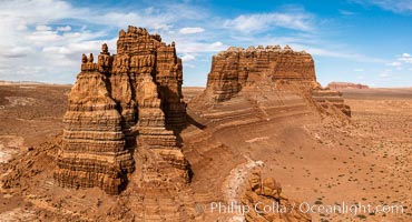
Molly's Castle, aerial view, Goblin Valley State Park. Curtis Formation whiteish caprock is on top, with reddish Entrada Sandstone below, both of Jurassic era. Molly's castle lies in the San Rafael desert near Goblin Valley, and drains into the Colorado River watershed. Aerial panoramic photograph.
Location: Goblin Valley State Park, Utah
Image ID: 37950
Location: Goblin Valley State Park, Utah
Image ID: 37950
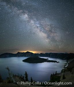
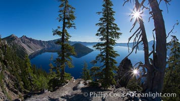
Milky Way and stars over Crater Lake at night. Panorama of Crater Lake and Wizard Island at night, Crater Lake National Park.
Location: Crater Lake National Park, Oregon
Image ID: 28643
Location: Crater Lake National Park, Oregon
Image ID: 28643
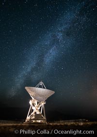
Radio telescope antenna, part of the Very Long Baseline Array (VLBA). The Very Long Baseline Array (VLBA) is a system of ten radio telescopes which are operated remotely from their Array Operations Center located in Socorro, New Mexico, as a part of the National Radio Astronomy Observatory (NRAO). These ten radio antennas work together as an array that forms the longest system in the world that uses very long baseline interferometry.
Location: Big Pine, California
Image ID: 28787
Location: Big Pine, California
Image ID: 28787
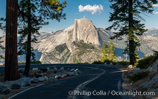
Half Dome and the Glacier Point Road, Yosemite National Park.
Location: Yosemite National Park, California
Image ID: 36380
Location: Yosemite National Park, California
Image ID: 36380
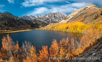
Sierra Nevada Fall Colors, North Lake, Bishop Creek Canyon.
Species: Quaking aspen, Populus tremuloides
Location: Bishop Creek Canyon, Sierra Nevada Mountains, California
Image ID: 36437
Panorama dimensions: 6440 x 10545
Species: Quaking aspen, Populus tremuloides
Location: Bishop Creek Canyon, Sierra Nevada Mountains, California
Image ID: 36437
Panorama dimensions: 6440 x 10545
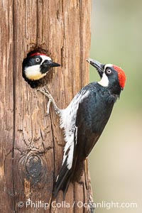
Two Adult Acorn Woodpeckers in their Nest Hole, Lake Hodges.
Location: Lake Hodges, San Diego, California
Image ID: 39397
Location: Lake Hodges, San Diego, California
Image ID: 39397
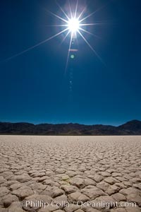
Racetrack Playa, an ancient lake now dried and covered with dessicated mud.
Location: Racetrack Playa, Death Valley National Park, California
Image ID: 25263
Location: Racetrack Playa, Death Valley National Park, California
Image ID: 25263
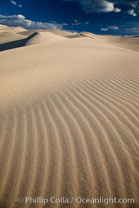
Eureka Dunes. The Eureka Valley Sand Dunes are California's tallest sand dunes, and one of the tallest in the United States. Rising 680' above the floor of the Eureka Valley, the Eureka sand dunes are home to several endangered species, as well as "singing sand" that makes strange sounds when it shifts. Located in the remote northern portion of Death Valley National Park, the Eureka Dunes see very few visitors.
Location: Eureka Dunes, Death Valley National Park, California
Image ID: 25250
Location: Eureka Dunes, Death Valley National Park, California
Image ID: 25250
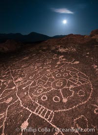
Sky Rock at night, light by moonlight with stars in the clear night sky above. Sky Rock petroglyphs near Bishop, California. Hidden atop an enormous boulder in the Volcanic Tablelands lies Sky Rock, a set of petroglyphs that face the sky. These superb examples of native American petroglyph artwork are thought to be Paiute in origin, but little is known about them.
Image ID: 28505
Image ID: 28505
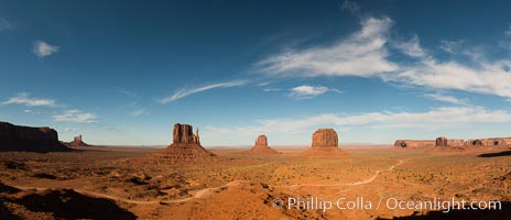
Monument Valley panorama.
Location: Monument Valley, Arizona
Image ID: 28597
Panorama dimensions: 6429 x 14925
Location: Monument Valley, Arizona
Image ID: 28597
Panorama dimensions: 6429 x 14925
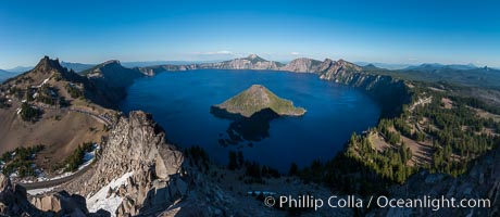
Panorama of Crater Lake from Watchman Lookout Station, panoramic picture. The Watchman Lookout Station No. 168 is one of two fire lookout towers in Crater Lake National Park in southern Oregon. For many years, National Park Service personnel used the lookout to watch for wildfires during the summer months. It is also a popular hiking destination because it offers an excellent view of Crater Lake and the surrounding area.
Location: Crater Lake National Park, Oregon
Image ID: 28633
Panorama dimensions: 4885 x 11229
Location: Crater Lake National Park, Oregon
Image ID: 28633
Panorama dimensions: 4885 x 11229
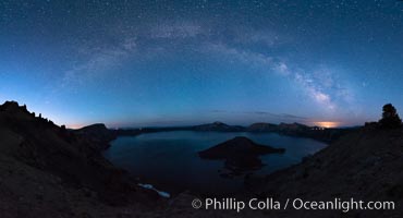
Milky Way and stars over Crater Lake at night. Panorama of Crater Lake and Wizard Island at night, Crater Lake National Park.
Location: Crater Lake National Park, Oregon
Image ID: 28635
Panorama dimensions: 6635 x 12270
Location: Crater Lake National Park, Oregon
Image ID: 28635
Panorama dimensions: 6635 x 12270
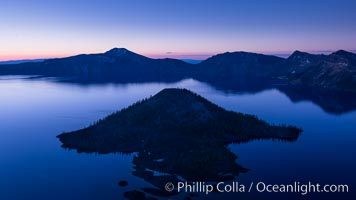
Crater Lake and Wizard Island at sunrise.
Location: Crater Lake National Park, Oregon
Image ID: 28668
Location: Crater Lake National Park, Oregon
Image ID: 28668
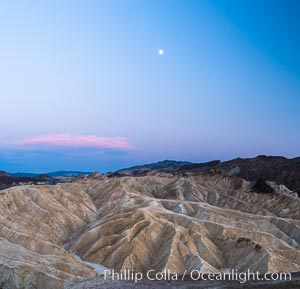
Full moon over Zabriskie Point landscape.
Location: Zabriskie Point, Death Valley National Park, California
Image ID: 28676
Location: Zabriskie Point, Death Valley National Park, California
Image ID: 28676
