
Buckskin Gulch hiker. A hiker moves through the deep narrow passages of Buckskin Gulch, a slot canyon cut deep into sandstone by years of river-induced erosion. In some places the Buckskin Gulch narrows are only about 15 feet wide but several hundred feet high, blocking sunlight. Flash floods are dangerous as there is no escape once into the Buckskin Gulch slot canyons. This is a panorama made of sixteen individual photos.
Location: Buckskin Gulch, Paria Canyon-Vermilion Cliffs Wilderness, Arizona
Image ID: 20699
Panorama dimensions: 4771 x 15311
Location: Buckskin Gulch, Paria Canyon-Vermilion Cliffs Wilderness, Arizona
Image ID: 20699
Panorama dimensions: 4771 x 15311
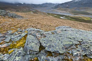
Grassy windy highlands and rocks, overlooking alluvial floodplain formed by glacier runoff near Stromness Bay.
Location: Stromness Harbour, South Georgia Island
Image ID: 24584
Location: Stromness Harbour, South Georgia Island
Image ID: 24584
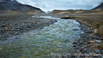
Glacial melt waters, runoff, flows across an alluvial flood plain between mountains, on its way to Stromness Bay.
Location: Stromness Harbour, South Georgia Island
Image ID: 24587
Location: Stromness Harbour, South Georgia Island
Image ID: 24587
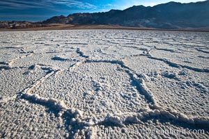
Devils Golf Course, California. Evaporated salt has formed into gnarled, complex crystalline shapes in on the salt pan of Death Valley National Park, one of the largest salt pans in the world. The shapes are constantly evolving as occasional floods submerge the salt concretions before receding and depositing more salt.
Location: Devils Golf Course, Death Valley National Park, California
Image ID: 15582
Location: Devils Golf Course, Death Valley National Park, California
Image ID: 15582
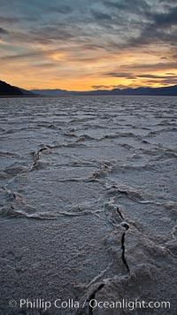
Salt polygons. After winter flooding, the salt on the Badwater Basin playa dries into geometric polygonal shapes.
Location: Badwater, Death Valley National Park, California
Image ID: 27635
Location: Badwater, Death Valley National Park, California
Image ID: 27635
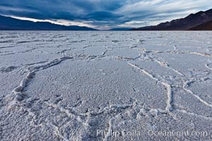
Salt polygons. After winter flooding, the salt on the Badwater Basin playa dries into geometric polygonal shapes.
Location: Badwater, Death Valley National Park, California
Image ID: 27632
Location: Badwater, Death Valley National Park, California
Image ID: 27632
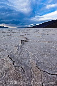
Salt polygons. After winter flooding, the salt on the Badwater Basin playa dries into geometric polygonal shapes.
Location: Badwater, Death Valley National Park, California
Image ID: 27633
Location: Badwater, Death Valley National Park, California
Image ID: 27633
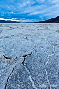
Salt polygons. After winter flooding, the salt on the Badwater Basin playa dries into geometric polygonal shapes.
Location: Badwater, Death Valley National Park, California
Image ID: 27634
Location: Badwater, Death Valley National Park, California
Image ID: 27634
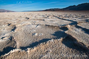
Devils Golf Course, California. Evaporated salt has formed into gnarled, complex crystalline shapes in on the salt pan of Death Valley National Park, one of the largest salt pans in the world. The shapes are constantly evolving as occasional floods submerge the salt concretions before receding and depositing more salt.
Location: Devils Golf Course, Death Valley National Park, California
Image ID: 15583
Location: Devils Golf Course, Death Valley National Park, California
Image ID: 15583
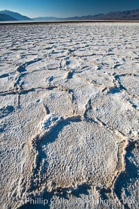
Devils Golf Course, California. Evaporated salt has formed into gnarled, complex crystalline shapes in on the salt pan of Death Valley National Park, one of the largest salt pans in the world. The shapes are constantly evolving as occasional floods submerge the salt concretions before receding and depositing more salt.
Location: Devils Golf Course, Death Valley National Park, California
Image ID: 15597
Location: Devils Golf Course, Death Valley National Park, California
Image ID: 15597
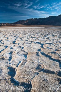
Devils Golf Course, California. Evaporated salt has formed into gnarled, complex crystalline shapes in on the salt pan of Death Valley National Park, one of the largest salt pans in the world. The shapes are constantly evolving as occasional floods submerge the salt concretions before receding and depositing more salt.
Location: Devils Golf Course, Death Valley National Park, California
Image ID: 15614
Location: Devils Golf Course, Death Valley National Park, California
Image ID: 15614
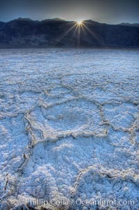
Devils Golf Course. Evaporated salt has formed into gnarled, complex crystalline shapes on the salt pan of Death Valley National Park, one of the largest salt pans in the world. The shapes are constantly evolving as occasional floods submerge the salt concretions before receding and depositing more salt.
Location: Devils Golf Course, Death Valley National Park, California
Image ID: 20552
Location: Devils Golf Course, Death Valley National Park, California
Image ID: 20552
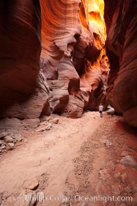
Hiker in Buckskin Gulch. A hiker considers the towering walls and narrow passageway of Buckskin Gulch, a dramatic slot canyon forged by centuries of erosion through sandstone. Buckskin Gulch is the worlds longest accessible slot canyon, running from the Paria River toward the Colorado River. Flash flooding is a serious danger in the narrows where there is no escape.
Location: Buckskin Gulch, Paria Canyon-Vermilion Cliffs Wilderness, Arizona
Image ID: 20710
Location: Buckskin Gulch, Paria Canyon-Vermilion Cliffs Wilderness, Arizona
Image ID: 20710
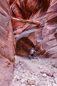
Suspended log in Buckskin Gulch. A hiker considers a heavy log stuck between the narrow walls of Buckskin Gulch, placed there by a flash flood some time in the past. Buckskin Gulch is the world's longest accessible slot canyon, forged by centuries of erosion through sandstone. Flash flooding is a serious danger in the narrows where there is no escape.
Location: Buckskin Gulch, Paria Canyon-Vermilion Cliffs Wilderness, Arizona
Image ID: 20717
Location: Buckskin Gulch, Paria Canyon-Vermilion Cliffs Wilderness, Arizona
Image ID: 20717
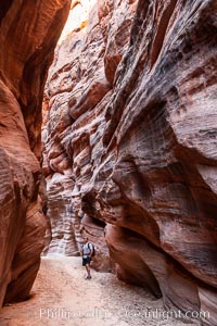
Hiker in Buckskin Gulch. A hiker considers the towering walls and narrow passageway of Buckskin Gulch, a dramatic slot canyon forged by centuries of erosion through sandstone. Buckskin Gulch is the worlds longest accessible slot canyon, running from the Paria River toward the Colorado River. Flash flooding is a serious danger in the narrows where there is no escape.
Location: Buckskin Gulch, Paria Canyon-Vermilion Cliffs Wilderness, Arizona
Image ID: 20772
Location: Buckskin Gulch, Paria Canyon-Vermilion Cliffs Wilderness, Arizona
Image ID: 20772
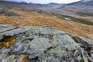
Grassy windy highlands and rocks, overlooking alluvial floodplain formed by glacier runoff near Stromness Bay.
Location: Stromness Harbour, South Georgia Island
Image ID: 24610
Location: Stromness Harbour, South Georgia Island
Image ID: 24610
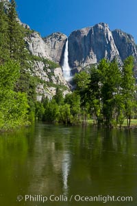
Yosemite Falls reflected in the Merced River, from Swinging Bridge. The Merced River is flooded with heavy springtime flow as winter snow melts in the high country above Yosemite Valley.
Location: Yosemite National Park, California
Image ID: 26889
Location: Yosemite National Park, California
Image ID: 26889
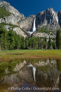
Yosemite Falls reflected in flooded meadow. The Merced River floods its banks in spring, forming beautiful reflections of Yosemite Falls.
Location: Yosemite National Park, California
Image ID: 26890
Location: Yosemite National Park, California
Image ID: 26890
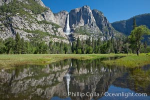
Yosemite Falls reflected in flooded meadow. The Merced River floods its banks in spring, forming beautiful reflections of Yosemite Falls.
Location: Yosemite National Park, California
Image ID: 26892
Location: Yosemite National Park, California
Image ID: 26892
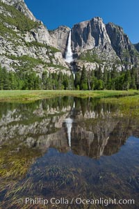
Yosemite Falls reflected in flooded meadow. The Merced River floods its banks in spring, forming beautiful reflections of Yosemite Falls.
Location: Yosemite National Park, California
Image ID: 26893
Location: Yosemite National Park, California
Image ID: 26893
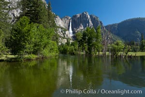
Yosemite Falls reflected in the Merced River, from Swinging Bridge. The Merced River is flooded with heavy springtime flow as winter snow melts in the high country above Yosemite Valley.
Location: Yosemite National Park, California
Image ID: 26894
Location: Yosemite National Park, California
Image ID: 26894
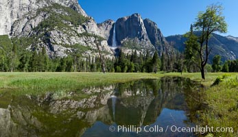
Yosemite Falls reflected in flooded meadow. The Merced River floods its banks in spring, forming beautiful reflections of Yosemite Falls.
Location: Yosemite National Park, California
Image ID: 26897
Panorama dimensions: 5371 x 9328
Location: Yosemite National Park, California
Image ID: 26897
Panorama dimensions: 5371 x 9328
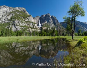
Yosemite Falls reflected in flooded meadow. The Merced River floods its banks in spring, forming beautiful reflections of Yosemite Falls.
Location: Yosemite National Park, California
Image ID: 26898
Panorama dimensions: 5217 x 6670
Location: Yosemite National Park, California
Image ID: 26898
Panorama dimensions: 5217 x 6670
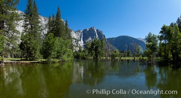
Yosemite Falls reflected in the Merced River, from Swinging Bridge. The Merced River is flooded with heavy springtime flow as winter snow melts in the high country above Yosemite Valley.
Location: Yosemite National Park, California
Image ID: 26899
Panorama dimensions: 5171 x 9598
Location: Yosemite National Park, California
Image ID: 26899
Panorama dimensions: 5171 x 9598
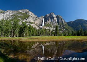
Yosemite Falls reflected in flooded meadow. The Merced River floods its banks in spring, forming beautiful reflections of Yosemite Falls.
Location: Yosemite National Park, California
Image ID: 26900
Panorama dimensions: 4961 x 6942
Location: Yosemite National Park, California
Image ID: 26900
Panorama dimensions: 4961 x 6942
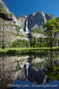
Yosemite Falls reflected in the Merced River, from Swinging Bridge. The Merced River is flooded with heavy springtime flow as winter snow melts in the high country above Yosemite Valley.
Location: Yosemite National Park, California
Image ID: 26901
Location: Yosemite National Park, California
Image ID: 26901
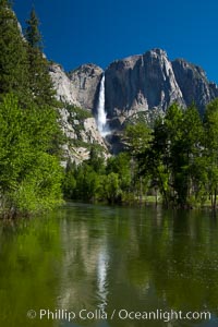
Yosemite Falls reflected in the Merced River, from Swinging Bridge. The Merced River is flooded with heavy springtime flow as winter snow melts in the high country above Yosemite Valley.
Location: Yosemite National Park, California
Image ID: 26902
Location: Yosemite National Park, California
Image ID: 26902
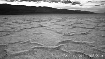
Salt polygons. After winter flooding, the salt on the Badwater Basin playa dries into geometric polygonal shapes.
Location: Badwater, Death Valley National Park, California
Image ID: 25299
Location: Badwater, Death Valley National Park, California
Image ID: 25299
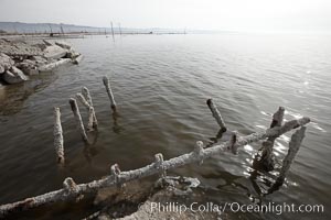
Bombay Beach, lies alongside and below the flood level of the Salton Sea, so that it floods occasionally when the Salton Sea rises. A part of Bombay Beach is composed of derelict old trailer homes, shacks and wharfs, slowly sinking in the mud and salt.
Location: Salton Sea, Imperial County, California
Image ID: 22487
Location: Salton Sea, Imperial County, California
Image ID: 22487
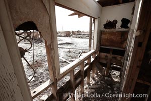
Bombay Beach, lies alongside and below the flood level of the Salton Sea, so that it floods occasionally when the Salton Sea rises. A part of Bombay Beach is composed of derelict old trailer homes, shacks and wharfs, slowly sinking in the mud and salt.
Location: Salton Sea, Imperial County, California
Image ID: 22488
Location: Salton Sea, Imperial County, California
Image ID: 22488