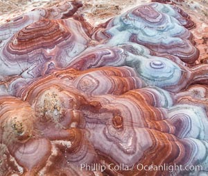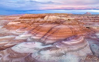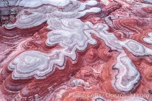
Fantastic colorful sedimentary patterns of Bentonite layers, seen as striations exposed in the Utah Badlands. The Bentonite Hills are composed of the Brushy Basin shale member of the Morrison Formation formed during Jurassic times when mud, silt, fine sand, and volcanic ash were deposited in swamps and lakes into layers, now revealed through erosion. Aerial photograph.
Location: Utah
Image ID: 37947
Location: Utah
Image ID: 37947
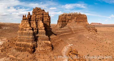
Molly's Castle, aerial view, Goblin Valley State Park. Curtis Formation whiteish caprock is on top, with reddish Entrada Sandstone below, both of Jurassic era. Molly's castle lies in the San Rafael desert near Goblin Valley, and drains into the Colorado River watershed. Aerial panoramic photograph.
Location: Goblin Valley State Park, Utah
Image ID: 37950
Location: Goblin Valley State Park, Utah
Image ID: 37950
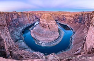
Belt of Venus over Horseshoe Bend on the Colorado River. The Colorado River makes a 180-degree turn at Horseshoe Bend. Here the river has eroded the Navajo sandstone for eons, digging a canyon 1100-feet deep. The Belt of Venus, or anti-twilight arch, is the shadow of the earth cast upon the atmosphere just above the horizon, and occurs a few minutes before sunrise or after sunset.
Location: Page, Arizona
Image ID: 37781
Panorama dimensions: 5719 x 8788
Location: Page, Arizona
Image ID: 37781
Panorama dimensions: 5719 x 8788
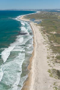
Aerial Photo of Tijuana River Mouth SMCA. Tijuana River Mouth State Marine Conservation Area borders Imperial Beach and the Mexican Border.
Location: Imperial Beach, California
Image ID: 30649
Location: Imperial Beach, California
Image ID: 30649
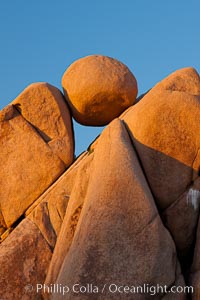
Boulders and sunset in Joshua Tree National Park. The warm sunlight gently lights unusual boulder formations at Jumbo Rocks in Joshua Tree National Park, California.
Location: Joshua Tree National Park, California
Image ID: 26726
Location: Joshua Tree National Park, California
Image ID: 26726
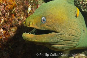
Panamic Green Moray Eel, Sea of Cortez, Baja California, Mexico.
Species: Panamic green moray eel, Gymnothorax castaneus
Location: Sea of Cortez, Baja California, Mexico
Image ID: 27466
Species: Panamic green moray eel, Gymnothorax castaneus
Location: Sea of Cortez, Baja California, Mexico
Image ID: 27466
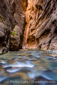
The Virgin River Narrows, where the Virgin River has carved deep, narrow canyons through the Zion National Park sandstone, creating one of the finest hikes in the world.
Location: Virgin River Narrows, Zion National Park, Utah
Image ID: 28578
Location: Virgin River Narrows, Zion National Park, Utah
Image ID: 28578
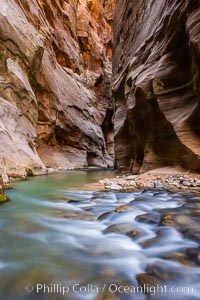
The Virgin River Narrows, where the Virgin River has carved deep, narrow canyons through the Zion National Park sandstone, creating one of the finest hikes in the world.
Location: Virgin River Narrows, Zion National Park, Utah
Image ID: 28579
Location: Virgin River Narrows, Zion National Park, Utah
Image ID: 28579
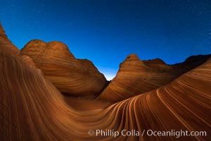
The Wave at Night, under a clear night sky full of stars. The Wave, an area of fantastic eroded sandstone featuring beautiful swirls, wild colors, countless striations, and bizarre shapes set amidst the dramatic surrounding North Coyote Buttes of Arizona and Utah. The sandstone formations of the North Coyote Buttes, including the Wave, date from the Jurassic period. Managed by the Bureau of Land Management, the Wave is located in the Paria Canyon-Vermilion Cliffs Wilderness and is accessible on foot by permit only.
Location: North Coyote Buttes, Paria Canyon-Vermilion Cliffs Wilderness, Arizona
Image ID: 28621
Location: North Coyote Buttes, Paria Canyon-Vermilion Cliffs Wilderness, Arizona
Image ID: 28621
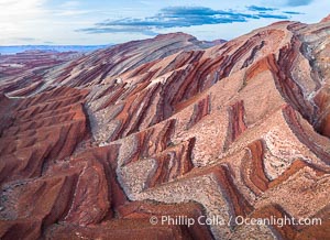
Aerial Photo of Raplee Ridge near Mexican Hat, Utah. Raplee Ridge is a spectacular series of multicolored triangular flatirons near the San Juan River. Often called "the Raplee Anticline" the geologic structure is in fact better described as a monocline, according to the Utah Geological Survey.
Location: Mexican Hat, Utah
Image ID: 39490
Location: Mexican Hat, Utah
Image ID: 39490
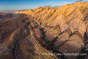
Aerial photo of the San Rafael Reef at dawn. A fold in the Earth's crust leads to this inclined section of the San Rafael Reef, at the eastern edge of the San Rafael Swell. Clearly seen are the characteristic triangular flatiron erosion patterns that typical this formation. The colors seen here arise primarily from Navajo and Wingate sandstone.
Location: Utah
Image ID: 39784
Location: Utah
Image ID: 39784
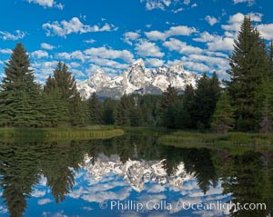
The Grand Tetons, reflected in the glassy waters of the Snake River at Schwabacher Landing, on a beautiful summer morning.
Location: Grand Teton National Park, Wyoming
Image ID: 26923
Panorama dimensions: 5318 x 6689
Location: Grand Teton National Park, Wyoming
Image ID: 26923
Panorama dimensions: 5318 x 6689
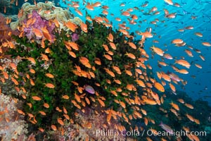
Anthias fish school around green fan coral, Fiji.
Species: Anthias, Pseudanthias
Location: Fiji
Image ID: 34806
Species: Anthias, Pseudanthias
Location: Fiji
Image ID: 34806

Saint Peter's Basilica over the Tiber River, Vatican City.
Location: Vatican City, Rome, Italy
Image ID: 35547
Location: Vatican City, Rome, Italy
Image ID: 35547
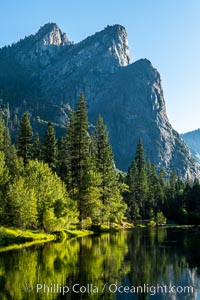
Three Brothers and Merced River in spring, Yosemite National Park.
Location: Yosemite National Park, California
Image ID: 36354
Location: Yosemite National Park, California
Image ID: 36354
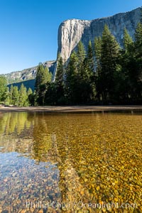
El Capitan and the Merced River, early morning, Yosemite National Park.
Location: Yosemite National Park, California
Image ID: 36355
Location: Yosemite National Park, California
Image ID: 36355
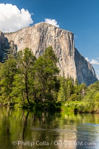
El Capitan and the Merced River in spring, Yosemite National Park.
Location: Yosemite National Park, California
Image ID: 36377
Location: Yosemite National Park, California
Image ID: 36377
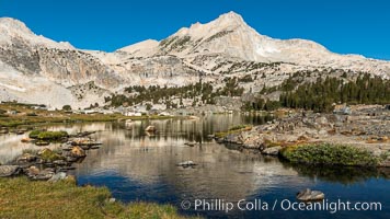
Greenstone Lake and North Peak, Hoover Wilderness.
Location: 20 Lakes Basin, Hoover Wilderness, California
Image ID: 36420
Location: 20 Lakes Basin, Hoover Wilderness, California
Image ID: 36420
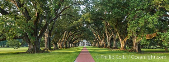
Oak Alley Plantation and its famous shaded tunnel of 300-year-old southern live oak trees (Quercus virginiana). The plantation is now designated as a National Historic Landmark.
Species: Southern live oak, Quercus virginiana
Location: Oak Alley Plantation, Vacherie, Louisiana
Image ID: 31018
Panorama dimensions: 6564 x 17803
Species: Southern live oak, Quercus virginiana
Location: Oak Alley Plantation, Vacherie, Louisiana
Image ID: 31018
Panorama dimensions: 6564 x 17803
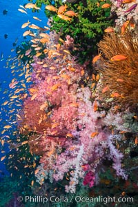
Vibrant Dendronephthya soft corals, green fan coral and schooling Anthias fish on coral reef, Fiji.
Species: Anthias, Black sun coral, Dendronephthya soft coral, Dendronephthya, Pseudanthias, Tubastrea micrantha
Location: Vatu I Ra Passage, Bligh Waters, Viti Levu Island, Fiji
Image ID: 31352
Species: Anthias, Black sun coral, Dendronephthya soft coral, Dendronephthya, Pseudanthias, Tubastrea micrantha
Location: Vatu I Ra Passage, Bligh Waters, Viti Levu Island, Fiji
Image ID: 31352
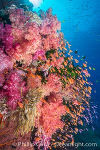
Vibrant Dendronephthya soft corals, green fan coral and schooling Anthias fish on coral reef, Fiji.
Species: Anthias, Black sun coral, Dendronephthya soft coral, Dendronephthya, Pseudanthias, Tubastrea micrantha
Location: Vatu I Ra Passage, Bligh Waters, Viti Levu Island, Fiji
Image ID: 31354
Species: Anthias, Black sun coral, Dendronephthya soft coral, Dendronephthya, Pseudanthias, Tubastrea micrantha
Location: Vatu I Ra Passage, Bligh Waters, Viti Levu Island, Fiji
Image ID: 31354
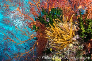
Yellow crinoid, green fan coral and red gorgonian on colorful and pristine coral reef, Fiji.
Species: Black sun coral, Crinoid feather star, Gorgonian, Crinoidea, Gorgonacea, Tubastrea micrantha
Location: Wakaya Island, Lomaiviti Archipelago, Fiji
Image ID: 31396
Species: Black sun coral, Crinoid feather star, Gorgonian, Crinoidea, Gorgonacea, Tubastrea micrantha
Location: Wakaya Island, Lomaiviti Archipelago, Fiji
Image ID: 31396
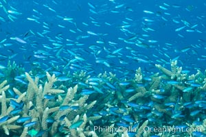
Juvenile blue-green chromis schooling in ocean current over hard corals, Fijii.
Species: Blue-green chromis, Chromis viridis
Location: Makogai Island, Lomaiviti Archipelago, Fiji
Image ID: 31398
Species: Blue-green chromis, Chromis viridis
Location: Makogai Island, Lomaiviti Archipelago, Fiji
Image ID: 31398
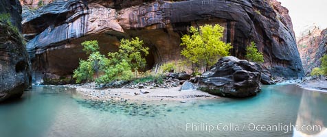
Fall Colors in the Virgin River Narrows, Zion National Park, Utah.
Location: Virgin River Narrows, Zion National Park, Utah
Image ID: 32635
Panorama dimensions: 4795 x 11405
Location: Virgin River Narrows, Zion National Park, Utah
Image ID: 32635
Panorama dimensions: 4795 x 11405
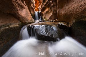
Kanarra Creek Falls in Kanarra Canyon, Utah.
Location: Kanarra Creek, Kanarraville, Utah
Image ID: 32644
Location: Kanarra Creek, Kanarraville, Utah
Image ID: 32644
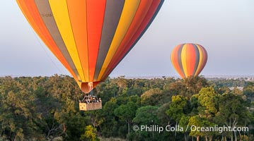
Ballooning over the Maasai Mara National Reserve and Mara River, Kenya.
Location: Maasai Mara National Reserve, Kenya
Image ID: 39614
Location: Maasai Mara National Reserve, Kenya
Image ID: 39614
