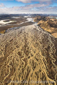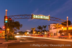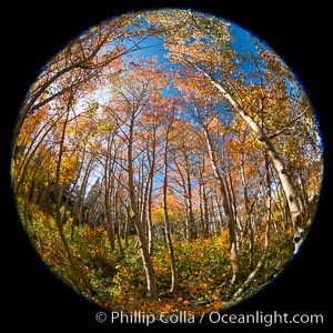
Aspen grove, Dunderberg Meadows, eastern Sierra Nevada.
Location: Sierra Nevada Mountains, California
Image ID: 35835
Location: Sierra Nevada Mountains, California
Image ID: 35835
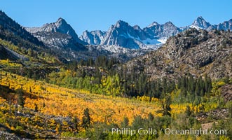
Aspen trees cover Bishop Creek Canyon above Aspendel.
Location: Bishop Creek Canyon, Sierra Nevada Mountains, California
Image ID: 35836
Location: Bishop Creek Canyon, Sierra Nevada Mountains, California
Image ID: 35836
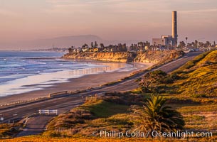
Carlsbad Coast Highway Sunset, Terramar and North Ponto to Oceanside with Camp Pendleton in the distance. Rising in the distance is San Onofre Mountain (1722') topped by a tall signal tower, one of the southern peaks in the Santa Ana Mountains.
Location: Carlsbad, California
Image ID: 35902
Location: Carlsbad, California
Image ID: 35902
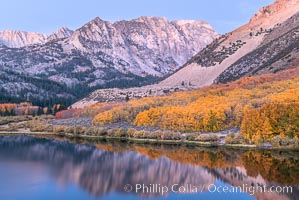
Sierra Nevada fall colors in soft predawn light, North Lake, Bishop Creek Canyon.
Species: Quaking aspen, Populus tremuloides
Location: Bishop Creek Canyon, Sierra Nevada Mountains, California
Image ID: 36431
Species: Quaking aspen, Populus tremuloides
Location: Bishop Creek Canyon, Sierra Nevada Mountains, California
Image ID: 36431
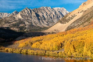
Paiute Peak, Aspen Trees and North Lake, fal colors, Bishop Creek Canyon.
Species: Quaking aspen, Populus tremuloides
Location: Bishop Creek Canyon, Sierra Nevada Mountains, California
Image ID: 36435
Species: Quaking aspen, Populus tremuloides
Location: Bishop Creek Canyon, Sierra Nevada Mountains, California
Image ID: 36435
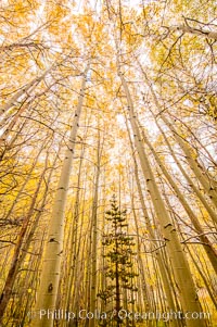
Quaking Aspen Trees, Sierra Nevada Fall Colors, Bishop Creek Canyon.
Species: Quaking aspen, Populus tremuloides
Location: Bishop Creek Canyon, Sierra Nevada Mountains, California
Image ID: 36443
Species: Quaking aspen, Populus tremuloides
Location: Bishop Creek Canyon, Sierra Nevada Mountains, California
Image ID: 36443
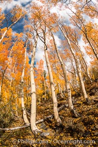
Aspen Trees and Sierra Nevada Fall Colors, Bishop Creek Canyon.
Species: Quaking aspen, Populus tremuloides
Location: Bishop Creek Canyon, Sierra Nevada Mountains, California
Image ID: 36447
Species: Quaking aspen, Populus tremuloides
Location: Bishop Creek Canyon, Sierra Nevada Mountains, California
Image ID: 36447
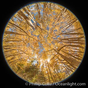
Aspen Trees and Sierra Nevada Fall Colors, Bishop Creek Canyon.
Species: Quaking aspen, Populus tremuloides
Location: Bishop Creek Canyon, Sierra Nevada Mountains, California
Image ID: 36450
Species: Quaking aspen, Populus tremuloides
Location: Bishop Creek Canyon, Sierra Nevada Mountains, California
Image ID: 36450

Half Dome and Yosemite High Country from Sierra Point.
Location: Yosemite National Park, California
Image ID: 36905
Panorama dimensions: 5490 x 18963
Location: Yosemite National Park, California
Image ID: 36905
Panorama dimensions: 5490 x 18963

Belt of Venus and Earth Shadow at Dawn. The Belt of Venus is actually alpenglow visible near the horizon during twilight, above the antisolar point. Like alpenglow, the backscatter of reddened sunlight also creates the Belt of Venus. Unlike alpenglow, the sunlight scattered by fine particulates that cause the rosy arch of the Belt shines high in the atmosphere and lasts for a while after sunset or before sunrise.
Location: La Jolla, California
Image ID: 37476
Location: La Jolla, California
Image ID: 37476
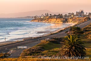
Carlsbad Coast Highway Sunset, Terramar and North Ponto to Oceanside with Camp Pendleton in the distance. Rising in the distance is San Onofre Mountain (1722') topped by a tall signal tower, one of the southern peaks in the Santa Ana Mountains.
Location: Carlsbad, California
Image ID: 37478
Location: Carlsbad, California
Image ID: 37478
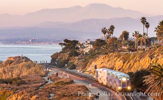
Sunset on the Del Mar Bluffs and Train Tracks, with North County coastline. The highest peaks in the distance are Santiago Peak and Modjeska Peak, the pair commonly known as Saddleback.
Location: Del Mar, California
Image ID: 37604
Location: Del Mar, California
Image ID: 37604

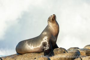
California Sea Lion Posing of Rocks in La Jolla, high surf crashing in the background.
Location: La Jolla, California
Image ID: 36592
Location: La Jolla, California
Image ID: 36592
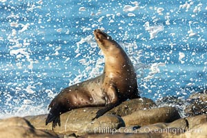
California Sea Lion Posing of Rocks in La Jolla, high surf crashing in the background.
Location: La Jolla, California
Image ID: 36595
Location: La Jolla, California
Image ID: 36595
California Sea Lion Posing of Rocks in La Jolla, high surf crashing in the background.
Location: La Jolla, California
Image ID: 36603
Location: La Jolla, California
Image ID: 36603

Panoramic view from Vogelsang Pass (10685') in Yosemite's high country, looking south. A hiker appears twice in this curious panoramic photo, enjoying the spectacular view. Visible on the left are Parson's Peak (12147'), Gallison Lake and Bernice Lake, while Vogelsang Peak (11516') rises to the right.
Location: Yosemite National Park, California
Image ID: 23210
Panorama dimensions: 4512 x 17738
Location: Yosemite National Park, California
Image ID: 23210
Panorama dimensions: 4512 x 17738
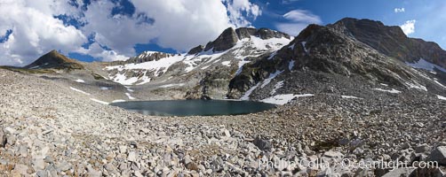
Panorama of Nameless Lake (10709'), surrounded by glacier-sculpted granite peaks of the Cathedral Range, near Vogelsang High Sierra Camp.
Location: Yosemite National Park, California
Image ID: 23211
Panorama dimensions: 3756 x 9102
Location: Yosemite National Park, California
Image ID: 23211
Panorama dimensions: 3756 x 9102
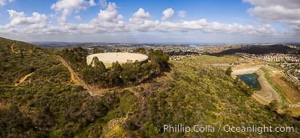
Water Tower Hill and Denk Mountain, and view to the west, highest point in Carlsbad.
Image ID: 38203
Image ID: 38203
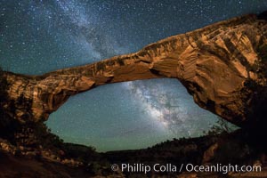
Owachomo Bridge and Milky Way. Owachomo Bridge, a natural stone bridge standing 106' high and spanning 130' wide,stretches across a canyon with the Milky Way crossing the night sky.
Location: Owachomo Bridge, Natural Bridges National Monument, Utah
Image ID: 28545
Location: Owachomo Bridge, Natural Bridges National Monument, Utah
Image ID: 28545
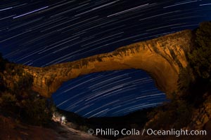
Owachomo Bridge and Star Trails, at night. Owachomo Bridge, a natural stone bridge standing 106' high and spanning 130' wide,stretches across a canyon with the Milky Way crossing the night sky.
Location: Owachomo Bridge, Natural Bridges National Monument, Utah
Image ID: 28550
Location: Owachomo Bridge, Natural Bridges National Monument, Utah
Image ID: 28550
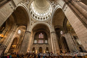
Sacre-Coeur Basilica. The Basilica of the Sacred Heart of Paris, commonly known as Sacre-Coeur Basilica, is a Roman Catholic church and minor basilica, dedicated to the Sacred Heart of Jesus, in Paris, France. A popular landmark, the basilica is located at the summit of the butte Montmartre, the highest point in the city.
Location: Basilique du Sacre-Coeur, Paris, France
Image ID: 28118
Location: Basilique du Sacre-Coeur, Paris, France
Image ID: 28118
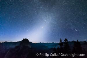
Zodiacal Light and planet Jupiter in the northeastern horizon, above Half Dome and the Yosemite high country.
Location: Glacier Point, Yosemite National Park, California
Image ID: 28745
Location: Glacier Point, Yosemite National Park, California
Image ID: 28745

Panorama of Vogelsang basin, surrounding Vogelsang Lake in Yosemite's High Sierra, viewed from near Vogelsang Pass (10685'). Left is Vogelsang Peak (11516'), Choo-choo Ridge is in the distant middle, and the western flank of Fletcher Peak is to the right.
Location: Yosemite National Park, California
Image ID: 23217
Panorama dimensions: 2945 x 13845
Location: Yosemite National Park, California
Image ID: 23217
Panorama dimensions: 2945 x 13845
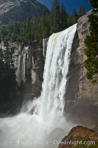
Vernal Falls and Merced River in spring, heavy flow due to snow melt in the high country above Yosemite Valley.
Location: Yosemite National Park, California
Image ID: 26878
Location: Yosemite National Park, California
Image ID: 26878

Aerial Panorama of La Jolla, University City, showing (from left) University of California at San Diego, University City, Scripps Institution of Oceanography, La Jolla Shores, Point La Jolla, Mount Soledad, in the background some of the mountains to the east of San Diego. The highest peak in the center of the panoram is Cuyamaca Peak (6512') while the rocky peak directly in front of it is El Cajon Mountain (3675').
Image ID: 29098
Panorama dimensions: 3881 x 20864
Image ID: 29098
Panorama dimensions: 3881 x 20864
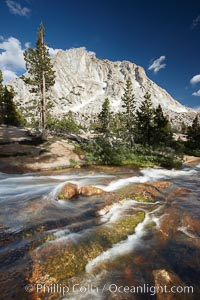
Fletcher Peak (10319') at sunset, viewed from Vogelsang High Sierra Camp in Yosemite's high country.
Location: Yosemite National Park, California
Image ID: 23248
Location: Yosemite National Park, California
Image ID: 23248
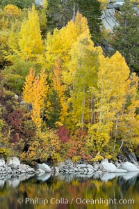
Aspen trees display Eastern Sierra fall colors, Lake Sabrina, Bishop Creek Canyon.
Species: Aspen, Populus tremuloides
Location: Bishop Creek Canyon, Sierra Nevada Mountains, California
Image ID: 17497
Species: Aspen, Populus tremuloides
Location: Bishop Creek Canyon, Sierra Nevada Mountains, California
Image ID: 17497
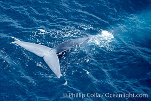
Blue whale fluking. An enormous blue whale raises its powerful fluke (tail) high out of the water as it makes a steep dive into the open ocean.
Species: Blue whale, Balaenoptera musculus
Location: La Jolla, California
Image ID: 21261
Species: Blue whale, Balaenoptera musculus
Location: La Jolla, California
Image ID: 21261
