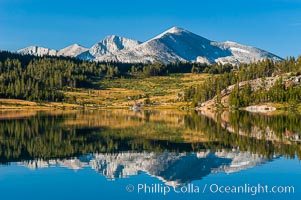
Mammoth Peak and alpine meadows in the High Sierra are reflected in Tioga Lake at sunrise. This spectacular location is just a short walk from the Tioga Pass road. Near Tuolumne Meadows and Yosemite National Park.
Location: Tioga Lake, Yosemite National Park, California
Image ID: 09949
Location: Tioga Lake, Yosemite National Park, California
Image ID: 09949

Panorama of Tenaya Lake, in Yosemite's high country.
Location: Tenaya Lake, Yosemite National Park, California
Image ID: 19121
Panorama dimensions: 2009 x 14383
Location: Tenaya Lake, Yosemite National Park, California
Image ID: 19121
Panorama dimensions: 2009 x 14383
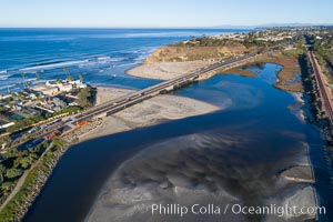
San Dieguito Lagoon and San Dieguito River empty into the Pacific Ocean at Dog Beach in Del Mar, aerial photo.
Location: Del Mar, California
Image ID: 38107
Location: Del Mar, California
Image ID: 38107
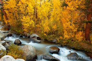
Aspens turn yellow in autumn, changing color alongside the south fork of Bishop Creek at sunset.
Species: Aspen, Populus tremuloides
Location: Bishop Creek Canyon, Sierra Nevada Mountains, California
Image ID: 23323
Species: Aspen, Populus tremuloides
Location: Bishop Creek Canyon, Sierra Nevada Mountains, California
Image ID: 23323
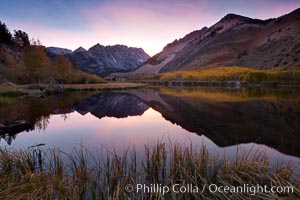
Sunset on North Lake in the eastern Sierra Nevada, autumn.
Location: Bishop Creek Canyon Sierra Nevada Mountains, California
Image ID: 26054
Location: Bishop Creek Canyon Sierra Nevada Mountains, California
Image ID: 26054
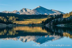
Mammoth Peak in the High Sierra range is reflected in Tioga Lake at sunrise. This spectacular location is just a short walk from the Tioga Pass road. Near Tuolumne Meadows and Yosemite National Park.
Location: Tioga Lake, Yosemite National Park, California
Image ID: 09948
Location: Tioga Lake, Yosemite National Park, California
Image ID: 09948

Panoramic view of the Cathedral Range from the summit of Vogelsang Peak (11500'). The shadow of Vogelsang Peak can be seen in the middle of the picture.
Location: Yosemite National Park, California
Image ID: 25751
Panorama dimensions: 3268 x 15705
Location: Yosemite National Park, California
Image ID: 25751
Panorama dimensions: 3268 x 15705
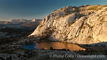
Fletcher Peak is reflected in Vogelsang Lake at sunset, viewed from near summit of Vogelsang Peak.
Location: Yosemite National Park, California
Image ID: 25757
Location: Yosemite National Park, California
Image ID: 25757
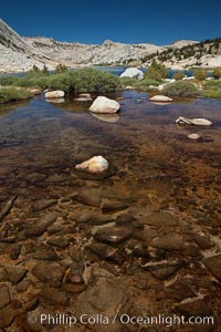
Rocks and stream connecting the two sections of Townsley Lake, with Choo-choo Ridge (11357') visible in the distance.
Location: Yosemite National Park, California
Image ID: 25779
Location: Yosemite National Park, California
Image ID: 25779
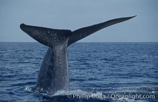
An enormous blue whale raises its fluke (tail) high out of the water before diving. Open ocean offshore of San Diego.
Species: Blue whale, Balaenoptera musculus
Location: San Diego, California
Image ID: 07556
Species: Blue whale, Balaenoptera musculus
Location: San Diego, California
Image ID: 07556
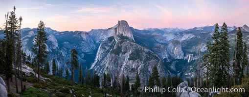
Panoramic view of Half Dome at sunset, Tenaya Canyon and Yosemite High Country, Yosemite National Park.
Location: Yosemite National Park, California
Image ID: 36382
Panorama dimensions: 5279 x 14692
Location: Yosemite National Park, California
Image ID: 36382
Panorama dimensions: 5279 x 14692
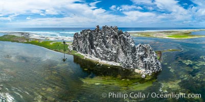
Clipperton Rock, a 95' high volcanic remnant, is the highest point on Clipperton Island, a spectacular coral atoll in the eastern Pacific. By permit HC / 1485 / CAB (France).
Location: Clipperton Island, France
Image ID: 32941
Panorama dimensions: 4867 x 9748
Location: Clipperton Island, France
Image ID: 32941
Panorama dimensions: 4867 x 9748
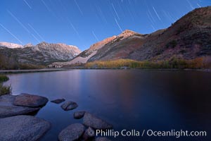
Star trails and alpenglow on the Sierra Nevada, Paiute Peak, before sunrise, reflected in North Lake in the Sierra Nevada.
Location: Bishop Creek Canyon Sierra Nevada Mountains, California
Image ID: 26053
Location: Bishop Creek Canyon Sierra Nevada Mountains, California
Image ID: 26053
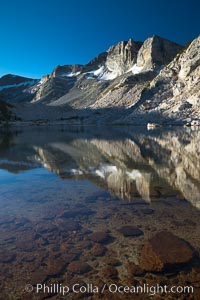
Cathedral Range peaks reflected in the still waters of Townsley Lake at sunrise.
Location: Yosemite National Park, California
Image ID: 25764
Location: Yosemite National Park, California
Image ID: 25764
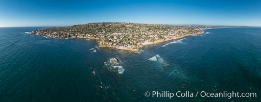
Aerial Panoramic Photo of Bird Rock and La Jolla Coast, with surfers in the waves. Pacific Beach and Mission Beach are to the far right (south). La Jolla's Mount Soledad rises in the center. The submarine reefs around Bird Rock are visible through the clear water. This extremely high resolution panorama will print 80 inches high by 200 inches wide.
Location: La Jolla, California
Image ID: 30778
Panorama dimensions: 7948 x 20303
Location: La Jolla, California
Image ID: 30778
Panorama dimensions: 7948 x 20303
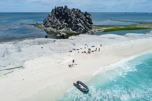
Clipperton Rock, a 95' high volcanic remnant, is the highest point on Clipperton Island, a spectacular coral atoll in the eastern Pacific. By permit HC / 1485 / CAB (France).
Location: Clipperton Island, France
Image ID: 32829
Location: Clipperton Island, France
Image ID: 32829
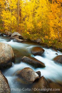
Aspens turn yellow in autumn, changing color alongside the south fork of Bishop Creek at sunset.
Species: Aspen, Populus tremuloides
Location: Bishop Creek Canyon, Sierra Nevada Mountains, California
Image ID: 23329
Species: Aspen, Populus tremuloides
Location: Bishop Creek Canyon, Sierra Nevada Mountains, California
Image ID: 23329
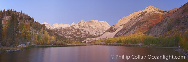
North Lake lit by alpenglow before sunrise, a three frame panorama, with groves of yellow and orange aspen trees on the side of Paiute Peak.
Location: Bishop Creek Canyon, Sierra Nevada Mountains, California
Image ID: 23336
Panorama dimensions: 2991 x 8972
Location: Bishop Creek Canyon, Sierra Nevada Mountains, California
Image ID: 23336
Panorama dimensions: 2991 x 8972
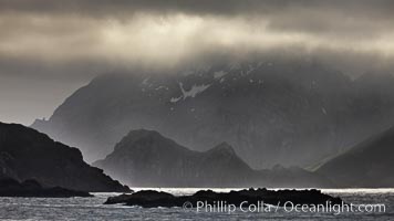
South Georgia Island coastline, showing the island's characteristic rugged topography. 56% of the island is covered by 161 glaciers, which have created numerous large bays and inlets that provide excellent habitat for marine animals and seabirds. Mountains meet the sea in steep-sided seacliffs covered with sparse vegetation. The highest point on South Georgia Island is Mt. Paget at 2,915m.
Location: South Georgia Island
Image ID: 24317
Location: South Georgia Island
Image ID: 24317
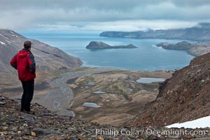
Hiker looks down on Stromness Harbour from the pass high above.
Location: Stromness Harbour, South Georgia Island
Image ID: 24582
Location: Stromness Harbour, South Georgia Island
Image ID: 24582
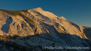
Cloud's Rest at sunset, viewed from Olmsted Point. Clouds Rest is one of the most massive -- if not the singlemost massive -- granite monoliths in the world. A vast lobe of Mesozoic-era granodiorite magma cooled to rock and was gradually uplifted to its present altitude of 9926 ft. Later, glaciers cut it into its present shape.
Location: Yosemite National Park, California
Image ID: 25761
Location: Yosemite National Park, California
Image ID: 25761
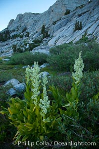
Corn lily blooms near Vogelsang Lake, in shade at sunrise.
Species: California false hellebore, Corn lily, Veratrum californicum
Location: Yosemite National Park, California
Image ID: 25762
Species: California false hellebore, Corn lily, Veratrum californicum
Location: Yosemite National Park, California
Image ID: 25762
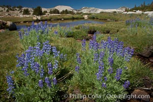
Purple lupine flowers bloom in late summer, along a stream that feeds to Lake Evelyn in the high Sierra Nevada near Vogelsang High Sierra Camp.
Location: Yosemite National Park, California
Image ID: 25763
Location: Yosemite National Park, California
Image ID: 25763
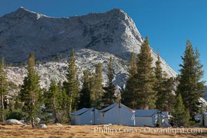
Vogelsang Peak (11500') rises above Vogelsang High Sierra Camp, in Yosemite's high country, with semi-permanent tent cabins serving camp visitors seen in the foreground.
Location: Yosemite National Park, California
Image ID: 25765
Location: Yosemite National Park, California
Image ID: 25765

A sea otter eats a clam that it has taken from the shallow sandy bottom of Elkhorn Slough. Because sea otters have such a high metabolic rate, they eat up to 30% of their body weight each day in the form of clams, mussels, urchins, crabs and abalone. Sea otters are the only known tool-using marine mammal, using a stone or old shell to open the shells of their prey as they float on their backs.
Species: Sea otter, Enhydra lutris
Location: Elkhorn Slough National Estuarine Research Reserve, Moss Landing, California
Image ID: 21612
Species: Sea otter, Enhydra lutris
Location: Elkhorn Slough National Estuarine Research Reserve, Moss Landing, California
Image ID: 21612
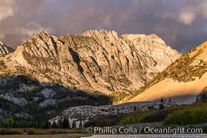
Sunrise on Paiute Peak, over North Lake in the eastern Sierra Nevada.
Location: Bishop Creek Canyon, Sierra Nevada Mountains, California
Image ID: 35831
Location: Bishop Creek Canyon, Sierra Nevada Mountains, California
Image ID: 35831
