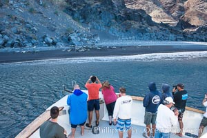
Viewing northern elephant seals along the beach, from the vessel Horizon, at Guadalupe Island.
Location: Guadalupe Island (Isla Guadalupe), Baja California, Mexico
Image ID: 28776
Location: Guadalupe Island (Isla Guadalupe), Baja California, Mexico
Image ID: 28776

Photographer takes picture of a spectacular sunset arch, spanning the heavens from horizon to horizon, over the open sea between the Falkland Islands and South Georgia Island.
Location: Southern Ocean
Image ID: 24096
Location: Southern Ocean
Image ID: 24096
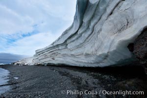
Horizontal striations and layers in packed snow, melting and overhanging, seen from the edge of the snowpack, along a rocky beach.
Location: Brown Bluff, Antarctic Peninsula, Antarctica
Image ID: 24782
Location: Brown Bluff, Antarctic Peninsula, Antarctica
Image ID: 24782
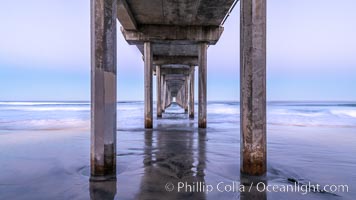
Scripps Institution of Oceanography Pier and Belt of Venus in pre-dawn light. The Earth's shadow appears as the blue just above the horizon.
Location: Scripps Institution of Oceanography, La Jolla, California
Image ID: 37696
Location: Scripps Institution of Oceanography, La Jolla, California
Image ID: 37696

Scripps Institution of Oceanography Pier and Belt of Venus in pre-dawn light. The Earth's shadow appears as the blue just above the horizon.
Location: Scripps Institution of Oceanography, La Jolla, California
Image ID: 37698
Location: Scripps Institution of Oceanography, La Jolla, California
Image ID: 37698
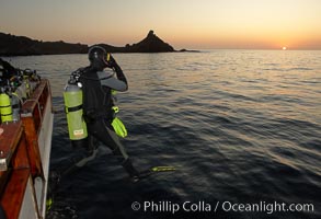
A SCUBA diver leaps into the water, from boat Horizon, into the kelp forest and rich waters of San Clemente Island, China Hat Point, Balanced Rock, sunrise.
Location: San Clemente Island, California
Image ID: 23557
Location: San Clemente Island, California
Image ID: 23557
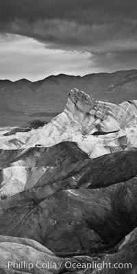
Sunrise at Zabriskie Point, Manly Beacon is lit by the morning sun while dark clouds lie on the horizon.
Location: Zabriskie Point, Death Valley National Park, California
Image ID: 26386
Location: Zabriskie Point, Death Valley National Park, California
Image ID: 26386
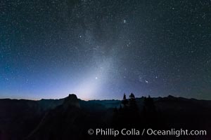
Zodiacal Light and planet Jupiter in the northeastern horizon, above Half Dome and the Yosemite high country.
Location: Glacier Point, Yosemite National Park, California
Image ID: 28743
Location: Glacier Point, Yosemite National Park, California
Image ID: 28743
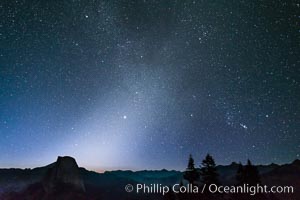
Zodiacal Light and planet Jupiter in the northeastern horizon, above Half Dome and the Yosemite high country.
Location: Glacier Point, Yosemite National Park, California
Image ID: 28744
Location: Glacier Point, Yosemite National Park, California
Image ID: 28744
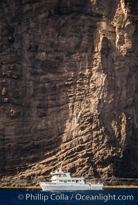
Boat Horizon at Isla Auera, Guadalupe Island, Mexico.
Location: Guadalupe Island (Isla Guadalupe), Baja California, Mexico
Image ID: 36149
Location: Guadalupe Island (Isla Guadalupe), Baja California, Mexico
Image ID: 36149
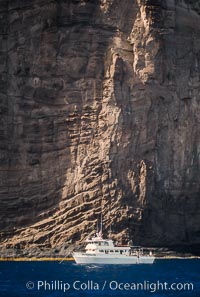
Boat Horizon at Isla Auera, Guadalupe Island, Mexico.
Location: Guadalupe Island (Isla Guadalupe), Baja California, Mexico
Image ID: 36150
Location: Guadalupe Island (Isla Guadalupe), Baja California, Mexico
Image ID: 36150
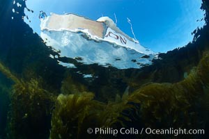
Boat Horizon floats above a kelp forest, underwater.
Species: Giant kelp, Macrocystis pyrifera
Location: San Clemente Island, California
Image ID: 23569
Species: Giant kelp, Macrocystis pyrifera
Location: San Clemente Island, California
Image ID: 23569

Photographer takes picture of a spectacular sunset arch, spanning the heavens from horizon to horizon, over the open sea between the Falkland Islands and South Georgia Island.
Location: Southern Ocean
Image ID: 24095
Location: Southern Ocean
Image ID: 24095

Sunset clouds create a colorful arch, spanning the heavens from horizon to horizon, over the open sea between the Falkland Islands and South Georgia Island.
Location: Southern Ocean
Image ID: 24181
Location: Southern Ocean
Image ID: 24181

Sunset clouds create a colorful arch, spanning the heavens from horizon to horizon, over the open sea between the Falkland Islands and South Georgia Island.
Location: Southern Ocean
Image ID: 24182
Location: Southern Ocean
Image ID: 24182

Photographer takes picture of a spectacular sunset arch, spanning the heavens from horizon to horizon, over the open sea between the Falkland Islands and South Georgia Island.
Location: Southern Ocean
Image ID: 24183
Location: Southern Ocean
Image ID: 24183
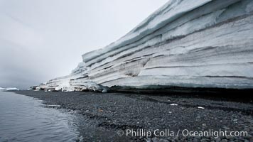
Horizontal striations and layers in packed snow, melting and overhanging, seen from the edge of the snowpack, along a rocky beach.
Location: Brown Bluff, Antarctic Peninsula, Antarctica
Image ID: 24871
Location: Brown Bluff, Antarctic Peninsula, Antarctica
Image ID: 24871
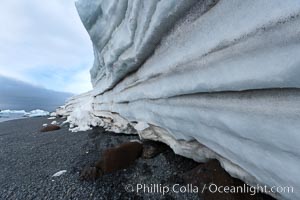
Horizontal striations and layers in packed snow, melting and overhanging, seen from the edge of the snowpack, along a rocky beach.
Location: Brown Bluff, Antarctic Peninsula, Antarctica
Image ID: 24873
Location: Brown Bluff, Antarctic Peninsula, Antarctica
Image ID: 24873
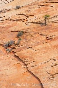
Navajo sandstone forms the cliffs and walls of Zion National Park. The sandstone reaches a thickness of 2300 feet and consists of ancient cemented desert sand dunes. Horizontal lines, commonly called crossbedding, represent layers of wind-blown sand that built up into sand dunes. These dunes were then buried, and the sand grains glued together by calcite and iron oxide to form sandstone.
Location: Zion National Park, Utah
Image ID: 12514
Location: Zion National Park, Utah
Image ID: 12514
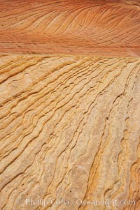
Navajo sandstone forms the cliffs and walls of Zion National Park. The sandstone reaches a thickness of 2300 feet and consists of ancient cemented desert sand dunes. Horizontal lines, commonly called crossbedding, represent layers of wind-blown sand that built up into sand dunes. These dunes were then buried, and the sand grains glued together by calcite and iron oxide to form sandstone.
Location: Zion National Park, Utah
Image ID: 12515
Location: Zion National Park, Utah
Image ID: 12515
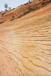
Navajo sandstone forms the cliffs and walls of Zion National Park. The sandstone reaches a thickness of 2300 feet and consists of ancient cemented desert sand dunes. Horizontal lines, commonly called crossbedding, represent layers of wind-blown sand that built up into sand dunes. These dunes were then buried, and the sand grains glued together by calcite and iron oxide to form sandstone.
Location: Zion National Park, Utah
Image ID: 12516
Location: Zion National Park, Utah
Image ID: 12516
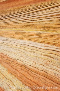
Navajo sandstone forms the cliffs and walls of Zion National Park. The sandstone reaches a thickness of 2300 feet and consists of ancient cemented desert sand dunes. Horizontal lines, commonly called crossbedding, represent layers of wind-blown sand that built up into sand dunes. These dunes were then buried, and the sand grains glued together by calcite and iron oxide to form sandstone.
Location: Zion National Park, Utah
Image ID: 12517
Location: Zion National Park, Utah
Image ID: 12517
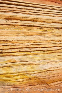
Navajo sandstone forms the cliffs and walls of Zion National Park. The sandstone reaches a thickness of 2300 feet and consists of ancient cemented desert sand dunes. Horizontal lines, commonly called crossbedding, represent layers of wind-blown sand that built up into sand dunes. These dunes were then buried, and the sand grains glued together by calcite and iron oxide to form sandstone.
Location: Zion National Park, Utah
Image ID: 12518
Location: Zion National Park, Utah
Image ID: 12518
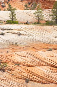
Navajo sandstone forms the cliffs and walls of Zion National Park. The sandstone reaches a thickness of 2300 feet and consists of ancient cemented desert sand dunes. Horizontal lines, commonly called crossbedding, represent layers of wind-blown sand that built up into sand dunes. These dunes were then buried, and the sand grains glued together by calcite and iron oxide to form sandstone.
Location: Zion National Park, Utah
Image ID: 12520
Location: Zion National Park, Utah
Image ID: 12520
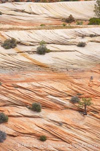
Navajo sandstone forms the cliffs and walls of Zion National Park. The sandstone reaches a thickness of 2300 feet and consists of ancient cemented desert sand dunes. Horizontal lines, commonly called crossbedding, represent layers of wind-blown sand that built up into sand dunes. These dunes were then buried, and the sand grains glued together by calcite and iron oxide to form sandstone.
Location: Zion National Park, Utah
Image ID: 12521
Location: Zion National Park, Utah
Image ID: 12521
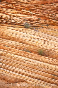
Navajo sandstone forms the cliffs and walls of Zion National Park. The sandstone reaches a thickness of 2300 feet and consists of ancient cemented desert sand dunes. Horizontal lines, commonly called crossbedding, represent layers of wind-blown sand that built up into sand dunes. These dunes were then buried, and the sand grains glued together by calcite and iron oxide to form sandstone.
Location: Zion National Park, Utah
Image ID: 12522
Location: Zion National Park, Utah
Image ID: 12522
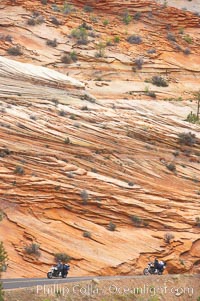
Navajo sandstone forms the cliffs and walls of Zion National Park. The sandstone reaches a thickness of 2300 feet and consists of ancient cemented desert sand dunes. Horizontal lines, commonly called crossbedding, represent layers of wind-blown sand that built up into sand dunes. These dunes were then buried, and the sand grains glued together by calcite and iron oxide to form sandstone.
Location: Zion National Park, Utah
Image ID: 12523
Location: Zion National Park, Utah
Image ID: 12523
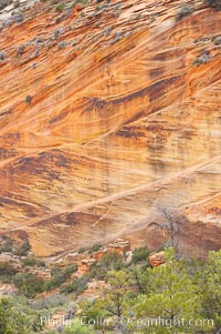
Navajo sandstone forms the cliffs and walls of Zion National Park. The sandstone reaches a thickness of 2300 feet and consists of ancient cemented desert sand dunes. Horizontal lines, commonly called crossbedding, represent layers of wind-blown sand that built up into sand dunes. These dunes were then buried, and the sand grains glued together by calcite and iron oxide to form sandstone.
Location: Zion National Park, Utah
Image ID: 12524
Location: Zion National Park, Utah
Image ID: 12524
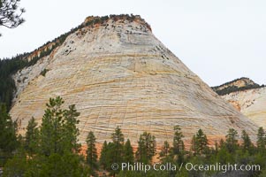
Checkerboard Mesa, a good example of crossbedding (horizontal lines) and vertical cracks caused by thermal expansion/contraction. Navajo sandstone forms the cliffs and walls of Zion National Park. The sandstone reaches a thickness of 2300 feet and consists of ancient cemented desert sand dunes. Horizontal lines, commonly called crossbedding, represent layers of wind-blown sand that built up into sand dunes. These dunes were then buried, and the sand grains glued together by calcite and iron oxide to form sandstone.
Location: Zion National Park, Utah
Image ID: 12526
Location: Zion National Park, Utah
Image ID: 12526
