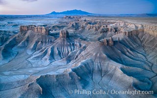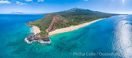
San Diego Bay and Skyline at sunset, viewed from Point Loma, panoramic photograph.
Location: San Diego, California
Image ID: 30214
Panorama dimensions: 4888 x 33004
Location: San Diego, California
Image ID: 30214
Panorama dimensions: 4888 x 33004
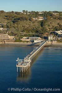
SIO Pier, Scripps Pier, La Jolla. The Scripps Institution of Oceanography research pier is 1090 feet long and was built of reinforced concrete in 1988, replacing the original wooden pier built in 1915. The Scripps Pier is home to a variety of sensing equipment above and below water that collects various oceanographic data. The Scripps research diving facility is located at the foot of the pier. Fresh seawater is pumped from the pier to the many tanks and facilities of SIO, including the Birch Aquarium. The Scripps Pier is named in honor of Ellen Browning Scripps, the most significant donor and benefactor of the Institution.
Location: Scripps Institution of Oceanography, La Jolla, California
Image ID: 22286
Location: Scripps Institution of Oceanography, La Jolla, California
Image ID: 22286
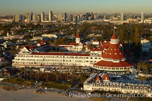
Hotel del Coronado, known affectionately as the Hotel Del. It was once the largest hotel in the world, and is one of the few remaining wooden Victorian beach resorts. It sits on the beach on Coronado Island, seen here with downtown San Diego in the distance. It is widely considered to be one of Americas most beautiful and classic hotels. Built in 1888, it was designated a National Historic Landmark in 1977.
Location: San Diego, California
Image ID: 22287
Location: San Diego, California
Image ID: 22287

Self portrait at sunrise, panorama of Crater Lake. Crater Lake is the six-mile wide lake inside the collapsed caldera of volcanic Mount Mazama. Crater Lake is the deepest lake in the United States and the seventh-deepest in the world. Its maximum recorded depth is 1996 feet (608m). It lies at an altitude of 6178 feet (1880m).
Location: Crater Lake National Park, Oregon
Image ID: 19130
Panorama dimensions: 2726 x 9677
Location: Crater Lake National Park, Oregon
Image ID: 19130
Panorama dimensions: 2726 x 9677
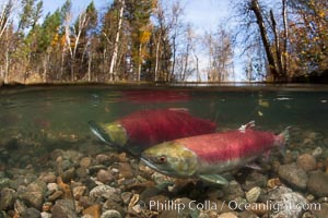
A sockeye salmon swims in the shallows of the Adams River, with the surrounding forest visible in this split-level over-under photograph.
Species: Sockeye salmon, Oncorhynchus nerka
Location: Adams River, Roderick Haig-Brown Provincial Park, British Columbia, Canada
Image ID: 26144
Species: Sockeye salmon, Oncorhynchus nerka
Location: Adams River, Roderick Haig-Brown Provincial Park, British Columbia, Canada
Image ID: 26144
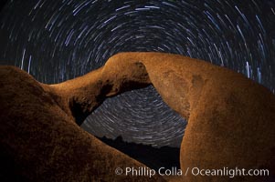
Mobius Arch in the Alabama Hills, seen here at night with swirling star trails formed in the sky above due to a long time exposure.
Location: Alabama Hills Recreational Area, California
Image ID: 27681
Location: Alabama Hills Recreational Area, California
Image ID: 27681
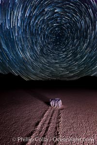
Racetrack sailing stone and star trails. A sliding rock of the Racetrack Playa. The sliding rocks, or sailing stones, move across the mud flats of the Racetrack Playa, leaving trails behind in the mud. The explanation for their movement is not known with certainty, but many believe wind pushes the rocks over wet and perhaps icy mud in winter.
Location: Racetrack Playa, Death Valley National Park, California
Image ID: 27671
Location: Racetrack Playa, Death Valley National Park, California
Image ID: 27671

Sunset at Dead Horse Point Overlook, with the Colorado River flowing 2,000 feet below. 300 million years of erosion has carved the expansive canyons, cliffs and walls below and surrounding Deadhorse Point.
Location: Dead Horse Point State Park, Utah
Image ID: 27823
Panorama dimensions: 5303 x 17695
Location: Dead Horse Point State Park, Utah
Image ID: 27823
Panorama dimensions: 5303 x 17695
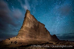
Stars over the Tower of Babel, starry night, Arches National Park, Utah.
Location: Arches National Park, Utah
Image ID: 27847
Location: Arches National Park, Utah
Image ID: 27847
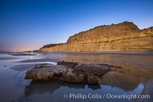
Torrey Pines Cliffs lit at night by a full moon, low tide reflections.
Location: Torrey Pines State Reserve, San Diego, California
Image ID: 28461
Location: Torrey Pines State Reserve, San Diego, California
Image ID: 28461
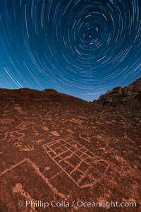
Star Trails over Sky Rock. Sky Rock petroglyphs near Bishop, California. Hidden atop an enormous boulder in the Volcanic Tablelands lies Sky Rock, a set of petroglyphs that face the sky. These superb examples of native American petroglyph artwork are thought to be Paiute in origin, but little is known about them.
Image ID: 28498
Image ID: 28498
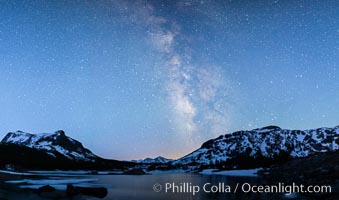
Milky Way over Tioga Lake, Yosemite National Park.
Location: Tioga Lake, Yosemite National Park, California
Image ID: 28521
Location: Tioga Lake, Yosemite National Park, California
Image ID: 28521
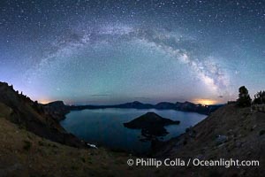
Milky Way and stars over Crater Lake at night. Panorama of Crater Lake and Wizard Island at night, Crater Lake National Park.
Location: Crater Lake National Park, Oregon
Image ID: 28640
Panorama dimensions: 5244 x 9702
Location: Crater Lake National Park, Oregon
Image ID: 28640
Panorama dimensions: 5244 x 9702

Blue Moon, Full Moon at Sunset over San Diego City Skyline, approaching jet with headlights appearing in front of the moon.
Location: San Diego, California
Image ID: 28753
Location: San Diego, California
Image ID: 28753

Enormous Ocean sunfish and freediving photographer, open ocean.
Species: Ocean sunfish, Mola mola
Location: San Diego, California
Image ID: 03491
Species: Ocean sunfish, Mola mola
Location: San Diego, California
Image ID: 03491
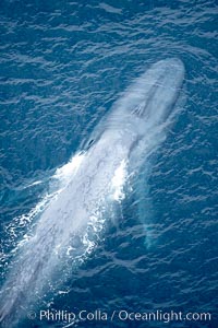
Blue whale, swimming through the open ocean.
Species: Blue whale, Balaenoptera musculus
Location: La Jolla, California
Image ID: 21248
Species: Blue whale, Balaenoptera musculus
Location: La Jolla, California
Image ID: 21248
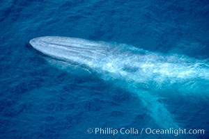
Blue whale. The sleek hydrodynamic shape of the enormous blue whale allows it to swim swiftly through the ocean, at times over one hundred miles in a single day.
Species: Blue whale, Balaenoptera musculus
Location: La Jolla, California
Image ID: 21250
Species: Blue whale, Balaenoptera musculus
Location: La Jolla, California
Image ID: 21250
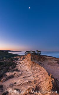
Quarter Moon over Broken Hill, Torrey Pines State Reserve.
Location: Torrey Pines State Reserve, San Diego, California
Image ID: 28366
Location: Torrey Pines State Reserve, San Diego, California
Image ID: 28366
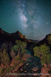
Milky Way over the Watchman, Zion National Park. The Milky Way galaxy rises in the night sky above the the Watchman.
Location: Zion National Park, Utah
Image ID: 28590
Location: Zion National Park, Utah
Image ID: 28590
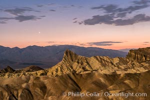
Venus sets over Manley Beacon and the Panamint Mountains, viewed from Zabriskie Point, landscape lit by a full moon, evening, stars.
Location: Zabriskie Point, Death Valley National Park, California
Image ID: 28677
Location: Zabriskie Point, Death Valley National Park, California
Image ID: 28677
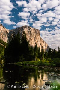
El Capitan and clouds lit by full moon, stars, evening.
Location: El Capitan, Yosemite National Park, California
Image ID: 28695
Location: El Capitan, Yosemite National Park, California
Image ID: 28695
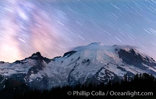
Moutain climbers light see upon Mount Rainier, Milky Way and stars at night above Mount Rainier.
Location: Sunrise, Mount Rainier National Park, Washington
Image ID: 28726
Location: Sunrise, Mount Rainier National Park, Washington
Image ID: 28726

Guadalupe Island at sunrise, panorama. Volcanic coastline south of Pilot Rock and Spanish Cove, near El Faro lighthouse.
Location: Guadalupe Island (Isla Guadalupe), Baja California, Mexico
Image ID: 28758
Panorama dimensions: 4224 x 25926
Location: Guadalupe Island (Isla Guadalupe), Baja California, Mexico
Image ID: 28758
Panorama dimensions: 4224 x 25926
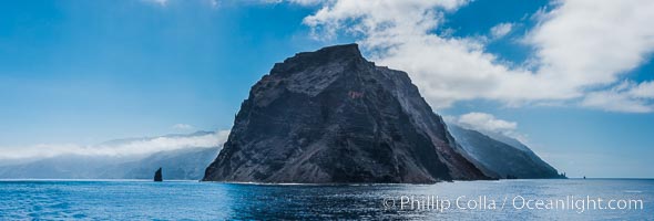
Punta Norte, the northern point of Guadalupe Island, viewed from the north. Punta Desfiladero (Blunt Point) and Roca Elefante are just visible at far right, and Roca Piloto (Pilot Rock) is see to the left of the island against the distant sweep of the cliffs that comprise the northeastern bight of the island, actually the rim of an enormous caldera.
Location: Guadalupe Island (Isla Guadalupe), Baja California, Mexico
Image ID: 28760
Panorama dimensions: 4595 x 13560
Location: Guadalupe Island (Isla Guadalupe), Baja California, Mexico
Image ID: 28760
Panorama dimensions: 4595 x 13560
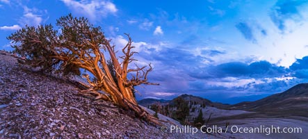
Ancient Bristlecone Pine Tree at sunset, panorama, with storm clouds passing over the White Mountains. The eastern Sierra Nevada is just visible in the distance.
Species: Ancient bristlecone pine, Pinus longaeva
Location: Ancient Bristlecone Pine Forest, White Mountains, Inyo National Forest, California
Image ID: 28781
Panorama dimensions: 4549 x 10085
Species: Ancient bristlecone pine, Pinus longaeva
Location: Ancient Bristlecone Pine Forest, White Mountains, Inyo National Forest, California
Image ID: 28781
Panorama dimensions: 4549 x 10085
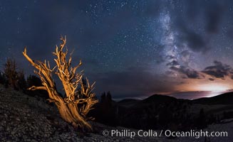
Ancient Bristlecone Pine Tree at night, stars and the Milky Way galaxy visible in the evening sky, near Patriarch Grove.
Species: Ancient bristlecone pine, Pinus longaeva
Location: Ancient Bristlecone Pine Forest, White Mountains, Inyo National Forest, California
Image ID: 28782
Panorama dimensions: 5237 x 8556
Species: Ancient bristlecone pine, Pinus longaeva
Location: Ancient Bristlecone Pine Forest, White Mountains, Inyo National Forest, California
Image ID: 28782
Panorama dimensions: 5237 x 8556
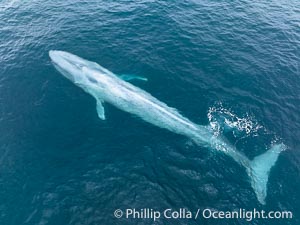
Aerial photo of blue whale near San Diego. This enormous blue whale glides at the surface of the ocean, resting and breathing before it dives to feed on subsurface krill.
Species: Blue whale, Balaenoptera musculus
Location: San Diego, California
Image ID: 39422
Species: Blue whale, Balaenoptera musculus
Location: San Diego, California
Image ID: 39422
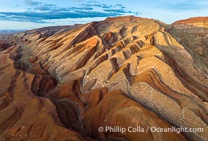
Aerial Photo of Raplee Ridge near Mexican Hat, Utah. Raplee Ridge is a spectacular series of multicolored triangular flatirons near the San Juan River. Often called "the Raplee Anticline" the geologic structure is in fact better described as a monocline, according to the Utah Geological Survey.
Location: Mexican Hat, Utah
Image ID: 39489
Location: Mexican Hat, Utah
Image ID: 39489
