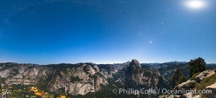
Half Dome and nighttime stars, viewed from Glacier Point.
Location: Glacier Point, Yosemite National Park, California
Image ID: 27951
Panorama dimensions: 4761 x 10519
Location: Glacier Point, Yosemite National Park, California
Image ID: 27951
Panorama dimensions: 4761 x 10519
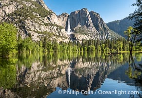
Yosemite Falls reflected in Flooded Sentinel Meadow, when the Merced River floods Yosemite Valley following a winter of historic snowfall in the Sierra Nevada, Yosemite National Park.
Location: Yosemite National Park, California
Image ID: 39378
Location: Yosemite National Park, California
Image ID: 39378

Sunrise at San Clemente Island, south end showing China Hat (Balanced Rock) and Pyramid Head, near Pyramid Cove, storm clouds. Panoramic photo.
Location: San Clemente Island, California
Image ID: 30855
Panorama dimensions: 5232 x 24109
Location: San Clemente Island, California
Image ID: 30855
Panorama dimensions: 5232 x 24109
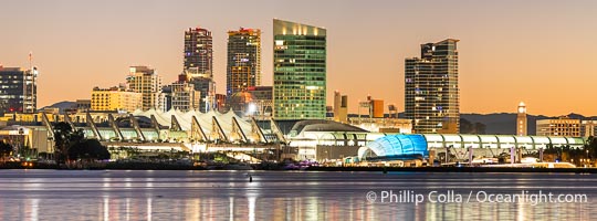
San Diego Convention Center Skyline and Waterfront at Sunrise. San Diego Convention Center, located in the Marina District of downtown San Diego. Built in 1989, the San Diego Convention Center offers 525,700 square feet of exhibit space. It is noted for its distinctive "sails" made of Teflon-coated fiberglass suspended over the central exhibition hall, aptly named Sails Pavilion.
Location: San Diego, California
Image ID: 40046
Panorama dimensions: 5186 x 13999
Location: San Diego, California
Image ID: 40046
Panorama dimensions: 5186 x 13999
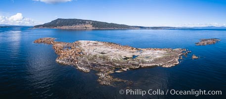
Steller Sea Lions atop Norris Rocks, Hornby Island in the distance, panoramic photo.
Species: Steller sea lion, Eumetopias jubatus
Location: British Columbia, Canada
Image ID: 34467
Panorama dimensions: 3758 x 8590
Species: Steller sea lion, Eumetopias jubatus
Location: British Columbia, Canada
Image ID: 34467
Panorama dimensions: 3758 x 8590
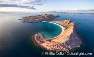
Isla San Francisquito, Aerial Photo, Sea of of Cortez.
Location: Isla San Francisquito, Baja California, Mexico
Image ID: 32441
Location: Isla San Francisquito, Baja California, Mexico
Image ID: 32441

San Diego Bay and Skyline at sunset, viewed from Point Loma, panoramic photograph.
Location: San Diego, California
Image ID: 30214
Panorama dimensions: 4888 x 33004
Location: San Diego, California
Image ID: 30214
Panorama dimensions: 4888 x 33004
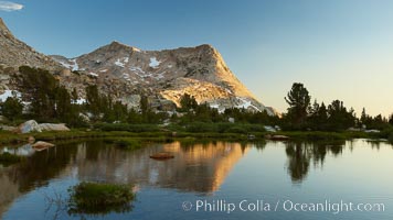
Vogelsang Peak (11516') at sunset, reflected in a small creek near Vogelsang High Sierra Camp in Yosemite's high country.
Location: Yosemite National Park, California
Image ID: 23202
Location: Yosemite National Park, California
Image ID: 23202

Self portrait at sunrise, panorama of Crater Lake. Crater Lake is the six-mile wide lake inside the collapsed caldera of volcanic Mount Mazama. Crater Lake is the deepest lake in the United States and the seventh-deepest in the world. Its maximum recorded depth is 1996 feet (608m). It lies at an altitude of 6178 feet (1880m).
Location: Crater Lake National Park, Oregon
Image ID: 19130
Panorama dimensions: 2726 x 9677
Location: Crater Lake National Park, Oregon
Image ID: 19130
Panorama dimensions: 2726 x 9677

Sunset at Dead Horse Point Overlook, with the Colorado River flowing 2,000 feet below. 300 million years of erosion has carved the expansive canyons, cliffs and walls below and surrounding Deadhorse Point.
Location: Dead Horse Point State Park, Utah
Image ID: 27823
Panorama dimensions: 5303 x 17695
Location: Dead Horse Point State Park, Utah
Image ID: 27823
Panorama dimensions: 5303 x 17695
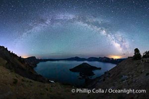
Milky Way and stars over Crater Lake at night. Panorama of Crater Lake and Wizard Island at night, Crater Lake National Park.
Location: Crater Lake National Park, Oregon
Image ID: 28640
Panorama dimensions: 5244 x 9702
Location: Crater Lake National Park, Oregon
Image ID: 28640
Panorama dimensions: 5244 x 9702
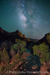
Milky Way over the Watchman, Zion National Park. The Milky Way galaxy rises in the night sky above the the Watchman.
Location: Zion National Park, Utah
Image ID: 28590
Location: Zion National Park, Utah
Image ID: 28590
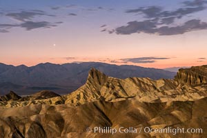
Venus sets over Manley Beacon and the Panamint Mountains, viewed from Zabriskie Point, landscape lit by a full moon, evening, stars.
Location: Zabriskie Point, Death Valley National Park, California
Image ID: 28677
Location: Zabriskie Point, Death Valley National Park, California
Image ID: 28677
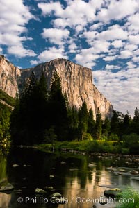
El Capitan and clouds lit by full moon, stars, evening.
Location: El Capitan, Yosemite National Park, California
Image ID: 28695
Location: El Capitan, Yosemite National Park, California
Image ID: 28695

Guadalupe Island at sunrise, panorama. Volcanic coastline south of Pilot Rock and Spanish Cove, near El Faro lighthouse.
Location: Guadalupe Island (Isla Guadalupe), Baja California, Mexico
Image ID: 28758
Panorama dimensions: 4224 x 25926
Location: Guadalupe Island (Isla Guadalupe), Baja California, Mexico
Image ID: 28758
Panorama dimensions: 4224 x 25926
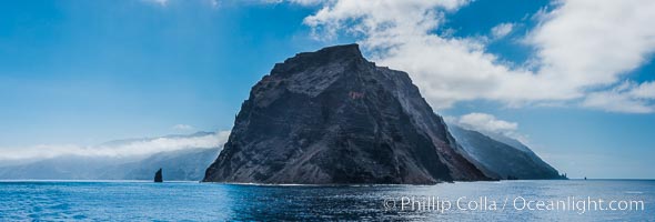
Punta Norte, the northern point of Guadalupe Island, viewed from the north. Punta Desfiladero (Blunt Point) and Roca Elefante are just visible at far right, and Roca Piloto (Pilot Rock) is see to the left of the island against the distant sweep of the cliffs that comprise the northeastern bight of the island, actually the rim of an enormous caldera.
Location: Guadalupe Island (Isla Guadalupe), Baja California, Mexico
Image ID: 28760
Panorama dimensions: 4595 x 13560
Location: Guadalupe Island (Isla Guadalupe), Baja California, Mexico
Image ID: 28760
Panorama dimensions: 4595 x 13560
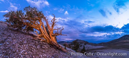
Ancient Bristlecone Pine Tree at sunset, panorama, with storm clouds passing over the White Mountains. The eastern Sierra Nevada is just visible in the distance.
Species: Ancient bristlecone pine, Pinus longaeva
Location: Ancient Bristlecone Pine Forest, White Mountains, Inyo National Forest, California
Image ID: 28781
Panorama dimensions: 4549 x 10085
Species: Ancient bristlecone pine, Pinus longaeva
Location: Ancient Bristlecone Pine Forest, White Mountains, Inyo National Forest, California
Image ID: 28781
Panorama dimensions: 4549 x 10085
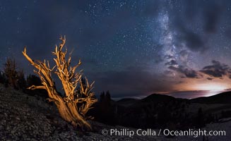
Ancient Bristlecone Pine Tree at night, stars and the Milky Way galaxy visible in the evening sky, near Patriarch Grove.
Species: Ancient bristlecone pine, Pinus longaeva
Location: Ancient Bristlecone Pine Forest, White Mountains, Inyo National Forest, California
Image ID: 28782
Panorama dimensions: 5237 x 8556
Species: Ancient bristlecone pine, Pinus longaeva
Location: Ancient Bristlecone Pine Forest, White Mountains, Inyo National Forest, California
Image ID: 28782
Panorama dimensions: 5237 x 8556
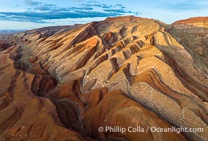
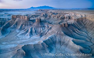
Aerial Photo of Raplee Ridge near Mexican Hat, Utah. Raplee Ridge is a spectacular series of multicolored triangular flatirons near the San Juan River. Often called "the Raplee Anticline" the geologic structure is in fact better described as a monocline, according to the Utah Geological Survey.
Location: Mexican Hat, Utah
Image ID: 39489
Location: Mexican Hat, Utah
Image ID: 39489
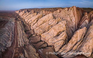
Aerial photo of the San Rafael Reef at dawn. A fold in the Earth's crust leads to this inclined section of the San Rafael Reef, at the eastern edge of the San Rafael Swell. Clearly seen are the characteristic triangular flatiron erosion patterns that typical this formation. The colors seen here arise primarily from Navajo and Wingate sandstone.
Location: Utah
Image ID: 39787
Location: Utah
Image ID: 39787
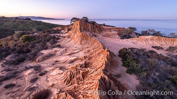
Broken Hill in soft pre-dawn light, overlooking the Pacific Ocean and Torrey Pines State Reserve. La Jolla and Mount Soledad in the distance.
Location: Torrey Pines State Reserve, San Diego, California
Image ID: 36564
Location: Torrey Pines State Reserve, San Diego, California
Image ID: 36564
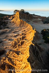
Broken Hill by the first light of dawn, overlooking the Pacific Ocean and Torrey Pines State Reserve.
Location: Torrey Pines State Reserve, San Diego, California
Image ID: 36567
Location: Torrey Pines State Reserve, San Diego, California
Image ID: 36567
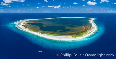
Aerial panorama of Clipperton Island, showing the entire atoll. Clipperton Island, a minor territory of France also known as Ile de la Passion, is a small (2.3 sq mi) but spectacular coral atoll in the eastern Pacific. By permit HC / 1485 / CAB (France).
Location: Clipperton Island, France
Image ID: 32889
Location: Clipperton Island, France
Image ID: 32889
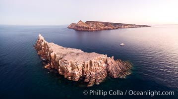
Los Islotes and Isla Partida, the northern part of Archipelago Espiritu Santo, Sea of Cortez, Aerial Photo. Islotes is famous for its friendly colony of California sea lions.
Location: Los Islotes, Baja California, Mexico
Image ID: 32402
Location: Los Islotes, Baja California, Mexico
Image ID: 32402
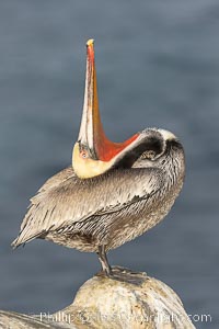
Pelican yoga, Utthita Tadasana, extended mountain pose with backbend. A California brown pelican preening, rubbing the back of its head and neck on the uropygial gland (preen gland) near the base of its tail. Preen oil from the uropygial gland is spread by the pelican's beak and back of its head to all other feathers on the pelican, helping to keep them water resistant and dry. Adult winter breeding plumage showing brown hindneck and red gular throat pouch.
Species: Brown Pelican, Pelecanus occidentalis, Pelecanus occidentalis californicus
Location: La Jolla, California
Image ID: 38710
Species: Brown Pelican, Pelecanus occidentalis, Pelecanus occidentalis californicus
Location: La Jolla, California
Image ID: 38710

San Diego and Tijuana City Skyline, panoramic photo, viewed from Mount Soledad.
Location: San Diego, California
Image ID: 36657
Panorama dimensions: 5513 x 19828
Location: San Diego, California
Image ID: 36657
Panorama dimensions: 5513 x 19828
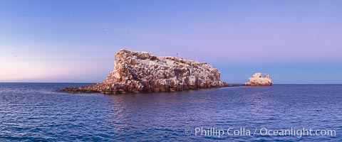
Earth shadow over Los Islotes Island, famous for its friendly colony of California sea lions, Espiritu Santo Biosphere Reserve, Sea of Cortez, Baja California, Mexico.
Location: Sea of Cortez, Baja California, Mexico
Image ID: 27364
Panorama dimensions: 5269 x 12646
Location: Sea of Cortez, Baja California, Mexico
Image ID: 27364
Panorama dimensions: 5269 x 12646
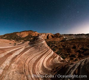
The Fire Wave by Moonlight, stars and the night sky, Valley of Fire State Park.
Location: Valley of Fire State Park, Nevada
Image ID: 28442
Panorama dimensions: 6250 x 6887
Location: Valley of Fire State Park, Nevada
Image ID: 28442
Panorama dimensions: 6250 x 6887
