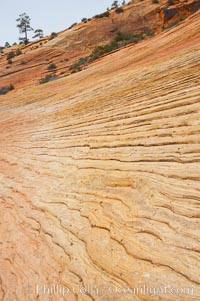
Navajo sandstone forms the cliffs and walls of Zion National Park. The sandstone reaches a thickness of 2300 feet and consists of ancient cemented desert sand dunes. Horizontal lines, commonly called crossbedding, represent layers of wind-blown sand that built up into sand dunes. These dunes were then buried, and the sand grains glued together by calcite and iron oxide to form sandstone.
Location: Zion National Park, Utah
Image ID: 12516
Location: Zion National Park, Utah
Image ID: 12516
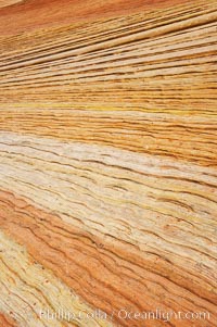
Navajo sandstone forms the cliffs and walls of Zion National Park. The sandstone reaches a thickness of 2300 feet and consists of ancient cemented desert sand dunes. Horizontal lines, commonly called crossbedding, represent layers of wind-blown sand that built up into sand dunes. These dunes were then buried, and the sand grains glued together by calcite and iron oxide to form sandstone.
Location: Zion National Park, Utah
Image ID: 12517
Location: Zion National Park, Utah
Image ID: 12517
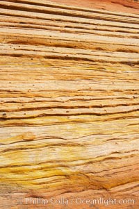
Navajo sandstone forms the cliffs and walls of Zion National Park. The sandstone reaches a thickness of 2300 feet and consists of ancient cemented desert sand dunes. Horizontal lines, commonly called crossbedding, represent layers of wind-blown sand that built up into sand dunes. These dunes were then buried, and the sand grains glued together by calcite and iron oxide to form sandstone.
Location: Zion National Park, Utah
Image ID: 12518
Location: Zion National Park, Utah
Image ID: 12518
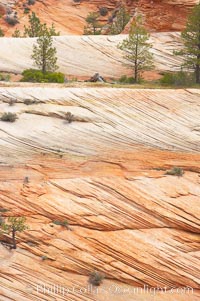
Navajo sandstone forms the cliffs and walls of Zion National Park. The sandstone reaches a thickness of 2300 feet and consists of ancient cemented desert sand dunes. Horizontal lines, commonly called crossbedding, represent layers of wind-blown sand that built up into sand dunes. These dunes were then buried, and the sand grains glued together by calcite and iron oxide to form sandstone.
Location: Zion National Park, Utah
Image ID: 12520
Location: Zion National Park, Utah
Image ID: 12520
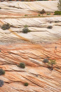
Navajo sandstone forms the cliffs and walls of Zion National Park. The sandstone reaches a thickness of 2300 feet and consists of ancient cemented desert sand dunes. Horizontal lines, commonly called crossbedding, represent layers of wind-blown sand that built up into sand dunes. These dunes were then buried, and the sand grains glued together by calcite and iron oxide to form sandstone.
Location: Zion National Park, Utah
Image ID: 12521
Location: Zion National Park, Utah
Image ID: 12521
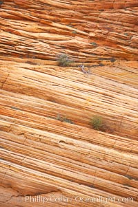
Navajo sandstone forms the cliffs and walls of Zion National Park. The sandstone reaches a thickness of 2300 feet and consists of ancient cemented desert sand dunes. Horizontal lines, commonly called crossbedding, represent layers of wind-blown sand that built up into sand dunes. These dunes were then buried, and the sand grains glued together by calcite and iron oxide to form sandstone.
Location: Zion National Park, Utah
Image ID: 12522
Location: Zion National Park, Utah
Image ID: 12522
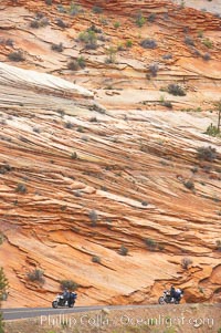
Navajo sandstone forms the cliffs and walls of Zion National Park. The sandstone reaches a thickness of 2300 feet and consists of ancient cemented desert sand dunes. Horizontal lines, commonly called crossbedding, represent layers of wind-blown sand that built up into sand dunes. These dunes were then buried, and the sand grains glued together by calcite and iron oxide to form sandstone.
Location: Zion National Park, Utah
Image ID: 12523
Location: Zion National Park, Utah
Image ID: 12523
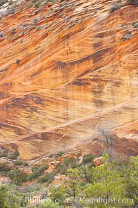
Navajo sandstone forms the cliffs and walls of Zion National Park. The sandstone reaches a thickness of 2300 feet and consists of ancient cemented desert sand dunes. Horizontal lines, commonly called crossbedding, represent layers of wind-blown sand that built up into sand dunes. These dunes were then buried, and the sand grains glued together by calcite and iron oxide to form sandstone.
Location: Zion National Park, Utah
Image ID: 12524
Location: Zion National Park, Utah
Image ID: 12524
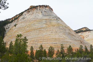
Checkerboard Mesa, a good example of crossbedding (horizontal lines) and vertical cracks caused by thermal expansion/contraction. Navajo sandstone forms the cliffs and walls of Zion National Park. The sandstone reaches a thickness of 2300 feet and consists of ancient cemented desert sand dunes. Horizontal lines, commonly called crossbedding, represent layers of wind-blown sand that built up into sand dunes. These dunes were then buried, and the sand grains glued together by calcite and iron oxide to form sandstone.
Location: Zion National Park, Utah
Image ID: 12526
Location: Zion National Park, Utah
Image ID: 12526
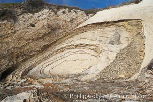
Shale is a fine-grained detrital sedimentary rock formed by the compaction of clay, silt, or mud. Shale is formed when mud is pressed into rock over millions of years and often breaks into big flat pieces. Here layers of shale emerge from the sand and cliffs at Gaviota State Beach north of Santa Barbara.
Location: Gaviota State Beach, Santa Barbara, California
Image ID: 14892
Location: Gaviota State Beach, Santa Barbara, California
Image ID: 14892
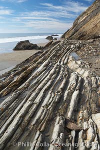
Shale is a fine-grained detrital sedimentary rock formed by the compaction of clay, silt, or mud. Shale is formed when mud is pressed into rock over millions of years and often breaks into big flat pieces. Here layers of shale emerge from the sand and cliffs at Gaviota State Beach north of Santa Barbara.
Location: Gaviota State Beach, Santa Barbara, California
Image ID: 14893
Location: Gaviota State Beach, Santa Barbara, California
Image ID: 14893
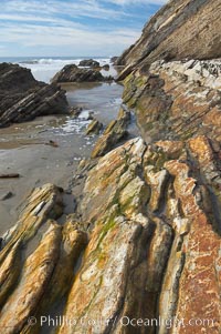
Shale is a fine-grained detrital sedimentary rock formed by the compaction of clay, silt, or mud. Shale is formed when mud is pressed into rock over millions of years and often breaks into big flat pieces. Here layers of shale emerge from the sand and cliffs at Gaviota State Beach north of Santa Barbara.
Location: Gaviota State Beach, Santa Barbara, California
Image ID: 14894
Location: Gaviota State Beach, Santa Barbara, California
Image ID: 14894
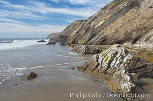
Shale is a fine-grained detrital sedimentary rock formed by the compaction of clay, silt, or mud. Shale is formed when mud is pressed into rock over millions of years and often breaks into big flat pieces. Here layers of shale emerge from the sand and cliffs at Gaviota State Beach north of Santa Barbara.
Location: Gaviota State Beach, Santa Barbara, California
Image ID: 14895
Location: Gaviota State Beach, Santa Barbara, California
Image ID: 14895
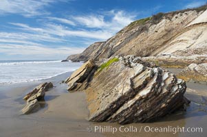
Shale is a fine-grained detrital sedimentary rock formed by the compaction of clay, silt, or mud. Shale is formed when mud is pressed into rock over millions of years and often breaks into big flat pieces. Here layers of shale emerge from the sand and cliffs at Gaviota State Beach north of Santa Barbara.
Location: Gaviota State Beach, Santa Barbara, California
Image ID: 14896
Location: Gaviota State Beach, Santa Barbara, California
Image ID: 14896
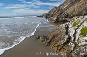
Shale is a fine-grained detrital sedimentary rock formed by the compaction of clay, silt, or mud. Shale is formed when mud is pressed into rock over millions of years and often breaks into big flat pieces. Here layers of shale emerge from the sand and cliffs at Gaviota State Beach north of Santa Barbara.
Location: Gaviota State Beach, Santa Barbara, California
Image ID: 14897
Location: Gaviota State Beach, Santa Barbara, California
Image ID: 14897
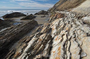
Shale is a fine-grained detrital sedimentary rock formed by the compaction of clay, silt, or mud. Shale is formed when mud is pressed into rock over millions of years and often breaks into big flat pieces. Here layers of shale emerge from the sand and cliffs at Gaviota State Beach north of Santa Barbara.
Location: Gaviota State Beach, Santa Barbara, California
Image ID: 14898
Location: Gaviota State Beach, Santa Barbara, California
Image ID: 14898
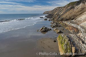
Shale is a fine-grained detrital sedimentary rock formed by the compaction of clay, silt, or mud. Shale is formed when mud is pressed into rock over millions of years and often breaks into big flat pieces. Here layers of shale emerge from the sand and cliffs at Gaviota State Beach north of Santa Barbara.
Location: Gaviota State Beach, Santa Barbara, California
Image ID: 14899
Location: Gaviota State Beach, Santa Barbara, California
Image ID: 14899
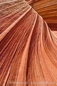
The Wave, an area of fantastic eroded sandstone featuring beautiful swirls, wild colors, countless striations, and bizarre shapes set amidst the dramatic surrounding North Coyote Buttes of Arizona and Utah. The sandstone formations of the North Coyote Buttes, including the Wave, date from the Jurassic period. Managed by the Bureau of Land Management, the Wave is located in the Paria Canyon-Vermilion Cliffs Wilderness and is accessible on foot by permit only.
Location: North Coyote Buttes, Paria Canyon-Vermilion Cliffs Wilderness, Arizona
Image ID: 20615
Location: North Coyote Buttes, Paria Canyon-Vermilion Cliffs Wilderness, Arizona
Image ID: 20615
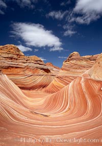
The Wave, an area of fantastic eroded sandstone featuring beautiful swirls, wild colors, countless striations, and bizarre shapes set amidst the dramatic surrounding North Coyote Buttes of Arizona and Utah. The sandstone formations of the North Coyote Buttes, including the Wave, date from the Jurassic period. Managed by the Bureau of Land Management, the Wave is located in the Paria Canyon-Vermilion Cliffs Wilderness and is accessible on foot by permit only.
Location: North Coyote Buttes, Paria Canyon-Vermilion Cliffs Wilderness, Arizona
Image ID: 20616
Location: North Coyote Buttes, Paria Canyon-Vermilion Cliffs Wilderness, Arizona
Image ID: 20616
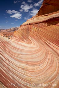
The Wave, an area of fantastic eroded sandstone featuring beautiful swirls, wild colors, countless striations, and bizarre shapes set amidst the dramatic surrounding North Coyote Buttes of Arizona and Utah. The sandstone formations of the North Coyote Buttes, including the Wave, date from the Jurassic period. Managed by the Bureau of Land Management, the Wave is located in the Paria Canyon-Vermilion Cliffs Wilderness and is accessible on foot by permit only.
Location: North Coyote Buttes, Paria Canyon-Vermilion Cliffs Wilderness, Arizona
Image ID: 20618
Location: North Coyote Buttes, Paria Canyon-Vermilion Cliffs Wilderness, Arizona
Image ID: 20618
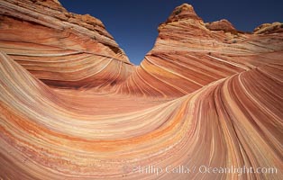
The Wave, an area of fantastic eroded sandstone featuring beautiful swirls, wild colors, countless striations, and bizarre shapes set amidst the dramatic surrounding North Coyote Buttes of Arizona and Utah. The sandstone formations of the North Coyote Buttes, including the Wave, date from the Jurassic period. Managed by the Bureau of Land Management, the Wave is located in the Paria Canyon-Vermilion Cliffs Wilderness and is accessible on foot by permit only.
Location: North Coyote Buttes, Paria Canyon-Vermilion Cliffs Wilderness, Arizona
Image ID: 20619
Location: North Coyote Buttes, Paria Canyon-Vermilion Cliffs Wilderness, Arizona
Image ID: 20619
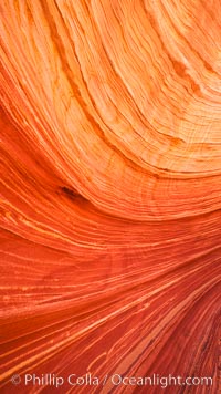
The Wave, an area of fantastic eroded sandstone featuring beautiful swirls, wild colors, countless striations, and bizarre shapes set amidst the dramatic surrounding North Coyote Buttes of Arizona and Utah. The sandstone formations of the North Coyote Buttes, including the Wave, date from the Jurassic period. Managed by the Bureau of Land Management, the Wave is located in the Paria Canyon-Vermilion Cliffs Wilderness and is accessible on foot by permit only.
Location: North Coyote Buttes, Paria Canyon-Vermilion Cliffs Wilderness, Arizona
Image ID: 20620
Location: North Coyote Buttes, Paria Canyon-Vermilion Cliffs Wilderness, Arizona
Image ID: 20620

The Wave, an area of fantastic eroded sandstone featuring beautiful swirls, wild colors, countless striations, and bizarre shapes set amidst the dramatic surrounding North Coyote Buttes of Arizona and Utah. The sandstone formations of the North Coyote Buttes, including the Wave, date from the Jurassic period. Managed by the Bureau of Land Management, the Wave is located in the Paria Canyon-Vermilion Cliffs Wilderness and is accessible on foot by permit only.
Location: North Coyote Buttes, Paria Canyon-Vermilion Cliffs Wilderness, Arizona
Image ID: 20621
Location: North Coyote Buttes, Paria Canyon-Vermilion Cliffs Wilderness, Arizona
Image ID: 20621
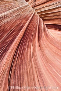
The Wave, an area of fantastic eroded sandstone featuring beautiful swirls, wild colors, countless striations, and bizarre shapes set amidst the dramatic surrounding North Coyote Buttes of Arizona and Utah. The sandstone formations of the North Coyote Buttes, including the Wave, date from the Jurassic period. Managed by the Bureau of Land Management, the Wave is located in the Paria Canyon-Vermilion Cliffs Wilderness and is accessible on foot by permit only.
Location: North Coyote Buttes, Paria Canyon-Vermilion Cliffs Wilderness, Arizona
Image ID: 20622
Location: North Coyote Buttes, Paria Canyon-Vermilion Cliffs Wilderness, Arizona
Image ID: 20622
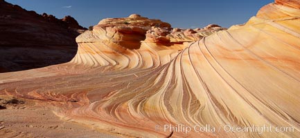
The Second Wave at sunset. The Second Wave, a curiously-shaped sandstone swirl, takes on rich warm tones and dramatic shadowed textures at sunset. Set in the North Coyote Buttes of Arizona and Utah, the Second Wave is characterized by striations revealing layers of sedimentary deposits, a visible historical record depicting eons of submarine geology.
Location: North Coyote Buttes, Paria Canyon-Vermilion Cliffs Wilderness, Arizona
Image ID: 20624
Location: North Coyote Buttes, Paria Canyon-Vermilion Cliffs Wilderness, Arizona
Image ID: 20624
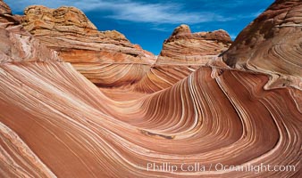
The Wave, an area of fantastic eroded sandstone featuring beautiful swirls, wild colors, countless striations, and bizarre shapes set amidst the dramatic surrounding North Coyote Buttes of Arizona and Utah. The sandstone formations of the North Coyote Buttes, including the Wave, date from the Jurassic period. Managed by the Bureau of Land Management, the Wave is located in the Paria Canyon-Vermilion Cliffs Wilderness and is accessible on foot by permit only.
Location: North Coyote Buttes, Paria Canyon-Vermilion Cliffs Wilderness, Arizona
Image ID: 20625
Location: North Coyote Buttes, Paria Canyon-Vermilion Cliffs Wilderness, Arizona
Image ID: 20625
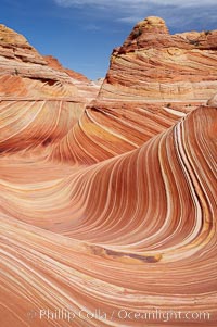
The Wave, an area of fantastic eroded sandstone featuring beautiful swirls, wild colors, countless striations, and bizarre shapes set amidst the dramatic surrounding North Coyote Buttes of Arizona and Utah. The sandstone formations of the North Coyote Buttes, including the Wave, date from the Jurassic period. Managed by the Bureau of Land Management, the Wave is located in the Paria Canyon-Vermilion Cliffs Wilderness and is accessible on foot by permit only.
Location: North Coyote Buttes, Paria Canyon-Vermilion Cliffs Wilderness, Arizona
Image ID: 20626
Location: North Coyote Buttes, Paria Canyon-Vermilion Cliffs Wilderness, Arizona
Image ID: 20626
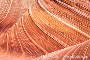
The Wave, an area of fantastic eroded sandstone featuring beautiful swirls, wild colors, countless striations, and bizarre shapes set amidst the dramatic surrounding North Coyote Buttes of Arizona and Utah. The sandstone formations of the North Coyote Buttes, including the Wave, date from the Jurassic period. Managed by the Bureau of Land Management, the Wave is located in the Paria Canyon-Vermilion Cliffs Wilderness and is accessible on foot by permit only.
Location: North Coyote Buttes, Paria Canyon-Vermilion Cliffs Wilderness, Arizona
Image ID: 20628
Location: North Coyote Buttes, Paria Canyon-Vermilion Cliffs Wilderness, Arizona
Image ID: 20628
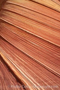
The Wave, an area of fantastic eroded sandstone featuring beautiful swirls, wild colors, countless striations, and bizarre shapes set amidst the dramatic surrounding North Coyote Buttes of Arizona and Utah. The sandstone formations of the North Coyote Buttes, including the Wave, date from the Jurassic period. Managed by the Bureau of Land Management, the Wave is located in the Paria Canyon-Vermilion Cliffs Wilderness and is accessible on foot by permit only.
Location: North Coyote Buttes, Paria Canyon-Vermilion Cliffs Wilderness, Arizona
Image ID: 20629
Location: North Coyote Buttes, Paria Canyon-Vermilion Cliffs Wilderness, Arizona
Image ID: 20629
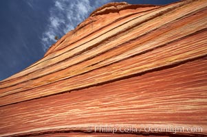
The Wave, an area of fantastic eroded sandstone featuring beautiful swirls, wild colors, countless striations, and bizarre shapes set amidst the dramatic surrounding North Coyote Buttes of Arizona and Utah. The sandstone formations of the North Coyote Buttes, including the Wave, date from the Jurassic period. Managed by the Bureau of Land Management, the Wave is located in the Paria Canyon-Vermilion Cliffs Wilderness and is accessible on foot by permit only.
Location: North Coyote Buttes, Paria Canyon-Vermilion Cliffs Wilderness, Arizona
Image ID: 20630
Location: North Coyote Buttes, Paria Canyon-Vermilion Cliffs Wilderness, Arizona
Image ID: 20630