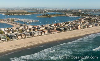
Mission Bay, Ocean Beach, Point Loma, OB Pier, Mission Bay Channel and Coronado islands, at night.
Location: San Diego, California
Image ID: 37497
Panorama dimensions: 1070 x 3500
Location: San Diego, California
Image ID: 37497
Panorama dimensions: 1070 x 3500
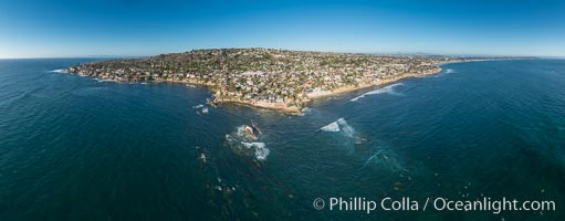
Aerial Panoramic Photo of Bird Rock and La Jolla Coast, with surfers in the waves. Pacific Beach and Mission Beach are to the far right (south). La Jolla's Mount Soledad rises in the center. The submarine reefs around Bird Rock are visible through the clear water. This extremely high resolution panorama will print 80 inches high by 200 inches wide.
Location: La Jolla, California
Image ID: 30778
Panorama dimensions: 7948 x 20303
Location: La Jolla, California
Image ID: 30778
Panorama dimensions: 7948 x 20303

Mission Bay, Ocean Beach, Point Loma, OB Pier, Mission Bay Channel and Coronado islands, at dawn, viewed from Mount Soledad, La Jolla.
Location: San Diego, California
Image ID: 37667
Panorama dimensions: 7490 x 28890
Location: San Diego, California
Image ID: 37667
Panorama dimensions: 7490 x 28890
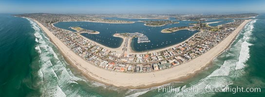
Aerial Panorama of Pacific Beach, Mission Beach and Mission Bay.
Location: San Diego, California
Image ID: 30848
Panorama dimensions: 7007 x 19076
Location: San Diego, California
Image ID: 30848
Panorama dimensions: 7007 x 19076

Aerial Panorama of Pacific Beach, Mission Beach and Mission Bay.
Location: San Diego, California
Image ID: 30852
Panorama dimensions: 6880 x 21724
Location: San Diego, California
Image ID: 30852
Panorama dimensions: 6880 x 21724
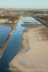
San Diego River, constrained by levees and jetties on both its north and south sides, just before it empties into the Pacific Ocean south of Mission Beach.
Location: San Diego, California
Image ID: 22303
Location: San Diego, California
Image ID: 22303
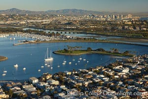
Mission Bay is the largest man-made aquatic park in the country. It spans 4,235 acres and is split nearly evenly between land and water. It is situated between the communities of Pacific Beach, Mission Beach, Bay Park and bordered on the south by the San Diego River channel. Once named "False Bay" by Juan Cabrillo in 1542, the tidelands were dredged in the 1940's creating the basins and islands of what is now Mission Bay.
Location: San Diego, California
Image ID: 22324
Location: San Diego, California
Image ID: 22324
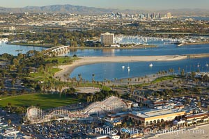
Mission Bay, is the largest man-made aquatic park in the country. It spans 4,235 acres and is split nearly evenly between land and water. It is situated between the communities of Pacific Beach, Mission Beach, Bay Park and bordered on the south by the San Diego River channel. Once named "False Bay" by Juan Cabrillo in 1542, the tidelands were dredged in the 1940's creating the basins and islands of what is now Mission Bay.
Location: San Diego, California
Image ID: 22381
Location: San Diego, California
Image ID: 22381
