A newborn harbor seal pup rests alongside its mother, as placenta is born from the mother just a few moments after the pup was born. Within an hour of being born, this pup had learned to nurse and had entered the ocean for its first swim.
Species: Pacific harbor seal, Phoca vitulina richardsi
Location: La Jolla, California
Image ID: 39110
Species: Pacific harbor seal, Phoca vitulina richardsi
Location: La Jolla, California
Image ID: 39110

A Western seagull picks at placenta on sand beach, as the seal pup born just moments before watches and tries to understand what is going on. Within an hour of being born, this pup had learned to nurse and had entered the ocean for its first swim.
Species: Pacific harbor seal, Phoca vitulina richardsi
Location: La Jolla, California
Image ID: 39111
Species: Pacific harbor seal, Phoca vitulina richardsi
Location: La Jolla, California
Image ID: 39111
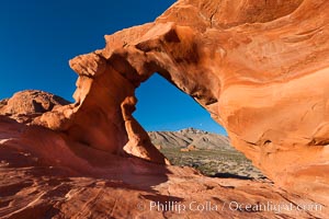
Arch Rock at sunrise, Valley of Fire State Park. Natural arch formed in sandstone. Sunrise with the full moon setting over mountains in the distance.
Location: Valley of Fire State Park, Nevada
Image ID: 26472
Location: Valley of Fire State Park, Nevada
Image ID: 26472
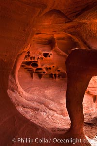
Fire Arch or Windstone Arch, also known as Fire Cave, is a tiny cave with a miniature arch and a group of natural pocket holes. Many people walk by this cave without realizing it is there!.
Location: Valley of Fire State Park, Nevada
Image ID: 26475
Location: Valley of Fire State Park, Nevada
Image ID: 26475
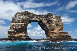
Darwin's Arch, a dramatic 50-foot tall natural lava arch, rises above the ocean a short distance offshore of Darwin Island. On June 10, 2021, Darwin's Arch broke and fell into the ocean, leaving behind two partial pillars.
Location: Darwin Island, Galapagos Islands, Ecuador
Image ID: 16621
Location: Darwin Island, Galapagos Islands, Ecuador
Image ID: 16621
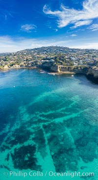
La Jolla Underwater Park visible at Extreme Low Tide, La Jolla, California.
Location: La Jolla, California
Image ID: 37985
Panorama dimensions: 11029 x 6025
Location: La Jolla, California
Image ID: 37985
Panorama dimensions: 11029 x 6025
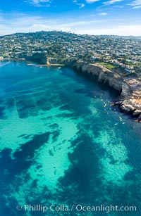
La Jolla Underwater Park visible at Extreme Low Tide, La Jolla, California.
Location: La Jolla, California
Image ID: 38008
Panorama dimensions: 9501 x 6182
Location: La Jolla, California
Image ID: 38008
Panorama dimensions: 9501 x 6182
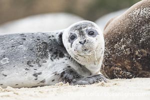
A young Pacific Harbor Seal pup with milk on its face from nursing. Mother harbor seals will only nurse their pups for about four to six weeks, at which point the small seal is weaned and must begin to forage and fend for itself. That short period of time is crucial for the young seal to learn how to hunt, socialize and swim.
Species: Pacific harbor seal, Phoca vitulina richardsi
Location: La Jolla, California
Image ID: 39130
Species: Pacific harbor seal, Phoca vitulina richardsi
Location: La Jolla, California
Image ID: 39130
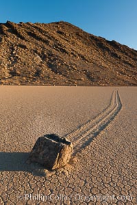
Sailing stone on the Racetrack Playa. The sliding rocks, or sailing stones, move across the mud flats of the Racetrack Playa, leaving trails behind in the mud. The explanation for their movement is not known with certainty, but many believe wind pushes the rocks over wet and perhaps icy mud in winter.
Location: Racetrack Playa, Death Valley National Park, California
Image ID: 27691
Location: Racetrack Playa, Death Valley National Park, California
Image ID: 27691
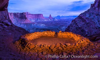
False Kiva at Sunset, Canyonlands National Park, Utah.
Location: False Kiva, Canyonlands National Park, Utah
Image ID: 28017
Location: False Kiva, Canyonlands National Park, Utah
Image ID: 28017
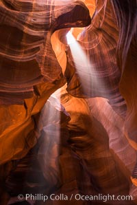
Light Beam in Upper Antelope Slot Canyon. Thin shafts of light briefly penetrate the convoluted narrows of Upper Antelope Slot Canyon, sending piercing beams through the sandstone maze to the sand floor below.
Location: Navajo Tribal Lands, Page, Arizona
Image ID: 28563
Location: Navajo Tribal Lands, Page, Arizona
Image ID: 28563
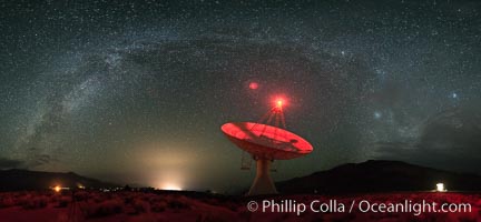
The OVRO 40 meter Telescope, part of the Owens Valley Radio Observatory located near Big Pine, California, USA. The telescope is used to conduct interferometric observations along with the other telescopes in the observatory, as a Very Long Baseline Interferometry (VLBI) station and as a single dish instrument. Its main focus today is on the monitoring of blazars.
Location: Big Pine, California
Image ID: 28788
Panorama dimensions: 5954 x 12875
Location: Big Pine, California
Image ID: 28788
Panorama dimensions: 5954 x 12875
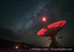
The OVRO 40 meter Telescope, part of the Owens Valley Radio Observatory located near Big Pine, California, USA. The telescope is used to conduct interferometric observations along with the other telescopes in the observatory, as a Very Long Baseline Interferometry (VLBI) station and as a single dish instrument. Its main focus today is on the monitoring of blazars.
Location: Big Pine, California
Image ID: 28793
Location: Big Pine, California
Image ID: 28793
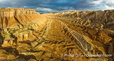
Aerial View of the San Rafael Reef, Utah. This is a canyon-like section of the San Rafael Reef, photographed at sunrise. The "reef proper" is on the right, with its characteristic triangular flatiron erosion. The canyon in the center is a fold in the Earth's crust affiliated with the boundary of the San Rafael Swell. The colors seen here arise primarily from Navajo and Wingate sandstone.
Location: Utah
Image ID: 39497
Panorama dimensions: 4490 x 8439
Location: Utah
Image ID: 39497
Panorama dimensions: 4490 x 8439
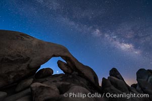
Arch Rock, Venus and Milky Way at Astronomical Twilight, Morning approaching, Joshua Tree National Park.
Location: Joshua Tree National Park, California
Image ID: 29231
Location: Joshua Tree National Park, California
Image ID: 29231
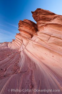
The Great Wall, Navajo Tribal Lands, Arizona. Sandstone "fins", eroded striations that depict how sandstone -- ancient compressed sand -- was laid down in layers over time. Now exposed, the layer erode at different rates, forming delicate "fins" that stretch for long distances.
Location: Navajo Tribal Lands, Page, Arizona
Image ID: 26643
Location: Navajo Tribal Lands, Page, Arizona
Image ID: 26643
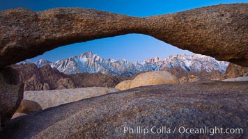
Mount Whitney and Lone Pine Peak are framed by Lathe Arch in the Alabama Hills at sunrise, California.
Location: Alabama Hills Recreational Area, California
Image ID: 27624
Location: Alabama Hills Recreational Area, California
Image ID: 27624
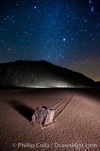
Racetrack sailing stone and Milky Way, at night. A sliding rock of the Racetrack Playa. The sliding rocks, or sailing stones, move across the mud flats of the Racetrack Playa, leaving trails behind in the mud. The explanation for their movement is not known with certainty, but many believe wind pushes the rocks over wet and perhaps icy mud in winter.
Location: Racetrack Playa, Death Valley National Park, California
Image ID: 27640
Location: Racetrack Playa, Death Valley National Park, California
Image ID: 27640
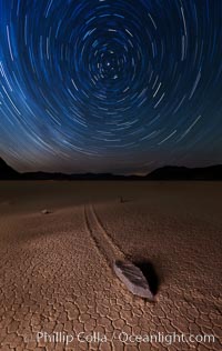
Racetrack sailing stone and star trails. A sliding rock of the Racetrack Playa. The sliding rocks, or sailing stones, move across the mud flats of the Racetrack Playa, leaving trails behind in the mud. The explanation for their movement is not known with certainty, but many believe wind pushes the rocks over wet and perhaps icy mud in winter.
Location: Racetrack Playa, Death Valley National Park, California
Image ID: 27667
Location: Racetrack Playa, Death Valley National Park, California
Image ID: 27667
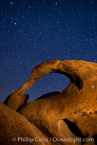
Mobius Arch and stars at night, Alabama Hills, California.
Location: Alabama Hills Recreational Area, California
Image ID: 27672
Location: Alabama Hills Recreational Area, California
Image ID: 27672
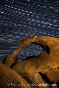
Mobius Arch in the Alabama Hills, seen here at night with swirling star trails formed in the sky above due to a long time exposure.
Location: Alabama Hills Recreational Area, California
Image ID: 27673
Location: Alabama Hills Recreational Area, California
Image ID: 27673
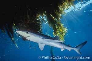
Blue shark and offshore drift kelp paddy, open ocean.
Species: Blue shark, Macrocystis pyrifera, Prionace glauca
Location: San Diego, California
Image ID: 01153
Species: Blue shark, Macrocystis pyrifera, Prionace glauca
Location: San Diego, California
Image ID: 01153
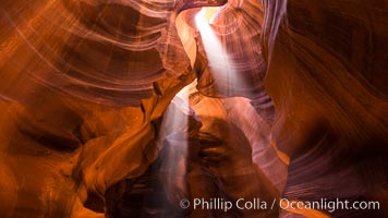
Light Beam in Upper Antelope Slot Canyon. Thin shafts of light briefly penetrate the convoluted narrows of Upper Antelope Slot Canyon, sending piercing beams through the sandstone maze to the sand floor below.
Location: Navajo Tribal Lands, Page, Arizona
Image ID: 28564
Location: Navajo Tribal Lands, Page, Arizona
Image ID: 28564
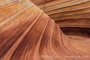
The Wave in the North Coyote Buttes, an area of fantastic eroded sandstone featuring beautiful swirls, wild colors, countless striations, and bizarre shapes set amidst the dramatic surrounding North Coyote Buttes of Arizona and Utah. The sandstone formations of the North Coyote Buttes, including the Wave, date from the Jurassic period. Managed by the Bureau of Land Management, the Wave is located in the Paria Canyon-Vermilion Cliffs Wilderness and is accessible on foot by permit only.
Location: North Coyote Buttes, Paria Canyon-Vermilion Cliffs Wilderness, Arizona
Image ID: 28602
Location: North Coyote Buttes, Paria Canyon-Vermilion Cliffs Wilderness, Arizona
Image ID: 28602
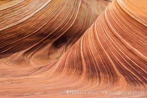
The Wave in the North Coyote Buttes, an area of fantastic eroded sandstone featuring beautiful swirls, wild colors, countless striations, and bizarre shapes set amidst the dramatic surrounding North Coyote Buttes of Arizona and Utah. The sandstone formations of the North Coyote Buttes, including the Wave, date from the Jurassic period. Managed by the Bureau of Land Management, the Wave is located in the Paria Canyon-Vermilion Cliffs Wilderness and is accessible on foot by permit only.
Location: North Coyote Buttes, Paria Canyon-Vermilion Cliffs Wilderness, Arizona
Image ID: 28603
Location: North Coyote Buttes, Paria Canyon-Vermilion Cliffs Wilderness, Arizona
Image ID: 28603
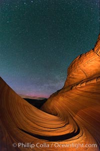
The Wave at Night, under a clear night sky full of stars. The Wave, an area of fantastic eroded sandstone featuring beautiful swirls, wild colors, countless striations, and bizarre shapes set amidst the dramatic surrounding North Coyote Buttes of Arizona and Utah. The sandstone formations of the North Coyote Buttes, including the Wave, date from the Jurassic period. Managed by the Bureau of Land Management, the Wave is located in the Paria Canyon-Vermilion Cliffs Wilderness and is accessible on foot by permit only.
Location: North Coyote Buttes, Paria Canyon-Vermilion Cliffs Wilderness, Arizona
Image ID: 28623
Location: North Coyote Buttes, Paria Canyon-Vermilion Cliffs Wilderness, Arizona
Image ID: 28623
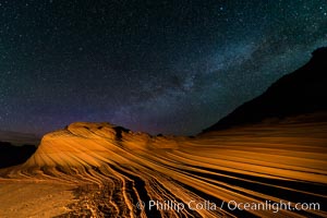
The Second Wave at Night. The Second Wave, a spectacular sandstone formation in the North Coyote Buttes, lies under a sky full of stars.
Location: North Coyote Buttes, Paria Canyon-Vermilion Cliffs Wilderness, Arizona
Image ID: 28628
Location: North Coyote Buttes, Paria Canyon-Vermilion Cliffs Wilderness, Arizona
Image ID: 28628
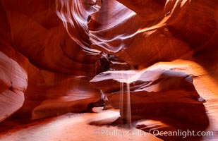
Upper Antelope Canyon, a deep, narrow and spectacular slot canyon lying on Navajo Tribal lands near Page, Arizona.
Location: Navajo Tribal Lands, Page, Arizona
Image ID: 35934
Location: Navajo Tribal Lands, Page, Arizona
Image ID: 35934
