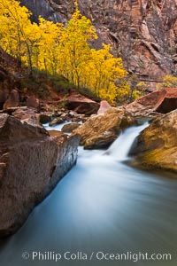
The Virgin River flows by autumn cottonwood trees, part of the Virgin River Narrows. This is a fantastic hike in fall with the comfortable temperatures, beautiful fall colors and light crowds.
Location: Virgin River Narrows, Zion National Park, Utah
Image ID: 26096
Location: Virgin River Narrows, Zion National Park, Utah
Image ID: 26096
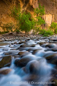
The Virgin River Narrows, where the Virgin River has carved deep, narrow canyons through the Zion National Park sandstone, creating one of the finest hikes in the world.
Location: Virgin River Narrows, Zion National Park, Utah
Image ID: 28575
Location: Virgin River Narrows, Zion National Park, Utah
Image ID: 28575
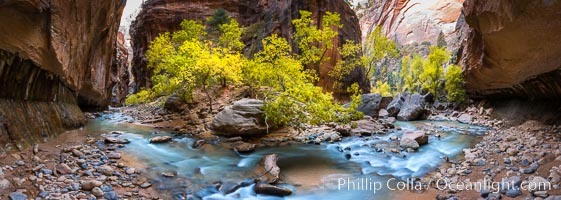
Fall Colors in the Virgin River Narrows, Zion National Park, Utah.
Location: Virgin River Narrows, Zion National Park, Utah
Image ID: 32634
Panorama dimensions: 5145 x 14424
Location: Virgin River Narrows, Zion National Park, Utah
Image ID: 32634
Panorama dimensions: 5145 x 14424
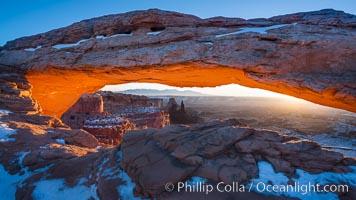
Mesa Arch spans 90 feet and stands at the edge of a mesa precipice thousands of feet above the Colorado River gorge. For a few moments at sunrise the underside of the arch glows dramatically red and orange.
Location: Island in the Sky, Canyonlands National Park, Utah
Image ID: 18040
Location: Island in the Sky, Canyonlands National Park, Utah
Image ID: 18040
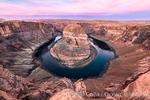
Spectacular Horseshoe Bend sunrise. The Colorado River makes a 180-degree turn at Horseshoe Bend. Here the river has eroded the Navajo sandstone for eons, digging a canyon 1100-feet deep.
Location: Horseshoe Bend, Page, Arizona
Image ID: 35939
Location: Horseshoe Bend, Page, Arizona
Image ID: 35939
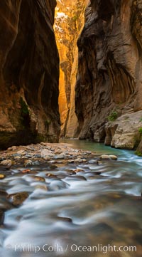
The Virgin River Narrows, where the Virgin River has carved deep, narrow canyons through the Zion National Park sandstone, creating one of the finest hikes in the world.
Location: Virgin River Narrows, Zion National Park, Utah
Image ID: 28583
Location: Virgin River Narrows, Zion National Park, Utah
Image ID: 28583
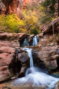
Fall Colors in Kanarra Creek Canyon, Utah.
Location: Kanarra Creek, Kanarraville, Utah
Image ID: 32639
Location: Kanarra Creek, Kanarraville, Utah
Image ID: 32639
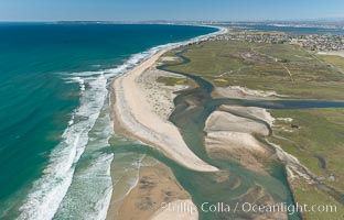
Aerial Photo of Tijuana River Mouth SMCA. Tijuana River Mouth State Marine Conservation Area borders Imperial Beach and the Mexican Border.
Location: Imperial Beach, California
Image ID: 30660
Location: Imperial Beach, California
Image ID: 30660
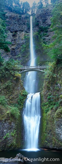
Multnomah Falls. Plummeting 620 feet from its origins on Larch Mountain, Multnomah Falls is the second highest year-round waterfall in the United States. Nearly two million visitors a year come to see this ancient waterfall making it Oregon's number one public destination.
Location: Multnomah Falls, Columbia River Gorge National Scenic Area, Oregon
Image ID: 19313
Panorama dimensions: 12453 x 4705
Location: Multnomah Falls, Columbia River Gorge National Scenic Area, Oregon
Image ID: 19313
Panorama dimensions: 12453 x 4705
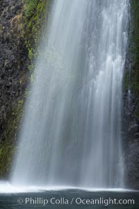
Horsetail Falls drops 176 feet just a few yards off the Columbia Gorge Scenic Highway.
Location: Horsetail Falls, Columbia River Gorge National Scenic Area, Oregon
Image ID: 19318
Location: Horsetail Falls, Columbia River Gorge National Scenic Area, Oregon
Image ID: 19318
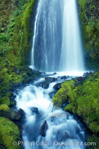
Wahkeena Falls drops 249 feet in several sections through a lush green temperate rainforest.
Location: Wahkeena Falls, Columbia River Gorge National Scenic Area, Oregon
Image ID: 19324
Location: Wahkeena Falls, Columbia River Gorge National Scenic Area, Oregon
Image ID: 19324
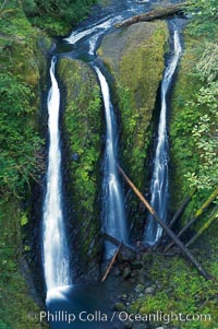
Triple Falls, in the upper part of Oneonta Gorge, fall 130 feet through a lush, beautiful temperate rainforest.
Location: Triple Falls, Columbia River Gorge National Scenic Area, Oregon
Image ID: 19326
Location: Triple Falls, Columbia River Gorge National Scenic Area, Oregon
Image ID: 19326
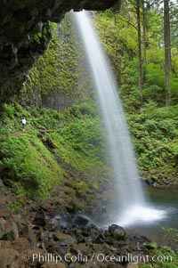
Ponytail Falls, where Horsetail Creeks drops 100 feet over an overhang below which hikers can walk.
Location: Ponytail Falls, Columbia River Gorge National Scenic Area, Oregon
Image ID: 19337
Location: Ponytail Falls, Columbia River Gorge National Scenic Area, Oregon
Image ID: 19337
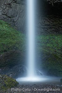
Latourelle Falls, in Guy W. Talbot State Park, drops 249 feet through a lush forest near the Columbia River.
Location: Latourelle Falls, Columbia River Gorge National Scenic Area, Oregon
Image ID: 19347
Location: Latourelle Falls, Columbia River Gorge National Scenic Area, Oregon
Image ID: 19347
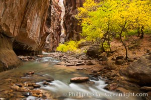
The Virgin River flows by autumn cottonwood trees, part of the Virgin River Narrows. This is a fantastic hike in fall with the comfortable temperatures, beautiful fall colors and light crowds.
Location: Virgin River Narrows, Zion National Park, Utah
Image ID: 26098
Location: Virgin River Narrows, Zion National Park, Utah
Image ID: 26098
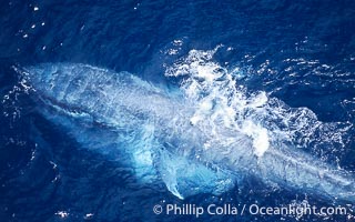
A blue whale eating krill. This blue whale is seen feeding and surfacing amid krill with its throat fully engorged with krill and water. It will push the water back out with its tongue, trapping the krill in its baleen which acts like a filter. Aerial photo, Baja California.
Species: Blue whale, Balaenoptera musculus
Image ID: 05837
Species: Blue whale, Balaenoptera musculus
Image ID: 05837
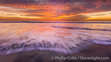
Sunset and incoming surf, gorgeous colors in the sky and on the ocean at dusk, the incoming waves are blurred in this long exposure.
Location: Carlsbad, California
Image ID: 27156
Location: Carlsbad, California
Image ID: 27156
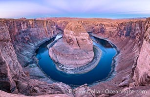
Belt of Venus over Horseshoe Bend on the Colorado River. The Colorado River makes a 180-degree turn at Horseshoe Bend. Here the river has eroded the Navajo sandstone for eons, digging a canyon 1100-feet deep. The Belt of Venus, or anti-twilight arch, is the shadow of the earth cast upon the atmosphere just above the horizon, and occurs a few minutes before sunrise or after sunset.
Location: Page, Arizona
Image ID: 37781
Panorama dimensions: 5719 x 8788
Location: Page, Arizona
Image ID: 37781
Panorama dimensions: 5719 x 8788
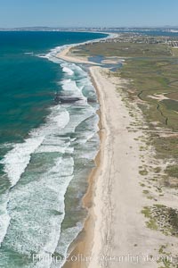
Aerial Photo of Tijuana River Mouth SMCA. Tijuana River Mouth State Marine Conservation Area borders Imperial Beach and the Mexican Border.
Location: Imperial Beach, California
Image ID: 30649
Location: Imperial Beach, California
Image ID: 30649
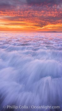
Sunset and incoming surf, gorgeous colors in the sky and on the ocean at dusk, the incoming waves are blurred in this long exposure.
Location: Carlsbad, California
Image ID: 27159
Location: Carlsbad, California
Image ID: 27159
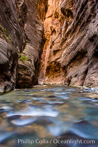
The Virgin River Narrows, where the Virgin River has carved deep, narrow canyons through the Zion National Park sandstone, creating one of the finest hikes in the world.
Location: Virgin River Narrows, Zion National Park, Utah
Image ID: 28578
Location: Virgin River Narrows, Zion National Park, Utah
Image ID: 28578
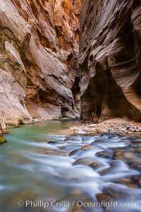
The Virgin River Narrows, where the Virgin River has carved deep, narrow canyons through the Zion National Park sandstone, creating one of the finest hikes in the world.
Location: Virgin River Narrows, Zion National Park, Utah
Image ID: 28579
Location: Virgin River Narrows, Zion National Park, Utah
Image ID: 28579
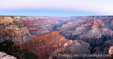
Belt of Venus over Grand Canyon at sunrise, viewed from Hopi Point on the south rim of Grand Canyon National Park. The Belt of Venus, or anti-twilight arch, is the shadow of the earth cast upon the atmosphere just above the horizon, and occurs a few minutes before sunrise or after sunset.
Location: Grand Canyon National Park, Arizona
Image ID: 37765
Panorama dimensions: 5409 x 10272
Location: Grand Canyon National Park, Arizona
Image ID: 37765
Panorama dimensions: 5409 x 10272
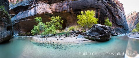
Fall Colors in the Virgin River Narrows, Zion National Park, Utah.
Location: Virgin River Narrows, Zion National Park, Utah
Image ID: 32635
Panorama dimensions: 4795 x 11405
Location: Virgin River Narrows, Zion National Park, Utah
Image ID: 32635
Panorama dimensions: 4795 x 11405
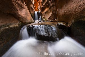
Kanarra Creek Falls in Kanarra Canyon, Utah.
Location: Kanarra Creek, Kanarraville, Utah
Image ID: 32644
Location: Kanarra Creek, Kanarraville, Utah
Image ID: 32644
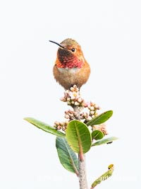
Rufous Hummingbird Brilliant Gorget Display While Perched, Coast Walk, La Jolla.
Species: Rufous Hummingbird, Selasphorus rufus
Location: La Jolla, California
Image ID: 40260
Species: Rufous Hummingbird, Selasphorus rufus
Location: La Jolla, California
Image ID: 40260
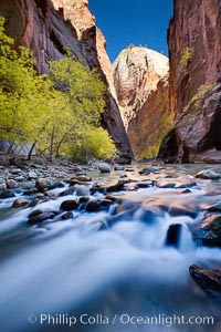
Yellow cottonwood trees in autumn, fall colors in the Virgin River Narrows in Zion National Park.
Location: Virgin River Narrows, Zion National Park, Utah
Image ID: 26090
Location: Virgin River Narrows, Zion National Park, Utah
Image ID: 26090
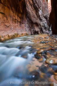
The Virgin River flows through the Zion Narrows, with tall sandstone walls towering hundreds of feet above.
Location: Virgin River Narrows, Zion National Park, Utah
Image ID: 26103
Location: Virgin River Narrows, Zion National Park, Utah
Image ID: 26103
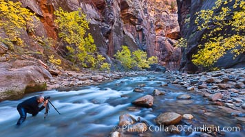
Photographer in the Virgin River Narrows, with flowing water, autumn cottonwood trees and towering red sandstone cliffs.
Location: Virgin River Narrows, Zion National Park, Utah
Image ID: 26106
Location: Virgin River Narrows, Zion National Park, Utah
Image ID: 26106
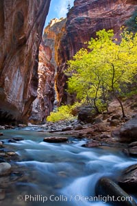
Yellow cottonwood trees in autumn, fall colors in the Virgin River Narrows in Zion National Park.
Location: Virgin River Narrows, Zion National Park, Utah
Image ID: 26091
Location: Virgin River Narrows, Zion National Park, Utah
Image ID: 26091