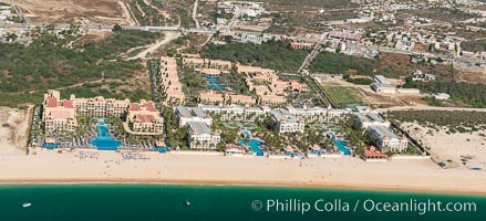
Hotel Riu along Medano Beach. Residential and resort development along the coast near Cabo San Lucas, Mexico.
Location: Cabo San Lucas, Baja California, Mexico
Image ID: 28900
Panorama dimensions: 4620 x 10133
Location: Cabo San Lucas, Baja California, Mexico
Image ID: 28900
Panorama dimensions: 4620 x 10133
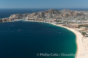
Aerial photograph of Medano Beach and Cabo San Lucas, Mexico.
Location: Cabo San Lucas, Baja California, Mexico
Image ID: 28936
Location: Cabo San Lucas, Baja California, Mexico
Image ID: 28936
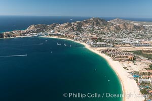
Aerial photograph of Medano Beach and Cabo San Lucas, Mexico.
Location: Cabo San Lucas, Baja California, Mexico
Image ID: 28937
Location: Cabo San Lucas, Baja California, Mexico
Image ID: 28937
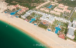
Hotel Riu along Medano Beach. Residential and resort development along the coast near Cabo San Lucas, Mexico.
Location: Cabo San Lucas, Baja California, Mexico
Image ID: 28938
Location: Cabo San Lucas, Baja California, Mexico
Image ID: 28938
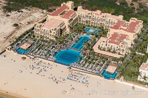
Hotel Riu along Medano Beach. Residential and resort development along the coast near Cabo San Lucas, Mexico.
Location: Cabo San Lucas, Baja California, Mexico
Image ID: 28939
Location: Cabo San Lucas, Baja California, Mexico
Image ID: 28939
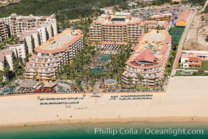
Villa del Palmar along Medano Beach. Residential and resort development along the coast near Cabo San Lucas, Mexico.
Location: Cabo San Lucas, Baja California, Mexico
Image ID: 28940
Location: Cabo San Lucas, Baja California, Mexico
Image ID: 28940
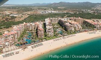
Villa del Arco (left), Villa la Estancia (center), Villa del Palmar (right). Residential and resort development along the coast near Cabo San Lucas, Mexico.
Location: Cabo San Lucas, Baja California, Mexico
Image ID: 28941
Location: Cabo San Lucas, Baja California, Mexico
Image ID: 28941
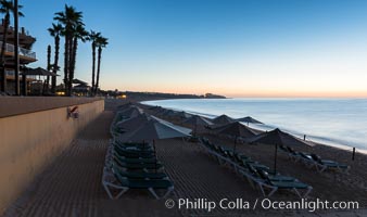
Beach chairs and umbrellas line the sand in front of resorts on Medano Beach, Cabo San Lucas, Mexico.
Location: Cabo San Lucas, Baja California, Mexico
Image ID: 28945
Location: Cabo San Lucas, Baja California, Mexico
Image ID: 28945
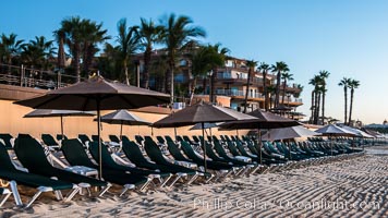
Beach chairs and umbrellas line the sand in front of resorts on Medano Beach, Cabo San Lucas, Mexico.
Location: Cabo San Lucas, Baja California, Mexico
Image ID: 28947
Location: Cabo San Lucas, Baja California, Mexico
Image ID: 28947
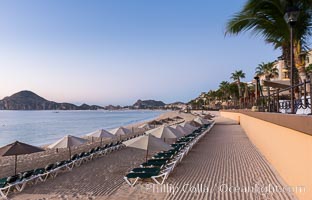
Beach chairs and umbrellas line the sand in front of resorts on Medano Beach, Cabo San Lucas, Mexico.
Location: Cabo San Lucas, Baja California, Mexico
Image ID: 28949
Location: Cabo San Lucas, Baja California, Mexico
Image ID: 28949
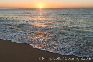
Sunrise on Medano Beach, on the coast of Cabo San Lucas, Mexico.
Location: Cabo San Lucas, Baja California, Mexico
Image ID: 28950
Location: Cabo San Lucas, Baja California, Mexico
Image ID: 28950
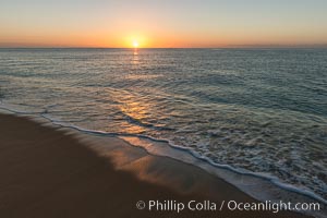
Sunrise on Medano Beach, on the coast of Cabo San Lucas, Mexico.
Location: Cabo San Lucas, Baja California, Mexico
Image ID: 28952
Location: Cabo San Lucas, Baja California, Mexico
Image ID: 28952

Sunrise on Medano Beach, on the coast of Cabo San Lucas, Mexico.
Location: Cabo San Lucas, Baja California, Mexico
Image ID: 28956
Panorama dimensions: 4060 x 19724
Location: Cabo San Lucas, Baja California, Mexico
Image ID: 28956
Panorama dimensions: 4060 x 19724

Sunrise on Medano Beach, on the coast of Cabo San Lucas, Mexico.
Location: Cabo San Lucas, Baja California, Mexico
Image ID: 28957
Panorama dimensions: 4440 x 22297
Location: Cabo San Lucas, Baja California, Mexico
Image ID: 28957
Panorama dimensions: 4440 x 22297
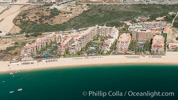
Villa del Arco (left), Villa la Estancia (center), Villa del Palmar (right). Residential and resort development along the coast near Cabo San Lucas, Mexico.
Location: Cabo San Lucas, Baja California, Mexico
Image ID: 28958
Location: Cabo San Lucas, Baja California, Mexico
Image ID: 28958
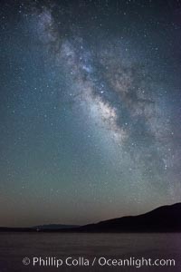
Milky Way over Clark Dry Lake playa, Anza Borrego Desert State Park.
Image ID: 31037
Image ID: 31037
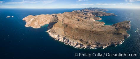
Isla Partida Aerial Photo, Playa Embudo and Los Islotes (left), Ensenada Grande (right), Sea of Cortez.
Location: Isla Partida, Baja California, Mexico
Image ID: 32450
Panorama dimensions: 3284 x 7768
Location: Isla Partida, Baja California, Mexico
Image ID: 32450
Panorama dimensions: 3284 x 7768
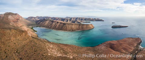
Isla Gallo and Playa Gallina, Isla Espiritu Santo, Sea of Cortez, Aerial Photo.
Location: Isla Espiritu Santo, Baja California, Mexico
Image ID: 32468
Location: Isla Espiritu Santo, Baja California, Mexico
Image ID: 32468
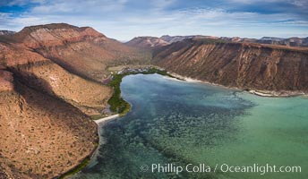
Playa Gallina and arroyo on Isla Espiritu Santo, Sea of Cortez, Aerial Photo.
Location: Isla Espiritu Santo, Baja California, Mexico
Image ID: 32469
Location: Isla Espiritu Santo, Baja California, Mexico
Image ID: 32469
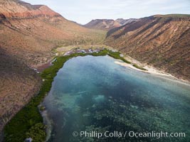
Playa Gallina and arroyo on Isla Espiritu Santo, Sea of Cortez, Aerial Photo.
Location: Isla Espiritu Santo, Baja California, Mexico
Image ID: 32470
Location: Isla Espiritu Santo, Baja California, Mexico
Image ID: 32470
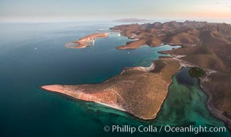
Bay of La Paz coast near Playa el Tesoro, Aerial Photo at Sunrise.
Location: La Paz, Baja California, Mexico
Image ID: 32475
Location: La Paz, Baja California, Mexico
Image ID: 32475
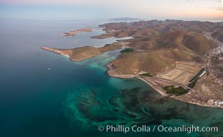
Bay of La Paz coast near Playa el Tesoro, Aerial Photo at Sunrise.
Location: La Paz, Baja California, Mexico
Image ID: 32476
Location: La Paz, Baja California, Mexico
Image ID: 32476
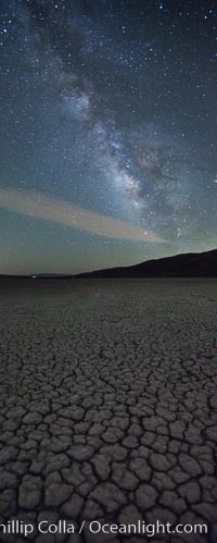
Milky Way over Clark Dry Lake playa, Anza Borrego Desert State Park.
Image ID: 31035
Image ID: 31035
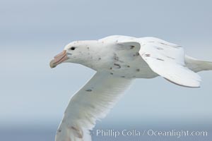
White nellie, the white morph of the southern giant petrel. Southern giant petrel in flight.
Species: Southern giant petrel, Macronectes giganteus
Location: Falkland Islands, United Kingdom
Image ID: 23678
Species: Southern giant petrel, Macronectes giganteus
Location: Falkland Islands, United Kingdom
Image ID: 23678
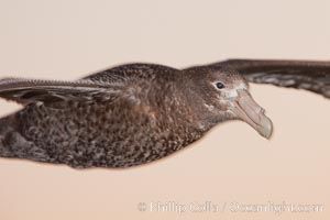
Southern giant petrel in flight. The distinctive tube nose (naricorn), characteristic of species in the Procellariidae family (tube-snouts), is easily seen.
Species: Southern giant petrel, Macronectes giganteus
Location: Falkland Islands, United Kingdom
Image ID: 23681
Species: Southern giant petrel, Macronectes giganteus
Location: Falkland Islands, United Kingdom
Image ID: 23681
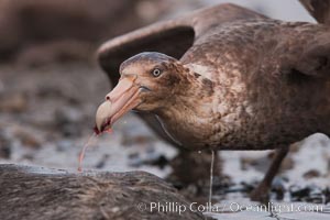
Northern giant petrel scavenging a fur seal carcass. Giant petrels will often feed on carrion, defending it in a territorial manner from other petrels and carrion feeders.
Species: Northern giant petrel, Macronectes halli
Location: Right Whale Bay, South Georgia Island
Image ID: 23683
Species: Northern giant petrel, Macronectes halli
Location: Right Whale Bay, South Georgia Island
Image ID: 23683
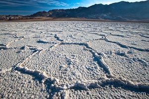
Devils Golf Course, California. Evaporated salt has formed into gnarled, complex crystalline shapes in on the salt pan of Death Valley National Park, one of the largest salt pans in the world. The shapes are constantly evolving as occasional floods submerge the salt concretions before receding and depositing more salt.
Location: Devils Golf Course, Death Valley National Park, California
Image ID: 15582
Location: Devils Golf Course, Death Valley National Park, California
Image ID: 15582
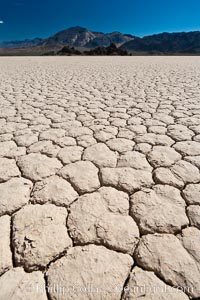
Racetrack Playa, an ancient lake now dried and covered with dessicated mud.
Location: Racetrack Playa, Death Valley National Park, California
Image ID: 26385
Location: Racetrack Playa, Death Valley National Park, California
Image ID: 26385
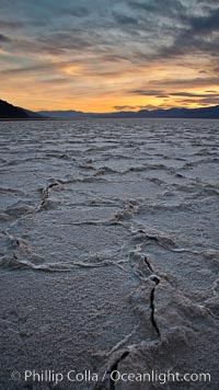
Salt polygons. After winter flooding, the salt on the Badwater Basin playa dries into geometric polygonal shapes.
Location: Badwater, Death Valley National Park, California
Image ID: 27635
Location: Badwater, Death Valley National Park, California
Image ID: 27635
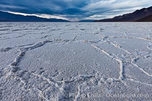
Salt polygons. After winter flooding, the salt on the Badwater Basin playa dries into geometric polygonal shapes.
Location: Badwater, Death Valley National Park, California
Image ID: 27632
Location: Badwater, Death Valley National Park, California
Image ID: 27632