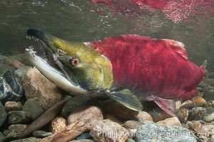
A male sockeye salmon, showing injuries sustained as it migrated hundreds of miles from the ocean up the Fraser River, swims upstream in the Adams River to reach the place where it will fertilize eggs laid by a female in the rocks. It will die so after spawning.
Species: Sockeye salmon, Oncorhynchus nerka
Location: Adams River, Roderick Haig-Brown Provincial Park, British Columbia, Canada
Image ID: 26174
Species: Sockeye salmon, Oncorhynchus nerka
Location: Adams River, Roderick Haig-Brown Provincial Park, British Columbia, Canada
Image ID: 26174
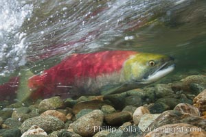
Adams River sockeye salmon. A female sockeye salmon swims upstream in the Adams River to spawn, having traveled hundreds of miles upstream from the ocean.
Species: Sockeye salmon, Oncorhynchus nerka
Location: Adams River, Roderick Haig-Brown Provincial Park, British Columbia, Canada
Image ID: 26175
Species: Sockeye salmon, Oncorhynchus nerka
Location: Adams River, Roderick Haig-Brown Provincial Park, British Columbia, Canada
Image ID: 26175
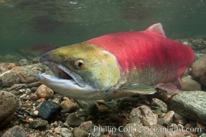
Adams River sockeye salmon. A female sockeye salmon swims upstream in the Adams River to spawn, having traveled hundreds of miles upstream from the ocean.
Species: Sockeye salmon, Oncorhynchus nerka
Location: Adams River, Roderick Haig-Brown Provincial Park, British Columbia, Canada
Image ID: 26178
Species: Sockeye salmon, Oncorhynchus nerka
Location: Adams River, Roderick Haig-Brown Provincial Park, British Columbia, Canada
Image ID: 26178
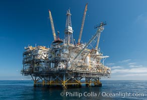
Oil Rig Eureka, 8.5 miles off Long Beach, California, lies in 720' of water.
Location: Long Beach, California
Image ID: 31094
Location: Long Beach, California
Image ID: 31094
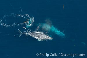
Gray whales traveling south to Mexico during their winter migration. The annual migration of the California gray whale is the longest known migration of any mammal, 10,000 to 12,000 miles from the Bering Sea to Baja California.
Species: Gray whale, Eschrichtius robustus
Location: Coronado Islands (Islas Coronado), Baja California, Mexico
Image ID: 29046
Species: Gray whale, Eschrichtius robustus
Location: Coronado Islands (Islas Coronado), Baja California, Mexico
Image ID: 29046
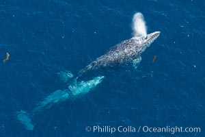
Gray whales traveling south to Mexico during their winter migration. The annual migration of the California gray whale is the longest known migration of any mammal, 10,000 to 12,000 miles from the Bering Sea to Baja California.
Species: Gray whale, Eschrichtius robustus
Location: Coronado Islands (Islas Coronado), Baja California, Mexico
Image ID: 29047
Species: Gray whale, Eschrichtius robustus
Location: Coronado Islands (Islas Coronado), Baja California, Mexico
Image ID: 29047
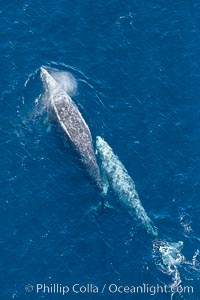
Gray whales traveling south to Mexico during their winter migration. The annual migration of the California gray whale is the longest known migration of any mammal, 10,000 to 12,000 miles from the Bering Sea to Baja California.
Species: Gray whale, Eschrichtius robustus
Location: Coronado Islands (Islas Coronado), Baja California, Mexico
Image ID: 29049
Species: Gray whale, Eschrichtius robustus
Location: Coronado Islands (Islas Coronado), Baja California, Mexico
Image ID: 29049
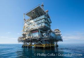
Oil Rig Eureka, 8.5 miles off Long Beach, California, lies in 720' of water.
Location: Long Beach, California
Image ID: 31090
Location: Long Beach, California
Image ID: 31090
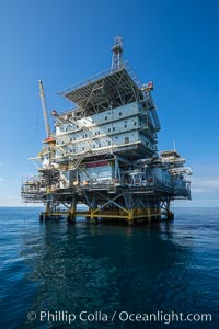
Oil Rig Eureka, 8.5 miles off Long Beach, California, lies in 720' of water.
Location: Long Beach, California
Image ID: 31091
Location: Long Beach, California
Image ID: 31091
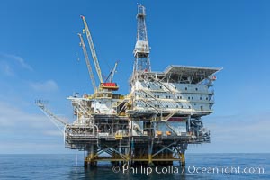
Oil Rig Eureka, 8.5 miles off Long Beach, California, lies in 720' of water.
Location: Long Beach, California
Image ID: 31092
Location: Long Beach, California
Image ID: 31092
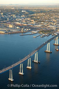
San Diego Coronado Bridge, known locally as the Coronado Bridge, links San Diego with Coronado, California. The bridge was completed in 1969 and was a toll bridge until 2002. It is 2.1 miles long and reaches a height of 200 feet above San Diego Bay. Coronado Island is to the left, and downtown San Diego is to the right in this view looking north.
Location: San Diego, California
Image ID: 22467
Location: San Diego, California
Image ID: 22467
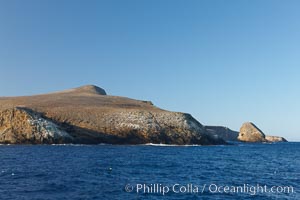
Northwest promontory of Santa Barbara Island, part of the Channel Islands National Marine Sanctuary. Santa Barbara Island lies 38 miles offshore of the coast of California, near Los Angeles and San Pedro.
Location: Santa Barbara Island, California
Image ID: 23561
Location: Santa Barbara Island, California
Image ID: 23561
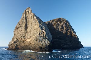
Sutil Island,a small barren island near Santa Barbara Island, part of the Channel Islands National Marine Sanctuary. Santa Barbara Island lies 38 miles offshore of the coast of California, near Los Angeles and San Pedro.
Location: Santa Barbara Island, California
Image ID: 23562
Location: Santa Barbara Island, California
Image ID: 23562
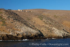
Western landing and National Park buildings on Santa Barbara Island, part of the Channel Islands National Marine Sanctuary. Santa Barbara Island lies 38 miles offshore of the coast of California, near Los Angeles and San Pedro.
Location: Santa Barbara Island, California
Image ID: 23563
Location: Santa Barbara Island, California
Image ID: 23563
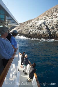
Visitors watch sea lions along the coast of Santa Barbara Island, part of the Channel Islands National Marine Sanctuary. Santa Barbara Island lies 38 miles offshore of the coast of California, near Los Angeles.
Location: Santa Barbara Island, California
Image ID: 23564
Location: Santa Barbara Island, California
Image ID: 23564
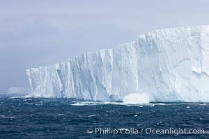
Tabular iceberg. The edge of a huge tabular iceberg. Tabular icebergs can be dozens or hundreds of miles in size, have flat tops and sheer sides.
Location: Scotia Sea, Southern Ocean
Image ID: 24847
Location: Scotia Sea, Southern Ocean
Image ID: 24847
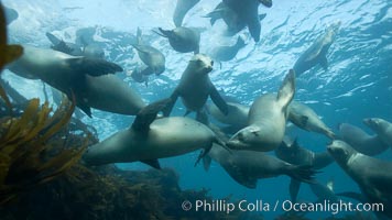
California sea lions, underwater at Santa Barbara Island. Santa Barbara Island, 38 miles off the coast of southern California, is part of the Channel Islands National Marine Sanctuary and Channel Islands National Park. It is home to a large population of sea lions.
Species: California sea lion, Zalophus californianus
Location: Santa Barbara Island, California
Image ID: 23527
Species: California sea lion, Zalophus californianus
Location: Santa Barbara Island, California
Image ID: 23527
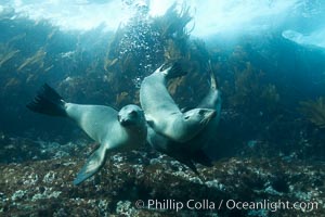
California sea lions, underwater at Santa Barbara Island. Santa Barbara Island, 38 miles off the coast of southern California, is part of the Channel Islands National Marine Sanctuary and Channel Islands National Park. It is home to a large population of sea lions.
Species: California sea lion, Zalophus californianus
Location: Santa Barbara Island, California
Image ID: 23532
Species: California sea lion, Zalophus californianus
Location: Santa Barbara Island, California
Image ID: 23532
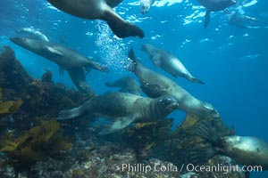
California sea lions, underwater at Santa Barbara Island. Santa Barbara Island, 38 miles off the coast of southern California, is part of the Channel Islands National Marine Sanctuary and Channel Islands National Park. It is home to a large population of sea lions.
Species: California sea lion, Zalophus californianus
Location: Santa Barbara Island, California
Image ID: 23533
Species: California sea lion, Zalophus californianus
Location: Santa Barbara Island, California
Image ID: 23533
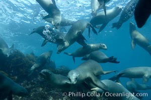
California sea lions, underwater at Santa Barbara Island. Santa Barbara Island, 38 miles off the coast of southern California, is part of the Channel Islands National Marine Sanctuary and Channel Islands National Park. It is home to a large population of sea lions.
Species: California sea lion, Zalophus californianus
Location: Santa Barbara Island, California
Image ID: 23540
Species: California sea lion, Zalophus californianus
Location: Santa Barbara Island, California
Image ID: 23540
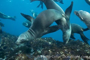
California sea lions, underwater at Santa Barbara Island. Santa Barbara Island, 38 miles off the coast of southern California, is part of the Channel Islands National Marine Sanctuary and Channel Islands National Park. It is home to a large population of sea lions.
Species: California sea lion, Zalophus californianus
Location: Santa Barbara Island, California
Image ID: 23541
Species: California sea lion, Zalophus californianus
Location: Santa Barbara Island, California
Image ID: 23541
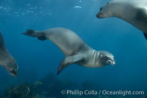
California sea lions, underwater at Santa Barbara Island. Santa Barbara Island, 38 miles off the coast of southern California, is part of the Channel Islands National Marine Sanctuary and Channel Islands National Park. It is home to a large population of sea lions.
Species: California sea lion, Zalophus californianus
Location: Santa Barbara Island, California
Image ID: 23542
Species: California sea lion, Zalophus californianus
Location: Santa Barbara Island, California
Image ID: 23542
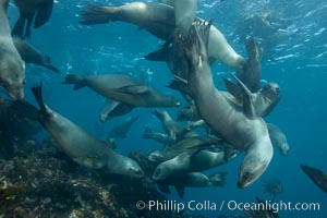
California sea lions, underwater at Santa Barbara Island. Santa Barbara Island, 38 miles off the coast of southern California, is part of the Channel Islands National Marine Sanctuary and Channel Islands National Park. It is home to a large population of sea lions.
Species: California sea lion, Zalophus californianus
Location: Santa Barbara Island, California
Image ID: 23547
Species: California sea lion, Zalophus californianus
Location: Santa Barbara Island, California
Image ID: 23547
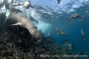
California sea lions, underwater at Santa Barbara Island. Santa Barbara Island, 38 miles off the coast of southern California, is part of the Channel Islands National Marine Sanctuary and Channel Islands National Park. It is home to a large population of sea lions.
Species: California sea lion, Zalophus californianus
Location: Santa Barbara Island, California
Image ID: 23548
Species: California sea lion, Zalophus californianus
Location: Santa Barbara Island, California
Image ID: 23548
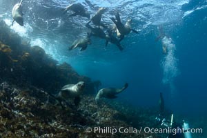
California sea lions, underwater at Santa Barbara Island. Santa Barbara Island, 38 miles off the coast of southern California, is part of the Channel Islands National Marine Sanctuary and Channel Islands National Park. It is home to a large population of sea lions.
Species: California sea lion, Zalophus californianus
Location: Santa Barbara Island, California
Image ID: 23549
Species: California sea lion, Zalophus californianus
Location: Santa Barbara Island, California
Image ID: 23549
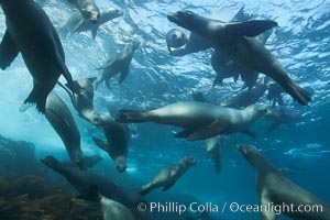
California sea lions, underwater at Santa Barbara Island. Santa Barbara Island, 38 miles off the coast of southern California, is part of the Channel Islands National Marine Sanctuary and Channel Islands National Park. It is home to a large population of sea lions.
Species: California sea lion, Zalophus californianus
Location: Santa Barbara Island, California
Image ID: 23555
Species: California sea lion, Zalophus californianus
Location: Santa Barbara Island, California
Image ID: 23555
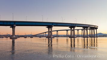
Coronado Bridge, linking San Diego to Coronado, sunrise, viewed from Coronado Island. San Diego Coronado Bridge, known locally as the Coronado Bridge, links San Diego with Coronado, California. The bridge was completed in 1969 and was a toll bridge until 2002. It is 2.1 miles long and reaches a height of 200 feet above San Diego Bay.
Location: San Diego, California
Image ID: 27094
Location: San Diego, California
Image ID: 27094
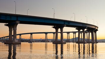
Coronado Bridge, linking San Diego to Coronado, sunrise, viewed from Coronado Island. San Diego Coronado Bridge, known locally as the Coronado Bridge, links San Diego with Coronado, California. The bridge was completed in 1969 and was a toll bridge until 2002. It is 2.1 miles long and reaches a height of 200 feet above San Diego Bay.
Location: San Diego, California
Image ID: 27095
Location: San Diego, California
Image ID: 27095

Coronado Bridge, linking San Diego to Coronado, sunrise, viewed from Coronado Island. San Diego Coronado Bridge, known locally as the Coronado Bridge, links San Diego with Coronado, California. The bridge was completed in 1969 and was a toll bridge until 2002. It is 2.1 miles long and reaches a height of 200 feet above San Diego Bay.
Location: San Diego, California
Image ID: 27096
Location: San Diego, California
Image ID: 27096
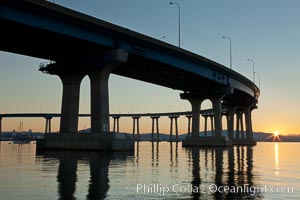
Coronado Bridge, linking San Diego to Coronado, sunrise, viewed from Coronado Island. San Diego Coronado Bridge, known locally as the Coronado Bridge, links San Diego with Coronado, California. The bridge was completed in 1969 and was a toll bridge until 2002. It is 2.1 miles long and reaches a height of 200 feet above San Diego Bay.
Location: San Diego, California
Image ID: 27097
Location: San Diego, California
Image ID: 27097