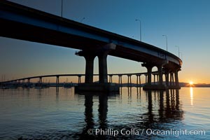
Coronado Bridge, linking San Diego to Coronado, sunrise, viewed from Coronado Island. San Diego Coronado Bridge, known locally as the Coronado Bridge, links San Diego with Coronado, California. The bridge was completed in 1969 and was a toll bridge until 2002. It is 2.1 miles long and reaches a height of 200 feet above San Diego Bay.
Location: San Diego, California
Image ID: 27098
Location: San Diego, California
Image ID: 27098
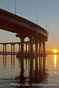
Coronado Bridge, linking San Diego to Coronado, sunrise, viewed from Coronado Island. San Diego Coronado Bridge, known locally as the Coronado Bridge, links San Diego with Coronado, California. The bridge was completed in 1969 and was a toll bridge until 2002. It is 2.1 miles long and reaches a height of 200 feet above San Diego Bay.
Location: San Diego, California
Image ID: 27099
Location: San Diego, California
Image ID: 27099
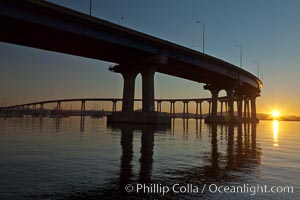
Coronado Bridge, linking San Diego to Coronado, sunrise, viewed from Coronado Island. San Diego Coronado Bridge, known locally as the Coronado Bridge, links San Diego with Coronado, California. The bridge was completed in 1969 and was a toll bridge until 2002. It is 2.1 miles long and reaches a height of 200 feet above San Diego Bay.
Location: San Diego, California
Image ID: 27100
Location: San Diego, California
Image ID: 27100
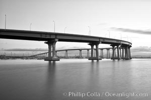
San Diego Coronado Bridge, known locally as the Coronado Bridge, links San Diego with Coronado, California. The bridge was completed in 1969 and was a toll bridge until 2002. It is 2.1 miles long and reaches a height of 200 feet above San Diego Bay.
Location: San Diego, California
Image ID: 27174
Location: San Diego, California
Image ID: 27174
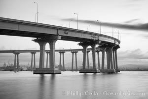
San Diego Coronado Bridge, known locally as the Coronado Bridge, links San Diego with Coronado, California. The bridge was completed in 1969 and was a toll bridge until 2002. It is 2.1 miles long and reaches a height of 200 feet above San Diego Bay.
Location: San Diego, California
Image ID: 27175
Location: San Diego, California
Image ID: 27175
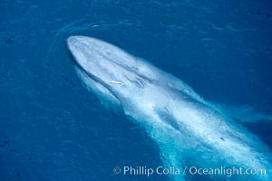
Blue whale. The sleek hydrodynamic shape of the enormous blue whale allows it to swim swiftly through the ocean, at times over one hundred miles in a single day.
Species: Blue whale, Balaenoptera musculus
Location: La Jolla, California
Image ID: 21268
Species: Blue whale, Balaenoptera musculus
Location: La Jolla, California
Image ID: 21268

Panoramic photo of Santa Barbara Island, part of the Channel Islands National Marine Sanctuary. Santa Barbara Island lies 38 miles offshore of the coast of California, near Los Angeles and San Pedro. California sea lions inhabit the island in the thousands, and can be seen hauled out on the shore in this image.
Location: Santa Barbara Island, California
Image ID: 23598
Panorama dimensions: 2759 x 18816
Location: Santa Barbara Island, California
Image ID: 23598
Panorama dimensions: 2759 x 18816
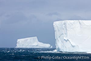
Iceberg (left) and tabular iceberg (right). Tabular icebergs can be dozens or hundreds of miles in size, have flat tops and sheer sides.
Location: Scotia Sea, Southern Ocean
Image ID: 24937
Location: Scotia Sea, Southern Ocean
Image ID: 24937
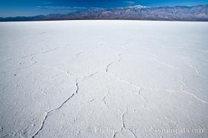
Badwater, California. Badwater, at 282 feet below sea level, is the lowest point in North America. 9000 square miles of watershed drain into the Badwater basin, to dry and form huge white salt flats.
Location: Badwater, Death Valley National Park, California
Image ID: 15579
Location: Badwater, Death Valley National Park, California
Image ID: 15579
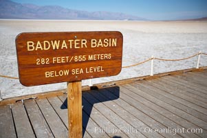
Badwater, California. Badwater, at 282 feet below sea level, is the lowest point in North America. 9000 square miles of watershed drain into the Badwater basin, to dry and form huge white salt flats.
Location: Badwater, Death Valley National Park, California
Image ID: 15580
Location: Badwater, Death Valley National Park, California
Image ID: 15580
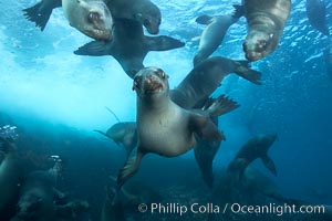
California sea lions, underwater at Santa Barbara Island. Santa Barbara Island, 38 miles off the coast of southern California, is part of the Channel Islands National Marine Sanctuary and Channel Islands National Park. It is home to a large population of sea lions.
Species: California sea lion, Zalophus californianus
Location: Santa Barbara Island, California
Image ID: 23575
Species: California sea lion, Zalophus californianus
Location: Santa Barbara Island, California
Image ID: 23575
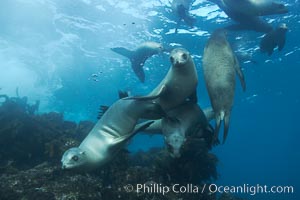
California sea lions, underwater at Santa Barbara Island. Santa Barbara Island, 38 miles off the coast of southern California, is part of the Channel Islands National Marine Sanctuary and Channel Islands National Park. It is home to a large population of sea lions.
Species: California sea lion, Zalophus californianus
Location: Santa Barbara Island, California
Image ID: 23576
Species: California sea lion, Zalophus californianus
Location: Santa Barbara Island, California
Image ID: 23576
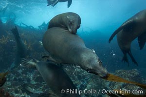
California sea lions, underwater at Santa Barbara Island. Santa Barbara Island, 38 miles off the coast of southern California, is part of the Channel Islands National Marine Sanctuary and Channel Islands National Park. It is home to a large population of sea lions.
Species: California sea lion, Zalophus californianus
Location: Santa Barbara Island, California
Image ID: 23577
Species: California sea lion, Zalophus californianus
Location: Santa Barbara Island, California
Image ID: 23577
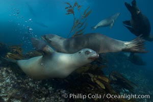
California sea lions, underwater at Santa Barbara Island. Santa Barbara Island, 38 miles off the coast of southern California, is part of the Channel Islands National Marine Sanctuary and Channel Islands National Park. It is home to a large population of sea lions.
Species: California sea lion, Zalophus californianus
Location: Santa Barbara Island, California
Image ID: 23578
Species: California sea lion, Zalophus californianus
Location: Santa Barbara Island, California
Image ID: 23578
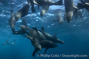
California sea lions, underwater at Santa Barbara Island. Santa Barbara Island, 38 miles off the coast of southern California, is part of the Channel Islands National Marine Sanctuary and Channel Islands National Park. It is home to a large population of sea lions.
Species: California sea lion, Zalophus californianus
Location: Santa Barbara Island, California
Image ID: 23579
Species: California sea lion, Zalophus californianus
Location: Santa Barbara Island, California
Image ID: 23579
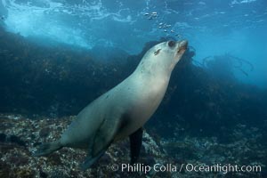
California sea lion, underwater at Santa Barbara Island. Santa Barbara Island, 38 miles off the coast of southern California, is part of the Channel Islands National Marine Sanctuary and Channel Islands National Park. It is home to a large population of sea lions.
Species: California sea lion, Zalophus californianus
Location: Santa Barbara Island, California
Image ID: 23580
Species: California sea lion, Zalophus californianus
Location: Santa Barbara Island, California
Image ID: 23580
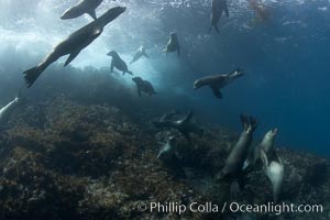
California sea lions, underwater at Santa Barbara Island. Santa Barbara Island, 38 miles off the coast of southern California, is part of the Channel Islands National Marine Sanctuary and Channel Islands National Park. It is home to a large population of sea lions.
Species: California sea lion, Zalophus californianus
Location: Santa Barbara Island, California
Image ID: 23581
Species: California sea lion, Zalophus californianus
Location: Santa Barbara Island, California
Image ID: 23581
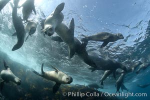
California sea lions, underwater at Santa Barbara Island. Santa Barbara Island, 38 miles off the coast of southern California, is part of the Channel Islands National Marine Sanctuary and Channel Islands National Park. It is home to a large population of sea lions.
Species: California sea lion, Zalophus californianus
Location: Santa Barbara Island, California
Image ID: 23582
Species: California sea lion, Zalophus californianus
Location: Santa Barbara Island, California
Image ID: 23582
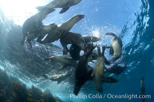
California sea lions, underwater at Santa Barbara Island. Santa Barbara Island, 38 miles off the coast of southern California, is part of the Channel Islands National Marine Sanctuary and Channel Islands National Park. It is home to a large population of sea lions.
Species: California sea lion, Zalophus californianus
Location: Santa Barbara Island, California
Image ID: 23583
Species: California sea lion, Zalophus californianus
Location: Santa Barbara Island, California
Image ID: 23583
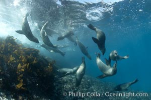
California sea lions, underwater at Santa Barbara Island. Santa Barbara Island, 38 miles off the coast of southern California, is part of the Channel Islands National Marine Sanctuary and Channel Islands National Park. It is home to a large population of sea lions.
Species: California sea lion, Zalophus californianus
Location: Santa Barbara Island, California
Image ID: 23584
Species: California sea lion, Zalophus californianus
Location: Santa Barbara Island, California
Image ID: 23584
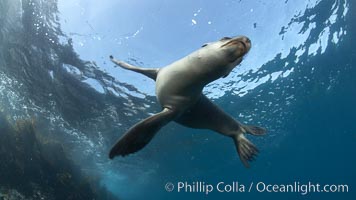
California sea lion, underwater at Santa Barbara Island. Santa Barbara Island, 38 miles off the coast of southern California, is part of the Channel Islands National Marine Sanctuary and Channel Islands National Park. It is home to a large population of sea lions.
Species: California sea lion, Zalophus californianus
Location: Santa Barbara Island, California
Image ID: 23585
Species: California sea lion, Zalophus californianus
Location: Santa Barbara Island, California
Image ID: 23585
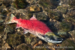
A sockeye salmon, a male sockeye dying on the edge of the Adams River, has completed its journey of hundreds of miles upstream inthe Fraser and Adams Rivers just to reach this spot, so that it can fertilize a females nest of eggs before dying.
Species: Sockeye salmon, Oncorhynchus nerka
Location: Adams River, Roderick Haig-Brown Provincial Park, British Columbia, Canada
Image ID: 26182
Species: Sockeye salmon, Oncorhynchus nerka
Location: Adams River, Roderick Haig-Brown Provincial Park, British Columbia, Canada
Image ID: 26182
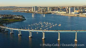
San Diego Coronado Bridge, known locally as the Coronado Bridge, links San Diego with Coronado, California. The bridge was completed in 1969 and was a toll bridge until 2002. It is 2.1 miles long and reaches a height of 200 feet above San Diego Bay. Coronado Island is to the left, and downtown San Diego is to the right in this view looking north.
Location: San Diego, California
Image ID: 22299
Location: San Diego, California
Image ID: 22299
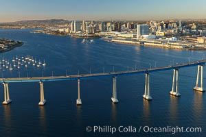
San Diego Coronado Bridge, known locally as the Coronado Bridge, links San Diego with Coronado, California. The bridge was completed in 1969 and was a toll bridge until 2002. It is 2.1 miles long and reaches a height of 200 feet above San Diego Bay. Coronado Island is to the left, and downtown San Diego is to the right in this view looking north.
Location: San Diego, California
Image ID: 22306
Location: San Diego, California
Image ID: 22306
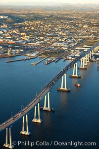
San Diego Coronado Bridge, known locally as the Coronado Bridge, links San Diego with Coronado, California. The bridge was completed in 1969 and was a toll bridge until 2002. It is 2.1 miles long and reaches a height of 200 feet above San Diego Bay.
Location: San Diego, California
Image ID: 22326
Location: San Diego, California
Image ID: 22326
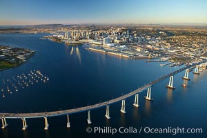
San Diego Coronado Bridge, known locally as the Coronado Bridge, links San Diego with Coronado, California. The bridge was completed in 1969 and was a toll bridge until 2002. It is 2.1 miles long and reaches a height of 200 feet above San Diego Bay. Coronado Island is to the left, and downtown San Diego is to the right in this view looking north.
Location: San Diego, California
Image ID: 22365
Location: San Diego, California
Image ID: 22365
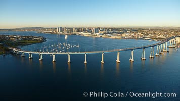
San Diego Coronado Bridge, known locally as the Coronado Bridge, links San Diego with Coronado, California. The bridge was completed in 1969 and was a toll bridge until 2002. It is 2.1 miles long and reaches a height of 200 feet above San Diego Bay. Coronado Island is to the left, and downtown San Diego is to the right in this view looking north.
Location: San Diego, California
Image ID: 22401
Location: San Diego, California
Image ID: 22401
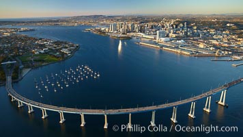
San Diego Coronado Bridge, known locally as the Coronado Bridge, links San Diego with Coronado, California. The bridge was completed in 1969 and was a toll bridge until 2002. It is 2.1 miles long and reaches a height of 200 feet above San Diego Bay. Coronado Island is to the left, and downtown San Diego is to the right in this view looking north.
Location: San Diego, California
Image ID: 22432
Location: San Diego, California
Image ID: 22432
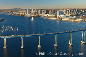
San Diego Coronado Bridge, known locally as the Coronado Bridge, links San Diego with Coronado, California. The bridge was completed in 1969 and was a toll bridge until 2002. It is 2.1 miles long and reaches a height of 200 feet above San Diego Bay. Coronado Island is to the left, and downtown San Diego is to the right in this view looking north.
Location: San Diego, California
Image ID: 22433
Location: San Diego, California
Image ID: 22433
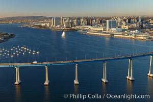
San Diego Coronado Bridge, known locally as the Coronado Bridge, links San Diego with Coronado, California. The bridge was completed in 1969 and was a toll bridge until 2002. It is 2.1 miles long and reaches a height of 200 feet above San Diego Bay. Coronado Island is to the left, and downtown San Diego is to the right in this view looking north.
Location: San Diego, California
Image ID: 22460
Location: San Diego, California
Image ID: 22460