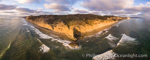
Flat Rock and Torrey Pines Seacliffs at Sunset, aerial photo.
Location: Torrey Pines State Reserve, San Diego, California
Image ID: 38227
Location: Torrey Pines State Reserve, San Diego, California
Image ID: 38227
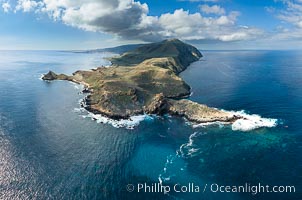
San Clemente Island aerial photo, Pyramid Head and Balanced Rock (China Hat) at the southern end of the island. San Clemente Island Pyramid Head, the distinctive pyramid shaped southern end of the island, exhibits distinctive geologic terracing, underwater reefs and giant kelp forests.
Location: San Clemente Island, California
Image ID: 38483
Location: San Clemente Island, California
Image ID: 38483
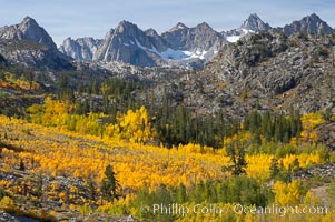
Aspen trees cover Bishop Creek Canyon above Aspendel.
Species: Aspen, Populus tremuloides
Location: Bishop Creek Canyon, Sierra Nevada Mountains, California
Image ID: 17528
Species: Aspen, Populus tremuloides
Location: Bishop Creek Canyon, Sierra Nevada Mountains, California
Image ID: 17528
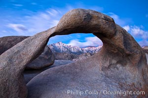
Mobius Arch at sunrise, framing snow dusted Lone Pine Peak and the Sierra Nevada Range in the background. Also known as Galen's Arch, Mobius Arch is found in the Alabama Hills Recreational Area near Lone Pine.
Location: Alabama Hills Recreational Area, California
Image ID: 27644
Location: Alabama Hills Recreational Area, California
Image ID: 27644
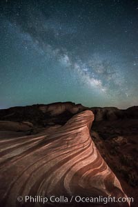
Milky Way galaxy rises above the Fire Wave, Valley of Fire State Park.
Location: Valley of Fire State Park, Nevada
Image ID: 28554
Location: Valley of Fire State Park, Nevada
Image ID: 28554
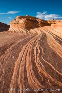
The Second Wave at Sunset, Vermillion Cliffs. The Second Wave, a curiously-shaped sandstone swirl, takes on rich warm tones and dramatic shadowed textures at sunset. Set in the North Coyote Buttes of Arizona and Utah, the Second Wave is characterized by striations revealing layers of sedimentary deposits, a visible historical record depicting eons of submarine geology.
Location: North Coyote Buttes, Paria Canyon-Vermilion Cliffs Wilderness, Arizona
Image ID: 28619
Location: North Coyote Buttes, Paria Canyon-Vermilion Cliffs Wilderness, Arizona
Image ID: 28619
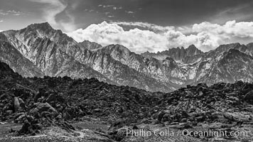
Mount Whitney and Lone Pine Peak over the Alabama Hills.
Image ID: 28691
Image ID: 28691
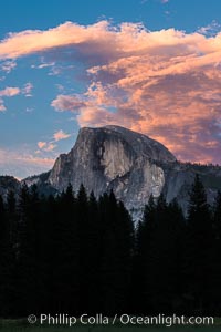
Half Dome and sunset clouds, evening.
Location: Half Dome, Yosemite National Park, California
Image ID: 28693
Location: Half Dome, Yosemite National Park, California
Image ID: 28693
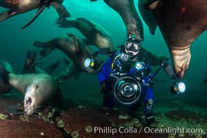
Photographer Celia Kujala and Steller Sea Lions Underwater, underwater photographer, Hornby Island, British Columbia, Canada.
Species: Steller sea lion, Eumetopias jubatus
Location: Norris Rocks, Hornby Island, British Columbia, Canada
Image ID: 36120
Species: Steller sea lion, Eumetopias jubatus
Location: Norris Rocks, Hornby Island, British Columbia, Canada
Image ID: 36120
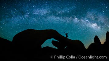
The Milky Way galaxy arches over Arch Rock on a clear evening in Joshua Tree National Park.
Location: Joshua Tree National Park, California
Image ID: 26792
Location: Joshua Tree National Park, California
Image ID: 26792
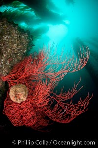
Bryozoan grows on a red gorgonian on rocky reef, below kelp forest, underwater. The red gorgonian is a filter-feeding temperate colonial species that lives on the rocky bottom at depths between 50 to 200 feet deep. Gorgonians are oriented at right angles to prevailing water currents to capture plankton drifting by.
Species: Red gorgonian, Leptogorgia chilensis, Lophogorgia chilensis
Location: San Clemente Island, California
Image ID: 25395
Species: Red gorgonian, Leptogorgia chilensis, Lophogorgia chilensis
Location: San Clemente Island, California
Image ID: 25395
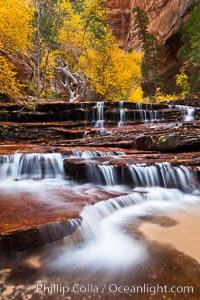
Archangel Falls in autumn, near the Subway in North Creek Canyon, with maples and cottonwoods turning fall colors.
Location: Zion National Park, Utah
Image ID: 26097
Location: Zion National Park, Utah
Image ID: 26097
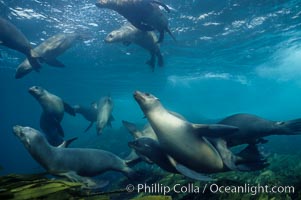
California sea lions swim and socialize over a kelp-covered rocky reef, underwater at San Clemente Island in California's southern Channel Islands.
Species: California sea lion, Zalophus californianus
Location: San Clemente Island, California
Image ID: 02158
Species: California sea lion, Zalophus californianus
Location: San Clemente Island, California
Image ID: 02158
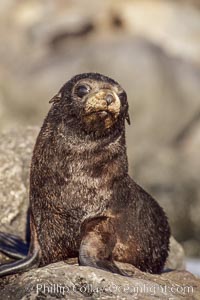
Guadalupe fur seal pup sits on brown rocks along the coastline of Guadalupe Island.
Species: Guadalupe fur seal, Arctocephalus townsendi
Location: Guadalupe Island (Isla Guadalupe), Baja California, Mexico
Image ID: 02441
Species: Guadalupe fur seal, Arctocephalus townsendi
Location: Guadalupe Island (Isla Guadalupe), Baja California, Mexico
Image ID: 02441
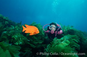
A SCUBA diver swimming over a rocky reef covered with kelp, watches a brightly colored orange garibaldi fish.
Species: Garibaldi, Hypsypops rubicundus
Location: San Clemente Island, California
Image ID: 01113
Species: Garibaldi, Hypsypops rubicundus
Location: San Clemente Island, California
Image ID: 01113
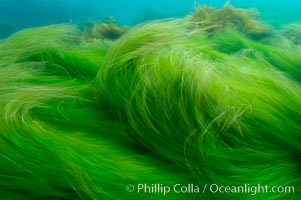
Surf grass on the rocky reef -- appearing blurred in this time exposure -- is tossed back and forth by powerful ocean waves passing by above. San Clemente Island.
Species: Surfgrass, Phyllospadix
Location: San Clemente Island, California
Image ID: 10237
Species: Surfgrass, Phyllospadix
Location: San Clemente Island, California
Image ID: 10237
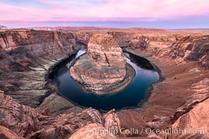
Spectacular Horseshoe Bend sunrise. The Colorado River makes a 180-degree turn at Horseshoe Bend. Here the river has eroded the Navajo sandstone for eons, digging a canyon 1100-feet deep.
Location: Horseshoe Bend, Page, Arizona
Image ID: 35939
Location: Horseshoe Bend, Page, Arizona
Image ID: 35939
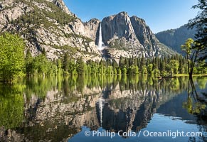
Yosemite Falls reflected in Flooded Sentinel Meadow, when the Merced River floods Yosemite Valley following a winter of historic snowfall in the Sierra Nevada, Yosemite National Park.
Location: Yosemite National Park, California
Image ID: 39378
Location: Yosemite National Park, California
Image ID: 39378

Sunrise at San Clemente Island, south end showing China Hat (Balanced Rock) and Pyramid Head, near Pyramid Cove, storm clouds. Panoramic photo.
Location: San Clemente Island, California
Image ID: 30855
Panorama dimensions: 5232 x 24109
Location: San Clemente Island, California
Image ID: 30855
Panorama dimensions: 5232 x 24109
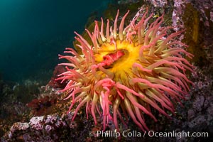
The Fish Eating Anemone Urticina piscivora, a large colorful anemone found on the rocky underwater reefs of Vancouver Island, British Columbia.
Species: Fish-eating anemone, Urticina piscivora
Location: British Columbia, Canada
Image ID: 34337
Species: Fish-eating anemone, Urticina piscivora
Location: British Columbia, Canada
Image ID: 34337
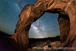
Milky Way and Stars over Broken Arch, Arches National Park, Utah.
Location: Broken Arch, Arches National Park, Utah
Image ID: 29238
Location: Broken Arch, Arches National Park, Utah
Image ID: 29238
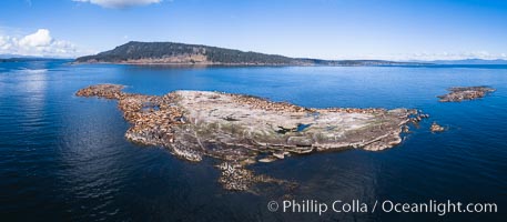
Steller Sea Lions atop Norris Rocks, Hornby Island in the distance, panoramic photo.
Species: Steller sea lion, Eumetopias jubatus
Location: British Columbia, Canada
Image ID: 34467
Panorama dimensions: 3758 x 8590
Species: Steller sea lion, Eumetopias jubatus
Location: British Columbia, Canada
Image ID: 34467
Panorama dimensions: 3758 x 8590
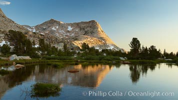
Vogelsang Peak (11516') at sunset, reflected in a small creek near Vogelsang High Sierra Camp in Yosemite's high country.
Location: Yosemite National Park, California
Image ID: 23202
Location: Yosemite National Park, California
Image ID: 23202
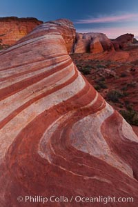
The Fire Wave, a beautiful sandstone formation exhibiting dramatic striations, striped layers in the geologic historical record.
Location: Valley of Fire State Park, Nevada
Image ID: 26473
Location: Valley of Fire State Park, Nevada
Image ID: 26473
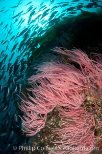
Red gorgonian on rocky reef, below kelp forest, underwater. The red gorgonian is a filter-feeding temperate colonial species that lives on the rocky bottom at depths between 50 to 200 feet deep. Gorgonians are oriented at right angles to prevailing water currents to capture plankton drifting by.
Species: Red gorgonian, Leptogorgia chilensis, Lophogorgia chilensis
Location: San Clemente Island, California
Image ID: 25393
Species: Red gorgonian, Leptogorgia chilensis, Lophogorgia chilensis
Location: San Clemente Island, California
Image ID: 25393
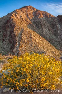
Brittlebush blooms in spring, Palm Canyon, Anza Borrego Desert State Park.
Species: Brittlebush, Encelia farinosa
Location: Anza-Borrego Desert State Park, Borrego Springs, California
Image ID: 24304
Species: Brittlebush, Encelia farinosa
Location: Anza-Borrego Desert State Park, Borrego Springs, California
Image ID: 24304
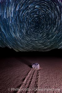
Racetrack sailing stone and star trails. A sliding rock of the Racetrack Playa. The sliding rocks, or sailing stones, move across the mud flats of the Racetrack Playa, leaving trails behind in the mud. The explanation for their movement is not known with certainty, but many believe wind pushes the rocks over wet and perhaps icy mud in winter.
Location: Racetrack Playa, Death Valley National Park, California
Image ID: 27671
Location: Racetrack Playa, Death Valley National Park, California
Image ID: 27671
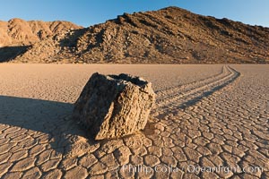
Sailing stone on the Racetrack Playa. The sliding rocks, or sailing stones, move across the mud flats of the Racetrack Playa, leaving trails behind in the mud. The explanation for their movement is not known with certainty, but many believe wind pushes the rocks over wet and perhaps icy mud in winter.
Location: Racetrack Playa, Death Valley National Park, California
Image ID: 27689
Location: Racetrack Playa, Death Valley National Park, California
Image ID: 27689

Sunset at Dead Horse Point Overlook, with the Colorado River flowing 2,000 feet below. 300 million years of erosion has carved the expansive canyons, cliffs and walls below and surrounding Deadhorse Point.
Location: Dead Horse Point State Park, Utah
Image ID: 27823
Panorama dimensions: 5303 x 17695
Location: Dead Horse Point State Park, Utah
Image ID: 27823
Panorama dimensions: 5303 x 17695
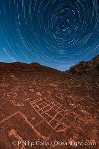
Star Trails over Sky Rock. Sky Rock petroglyphs near Bishop, California. Hidden atop an enormous boulder in the Volcanic Tablelands lies Sky Rock, a set of petroglyphs that face the sky. These superb examples of native American petroglyph artwork are thought to be Paiute in origin, but little is known about them.
Image ID: 28498
Image ID: 28498