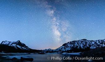
Milky Way over Tioga Lake, Yosemite National Park.
Location: Tioga Lake, Yosemite National Park, California
Image ID: 28521
Location: Tioga Lake, Yosemite National Park, California
Image ID: 28521
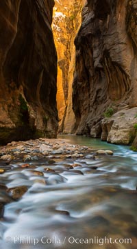
The Virgin River Narrows, where the Virgin River has carved deep, narrow canyons through the Zion National Park sandstone, creating one of the finest hikes in the world.
Location: Virgin River Narrows, Zion National Park, Utah
Image ID: 28583
Location: Virgin River Narrows, Zion National Park, Utah
Image ID: 28583
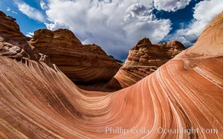
The Wave in the North Coyote Buttes, an area of fantastic eroded sandstone featuring beautiful swirls, wild colors, countless striations, and bizarre shapes set amidst the dramatic surrounding North Coyote Buttes of Arizona and Utah. The sandstone formations of the North Coyote Buttes, including the Wave, date from the Jurassic period. Managed by the Bureau of Land Management, the Wave is located in the Paria Canyon-Vermilion Cliffs Wilderness and is accessible on foot by permit only.
Location: North Coyote Buttes, Paria Canyon-Vermilion Cliffs Wilderness, Arizona
Image ID: 28601
Location: North Coyote Buttes, Paria Canyon-Vermilion Cliffs Wilderness, Arizona
Image ID: 28601
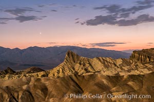
Venus sets over Manley Beacon and the Panamint Mountains, viewed from Zabriskie Point, landscape lit by a full moon, evening, stars.
Location: Zabriskie Point, Death Valley National Park, California
Image ID: 28677
Location: Zabriskie Point, Death Valley National Park, California
Image ID: 28677
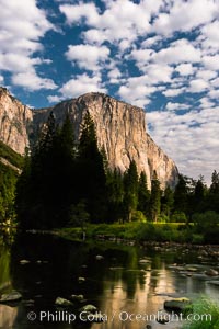
El Capitan and clouds lit by full moon, stars, evening.
Location: El Capitan, Yosemite National Park, California
Image ID: 28695
Location: El Capitan, Yosemite National Park, California
Image ID: 28695

Guadalupe Island at sunrise, panorama. Volcanic coastline south of Pilot Rock and Spanish Cove, near El Faro lighthouse.
Location: Guadalupe Island (Isla Guadalupe), Baja California, Mexico
Image ID: 28758
Panorama dimensions: 4224 x 25926
Location: Guadalupe Island (Isla Guadalupe), Baja California, Mexico
Image ID: 28758
Panorama dimensions: 4224 x 25926
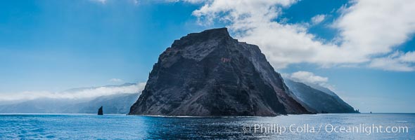
Punta Norte, the northern point of Guadalupe Island, viewed from the north. Punta Desfiladero (Blunt Point) and Roca Elefante are just visible at far right, and Roca Piloto (Pilot Rock) is see to the left of the island against the distant sweep of the cliffs that comprise the northeastern bight of the island, actually the rim of an enormous caldera.
Location: Guadalupe Island (Isla Guadalupe), Baja California, Mexico
Image ID: 28760
Panorama dimensions: 4595 x 13560
Location: Guadalupe Island (Isla Guadalupe), Baja California, Mexico
Image ID: 28760
Panorama dimensions: 4595 x 13560
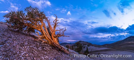
Ancient Bristlecone Pine Tree at sunset, panorama, with storm clouds passing over the White Mountains. The eastern Sierra Nevada is just visible in the distance.
Species: Ancient bristlecone pine, Pinus longaeva
Location: Ancient Bristlecone Pine Forest, White Mountains, Inyo National Forest, California
Image ID: 28781
Panorama dimensions: 4549 x 10085
Species: Ancient bristlecone pine, Pinus longaeva
Location: Ancient Bristlecone Pine Forest, White Mountains, Inyo National Forest, California
Image ID: 28781
Panorama dimensions: 4549 x 10085
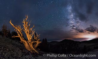
Ancient Bristlecone Pine Tree at night, stars and the Milky Way galaxy visible in the evening sky, near Patriarch Grove.
Species: Ancient bristlecone pine, Pinus longaeva
Location: Ancient Bristlecone Pine Forest, White Mountains, Inyo National Forest, California
Image ID: 28782
Panorama dimensions: 5237 x 8556
Species: Ancient bristlecone pine, Pinus longaeva
Location: Ancient Bristlecone Pine Forest, White Mountains, Inyo National Forest, California
Image ID: 28782
Panorama dimensions: 5237 x 8556
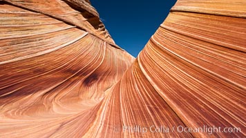
The Wave, an area of fantastic eroded sandstone featuring beautiful swirls, wild colors, countless striations, and bizarre shapes set amidst the dramatic surrounding North Coyote Buttes of Arizona and Utah. The sandstone formations of the North Coyote Buttes, including the Wave, date from the Jurassic period. Managed by the Bureau of Land Management, the Wave is located in the Paria Canyon-Vermilion Cliffs Wilderness and is accessible on foot by permit only.
Location: North Coyote Buttes, Paria Canyon-Vermilion Cliffs Wilderness, Arizona
Image ID: 20608
Location: North Coyote Buttes, Paria Canyon-Vermilion Cliffs Wilderness, Arizona
Image ID: 20608
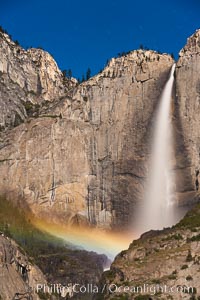
Upper Yosemite Falls and lunar rainbow, moonbow. A lunar rainbow (moonbow) can be seen to the left of Yosemite Falls, where the moon illuminates the spray of the falls.
Location: Yosemite Falls, Yosemite National Park, California
Image ID: 27751
Location: Yosemite Falls, Yosemite National Park, California
Image ID: 27751
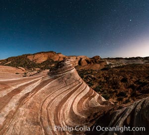
The Fire Wave by Moonlight, stars and the night sky, Valley of Fire State Park.
Location: Valley of Fire State Park, Nevada
Image ID: 28442
Panorama dimensions: 6250 x 6887
Location: Valley of Fire State Park, Nevada
Image ID: 28442
Panorama dimensions: 6250 x 6887
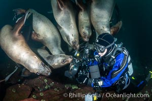
Photographer Celia Kujala and Steller Sea Lions Underwater, underwater photographer, Hornby Island, British Columbia, Canada.
Species: Steller sea lion, Eumetopias jubatus
Location: Norris Rocks, Hornby Island, British Columbia, Canada
Image ID: 36129
Species: Steller sea lion, Eumetopias jubatus
Location: Norris Rocks, Hornby Island, British Columbia, Canada
Image ID: 36129
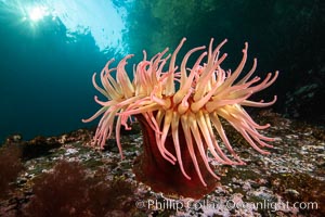
The Fish Eating Anemone Urticina piscivora, a large colorful anemone found on the rocky underwater reefs of Vancouver Island, British Columbia.
Species: Fish-eating anemone, Urticina piscivora
Location: British Columbia, Canada
Image ID: 35273
Species: Fish-eating anemone, Urticina piscivora
Location: British Columbia, Canada
Image ID: 35273
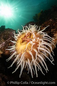
The Fish Eating Anemone Urticina piscivora, a large colorful anemone found on the rocky underwater reefs of Vancouver Island, British Columbia.
Species: Fish-eating anemone, Urticina piscivora
Location: British Columbia, Canada
Image ID: 35274
Species: Fish-eating anemone, Urticina piscivora
Location: British Columbia, Canada
Image ID: 35274
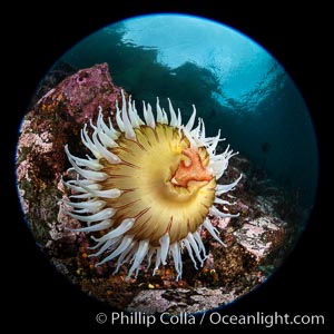
The Fish Eating Anemone Urticina piscivora, a large colorful anemone found on the rocky underwater reefs of Vancouver Island, British Columbia.
Species: Fish-eating anemone, Urticina piscivora
Location: British Columbia, Canada
Image ID: 35282
Species: Fish-eating anemone, Urticina piscivora
Location: British Columbia, Canada
Image ID: 35282
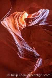
Upper Antelope Canyon, a deep, narrow and spectacular slot canyon lying on Navajo Tribal lands near Page, Arizona.
Location: Navajo Tribal Lands, Page, Arizona
Image ID: 35936
Location: Navajo Tribal Lands, Page, Arizona
Image ID: 35936
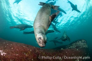
Steller sea lion underwater, Norris Rocks, Hornby Island, British Columbia, Canada.
Species: Steller sea lion, Eumetopias jubatus
Location: Hornby Island, British Columbia
Image ID: 36054
Species: Steller sea lion, Eumetopias jubatus
Location: Hornby Island, British Columbia
Image ID: 36054
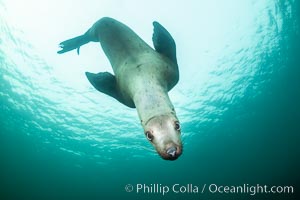
Steller sea lion underwater, Norris Rocks, Hornby Island, British Columbia, Canada.
Species: Steller sea lion, Eumetopias jubatus
Location: Hornby Island, British Columbia
Image ID: 36055
Species: Steller sea lion, Eumetopias jubatus
Location: Hornby Island, British Columbia
Image ID: 36055
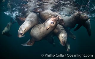
Steller sea lions underwater, Norris Rocks, Hornby Island, British Columbia, Canada.
Species: Steller sea lion, Eumetopias jubatus
Location: Hornby Island, British Columbia
Image ID: 36057
Species: Steller sea lion, Eumetopias jubatus
Location: Hornby Island, British Columbia
Image ID: 36057
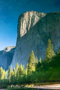
El Capitan reflection mirrored in the Merced River, Yosemite National Park.
Location: Yosemite National Park, California
Image ID: 36351
Location: Yosemite National Park, California
Image ID: 36351
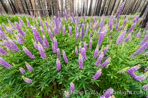
Lupine bloom in burned area after a forest fire, near Wawona, Yosemite National Park.
Location: Yosemite National Park, California
Image ID: 36366
Location: Yosemite National Park, California
Image ID: 36366
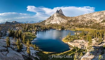
Cathedral Peak and Upper Cathedral Lake at Sunset, Yosemite National Park.
Location: Yosemite National Park, California
Image ID: 36419
Panorama dimensions: 7800 x 13628
Location: Yosemite National Park, California
Image ID: 36419
Panorama dimensions: 7800 x 13628
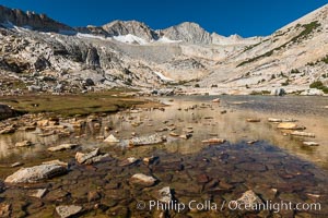
Mount Conness (12,589') over Lower Conness Lake, Hoover Wilderness.
Location: Conness Lakes Basin, Hoover Wilderness, California
Image ID: 36424
Location: Conness Lakes Basin, Hoover Wilderness, California
Image ID: 36424
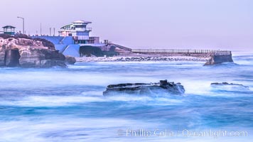
The Children's Pool, also known as Casa Cove, in pre-dawn light, La Jolla. Seal Rock in the foreground.
Location: La Jolla, California
Image ID: 37475
Location: La Jolla, California
Image ID: 37475
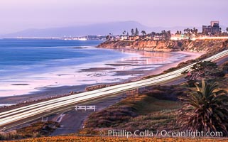
Carlsbad Coast Highway Sunset, from Terramar and North Ponto to Oceanside and Camp Pendleton. The smoke stack that marked the old Encina Power Plant was removed in 2021. Oceanside Pier is seen beautifully lit in the distance. Rising in the distance is San Onofre Mountain (1722') topped by a tall signal tower, one of the southern peaks in the Santa Ana Mountains.
Location: Carlsbad, California
Image ID: 37479
Location: Carlsbad, California
Image ID: 37479
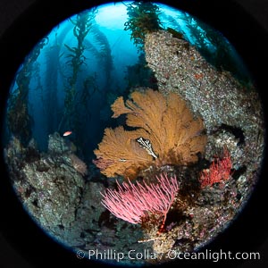
Red gorgonian and California golden gorgonian on underwater rocky reef, San Clemente Island. The golden gorgonian is a filter-feeding temperate colonial species that lives on the rocky bottom at depths between 50 to 200 feet deep. Each individual polyp is a distinct animal, together they secrete calcium that forms the structure of the colony. Gorgonians are oriented at right angles to prevailing water currents to capture plankton drifting by.
Species: Red gorgonian, California golden gorgonian, Leptogorgia chilensis, Lophogorgia chilensis, Muricea californica
Location: San Clemente Island, California
Image ID: 38499
Species: Red gorgonian, California golden gorgonian, Leptogorgia chilensis, Lophogorgia chilensis, Muricea californica
Location: San Clemente Island, California
Image ID: 38499
