Pacific Harbor Seal Mother and Pup Emerge from the Ocean, they will remain close for four to six weeks until the pup is weaned from its mother's milk.
Species: Pacific harbor seal, Phoca vitulina richardsi
Location: La Jolla, California
Image ID: 39078
Species: Pacific harbor seal, Phoca vitulina richardsi
Location: La Jolla, California
Image ID: 39078
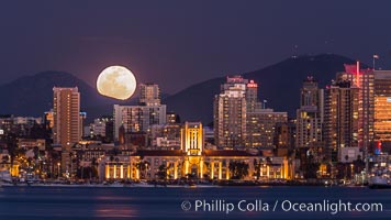
Full Moon rising over San Diego City Skyline, viewed from Harbor Island. Mount San Miguel is to the right, Lyons Peak to the left, in the distance.
Location: San Diego, California
Image ID: 29121
Location: San Diego, California
Image ID: 29121
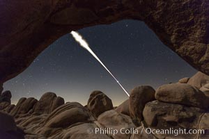
Lunar Eclipse Sequence, the path of the moon through the sky as it progresses from being fully visible (top) to fully eclipsed (middle) to almost fully visible again (bottom), viewed through Arch Rock, April 4 2015.
Location: Joshua Tree National Park, California
Image ID: 30713
Location: Joshua Tree National Park, California
Image ID: 30713
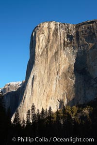
El Capitan eastern face, sunrise.
Location: El Capitan, Yosemite National Park, California
Image ID: 22745
Location: El Capitan, Yosemite National Park, California
Image ID: 22745
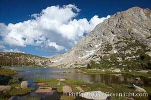
Fletcher Peak (11407') rises above Fletcher Lake (10174'), near Vogelsang High Sierra Camp in Yosemite's high country.
Location: Yosemite National Park, California
Image ID: 23208
Location: Yosemite National Park, California
Image ID: 23208
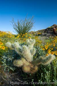
Cholla cactus, brittlebush, ocotillo and various cacti and wildflowers color the sides of Glorietta Canyon. Heavy winter rains led to a historic springtime bloom in 2005, carpeting the entire desert in vegetation and color for months.
Species: Encelia farinosa, Fouquieria splendens, Opuntia
Location: Anza-Borrego Desert State Park, Borrego Springs, California
Image ID: 10975
Species: Encelia farinosa, Fouquieria splendens, Opuntia
Location: Anza-Borrego Desert State Park, Borrego Springs, California
Image ID: 10975
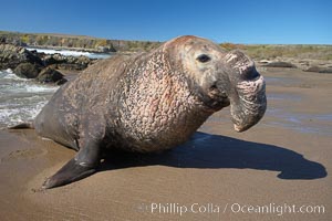
Bull elephant seal exits the water to retake his position on the beach. He shows considerable scarring on his chest and proboscis from many winters fighting other males for territory and rights to a harem of females. Sandy beach rookery, winter, Central California.
Species: Elephant seal, Mirounga angustirostris
Location: Piedras Blancas, San Simeon, California
Image ID: 15458
Species: Elephant seal, Mirounga angustirostris
Location: Piedras Blancas, San Simeon, California
Image ID: 15458

Steller sea lions (Northern sea lions) gather on rocks. Steller sea lions are the largest members of the Otariid (eared seal) family. Males can weigh up to 2400 lb., females up to 770 lb.
Species: Steller sea lion, Eumetopias jubatus
Location: Chiswell Islands, Kenai Fjords National Park, Alaska
Image ID: 16977
Species: Steller sea lion, Eumetopias jubatus
Location: Chiswell Islands, Kenai Fjords National Park, Alaska
Image ID: 16977
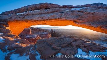
Mesa Arch spans 90 feet and stands at the edge of a mesa precipice thousands of feet above the Colorado River gorge. For a few moments at sunrise the underside of the arch glows dramatically red and orange.
Location: Island in the Sky, Canyonlands National Park, Utah
Image ID: 18040
Location: Island in the Sky, Canyonlands National Park, Utah
Image ID: 18040
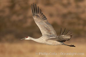
Sandhill crane spreads its broad wings as it takes flight in early morning light. This crane is one of over 5000 present in Bosque del Apache National Wildlife Refuge, stopping here during its winter migration.
Species: Sandhill crane, Grus canadensis
Location: Bosque del Apache National Wildlife Refuge, Socorro, New Mexico
Image ID: 21797
Species: Sandhill crane, Grus canadensis
Location: Bosque del Apache National Wildlife Refuge, Socorro, New Mexico
Image ID: 21797
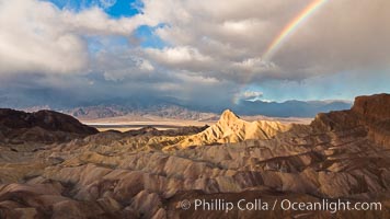
Rainbow and clearing storm clouds, sunrise light on Manly Beacon, Zabriskie Point, Death Valley National Park, California.
Location: Zabriskie Point, Death Valley National Park, California
Image ID: 27660
Location: Zabriskie Point, Death Valley National Park, California
Image ID: 27660
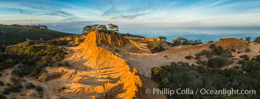
Broken Hill and view to La Jolla, panoramic photograph, from Torrey Pines State Reserve, sunrise.
Location: Torrey Pines State Reserve, San Diego, California
Image ID: 28397
Panorama dimensions: 4332 x 11344
Location: Torrey Pines State Reserve, San Diego, California
Image ID: 28397
Panorama dimensions: 4332 x 11344
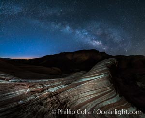
Milky Way galaxy rises above the Fire Wave, Valley of Fire State Park.
Location: Valley of Fire State Park, Nevada
Image ID: 28428
Location: Valley of Fire State Park, Nevada
Image ID: 28428
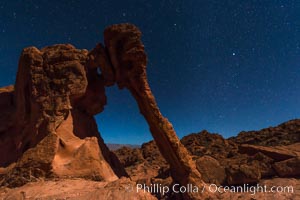
Elephant arch and stars at night, moonlight, Valley of Fire State Park.
Location: Valley of Fire State Park, Nevada
Image ID: 28435
Location: Valley of Fire State Park, Nevada
Image ID: 28435
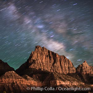
Milky Way over the Watchman, Zion National Park. The Milky Way galaxy rises in the night sky above the the Watchman.
Location: Zion National Park, Utah
Image ID: 28587
Location: Zion National Park, Utah
Image ID: 28587
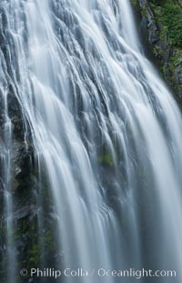
Narada Falls cascades down a cliff, with the flow blurred by a time exposure. Narada Falls is a 188 foot (57m) waterfall in Mount Rainier National Park.
Location: Narada Falls, Mount Rainier National Park, Washington
Image ID: 28718
Location: Narada Falls, Mount Rainier National Park, Washington
Image ID: 28718
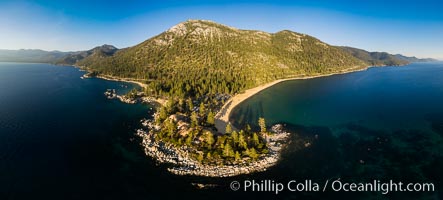
Sand Harbor Lake Tahoe at sunset, aerial photo.
Location: Lake Tahoe, Nevada
Image ID: 38131
Panorama dimensions: 4080 x 9028
Location: Lake Tahoe, Nevada
Image ID: 38131
Panorama dimensions: 4080 x 9028
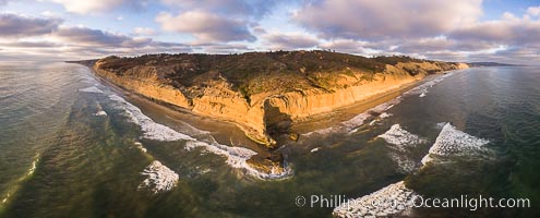
Flat Rock and Torrey Pines Seacliffs at Sunset, aerial photo.
Location: Torrey Pines State Reserve, San Diego, California
Image ID: 38227
Location: Torrey Pines State Reserve, San Diego, California
Image ID: 38227
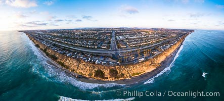
South Carlsbad State Beach and campground, aerial photo.
Location: Carlsbad, California
Image ID: 38228
Panorama dimensions: 4357 x 9642
Location: Carlsbad, California
Image ID: 38228
Panorama dimensions: 4357 x 9642
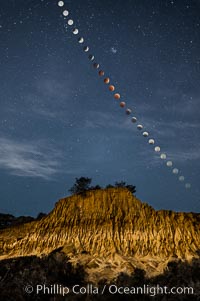
Lunar Eclipse Sequence Over Broken Hill, Torrey Pines State Reserve. While the moon lies in the full shadow of the earth (umbra) it receives only faint, red-tinged light refracted through the Earth's atmosphere. As the moon passes into the penumbra it receives increasing amounts of direct sunlight, eventually leaving the shadow of the Earth altogether. October 8, 2014.
Location: Torrey Pines State Reserve, San Diego, California
Image ID: 29412
Location: Torrey Pines State Reserve, San Diego, California
Image ID: 29412
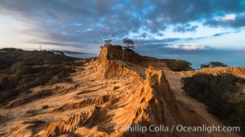
Clearing storm clouds over Broken Hill, overlooking La Jolla and the Pacific Ocean, Torrey Pines State Reserve.
Location: Torrey Pines State Reserve, San Diego, California
Image ID: 29416
Location: Torrey Pines State Reserve, San Diego, California
Image ID: 29416
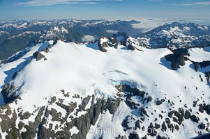
Mariner Mountain, on the west coast of Vancouver Island, British Columbia, Canada, part of Strathcona Provincial Park, located 36 km (22 mi) north of Tofino. It is 1,771 m (5,810 ft) high, snow covered year-round and home to several glaciers.
Location: Mariner Mountain, Strathcona Provincial Park, British Columbia, Canada
Image ID: 21072
Location: Mariner Mountain, Strathcona Provincial Park, British Columbia, Canada
Image ID: 21072
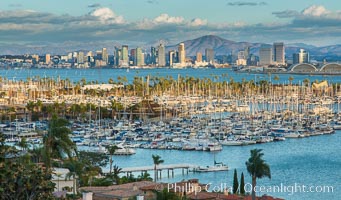
San Diego city skyline, dusk, clearing storm clouds.
Location: San Diego, California
Image ID: 28005
Location: San Diego, California
Image ID: 28005
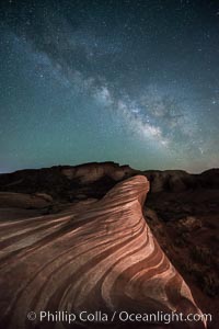
Milky Way galaxy rises above the Fire Wave, Valley of Fire State Park.
Location: Valley of Fire State Park, Nevada
Image ID: 28554
Location: Valley of Fire State Park, Nevada
Image ID: 28554
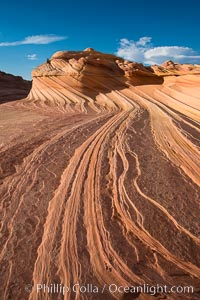
The Second Wave at Sunset, Vermillion Cliffs. The Second Wave, a curiously-shaped sandstone swirl, takes on rich warm tones and dramatic shadowed textures at sunset. Set in the North Coyote Buttes of Arizona and Utah, the Second Wave is characterized by striations revealing layers of sedimentary deposits, a visible historical record depicting eons of submarine geology.
Location: North Coyote Buttes, Paria Canyon-Vermilion Cliffs Wilderness, Arizona
Image ID: 28619
Location: North Coyote Buttes, Paria Canyon-Vermilion Cliffs Wilderness, Arizona
Image ID: 28619
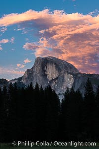
Half Dome and sunset clouds, evening.
Location: Half Dome, Yosemite National Park, California
Image ID: 28693
Location: Half Dome, Yosemite National Park, California
Image ID: 28693
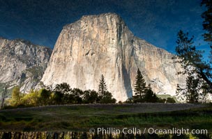
El Capitan reflected in Merced River, Yosemite National Park. Seriously, take a close look, the image as presented here is upside down!.
Location: El Capitan, Yosemite National Park, California
Image ID: 36458
Location: El Capitan, Yosemite National Park, California
Image ID: 36458
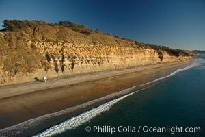
Torrey Pines seacliffs, rising up to 300 feet above the ocean, stretch from Del Mar to La Jolla. On the mesa atop the bluffs are found Torrey pine trees, one of the rare species of pines in the world.
Location: Torrey Pines State Reserve, San Diego, California
Image ID: 22285
Location: Torrey Pines State Reserve, San Diego, California
Image ID: 22285

San Diego Coronado Bridge, known locally as the Coronado Bridge, links San Diego with Coronado, California. The bridge was completed in 1969 and was a toll bridge until 2002. It is 2.1 miles long and reaches a height of 200 feet above San Diego Bay. Coronado Island is to the left, and downtown San Diego is to the right in this view looking north.
Location: San Diego, California
Image ID: 22288
Location: San Diego, California
Image ID: 22288
