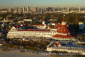
Hotel del Coronado, known affectionately as the Hotel Del. It was once the largest hotel in the world, and is one of the few remaining wooden Victorian beach resorts. It sits on the beach on Coronado Island, seen here with downtown San Diego in the distance. It is widely considered to be one of Americas most beautiful and classic hotels. Built in 1888, it was designated a National Historic Landmark in 1977.
Location: San Diego, California
Image ID: 22287
Location: San Diego, California
Image ID: 22287
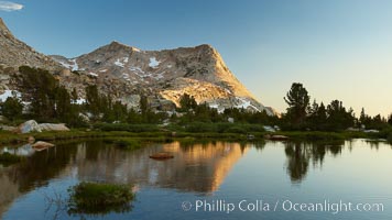
Vogelsang Peak (11516') at sunset, reflected in a small creek near Vogelsang High Sierra Camp in Yosemite's high country.
Location: Yosemite National Park, California
Image ID: 23202
Location: Yosemite National Park, California
Image ID: 23202
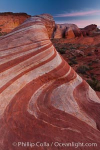
The Fire Wave, a beautiful sandstone formation exhibiting dramatic striations, striped layers in the geologic historical record.
Location: Valley of Fire State Park, Nevada
Image ID: 26473
Location: Valley of Fire State Park, Nevada
Image ID: 26473
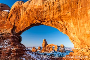
Turret Arch through North Window, winter, sunrise.
Location: North Window, Arches National Park, Utah
Image ID: 18120
Location: North Window, Arches National Park, Utah
Image ID: 18120

Self portrait at sunrise, panorama of Crater Lake. Crater Lake is the six-mile wide lake inside the collapsed caldera of volcanic Mount Mazama. Crater Lake is the deepest lake in the United States and the seventh-deepest in the world. Its maximum recorded depth is 1996 feet (608m). It lies at an altitude of 6178 feet (1880m).
Location: Crater Lake National Park, Oregon
Image ID: 19130
Panorama dimensions: 2726 x 9677
Location: Crater Lake National Park, Oregon
Image ID: 19130
Panorama dimensions: 2726 x 9677

Yaletown section of Vancouver at night, including Granville Island bridge (left), viewed from Granville Island with sailboat in the foreground.
Location: Granville Island, Vancouver, British Columbia, Canada
Image ID: 21169
Location: Granville Island, Vancouver, British Columbia, Canada
Image ID: 21169
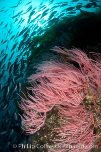
Red gorgonian on rocky reef, below kelp forest, underwater. The red gorgonian is a filter-feeding temperate colonial species that lives on the rocky bottom at depths between 50 to 200 feet deep. Gorgonians are oriented at right angles to prevailing water currents to capture plankton drifting by.
Species: Red gorgonian, Leptogorgia chilensis, Lophogorgia chilensis
Location: San Clemente Island, California
Image ID: 25393
Species: Red gorgonian, Leptogorgia chilensis, Lophogorgia chilensis
Location: San Clemente Island, California
Image ID: 25393
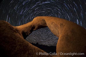
Mobius Arch in the Alabama Hills, seen here at night with swirling star trails formed in the sky above due to a long time exposure.
Location: Alabama Hills Recreational Area, California
Image ID: 27681
Location: Alabama Hills Recreational Area, California
Image ID: 27681
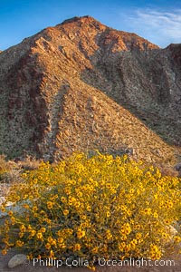
Brittlebush blooms in spring, Palm Canyon, Anza Borrego Desert State Park.
Species: Brittlebush, Encelia farinosa
Location: Anza-Borrego Desert State Park, Borrego Springs, California
Image ID: 24304
Species: Brittlebush, Encelia farinosa
Location: Anza-Borrego Desert State Park, Borrego Springs, California
Image ID: 24304
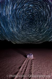
Racetrack sailing stone and star trails. A sliding rock of the Racetrack Playa. The sliding rocks, or sailing stones, move across the mud flats of the Racetrack Playa, leaving trails behind in the mud. The explanation for their movement is not known with certainty, but many believe wind pushes the rocks over wet and perhaps icy mud in winter.
Location: Racetrack Playa, Death Valley National Park, California
Image ID: 27671
Location: Racetrack Playa, Death Valley National Park, California
Image ID: 27671
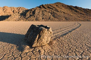
Sailing stone on the Racetrack Playa. The sliding rocks, or sailing stones, move across the mud flats of the Racetrack Playa, leaving trails behind in the mud. The explanation for their movement is not known with certainty, but many believe wind pushes the rocks over wet and perhaps icy mud in winter.
Location: Racetrack Playa, Death Valley National Park, California
Image ID: 27689
Location: Racetrack Playa, Death Valley National Park, California
Image ID: 27689

Sunset at Dead Horse Point Overlook, with the Colorado River flowing 2,000 feet below. 300 million years of erosion has carved the expansive canyons, cliffs and walls below and surrounding Deadhorse Point.
Location: Dead Horse Point State Park, Utah
Image ID: 27823
Panorama dimensions: 5303 x 17695
Location: Dead Horse Point State Park, Utah
Image ID: 27823
Panorama dimensions: 5303 x 17695
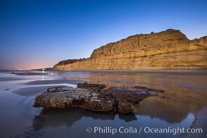
Torrey Pines Cliffs lit at night by a full moon, low tide reflections.
Location: Torrey Pines State Reserve, San Diego, California
Image ID: 28461
Location: Torrey Pines State Reserve, San Diego, California
Image ID: 28461
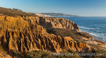
Torrey Pines Cliffs and Pacific Ocean, Razor Point view to La Jolla, San Diego, California.
Location: Torrey Pines State Reserve, San Diego, California
Image ID: 28487
Location: Torrey Pines State Reserve, San Diego, California
Image ID: 28487
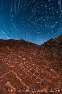
Star Trails over Sky Rock. Sky Rock petroglyphs near Bishop, California. Hidden atop an enormous boulder in the Volcanic Tablelands lies Sky Rock, a set of petroglyphs that face the sky. These superb examples of native American petroglyph artwork are thought to be Paiute in origin, but little is known about them.
Image ID: 28498
Image ID: 28498
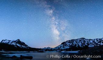
Milky Way over Tioga Lake, Yosemite National Park.
Location: Tioga Lake, Yosemite National Park, California
Image ID: 28521
Location: Tioga Lake, Yosemite National Park, California
Image ID: 28521
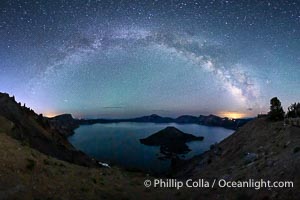
Milky Way and stars over Crater Lake at night. Panorama of Crater Lake and Wizard Island at night, Crater Lake National Park.
Location: Crater Lake National Park, Oregon
Image ID: 28640
Panorama dimensions: 5244 x 9702
Location: Crater Lake National Park, Oregon
Image ID: 28640
Panorama dimensions: 5244 x 9702

A large, powerful wave breaks with offshore winds at the Wedge in Newport Beach.
Location: The Wedge, Newport Beach, California
Image ID: 18706
Location: The Wedge, Newport Beach, California
Image ID: 18706
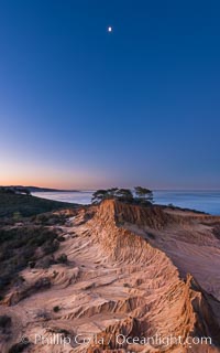
Quarter Moon over Broken Hill, Torrey Pines State Reserve.
Location: Torrey Pines State Reserve, San Diego, California
Image ID: 28366
Location: Torrey Pines State Reserve, San Diego, California
Image ID: 28366
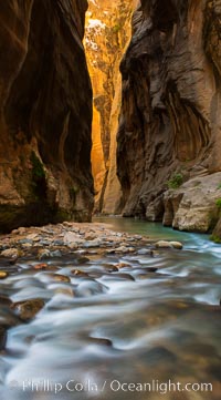
The Virgin River Narrows, where the Virgin River has carved deep, narrow canyons through the Zion National Park sandstone, creating one of the finest hikes in the world.
Location: Virgin River Narrows, Zion National Park, Utah
Image ID: 28583
Location: Virgin River Narrows, Zion National Park, Utah
Image ID: 28583
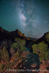
Milky Way over the Watchman, Zion National Park. The Milky Way galaxy rises in the night sky above the the Watchman.
Location: Zion National Park, Utah
Image ID: 28590
Location: Zion National Park, Utah
Image ID: 28590
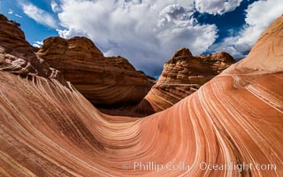
The Wave in the North Coyote Buttes, an area of fantastic eroded sandstone featuring beautiful swirls, wild colors, countless striations, and bizarre shapes set amidst the dramatic surrounding North Coyote Buttes of Arizona and Utah. The sandstone formations of the North Coyote Buttes, including the Wave, date from the Jurassic period. Managed by the Bureau of Land Management, the Wave is located in the Paria Canyon-Vermilion Cliffs Wilderness and is accessible on foot by permit only.
Location: North Coyote Buttes, Paria Canyon-Vermilion Cliffs Wilderness, Arizona
Image ID: 28601
Location: North Coyote Buttes, Paria Canyon-Vermilion Cliffs Wilderness, Arizona
Image ID: 28601
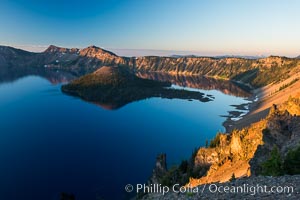
Crater Lake and Wizard Island at sunrise.
Location: Crater Lake National Park, Oregon
Image ID: 28669
Location: Crater Lake National Park, Oregon
Image ID: 28669
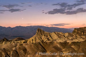
Venus sets over Manley Beacon and the Panamint Mountains, viewed from Zabriskie Point, landscape lit by a full moon, evening, stars.
Location: Zabriskie Point, Death Valley National Park, California
Image ID: 28677
Location: Zabriskie Point, Death Valley National Park, California
Image ID: 28677
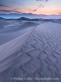
Mesquite Dunes sunrise, dawn, clouds and morning sky, sand dunes.
Location: Stovepipe Wells, Death Valley National Park, California
Image ID: 28680
Location: Stovepipe Wells, Death Valley National Park, California
Image ID: 28680
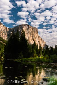
El Capitan and clouds lit by full moon, stars, evening.
Location: El Capitan, Yosemite National Park, California
Image ID: 28695
Location: El Capitan, Yosemite National Park, California
Image ID: 28695
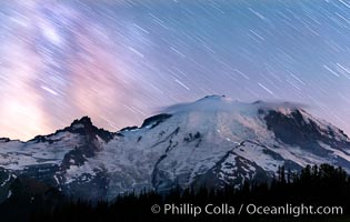
Moutain climbers light see upon Mount Rainier, Milky Way and stars at night above Mount Rainier.
Location: Sunrise, Mount Rainier National Park, Washington
Image ID: 28726
Location: Sunrise, Mount Rainier National Park, Washington
Image ID: 28726
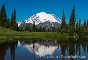
Mount Rainier reflected in Tipsoo Lake.
Location: Tipsoo Lakes, Mount Rainier National Park, Washington
Image ID: 28734
Location: Tipsoo Lakes, Mount Rainier National Park, Washington
Image ID: 28734
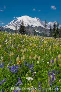
Mount Rainier and alpine wildflowers.
Location: Tipsoo Lakes, Mount Rainier National Park, Washington
Image ID: 28739
Location: Tipsoo Lakes, Mount Rainier National Park, Washington
Image ID: 28739
