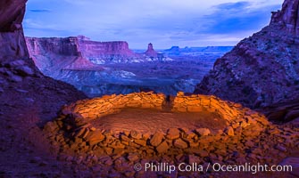
False Kiva at Sunset, Canyonlands National Park, Utah.
Location: False Kiva, Canyonlands National Park, Utah
Image ID: 28017
Location: False Kiva, Canyonlands National Park, Utah
Image ID: 28017
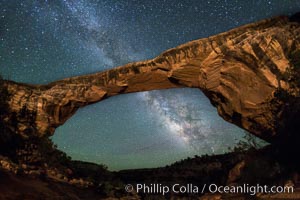
Owachomo Bridge and Milky Way. Owachomo Bridge, a natural stone bridge standing 106' high and spanning 130' wide,stretches across a canyon with the Milky Way crossing the night sky.
Location: Owachomo Bridge, Natural Bridges National Monument, Utah
Image ID: 28545
Location: Owachomo Bridge, Natural Bridges National Monument, Utah
Image ID: 28545
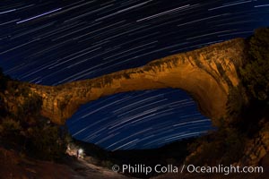
Owachomo Bridge and Star Trails, at night. Owachomo Bridge, a natural stone bridge standing 106' high and spanning 130' wide,stretches across a canyon with the Milky Way crossing the night sky.
Location: Owachomo Bridge, Natural Bridges National Monument, Utah
Image ID: 28550
Location: Owachomo Bridge, Natural Bridges National Monument, Utah
Image ID: 28550
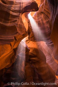
Light Beam in Upper Antelope Slot Canyon. Thin shafts of light briefly penetrate the convoluted narrows of Upper Antelope Slot Canyon, sending piercing beams through the sandstone maze to the sand floor below.
Location: Navajo Tribal Lands, Page, Arizona
Image ID: 28563
Location: Navajo Tribal Lands, Page, Arizona
Image ID: 28563
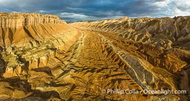
Aerial View of the San Rafael Reef, Utah. This is a canyon-like section of the San Rafael Reef, photographed at sunrise. The "reef proper" is on the right, with its characteristic triangular flatiron erosion. The canyon in the center is a fold in the Earth's crust affiliated with the boundary of the San Rafael Swell. The colors seen here arise primarily from Navajo and Wingate sandstone.
Location: Utah
Image ID: 39497
Panorama dimensions: 4490 x 8439
Location: Utah
Image ID: 39497
Panorama dimensions: 4490 x 8439
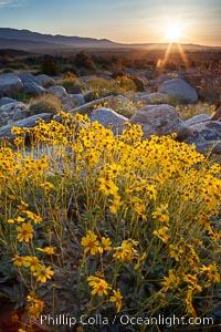
Brittlebush at sunrise, dawn, springtime bloom, Palm Canyon, Anza Borrego Desert State Park.
Species: Brittlebush, Encelia farinosa
Location: Anza-Borrego Desert State Park, Borrego Springs, California
Image ID: 24301
Species: Brittlebush, Encelia farinosa
Location: Anza-Borrego Desert State Park, Borrego Springs, California
Image ID: 24301
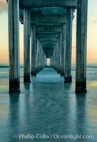
Scripps Pier, predawn abstract study of pier pilings and moving water.
Location: Scripps Institution of Oceanography, La Jolla, California
Image ID: 26340
Location: Scripps Institution of Oceanography, La Jolla, California
Image ID: 26340
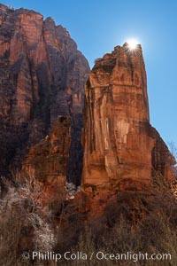
The Pulpit in the Temple of Sinawava, backlit by sun, early morning, Zion Canyon, Utah.
Location: Zion National Park, Utah
Image ID: 37796
Location: Zion National Park, Utah
Image ID: 37796
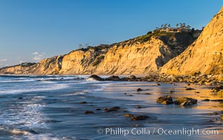
Black's Beach sea cliffs, sunset, looking north from Scripps Pier with Torrey Pines State Reserve in the distance.
Location: La Jolla, California
Image ID: 29165
Location: La Jolla, California
Image ID: 29165

Aerial Panorama of La Jolla, University City, showing (from left) University of California at San Diego, University City, Scripps Institution of Oceanography, La Jolla Shores, Point La Jolla, Mount Soledad, in the background some of the mountains to the east of San Diego. The highest peak in the center of the panoram is Cuyamaca Peak (6512') while the rocky peak directly in front of it is El Cajon Mountain (3675').
Image ID: 29098
Panorama dimensions: 3881 x 20864
Image ID: 29098
Panorama dimensions: 3881 x 20864
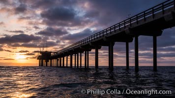
Scripps Pier, Surfer's view from among the waves. Research pier at Scripps Institution of Oceanography SIO, sunset.
Location: Scripps Institution of Oceanography, La Jolla, California
Image ID: 30147
Location: Scripps Institution of Oceanography, La Jolla, California
Image ID: 30147
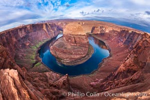
Horseshoe Bend. The Colorado River makes a 180-degree turn at Horseshoe Bend. Here the river has eroded the Navajo sandstone for eons, digging a canyon 1100-feet deep.
Location: Horseshoe Bend, Page, Arizona
Image ID: 26602
Location: Horseshoe Bend, Page, Arizona
Image ID: 26602
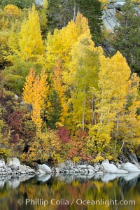
Aspen trees display Eastern Sierra fall colors, Lake Sabrina, Bishop Creek Canyon.
Species: Aspen, Populus tremuloides
Location: Bishop Creek Canyon, Sierra Nevada Mountains, California
Image ID: 17497
Species: Aspen, Populus tremuloides
Location: Bishop Creek Canyon, Sierra Nevada Mountains, California
Image ID: 17497
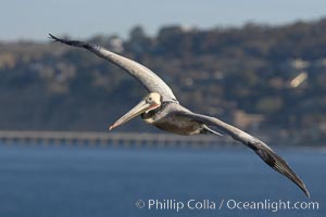
Brown pelican in flight. The wingspan of the brown pelican is over 7 feet wide. The California race of the brown pelican holds endangered species status. In winter months, breeding adults assume a dramatic plumage.
Species: Brown Pelican, Pelecanus occidentalis, Pelecanus occidentalis californicus
Location: La Jolla, California
Image ID: 20053
Species: Brown Pelican, Pelecanus occidentalis, Pelecanus occidentalis californicus
Location: La Jolla, California
Image ID: 20053
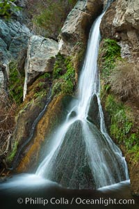
Darwin Falls in Death Valley, near the settlement of Panamint Springs. The falls are fed by a perennial stream that flows through a narrow canyon of plutonic rock, and drop of total of 80' (24m) in two sections.
Location: Death Valley National Park, California
Image ID: 27683
Location: Death Valley National Park, California
Image ID: 27683
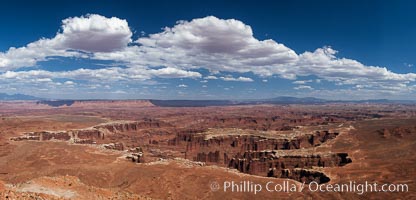
Canyonlands National Park panorama.
Location: Canyonlands National Park, Utah
Image ID: 27817
Panorama dimensions: 5316 x 11049
Location: Canyonlands National Park, Utah
Image ID: 27817
Panorama dimensions: 5316 x 11049
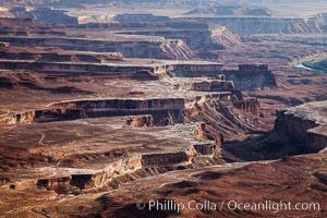
Soda Springs Basin from Green River Overlook, Island in the Sky, Canyonlands National Park, Utah.
Location: Canyonlands National Park, Utah
Image ID: 27841
Location: Canyonlands National Park, Utah
Image ID: 27841
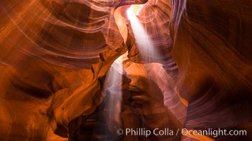
Light Beam in Upper Antelope Slot Canyon. Thin shafts of light briefly penetrate the convoluted narrows of Upper Antelope Slot Canyon, sending piercing beams through the sandstone maze to the sand floor below.
Location: Navajo Tribal Lands, Page, Arizona
Image ID: 28564
Location: Navajo Tribal Lands, Page, Arizona
Image ID: 28564
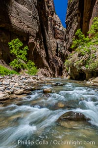
The Virgin River Narrows, where the Virgin River has carved deep, narrow canyons through the Zion National Park sandstone, creating one of the finest hikes in the world.
Location: Virgin River Narrows, Zion National Park, Utah
Image ID: 28585
Location: Virgin River Narrows, Zion National Park, Utah
Image ID: 28585
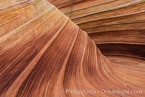
The Wave in the North Coyote Buttes, an area of fantastic eroded sandstone featuring beautiful swirls, wild colors, countless striations, and bizarre shapes set amidst the dramatic surrounding North Coyote Buttes of Arizona and Utah. The sandstone formations of the North Coyote Buttes, including the Wave, date from the Jurassic period. Managed by the Bureau of Land Management, the Wave is located in the Paria Canyon-Vermilion Cliffs Wilderness and is accessible on foot by permit only.
Location: North Coyote Buttes, Paria Canyon-Vermilion Cliffs Wilderness, Arizona
Image ID: 28602
Location: North Coyote Buttes, Paria Canyon-Vermilion Cliffs Wilderness, Arizona
Image ID: 28602
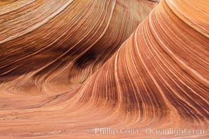
The Wave in the North Coyote Buttes, an area of fantastic eroded sandstone featuring beautiful swirls, wild colors, countless striations, and bizarre shapes set amidst the dramatic surrounding North Coyote Buttes of Arizona and Utah. The sandstone formations of the North Coyote Buttes, including the Wave, date from the Jurassic period. Managed by the Bureau of Land Management, the Wave is located in the Paria Canyon-Vermilion Cliffs Wilderness and is accessible on foot by permit only.
Location: North Coyote Buttes, Paria Canyon-Vermilion Cliffs Wilderness, Arizona
Image ID: 28603
Location: North Coyote Buttes, Paria Canyon-Vermilion Cliffs Wilderness, Arizona
Image ID: 28603
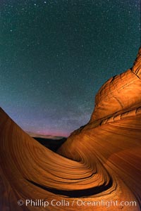
The Wave at Night, under a clear night sky full of stars. The Wave, an area of fantastic eroded sandstone featuring beautiful swirls, wild colors, countless striations, and bizarre shapes set amidst the dramatic surrounding North Coyote Buttes of Arizona and Utah. The sandstone formations of the North Coyote Buttes, including the Wave, date from the Jurassic period. Managed by the Bureau of Land Management, the Wave is located in the Paria Canyon-Vermilion Cliffs Wilderness and is accessible on foot by permit only.
Location: North Coyote Buttes, Paria Canyon-Vermilion Cliffs Wilderness, Arizona
Image ID: 28623
Location: North Coyote Buttes, Paria Canyon-Vermilion Cliffs Wilderness, Arizona
Image ID: 28623
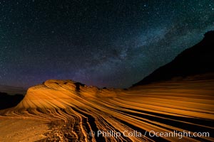
The Second Wave at Night. The Second Wave, a spectacular sandstone formation in the North Coyote Buttes, lies under a sky full of stars.
Location: North Coyote Buttes, Paria Canyon-Vermilion Cliffs Wilderness, Arizona
Image ID: 28628
Location: North Coyote Buttes, Paria Canyon-Vermilion Cliffs Wilderness, Arizona
Image ID: 28628
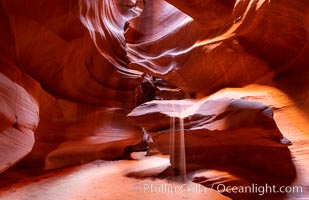
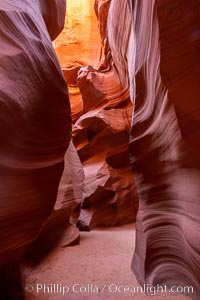
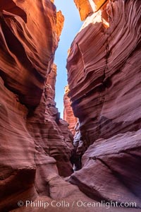
Upper Antelope Canyon, a deep, narrow and spectacular slot canyon lying on Navajo Tribal lands near Page, Arizona.
Location: Navajo Tribal Lands, Page, Arizona
Image ID: 35934
Location: Navajo Tribal Lands, Page, Arizona
Image ID: 35934
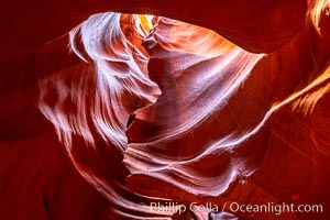
Upper Antelope Canyon, a deep, narrow and spectacular slot canyon lying on Navajo Tribal lands near Page, Arizona.
Location: Navajo Tribal Lands, Page, Arizona
Image ID: 35935
Location: Navajo Tribal Lands, Page, Arizona
Image ID: 35935
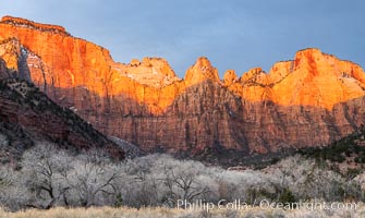
West Temple, The Sundial and the Altar of Sacrifice at sunrise.
Location: Zion National Park, Utah
Image ID: 37791
Location: Zion National Park, Utah
Image ID: 37791
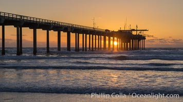
Scripps Pier at sunset.
Location: Scripps Institution of Oceanography, La Jolla, California
Image ID: 29171
Location: Scripps Institution of Oceanography, La Jolla, California
Image ID: 29171
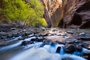
Yellow cottonwood trees in autumn, fall colors in the Virgin River Narrows in Zion National Park.
Location: Virgin River Narrows, Zion National Park, Utah
Image ID: 26089
Location: Virgin River Narrows, Zion National Park, Utah
Image ID: 26089
