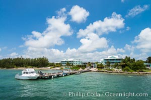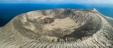
Barcena volcano crater, highest point on San Benedicto Island, Revillagigedos, Mexico.
Location: San Benedicto Island (Islas Revillagigedos), Baja California, Mexico
Image ID: 32922
Panorama dimensions: 3742 x 8857
Location: San Benedicto Island (Islas Revillagigedos), Baja California, Mexico
Image ID: 32922
Panorama dimensions: 3742 x 8857
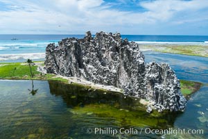
Clipperton Rock, a 95' high volcanic remnant, is the highest point on Clipperton Island, a spectacular coral atoll in the eastern Pacific. By permit HC / 1485 / CAB (France).
Location: Clipperton Island, France
Image ID: 32940
Location: Clipperton Island, France
Image ID: 32940
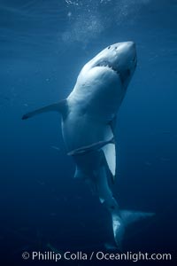
Great white shark, underwater.
Species: Great white shark, Carcharodon carcharias
Location: Guadalupe Island (Isla Guadalupe), Baja California, Mexico
Image ID: 21362
Species: Great white shark, Carcharodon carcharias
Location: Guadalupe Island (Isla Guadalupe), Baja California, Mexico
Image ID: 21362
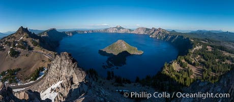
Panorama of Crater Lake from Watchman Lookout Station, panoramic picture. The Watchman Lookout Station No. 168 is one of two fire lookout towers in Crater Lake National Park in southern Oregon. For many years, National Park Service personnel used the lookout to watch for wildfires during the summer months. It is also a popular hiking destination because it offers an excellent view of Crater Lake and the surrounding area.
Location: Crater Lake National Park, Oregon
Image ID: 28633
Panorama dimensions: 4885 x 11229
Location: Crater Lake National Park, Oregon
Image ID: 28633
Panorama dimensions: 4885 x 11229
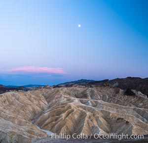
Full moon over Zabriskie Point landscape.
Location: Zabriskie Point, Death Valley National Park, California
Image ID: 28676
Location: Zabriskie Point, Death Valley National Park, California
Image ID: 28676
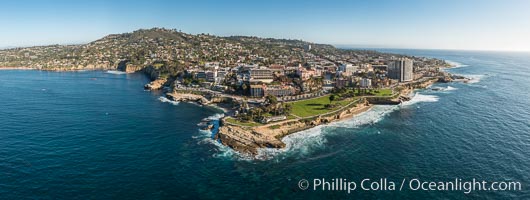
Aerial Panoramic Photo of Point La Jolla and La Jolla Cove, Boomer Beach, Scripps Park. Panoramic aerial photograph of La Jolla Cove and Scripps Parks (center), with La Jolla’s Mount Soledad rising above, La Jolla Shores and La Jolla Caves to the left and the La Jolla Coast with Children’s Pool (Casa Cove) to the right. The undersea reefs of Boomer Beach are seen through the clear, calm ocean waters. This extremely high resolution panorama will print 50″ high by 130″ long with no interpolation.
Location: La Jolla, California
Image ID: 30773
Panorama dimensions: 7744 x 20541
Location: La Jolla, California
Image ID: 30773
Panorama dimensions: 7744 x 20541
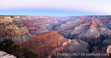
Belt of Venus over Grand Canyon at sunrise, viewed from Hopi Point on the south rim of Grand Canyon National Park. The Belt of Venus, or anti-twilight arch, is the shadow of the earth cast upon the atmosphere just above the horizon, and occurs a few minutes before sunrise or after sunset.
Location: Grand Canyon National Park, Arizona
Image ID: 37765
Panorama dimensions: 5409 x 10272
Location: Grand Canyon National Park, Arizona
Image ID: 37765
Panorama dimensions: 5409 x 10272

Great white shark, underwater.
Species: Great white shark, Carcharodon carcharias
Location: Guadalupe Island (Isla Guadalupe), Baja California, Mexico
Image ID: 21360
Species: Great white shark, Carcharodon carcharias
Location: Guadalupe Island (Isla Guadalupe), Baja California, Mexico
Image ID: 21360
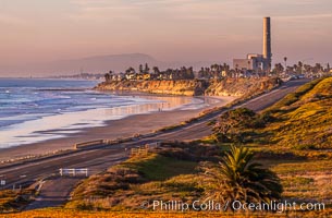
Carlsbad Coast Highway Sunset, Terramar and North Ponto to Oceanside with Camp Pendleton in the distance. Rising in the distance is San Onofre Mountain (1722') topped by a tall signal tower, one of the southern peaks in the Santa Ana Mountains.
Location: Carlsbad, California
Image ID: 35902
Location: Carlsbad, California
Image ID: 35902
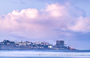
Point La Jolla viewed from Scripps Institution of Oceanography, big waves at sunrise.
Location: La Jolla, California
Image ID: 36630
Location: La Jolla, California
Image ID: 36630
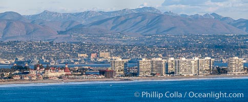
Hotel Del Coronado and Coronado Island City Skyline, viewed from Point Loma.
Location: San Diego, California
Image ID: 36632
Panorama dimensions: 5619 x 13610
Location: San Diego, California
Image ID: 36632
Panorama dimensions: 5619 x 13610

San Diego City Skyline at Sunset, viewed from Point Loma, panoramic photograph.
Location: San Diego, California
Image ID: 36633
Panorama dimensions: 5531 x 26407
Location: San Diego, California
Image ID: 36633
Panorama dimensions: 5531 x 26407

Full Moon Rises over the San Diego City Skyline and Mount Laguna, viewed from Point Loma, panoramic photograph.
Location: San Diego, California
Image ID: 36635
Panorama dimensions: 5258 x 15796
Location: San Diego, California
Image ID: 36635
Panorama dimensions: 5258 x 15796
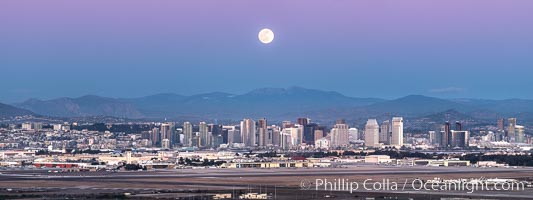
Full Moon Rises over the San Diego City Skyline and Mount Laguna, viewed from Point Loma, panoramic photograph.
Location: San Diego, California
Image ID: 36636
Panorama dimensions: 5432 x 14480
Location: San Diego, California
Image ID: 36636
Panorama dimensions: 5432 x 14480

San Diego City Skyline at Sunset, viewed from Point Loma, panoramic photograph.
Location: San Diego, California
Image ID: 36637
Panorama dimensions: 4988 x 25798
Location: San Diego, California
Image ID: 36637
Panorama dimensions: 4988 x 25798

San Diego City Skyline at Sunset, viewed from Point Loma, panoramic photograph.
Location: San Diego, California
Image ID: 36643
Panorama dimensions: 4820 x 9841
Location: San Diego, California
Image ID: 36643
Panorama dimensions: 4820 x 9841
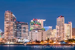
San Diego City Skyline at Sunset, viewed from Point Loma, panoramic photograph.
Location: San Diego, California
Image ID: 36644
Location: San Diego, California
Image ID: 36644
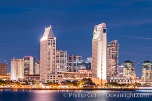
San Diego City Skyline at Sunset, viewed from Point Loma, panoramic photograph.
Location: San Diego, California
Image ID: 36645
Location: San Diego, California
Image ID: 36645

San Diego City Skyline at Sunset, viewed from Point Loma, panoramic photograph.
Location: San Diego, California
Image ID: 36648
Panorama dimensions: 5077 x 20742
Location: San Diego, California
Image ID: 36648
Panorama dimensions: 5077 x 20742

Half Dome and Yosemite High Country from Sierra Point.
Location: Yosemite National Park, California
Image ID: 36905
Panorama dimensions: 5490 x 18963
Location: Yosemite National Park, California
Image ID: 36905
Panorama dimensions: 5490 x 18963

Belt of Venus and Earth Shadow at Dawn. The Belt of Venus is actually alpenglow visible near the horizon during twilight, above the antisolar point. Like alpenglow, the backscatter of reddened sunlight also creates the Belt of Venus. Unlike alpenglow, the sunlight scattered by fine particulates that cause the rosy arch of the Belt shines high in the atmosphere and lasts for a while after sunset or before sunrise.
Location: La Jolla, California
Image ID: 37476
Location: La Jolla, California
Image ID: 37476
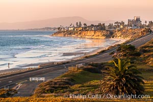
Carlsbad Coast Highway Sunset, Terramar and North Ponto to Oceanside with Camp Pendleton in the distance. Rising in the distance is San Onofre Mountain (1722') topped by a tall signal tower, one of the southern peaks in the Santa Ana Mountains.
Location: Carlsbad, California
Image ID: 37478
Location: Carlsbad, California
Image ID: 37478
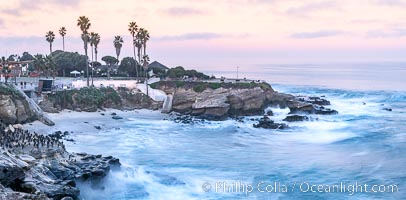
La Jolla Cove and Point La Jolla at Dawn, waves blur into abstract white, pre-sunrise soft light.
Location: La Jolla, California
Image ID: 38916
Panorama dimensions: 5384 x 10917
Location: La Jolla, California
Image ID: 38916
Panorama dimensions: 5384 x 10917
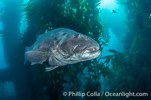
Giant Black Sea Bass with Distinctive Identifying Black Spots that allow researchers to carry out sight/resight studies on the animals distributions and growth. Black sea bass can reach 500 pounds and 8 feet in length.
Species: Giant black sea bass, Stereolepis gigas
Location: Catalina Island, California
Image ID: 39437
Species: Giant black sea bass, Stereolepis gigas
Location: Catalina Island, California
Image ID: 39437
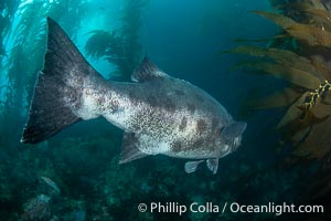
Broad Tail of a Black Sea Bass in the California Kelp Forest showing distinctive unique black spots that allow researchers to identify individual giant sea bass.
Species: Giant black sea bass, Stereolepis gigas
Location: Catalina Island, California
Image ID: 39438
Species: Giant black sea bass, Stereolepis gigas
Location: Catalina Island, California
Image ID: 39438
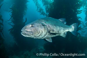
Giant black sea bass in the kelp forest at Catalina Island. An Endangered Giant Sea Bass can reach up to 8 feet in length and 500 pounds, seen here amid the giant kelp forest of Catalina Island. Once nearly fished to extinction and now thought to be at risk of a genetic bottleneck, the giant sea bass is slowly recovering and can be seen in summer months in California's kelp forests.
Species: Giant black sea bass, Stereolepis gigas
Location: Catalina Island, California
Image ID: 39439
Species: Giant black sea bass, Stereolepis gigas
Location: Catalina Island, California
Image ID: 39439
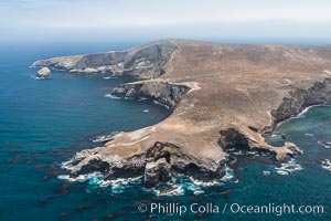
Webster Point, Santa Barbara Island, aerial photograph.
Location: Santa Barbara Island, California
Image ID: 29365
Location: Santa Barbara Island, California
Image ID: 29365
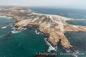
Point Bennett, San Miguel Island, aerial photograph.
Location: San Miguel Island, California
Image ID: 29381
Location: San Miguel Island, California
Image ID: 29381

San Diego Bay and Skyline, viewed from Point Loma, panoramic photograph.
Location: San Diego, California
Image ID: 30208
Panorama dimensions: 5662 x 20337
Location: San Diego, California
Image ID: 30208
Panorama dimensions: 5662 x 20337
