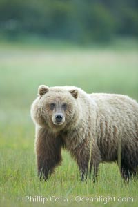
Coastal brown bear in meadow. The tall sedge grasses in this coastal meadow are a food source for brown bears, who may eat 30 lbs of it each day during summer while waiting for their preferred food, salmon, to arrive in the nearby rivers.
Species: Brown bear, Ursus arctos
Location: Lake Clark National Park, Alaska
Image ID: 19155
Species: Brown bear, Ursus arctos
Location: Lake Clark National Park, Alaska
Image ID: 19155
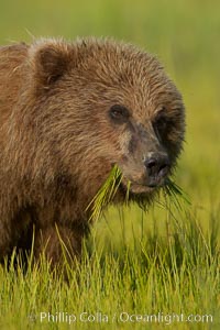
Young brown bear grazes in tall sedge grass. Brown bears can consume 30 lbs of sedge grass daily, waiting weeks until spawning salmon fill the rivers.
Species: Brown bear, Ursus arctos
Location: Lake Clark National Park, Alaska
Image ID: 19156
Species: Brown bear, Ursus arctos
Location: Lake Clark National Park, Alaska
Image ID: 19156
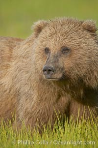
Portrait of a young brown bear, pausing while grazing in tall sedge grass. Brown bears can consume 30 lbs of sedge grass daily, waiting weeks until spawning salmon fill the rivers.
Species: Brown bear, Ursus arctos
Location: Lake Clark National Park, Alaska
Image ID: 19157
Species: Brown bear, Ursus arctos
Location: Lake Clark National Park, Alaska
Image ID: 19157
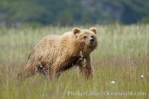
Coastal brown bear cub, one and a half years old, near Johnson River. This cub will remain with its mother for about another six months, and will be on its own next year.
Species: Brown bear, Ursus arctos
Location: Johnson River, Lake Clark National Park, Alaska
Image ID: 19159
Species: Brown bear, Ursus arctos
Location: Johnson River, Lake Clark National Park, Alaska
Image ID: 19159
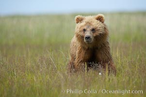
Coastal brown bear cub, one and a half years old, near Johnson River. This cub will remain with its mother for about another six months, and will be on its own next year.
Species: Brown bear, Ursus arctos
Location: Johnson River, Lake Clark National Park, Alaska
Image ID: 19199
Species: Brown bear, Ursus arctos
Location: Johnson River, Lake Clark National Park, Alaska
Image ID: 19199
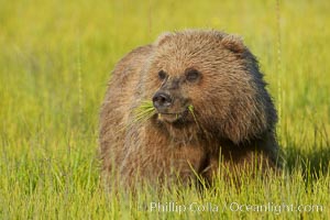
Young brown bear grazes in tall sedge grass. Brown bears can consume 30 lbs of sedge grass daily, waiting weeks until spawning salmon fill the rivers.
Species: Brown bear, Ursus arctos
Location: Lake Clark National Park, Alaska
Image ID: 19244
Species: Brown bear, Ursus arctos
Location: Lake Clark National Park, Alaska
Image ID: 19244
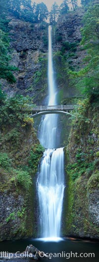
Multnomah Falls. Plummeting 620 feet from its origins on Larch Mountain, Multnomah Falls is the second highest year-round waterfall in the United States. Nearly two million visitors a year come to see this ancient waterfall making it Oregon's number one public destination.
Location: Multnomah Falls, Columbia River Gorge National Scenic Area, Oregon
Image ID: 19313
Panorama dimensions: 12453 x 4705
Location: Multnomah Falls, Columbia River Gorge National Scenic Area, Oregon
Image ID: 19313
Panorama dimensions: 12453 x 4705
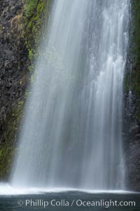
Horsetail Falls drops 176 feet just a few yards off the Columbia Gorge Scenic Highway.
Location: Horsetail Falls, Columbia River Gorge National Scenic Area, Oregon
Image ID: 19318
Location: Horsetail Falls, Columbia River Gorge National Scenic Area, Oregon
Image ID: 19318
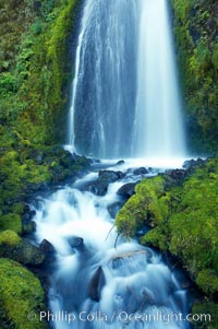
Wahkeena Falls drops 249 feet in several sections through a lush green temperate rainforest.
Location: Wahkeena Falls, Columbia River Gorge National Scenic Area, Oregon
Image ID: 19324
Location: Wahkeena Falls, Columbia River Gorge National Scenic Area, Oregon
Image ID: 19324
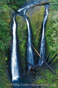
Triple Falls, in the upper part of Oneonta Gorge, fall 130 feet through a lush, beautiful temperate rainforest.
Location: Triple Falls, Columbia River Gorge National Scenic Area, Oregon
Image ID: 19326
Location: Triple Falls, Columbia River Gorge National Scenic Area, Oregon
Image ID: 19326
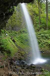
Ponytail Falls, where Horsetail Creeks drops 100 feet over an overhang below which hikers can walk.
Location: Ponytail Falls, Columbia River Gorge National Scenic Area, Oregon
Image ID: 19337
Location: Ponytail Falls, Columbia River Gorge National Scenic Area, Oregon
Image ID: 19337
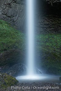
Latourelle Falls, in Guy W. Talbot State Park, drops 249 feet through a lush forest near the Columbia River.
Location: Latourelle Falls, Columbia River Gorge National Scenic Area, Oregon
Image ID: 19347
Location: Latourelle Falls, Columbia River Gorge National Scenic Area, Oregon
Image ID: 19347
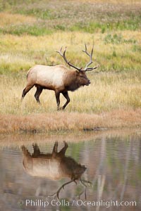
Male elk bugling during the fall rut. Large male elk are known as bulls. Male elk have large antlers which are shed each year. Male elk engage in competitive mating behaviors during the rut, including posturing, antler wrestling and bugling, a loud series of screams which is intended to establish dominance over other males and attract females.
Species: Elk, Cervus canadensis
Location: Madison River, Yellowstone National Park, Wyoming
Image ID: 19697
Species: Elk, Cervus canadensis
Location: Madison River, Yellowstone National Park, Wyoming
Image ID: 19697

Monument Valley panorama, a composite of twelve individual photographs.
Location: Monument Valley, Arizona
Image ID: 20901
Panorama dimensions: 3303 x 30000
Location: Monument Valley, Arizona
Image ID: 20901
Panorama dimensions: 3303 x 30000
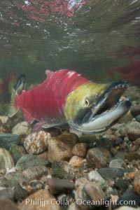
A male sockeye salmon, showing injuries sustained as it migrated hundreds of miles from the ocean up the Fraser River, swims upstream in the Adams River to reach the place where it will fertilize eggs laid by a female in the rocks. It will die so after spawning.
Species: Sockeye salmon, Oncorhynchus nerka
Location: Adams River, Roderick Haig-Brown Provincial Park, British Columbia, Canada
Image ID: 26147
Species: Sockeye salmon, Oncorhynchus nerka
Location: Adams River, Roderick Haig-Brown Provincial Park, British Columbia, Canada
Image ID: 26147
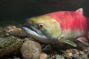
Adams River sockeye salmon. A female sockeye salmon swims upstream in the Adams River to spawn, having traveled hundreds of miles upstream from the ocean.
Species: Sockeye salmon, Oncorhynchus nerka
Location: Adams River, Roderick Haig-Brown Provincial Park, British Columbia, Canada
Image ID: 26157
Species: Sockeye salmon, Oncorhynchus nerka
Location: Adams River, Roderick Haig-Brown Provincial Park, British Columbia, Canada
Image ID: 26157
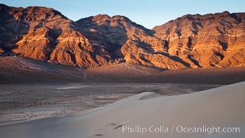
Sunset on the Last Chance Mountain Range, seen from Eureka Valley Sand Dunes.
Location: Eureka Dunes, Death Valley National Park, California
Image ID: 25238
Location: Eureka Dunes, Death Valley National Park, California
Image ID: 25238
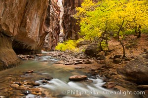
The Virgin River flows by autumn cottonwood trees, part of the Virgin River Narrows. This is a fantastic hike in fall with the comfortable temperatures, beautiful fall colors and light crowds.
Location: Virgin River Narrows, Zion National Park, Utah
Image ID: 26098
Location: Virgin River Narrows, Zion National Park, Utah
Image ID: 26098
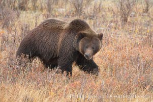
Grizzly bear in Yellowstone National Park in autumn, fall, walking through brown grasses.
Species: Grizzly bear, Ursus arctos horribilis
Location: Lamar Valley, Yellowstone National Park, Wyoming
Image ID: 19614
Species: Grizzly bear, Ursus arctos horribilis
Location: Lamar Valley, Yellowstone National Park, Wyoming
Image ID: 19614
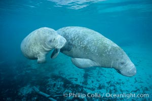
Two Florida manatees, or West Indian Manatees, swim together in the clear waters of Crystal River. Florida manatees are endangered.
Species: West indian manatee, Trichechus manatus
Location: Three Sisters Springs, Crystal River, Florida
Image ID: 02628
Species: West indian manatee, Trichechus manatus
Location: Three Sisters Springs, Crystal River, Florida
Image ID: 02628
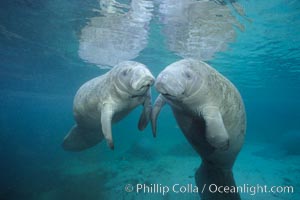
Two Florida manatees, or West Indian Manatees, swim together in the clear waters of Crystal River. Florida manatees are endangered.
Species: West indian manatee, Trichechus manatus
Location: Three Sisters Springs, Crystal River, Florida
Image ID: 02629
Species: West indian manatee, Trichechus manatus
Location: Three Sisters Springs, Crystal River, Florida
Image ID: 02629
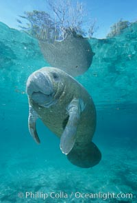
A Florida manatee, or West Indian Manatee, hovers in the clear waters of Crystal River.
Species: West indian manatee, Trichechus manatus
Location: Three Sisters Springs, Crystal River, Florida
Image ID: 02653
Species: West indian manatee, Trichechus manatus
Location: Three Sisters Springs, Crystal River, Florida
Image ID: 02653
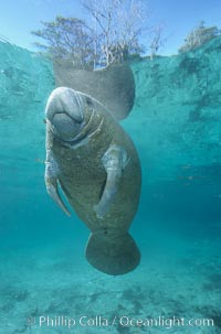
A Florida manatee, or West Indian Manatee, hovers in the clear waters of Crystal River.
Species: West indian manatee, Trichechus manatus
Location: Three Sisters Springs, Crystal River, Florida
Image ID: 02654
Species: West indian manatee, Trichechus manatus
Location: Three Sisters Springs, Crystal River, Florida
Image ID: 02654
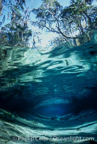
Three Sisters Springs depicted in an underwater landscape with sand, clear water and trees.
Location: Three Sisters Springs, Crystal River, Florida
Image ID: 02673
Location: Three Sisters Springs, Crystal River, Florida
Image ID: 02673
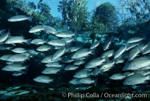
Mangrove snapper schooling in the clear waters of Crystal River, with trees in the background.
Species: Mangrove snapper, Lutjanus griseus
Location: Three Sisters Springs, Crystal River, Florida
Image ID: 02688
Species: Mangrove snapper, Lutjanus griseus
Location: Three Sisters Springs, Crystal River, Florida
Image ID: 02688
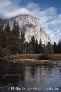
El Capitan and Merced River, Yosemite Valley.
Location: El Capitan, Yosemite National Park, California
Image ID: 05413
Location: El Capitan, Yosemite National Park, California
Image ID: 05413
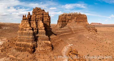
Molly's Castle, aerial view, Goblin Valley State Park. Curtis Formation whiteish caprock is on top, with reddish Entrada Sandstone below, both of Jurassic era. Molly's castle lies in the San Rafael desert near Goblin Valley, and drains into the Colorado River watershed. Aerial panoramic photograph.
Location: Goblin Valley State Park, Utah
Image ID: 37950
Location: Goblin Valley State Park, Utah
Image ID: 37950
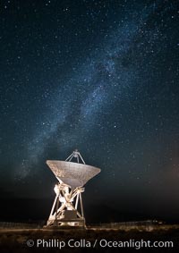
Radio telescope antenna, part of the Very Long Baseline Array (VLBA). The Very Long Baseline Array (VLBA) is a system of ten radio telescopes which are operated remotely from their Array Operations Center located in Socorro, New Mexico, as a part of the National Radio Astronomy Observatory (NRAO). These ten radio antennas work together as an array that forms the longest system in the world that uses very long baseline interferometry.
Location: Big Pine, California
Image ID: 28787
Location: Big Pine, California
Image ID: 28787
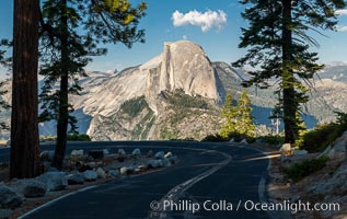
Half Dome and the Glacier Point Road, Yosemite National Park.
Location: Yosemite National Park, California
Image ID: 36380
Location: Yosemite National Park, California
Image ID: 36380
