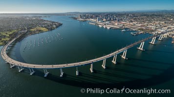
Aerial Photo of San Diego Coronado Bridge, known locally as the Coronado Bridge, links San Diego with Coronado, California. The bridge was completed in 1969 and was a toll bridge until 2002. It is 2.1 miles long and reaches a height of 200 feet above San Diego Bay. Coronado Island is to the left, and downtown San Diego is to the right in this view looking north.
Image ID: 30763
Image ID: 30763
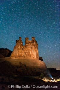
Stars over the Three Gossips, Arches National Park.
Location: Courthouse Towers, Arches National Park, Utah
Image ID: 29270
Location: Courthouse Towers, Arches National Park, Utah
Image ID: 29270
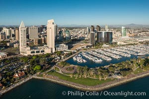
Aerial Phot of Marriott Hotel towers, rising above the Embarcadero Marine Park and yacht marina.
Image ID: 30766
Image ID: 30766
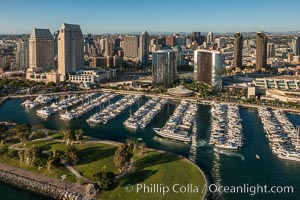
Aerial Phot of Marriott Hotel towers, rising above the Embarcadero Marine Park and yacht marina.
Image ID: 30767
Image ID: 30767
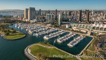
Aerial Phot of Marriott Hotel towers, rising above the Embarcadero Marine Park and yacht marina.
Image ID: 30768
Image ID: 30768
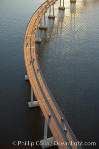
San Diego Coronado Bridge, known locally as the Coronado Bridge, links San Diego with Coronado, California. The bridge was completed in 1969 and was a toll bridge until 2002. It is 2.1 miles long and reaches a height of 200 feet above San Diego Bay.
Location: San Diego, California
Image ID: 22327
Location: San Diego, California
Image ID: 22327
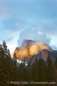
Half Dome and storm clouds at sunset, viewed from Sentinel Bridge.
Location: Half Dome, Yosemite National Park, California
Image ID: 22760
Location: Half Dome, Yosemite National Park, California
Image ID: 22760
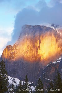
Half Dome and storm clouds at sunset, viewed from Sentinel Bridge.
Location: Half Dome, Yosemite National Park, California
Image ID: 22761
Location: Half Dome, Yosemite National Park, California
Image ID: 22761
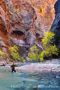
Photographer in the Virgin River Narrows, with flowing water, autumn cottonwood trees and towering red sandstone cliffs.
Location: Virgin River Narrows, Zion National Park, Utah
Image ID: 26130
Location: Virgin River Narrows, Zion National Park, Utah
Image ID: 26130
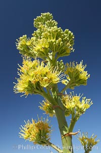
Desert agave, also known as the Century Plant, blooms in spring in Anza-Borrego Desert State Park. Desert agave is the only agave species to be found on the rocky slopes and flats bordering the Coachella Valley. It occurs over a wide range of elevations from 500 to over 4,000. It is called century plant in reference to the amount of time it takes it to bloom. This can be anywhere from 5 to 20 years. They send up towering flower stalks that can approach 15 feet in height. Sending up this tremendous display attracts a variety of pollinators including bats, hummingbirds, bees, moths and other insects and nectar-eating birds.
Species: Desert agave, Agave deserti
Image ID: 11551
Species: Desert agave, Agave deserti
Image ID: 11551
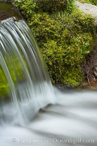
Fern Springs, a small natural spring in Yosemite Valley near the Pohono Bridge, trickles quietly over rocks as it flows into the Merced River. Yosemite Valley.
Location: Fern Springs, Yosemite National Park, California
Image ID: 16086
Location: Fern Springs, Yosemite National Park, California
Image ID: 16086
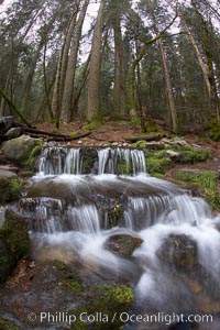
Fern Springs, a small natural spring in Yosemite Valley near the Pohono Bridge, trickles quietly over rocks as it flows into the Merced River.
Location: Fern Springs, Yosemite National Park, California
Image ID: 22754
Location: Fern Springs, Yosemite National Park, California
Image ID: 22754
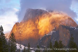
Half Dome and storm clouds at sunset, viewed from Sentinel Bridge.
Location: Half Dome, Yosemite National Park, California
Image ID: 22762
Location: Half Dome, Yosemite National Park, California
Image ID: 22762
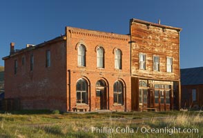
Main Street buildings, Dechambeau Hotel (left) and I.O.O.F. Hall (right).
Location: Bodie State Historical Park, California
Image ID: 23104
Location: Bodie State Historical Park, California
Image ID: 23104
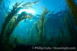
Kelp forest, sunlight filters through towering stands of giant kelp, underwater.
Species: Giant kelp, Macrocystis pyrifera
Location: Catalina Island, California
Image ID: 23448
Species: Giant kelp, Macrocystis pyrifera
Location: Catalina Island, California
Image ID: 23448
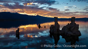
Tufa towers rise from Mono Lake, with the Eastern Sierra visible in the distance. Tufa towers are formed when underwater springs rich in calcium mix with lakewater rich in carbonates, forming calcium carbonate (limestone) structures below the surface of the lake. The towers were eventually revealed when the water level in the lake was lowered starting in 1941.
Location: Mono Lake, California
Image ID: 26983
Location: Mono Lake, California
Image ID: 26983
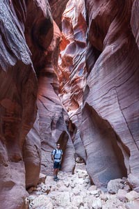
Hiker in Buckskin Gulch. A hiker considers the towering walls and narrow passageway of Buckskin Gulch, a dramatic slot canyon forged by centuries of erosion through sandstone. Buckskin Gulch is the worlds longest accessible slot canyon, running from the Paria River toward the Colorado River. Flash flooding is a serious danger in the narrows where there is no escape.
Location: Buckskin Gulch, Paria Canyon-Vermilion Cliffs Wilderness, Arizona
Image ID: 20716
Location: Buckskin Gulch, Paria Canyon-Vermilion Cliffs Wilderness, Arizona
Image ID: 20716
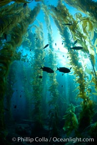
Kelp forest, sunlight filters through towering stands of giant kelp, underwater.
Species: Giant kelp, Macrocystis pyrifera
Location: Catalina Island, California
Image ID: 23456
Species: Giant kelp, Macrocystis pyrifera
Location: Catalina Island, California
Image ID: 23456
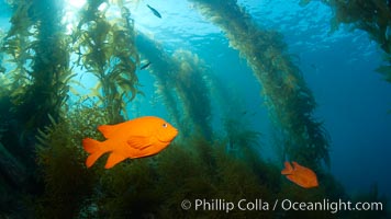
Garibaldi swims in the kelp forest, sunlight filters through towering giant kelp plants rising from the ocean bottom to the surface, underwater.
Species: Garibaldi, Hypsypops rubicundus
Location: Catalina Island, California
Image ID: 23457
Species: Garibaldi, Hypsypops rubicundus
Location: Catalina Island, California
Image ID: 23457
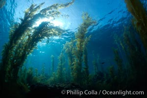
Kelp forest, sunlight filters through towering stands of giant kelp, underwater.
Species: Giant kelp, Macrocystis pyrifera
Location: Catalina Island, California
Image ID: 23482
Species: Giant kelp, Macrocystis pyrifera
Location: Catalina Island, California
Image ID: 23482
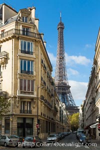
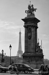
La Tour Eiffel. The Eiffel Tower is an iron lattice tower located on the Champ de Mars in Paris, named after the engineer Gustave Eiffel, who designed the tower in 1889 as the entrance arch to the 1889 World's Fair. The Eiffel tower is the tallest structure in Paris and the most-visited paid monument in the world.
Location: Tour Eiffel, Paris, France
Image ID: 28147
Location: Tour Eiffel, Paris, France
Image ID: 28147

Ile Saint-Louis, is one of two natural islands in the Seine river, in Paris, France. The island is named after King Louis IX of France (Saint Louis). The island is connected to the rest of Paris by bridges to both banks of the river and by the Pont Saint Louis to the Ile de la Cite.
Location: Ile Saint-Louis, Paris, France
Image ID: 28189
Panorama dimensions: 3437 x 12063
Location: Ile Saint-Louis, Paris, France
Image ID: 28189
Panorama dimensions: 3437 x 12063
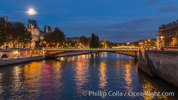
Ile Saint-Louis, is one of two natural islands in the Seine river, in Paris, France. The island is named after King Louis IX of France (Saint Louis). The island is connected to the rest of Paris by bridges to both banks of the river and by the Pont Saint Louis to the Ile de la Cite.
Location: Ile Saint-Louis, Paris, France
Image ID: 28190
Location: Ile Saint-Louis, Paris, France
Image ID: 28190
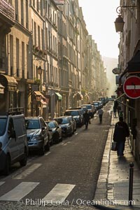
Rue de Ile Saint-Louis, early morning, Paris. Ile Saint-Louis is one of two natural islands in the Seine river, in Paris, France. The island is named after King Louis IX of France (Saint Louis). The island is connected to the rest of Paris by bridges to both banks of the river and by the Pont Saint Louis to the Ile de la Cite.
Location: Ile Saint-Louis, Paris, France
Image ID: 28216
Location: Ile Saint-Louis, Paris, France
Image ID: 28216
