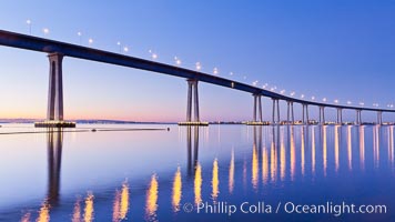
San Diego Coronado Bridge, linking San Diego to the island community of Coronado, spans San Diego Bay. Dawn, lavender sky.
Location: San Diego, California
Image ID: 27703
Location: San Diego, California
Image ID: 27703
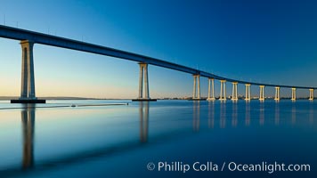
San Diego Coronado Bridge, linking San Diego to the island community of Coronado, spans San Diego Bay. Dawn.
Location: San Diego, California
Image ID: 27704
Location: San Diego, California
Image ID: 27704
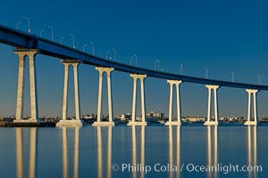
San Diego Coronado Bridge, linking San Diego to the island community of Coronado, spans San Diego Bay. Dawn.
Location: San Diego, California
Image ID: 27705
Location: San Diego, California
Image ID: 27705
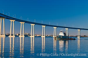
San Diego Coronado Bridge, linking San Diego to the island community of Coronado, spans San Diego Bay. Dawn.
Location: San Diego, California
Image ID: 27706
Location: San Diego, California
Image ID: 27706
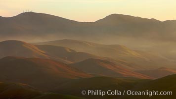
Hills between Morro Bay and Atascadero, early morning light, power transmission lines and signal attenae.
Location: Morro Bay, California
Image ID: 22220
Location: Morro Bay, California
Image ID: 22220
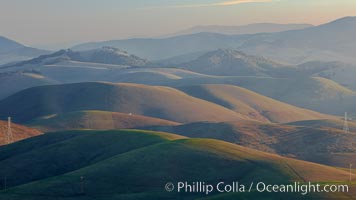
Hills between Morro Bay and Atascadero, early morning light, power transmission lines and signal attenae.
Location: Morro Bay, California
Image ID: 22221
Location: Morro Bay, California
Image ID: 22221

Crazy taxi ride through the streets of New York City.
Location: Manhattan, New York City
Image ID: 11187
Location: Manhattan, New York City
Image ID: 11187
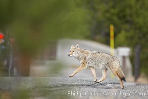
Coyote crosses a road in front of a car. Dozens of coyotes, wolves, bears, elk and bison are killed each year in Yellowstone as they attempt to cross the roads in front of drivers who are not paying attention or speeding.
Species: Coyote, Canis latrans
Location: Yellowstone National Park, Wyoming
Image ID: 19649
Species: Coyote, Canis latrans
Location: Yellowstone National Park, Wyoming
Image ID: 19649

The Grand Tetons, reflected in the glassy waters of the Snake River at Schwabacher Landing, on a beautiful summer morning.
Location: Grand Teton National Park, Wyoming
Image ID: 26917
Location: Grand Teton National Park, Wyoming
Image ID: 26917

Panoramic photo of the Teton Range, reflected in the still waters of Schwabacher Landing, a sidewater of the Snake River.
Location: Grand Teton National Park, Wyoming
Image ID: 26921
Panorama dimensions: 5643 x 22850
Location: Grand Teton National Park, Wyoming
Image ID: 26921
Panorama dimensions: 5643 x 22850
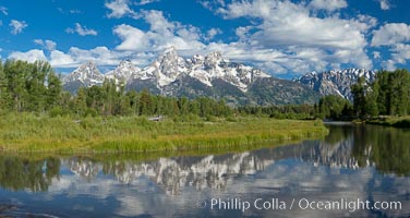
Panorama of the Teton Range, reflected in the still waters of Schwabacher Landing, a sidewater of the Snake River.
Location: Grand Teton National Park, Wyoming
Image ID: 26922
Panorama dimensions: 5370 x 10106
Location: Grand Teton National Park, Wyoming
Image ID: 26922
Panorama dimensions: 5370 x 10106
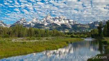
The Grand Tetons, reflected in the glassy waters of the Snake River at Schwabacher Landing, on a beautiful summer morning.
Location: Grand Teton National Park, Wyoming
Image ID: 26930
Location: Grand Teton National Park, Wyoming
Image ID: 26930

The Grand Tetons, reflected in the glassy waters of the Snake River at Schwabacher Landing, on a beautiful summer morning.
Location: Grand Teton National Park, Wyoming
Image ID: 26931
Location: Grand Teton National Park, Wyoming
Image ID: 26931

The Grand Tetons, reflected in the glassy waters of the Snake River at Schwabacher Landing, on a beautiful summer morning.
Location: Grand Teton National Park, Wyoming
Image ID: 26932
Location: Grand Teton National Park, Wyoming
Image ID: 26932
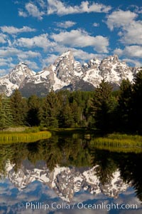
The Grand Tetons, reflected in the glassy waters of the Snake River at Schwabacher Landing, on a beautiful summer morning.
Location: Grand Teton National Park, Wyoming
Image ID: 26933
Location: Grand Teton National Park, Wyoming
Image ID: 26933
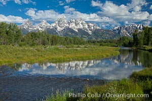
The Grand Tetons, reflected in the glassy waters of the Snake River at Schwabacher Landing, on a beautiful summer morning.
Location: Grand Teton National Park, Wyoming
Image ID: 26934
Location: Grand Teton National Park, Wyoming
Image ID: 26934
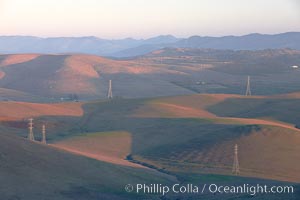
Hills between Morro Bay and Atascadero, early morning light, power transmission lines and signal attenae.
Location: Morro Bay, California
Image ID: 22217
Location: Morro Bay, California
Image ID: 22217
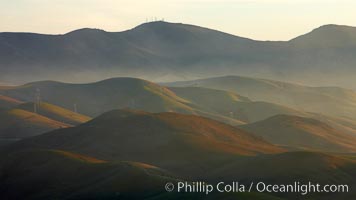
Hills between Morro Bay and Atascadero, early morning light, power transmission lines and signal attenae.
Location: Morro Bay, California
Image ID: 22222
Location: Morro Bay, California
Image ID: 22222
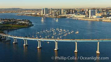
San Diego Coronado Bridge, known locally as the Coronado Bridge, links San Diego with Coronado, California. The bridge was completed in 1969 and was a toll bridge until 2002. It is 2.1 miles long and reaches a height of 200 feet above San Diego Bay. Coronado Island is to the left, and downtown San Diego is to the right in this view looking north.
Location: San Diego, California
Image ID: 22299
Location: San Diego, California
Image ID: 22299
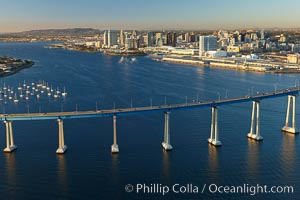
San Diego Coronado Bridge, known locally as the Coronado Bridge, links San Diego with Coronado, California. The bridge was completed in 1969 and was a toll bridge until 2002. It is 2.1 miles long and reaches a height of 200 feet above San Diego Bay. Coronado Island is to the left, and downtown San Diego is to the right in this view looking north.
Location: San Diego, California
Image ID: 22306
Location: San Diego, California
Image ID: 22306
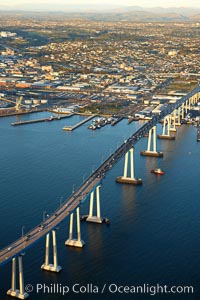
San Diego Coronado Bridge, known locally as the Coronado Bridge, links San Diego with Coronado, California. The bridge was completed in 1969 and was a toll bridge until 2002. It is 2.1 miles long and reaches a height of 200 feet above San Diego Bay.
Location: San Diego, California
Image ID: 22326
Location: San Diego, California
Image ID: 22326
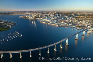
San Diego Coronado Bridge, known locally as the Coronado Bridge, links San Diego with Coronado, California. The bridge was completed in 1969 and was a toll bridge until 2002. It is 2.1 miles long and reaches a height of 200 feet above San Diego Bay. Coronado Island is to the left, and downtown San Diego is to the right in this view looking north.
Location: San Diego, California
Image ID: 22365
Location: San Diego, California
Image ID: 22365
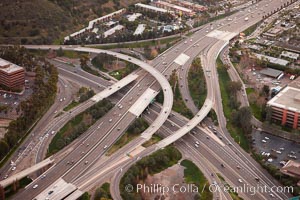
Freeway intersection, Interstate 8 and Highway 163, looking west.
Location: San Diego, California
Image ID: 22392
Location: San Diego, California
Image ID: 22392
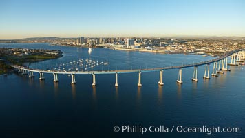
San Diego Coronado Bridge, known locally as the Coronado Bridge, links San Diego with Coronado, California. The bridge was completed in 1969 and was a toll bridge until 2002. It is 2.1 miles long and reaches a height of 200 feet above San Diego Bay. Coronado Island is to the left, and downtown San Diego is to the right in this view looking north.
Location: San Diego, California
Image ID: 22401
Location: San Diego, California
Image ID: 22401
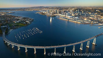
San Diego Coronado Bridge, known locally as the Coronado Bridge, links San Diego with Coronado, California. The bridge was completed in 1969 and was a toll bridge until 2002. It is 2.1 miles long and reaches a height of 200 feet above San Diego Bay. Coronado Island is to the left, and downtown San Diego is to the right in this view looking north.
Location: San Diego, California
Image ID: 22432
Location: San Diego, California
Image ID: 22432
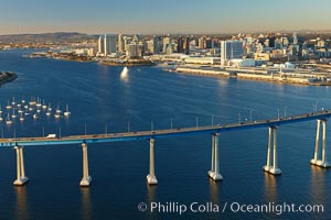
San Diego Coronado Bridge, known locally as the Coronado Bridge, links San Diego with Coronado, California. The bridge was completed in 1969 and was a toll bridge until 2002. It is 2.1 miles long and reaches a height of 200 feet above San Diego Bay. Coronado Island is to the left, and downtown San Diego is to the right in this view looking north.
Location: San Diego, California
Image ID: 22433
Location: San Diego, California
Image ID: 22433
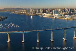
San Diego Coronado Bridge, known locally as the Coronado Bridge, links San Diego with Coronado, California. The bridge was completed in 1969 and was a toll bridge until 2002. It is 2.1 miles long and reaches a height of 200 feet above San Diego Bay. Coronado Island is to the left, and downtown San Diego is to the right in this view looking north.
Location: San Diego, California
Image ID: 22460
Location: San Diego, California
Image ID: 22460
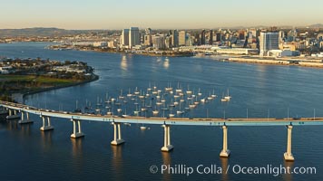
San Diego Coronado Bridge, known locally as the Coronado Bridge, links San Diego with Coronado, California. The bridge was completed in 1969 and was a toll bridge until 2002. It is 2.1 miles long and reaches a height of 200 feet above San Diego Bay. Coronado Island is to the left, and downtown San Diego is to the right in this view looking north.
Location: San Diego, California
Image ID: 22461
Location: San Diego, California
Image ID: 22461
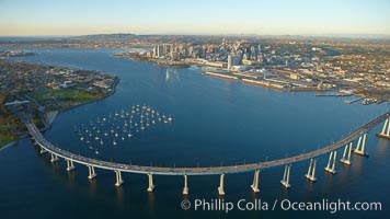
San Diego Coronado Bridge, known locally as the Coronado Bridge, links San Diego with Coronado, California. The bridge was completed in 1969 and was a toll bridge until 2002. It is 2.1 miles long and reaches a height of 200 feet above San Diego Bay. Coronado Island is to the left, and downtown San Diego is to the right in this view looking north.
Location: San Diego, California
Image ID: 22466
Location: San Diego, California
Image ID: 22466
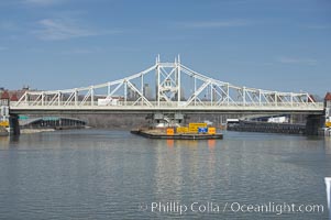
Macombs Dam Bridge. Macombs Dam Bridge is a swing bridge that spans the Harlem River in New York City, connecting the boroughs of Manhattan and the Bronx near Yankee Stadium. It is the third-oldest bridge in New York City and was designated an official landmark in January of 1992. The bridge is operated and maintained by the New York City Department of Transportation.
Location: Manhattan, New York City
Image ID: 11147
Location: Manhattan, New York City
Image ID: 11147