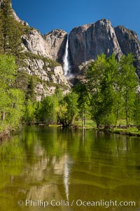
Yosemite Falls rises above the Merced River, viewed from the Swinging Bridge. The 2425' falls is the tallest in North America.
Location: Yosemite Falls, Yosemite National Park, California
Image ID: 34547
Panorama dimensions: 7921 x 5281
Location: Yosemite Falls, Yosemite National Park, California
Image ID: 34547
Panorama dimensions: 7921 x 5281
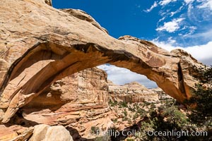
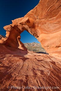
Hickman Bridge, Capitol Reef National Park.
Location: Capitol Reef National Park, Utah
Image ID: 37013
Location: Capitol Reef National Park, Utah
Image ID: 37013
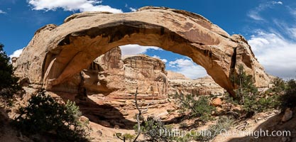
Hickman Bridge, Capitol Reef National Park.
Location: Capitol Reef National Park, Utah
Image ID: 37014
Panorama dimensions: 6222 x 12749
Location: Capitol Reef National Park, Utah
Image ID: 37014
Panorama dimensions: 6222 x 12749
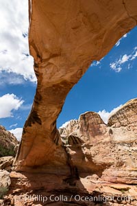
Hickman Bridge, Capitol Reef National Park.
Location: Capitol Reef National Park, Utah
Image ID: 37015
Location: Capitol Reef National Park, Utah
Image ID: 37015
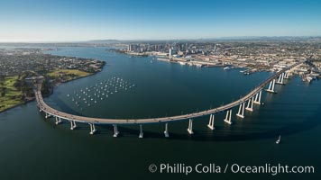
Aerial Photo of San Diego Coronado Bridge, known locally as the Coronado Bridge, links San Diego with Coronado, California. The bridge was completed in 1969 and was a toll bridge until 2002. It is 2.1 miles long and reaches a height of 200 feet above San Diego Bay. Coronado Island is to the left, and downtown San Diego is to the right in this view looking north.
Image ID: 30761
Image ID: 30761
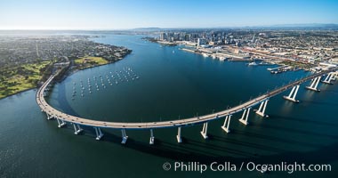
Aerial Photo of San Diego Coronado Bridge, known locally as the Coronado Bridge, links San Diego with Coronado, California. The bridge was completed in 1969 and was a toll bridge until 2002. It is 2.1 miles long and reaches a height of 200 feet above San Diego Bay. Coronado Island is to the left, and downtown San Diego is to the right in this view looking north.
Image ID: 30762
Image ID: 30762
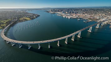
Aerial Photo of San Diego Coronado Bridge, known locally as the Coronado Bridge, links San Diego with Coronado, California. The bridge was completed in 1969 and was a toll bridge until 2002. It is 2.1 miles long and reaches a height of 200 feet above San Diego Bay. Coronado Island is to the left, and downtown San Diego is to the right in this view looking north.
Image ID: 30763
Image ID: 30763
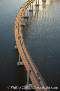
San Diego Coronado Bridge, known locally as the Coronado Bridge, links San Diego with Coronado, California. The bridge was completed in 1969 and was a toll bridge until 2002. It is 2.1 miles long and reaches a height of 200 feet above San Diego Bay.
Location: San Diego, California
Image ID: 22327
Location: San Diego, California
Image ID: 22327
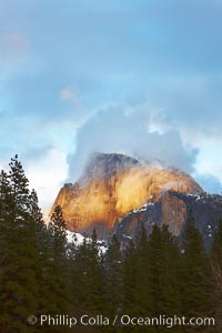
Half Dome and storm clouds at sunset, viewed from Sentinel Bridge.
Location: Half Dome, Yosemite National Park, California
Image ID: 22760
Location: Half Dome, Yosemite National Park, California
Image ID: 22760
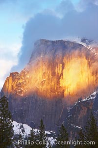
Half Dome and storm clouds at sunset, viewed from Sentinel Bridge.
Location: Half Dome, Yosemite National Park, California
Image ID: 22761
Location: Half Dome, Yosemite National Park, California
Image ID: 22761

Fern Springs, a small natural spring in Yosemite Valley near the Pohono Bridge, trickles quietly over rocks as it flows into the Merced River. Yosemite Valley.
Location: Fern Springs, Yosemite National Park, California
Image ID: 16086
Location: Fern Springs, Yosemite National Park, California
Image ID: 16086
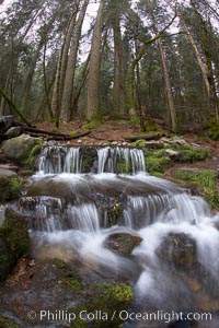
Fern Springs, a small natural spring in Yosemite Valley near the Pohono Bridge, trickles quietly over rocks as it flows into the Merced River.
Location: Fern Springs, Yosemite National Park, California
Image ID: 22754
Location: Fern Springs, Yosemite National Park, California
Image ID: 22754
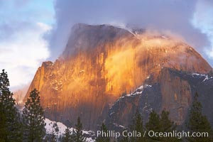
Half Dome and storm clouds at sunset, viewed from Sentinel Bridge.
Location: Half Dome, Yosemite National Park, California
Image ID: 22762
Location: Half Dome, Yosemite National Park, California
Image ID: 22762
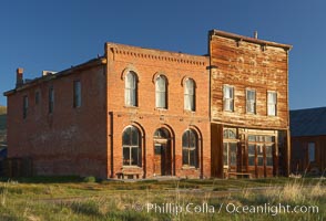
Main Street buildings, Dechambeau Hotel (left) and I.O.O.F. Hall (right).
Location: Bodie State Historical Park, California
Image ID: 23104
Location: Bodie State Historical Park, California
Image ID: 23104

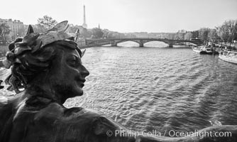
Ile Saint-Louis, is one of two natural islands in the Seine river, in Paris, France. The island is named after King Louis IX of France (Saint Louis). The island is connected to the rest of Paris by bridges to both banks of the river and by the Pont Saint Louis to the Ile de la Cite.
Location: Ile Saint-Louis, Paris, France
Image ID: 28189
Panorama dimensions: 3437 x 12063
Location: Ile Saint-Louis, Paris, France
Image ID: 28189
Panorama dimensions: 3437 x 12063
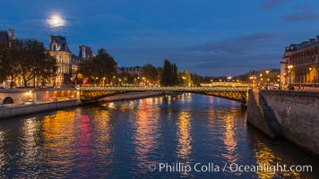
Ile Saint-Louis, is one of two natural islands in the Seine river, in Paris, France. The island is named after King Louis IX of France (Saint Louis). The island is connected to the rest of Paris by bridges to both banks of the river and by the Pont Saint Louis to the Ile de la Cite.
Location: Ile Saint-Louis, Paris, France
Image ID: 28190
Location: Ile Saint-Louis, Paris, France
Image ID: 28190
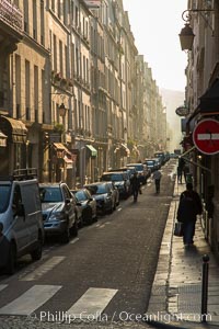
Rue de Ile Saint-Louis, early morning, Paris. Ile Saint-Louis is one of two natural islands in the Seine river, in Paris, France. The island is named after King Louis IX of France (Saint Louis). The island is connected to the rest of Paris by bridges to both banks of the river and by the Pont Saint Louis to the Ile de la Cite.
Location: Ile Saint-Louis, Paris, France
Image ID: 28216
Location: Ile Saint-Louis, Paris, France
Image ID: 28216
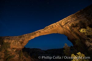
Owachomo Bridge at sunset, stars and blue sky. Owachomo Bridge, a natural stone bridge standing 106' high and spanning 130' wide,stretches across a canyon with the Milky Way crossing the night sky.
Location: Owachomo Bridge, Natural Bridges National Monument, Utah
Image ID: 28546
Location: Owachomo Bridge, Natural Bridges National Monument, Utah
Image ID: 28546
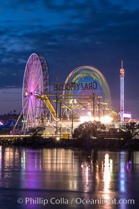
Del Mar Fair and San Dieguito Lagoon at Night. Lights from the San Diego Fair reflect in San Dieguito Lagooon, with the train track trestles to the left.
Location: Del Mar, California
Image ID: 31022
Location: Del Mar, California
Image ID: 31022
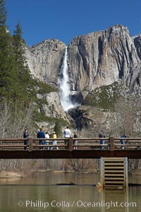
Visitors admire Yosemite Falls from the Swinging Bridge, Leidig Meadow.
Location: Yosemite Falls, Yosemite National Park, California
Image ID: 22758
Location: Yosemite Falls, Yosemite National Park, California
Image ID: 22758
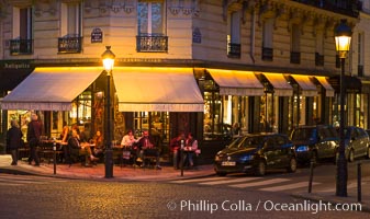
Ile Saint-Louis, is one of two natural islands in the Seine river, in Paris, France. The island is named after King Louis IX of France (Saint Louis). The island is connected to the rest of Paris by bridges to both banks of the river and by the Pont Saint Louis to the Ile de la Cite.
Location: Ile Saint-Louis, Paris, France
Image ID: 28201
Location: Ile Saint-Louis, Paris, France
Image ID: 28201
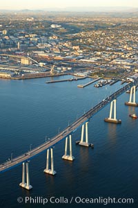
San Diego Coronado Bridge, known locally as the Coronado Bridge, links San Diego with Coronado, California. The bridge was completed in 1969 and was a toll bridge until 2002. It is 2.1 miles long and reaches a height of 200 feet above San Diego Bay. Coronado Island is to the left, and downtown San Diego is to the right in this view looking north.
Location: San Diego, California
Image ID: 22467
Location: San Diego, California
Image ID: 22467
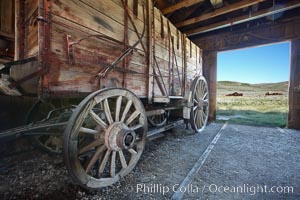
Wagon and interior of County Barn, Brown House and Moyle House in distance.
Location: Bodie State Historical Park, California
Image ID: 23106
Location: Bodie State Historical Park, California
Image ID: 23106
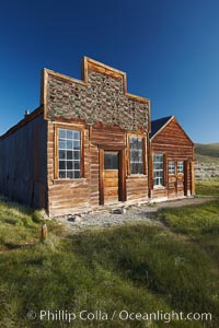
Barber shop, front porch and facade, Main Street.
Location: Bodie State Historical Park, California
Image ID: 23107
Location: Bodie State Historical Park, California
Image ID: 23107
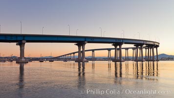
Coronado Bridge, linking San Diego to Coronado, sunrise, viewed from Coronado Island. San Diego Coronado Bridge, known locally as the Coronado Bridge, links San Diego with Coronado, California. The bridge was completed in 1969 and was a toll bridge until 2002. It is 2.1 miles long and reaches a height of 200 feet above San Diego Bay.
Location: San Diego, California
Image ID: 27094
Location: San Diego, California
Image ID: 27094
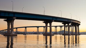
Coronado Bridge, linking San Diego to Coronado, sunrise, viewed from Coronado Island. San Diego Coronado Bridge, known locally as the Coronado Bridge, links San Diego with Coronado, California. The bridge was completed in 1969 and was a toll bridge until 2002. It is 2.1 miles long and reaches a height of 200 feet above San Diego Bay.
Location: San Diego, California
Image ID: 27095
Location: San Diego, California
Image ID: 27095
