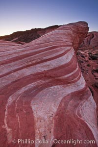
The Fire Wave, a beautiful sandstone formation exhibiting dramatic striations, striped layers in the geologic historical record.
Location: Valley of Fire State Park, Nevada
Image ID: 26517
Location: Valley of Fire State Park, Nevada
Image ID: 26517
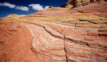
Striations in sandstone tell of eons of sedimentary deposits, a visible geologic record of the time when this region was under the sea.
Location: North Coyote Buttes, Paria Canyon-Vermilion Cliffs Wilderness, Arizona
Image ID: 20612
Location: North Coyote Buttes, Paria Canyon-Vermilion Cliffs Wilderness, Arizona
Image ID: 20612
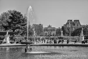
Jardin des Tuileries. The Tuileries Garden is a public garden located between the Louvre Museum and the Place de la Concorde in the 1st arrondissement of Paris. created by Catherine de Medicis as the garden of the Tuileries Palace in 1564.
Location: Jardin des Tuileries, Paris, France
Image ID: 28229
Location: Jardin des Tuileries, Paris, France
Image ID: 28229
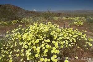
Springtime wildflowers bloom in Joshua Tree National Park following record rainfall in 2005.
Location: Joshua Tree National Park, California
Image ID: 11960
Location: Joshua Tree National Park, California
Image ID: 11960
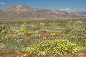
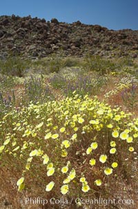
Springtime wildflowers bloom in Joshua Tree National Park following record rainfall in 2005.
Location: Joshua Tree National Park, California
Image ID: 11961
Location: Joshua Tree National Park, California
Image ID: 11961
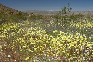
Springtime wildflowers bloom in Joshua Tree National Park following record rainfall in 2005.
Location: Joshua Tree National Park, California
Image ID: 11962
Location: Joshua Tree National Park, California
Image ID: 11962
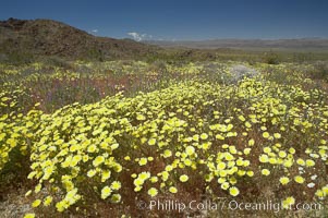
Springtime wildflowers bloom in Joshua Tree National Park following record rainfall in 2005.
Location: Joshua Tree National Park, California
Image ID: 11963
Location: Joshua Tree National Park, California
Image ID: 11963
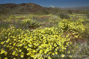
Springtime wildflowers bloom in Joshua Tree National Park following record rainfall in 2005.
Location: Joshua Tree National Park, California
Image ID: 11964
Location: Joshua Tree National Park, California
Image ID: 11964
Springtime wildflowers bloom in Joshua Tree National Park following record rainfall in 2005.
Location: Joshua Tree National Park, California
Image ID: 11965
Location: Joshua Tree National Park, California
Image ID: 11965
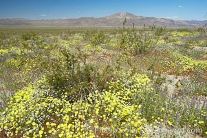
Springtime wildflowers bloom in Joshua Tree National Park following record rainfall in 2005.
Location: Joshua Tree National Park, California
Image ID: 11966
Location: Joshua Tree National Park, California
Image ID: 11966
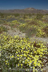
Springtime wildflowers bloom in Joshua Tree National Park following record rainfall in 2005.
Location: Joshua Tree National Park, California
Image ID: 11967
Location: Joshua Tree National Park, California
Image ID: 11967
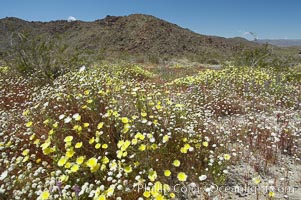
Springtime wildflowers bloom in Joshua Tree National Park following record rainfall in 2005.
Location: Joshua Tree National Park, California
Image ID: 11968
Location: Joshua Tree National Park, California
Image ID: 11968
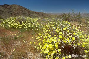
Springtime wildflowers bloom in Joshua Tree National Park following record rainfall in 2005.
Location: Joshua Tree National Park, California
Image ID: 11969
Location: Joshua Tree National Park, California
Image ID: 11969
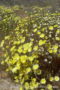
Springtime wildflowers bloom in Joshua Tree National Park following record rainfall in 2005.
Location: Joshua Tree National Park, California
Image ID: 11970
Location: Joshua Tree National Park, California
Image ID: 11970
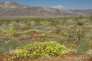
Springtime wildflowers bloom in Joshua Tree National Park following record rainfall in 2005.
Location: Joshua Tree National Park, California
Image ID: 11971
Location: Joshua Tree National Park, California
Image ID: 11971
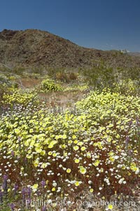
Springtime wildflowers bloom in Joshua Tree National Park following record rainfall in 2005.
Location: Joshua Tree National Park, California
Image ID: 11972
Location: Joshua Tree National Park, California
Image ID: 11972
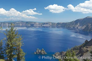
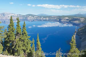
Crater Lake. Crater Lake is the six-mile wide lake inside the collapsed caldera of volcanic Mount Mazama. Crater Lake is the deepest lake in the United States and the seventh-deepest in the world. Its maximum recorded depth is 1996 feet (608m). It lies at an altitude of 6178 feet (1880m).
Location: Crater Lake National Park, Oregon
Image ID: 13932
Location: Crater Lake National Park, Oregon
Image ID: 13932
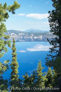
Crater Lake. Crater Lake is the six-mile wide lake inside the collapsed caldera of volcanic Mount Mazama. Crater Lake is the deepest lake in the United States and the seventh-deepest in the world. Its maximum recorded depth is 1996 feet (608m). It lies at an altitude of 6178 feet (1880m).
Location: Crater Lake National Park, Oregon
Image ID: 13934
Location: Crater Lake National Park, Oregon
Image ID: 13934
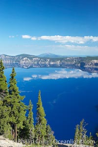
Crater Lake. Crater Lake is the six-mile wide lake inside the collapsed caldera of volcanic Mount Mazama. Crater Lake is the deepest lake in the United States and the seventh-deepest in the world. Its maximum recorded depth is 1996 feet (608m). It lies at an altitude of 6178 feet (1880m).
Location: Crater Lake National Park, Oregon
Image ID: 13938
Location: Crater Lake National Park, Oregon
Image ID: 13938
Crater Lake. Crater Lake is the six-mile wide lake inside the collapsed caldera of volcanic Mount Mazama. Crater Lake is the deepest lake in the United States and the seventh-deepest in the world. Its maximum recorded depth is 1996 feet (608m). It lies at an altitude of 6178 feet (1880m).
Location: Crater Lake National Park, Oregon
Image ID: 13940
Location: Crater Lake National Park, Oregon
Image ID: 13940

Panorama of Crater Lake at sunrise. Crater Lake is the six-mile wide lake inside the collapsed caldera of volcanic Mount Mazama. Crater Lake is the deepest lake in the United States and the seventh-deepest in the world. Its maximum recorded depth is 1996 feet (608m). It lies at an altitude of 6178 feet (1880m).
Location: Crater Lake National Park, Oregon
Image ID: 19114
Panorama dimensions: 4871 x 17774
Location: Crater Lake National Park, Oregon
Image ID: 19114
Panorama dimensions: 4871 x 17774

Panorama of Crater Lake, early morning. Crater Lake is the six-mile wide lake inside the collapsed caldera of volcanic Mount Mazama. Crater Lake is the deepest lake in the United States and the seventh-deepest in the world. Its maximum recorded depth is 1996 feet (608m). It lies at an altitude of 6178 feet (1880m).
Location: Crater Lake National Park, Oregon
Image ID: 19115
Panorama dimensions: 3205 x 22973
Location: Crater Lake National Park, Oregon
Image ID: 19115
Panorama dimensions: 3205 x 22973

Panorama of Crater Lake, early morning. Crater Lake is the six-mile wide lake inside the collapsed caldera of volcanic Mount Mazama. Crater Lake is the deepest lake in the United States and the seventh-deepest in the world. Its maximum recorded depth is 1996 feet (608m). It lies at an altitude of 6178 feet (1880m).
Location: Crater Lake National Park, Oregon
Image ID: 19116
Panorama dimensions: 4558 x 13838
Location: Crater Lake National Park, Oregon
Image ID: 19116
Panorama dimensions: 4558 x 13838
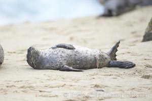
Pacific harbor seal, newborn pup with umbilical cord.
Species: Pacific harbor seal, Phoca vitulina richardsi
Location: La Jolla, California
Image ID: 20448
Species: Pacific harbor seal, Phoca vitulina richardsi
Location: La Jolla, California
Image ID: 20448
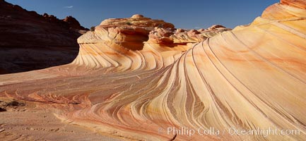
The Second Wave at sunset. The Second Wave, a curiously-shaped sandstone swirl, takes on rich warm tones and dramatic shadowed textures at sunset. Set in the North Coyote Buttes of Arizona and Utah, the Second Wave is characterized by striations revealing layers of sedimentary deposits, a visible historical record depicting eons of submarine geology.
Location: North Coyote Buttes, Paria Canyon-Vermilion Cliffs Wilderness, Arizona
Image ID: 20624
Location: North Coyote Buttes, Paria Canyon-Vermilion Cliffs Wilderness, Arizona
Image ID: 20624
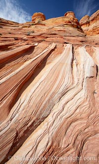
Striations in sandstone tell of eons of sedimentary deposits, a visible geologic record of the time when this region was under the sea.
Location: North Coyote Buttes, Paria Canyon-Vermilion Cliffs Wilderness, Arizona
Image ID: 20627
Location: North Coyote Buttes, Paria Canyon-Vermilion Cliffs Wilderness, Arizona
Image ID: 20627
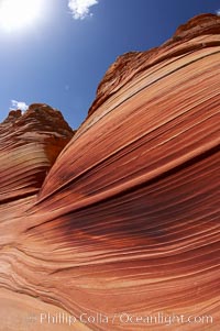
Striations in sandstone tell of eons of sedimentary deposits, a visible geologic record of the time when this region was under the sea.
Location: North Coyote Buttes, Paria Canyon-Vermilion Cliffs Wilderness, Arizona
Image ID: 20633
Location: North Coyote Buttes, Paria Canyon-Vermilion Cliffs Wilderness, Arizona
Image ID: 20633
