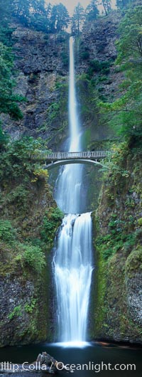
Multnomah Falls. Plummeting 620 feet from its origins on Larch Mountain, Multnomah Falls is the second highest year-round waterfall in the United States. Nearly two million visitors a year come to see this ancient waterfall making it Oregon's number one public destination.
Location: Multnomah Falls, Columbia River Gorge National Scenic Area, Oregon
Image ID: 19313
Panorama dimensions: 12453 x 4705
Location: Multnomah Falls, Columbia River Gorge National Scenic Area, Oregon
Image ID: 19313
Panorama dimensions: 12453 x 4705
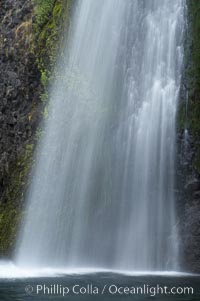
Horsetail Falls drops 176 feet just a few yards off the Columbia Gorge Scenic Highway.
Location: Horsetail Falls, Columbia River Gorge National Scenic Area, Oregon
Image ID: 19318
Location: Horsetail Falls, Columbia River Gorge National Scenic Area, Oregon
Image ID: 19318
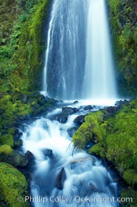
Wahkeena Falls drops 249 feet in several sections through a lush green temperate rainforest.
Location: Wahkeena Falls, Columbia River Gorge National Scenic Area, Oregon
Image ID: 19324
Location: Wahkeena Falls, Columbia River Gorge National Scenic Area, Oregon
Image ID: 19324
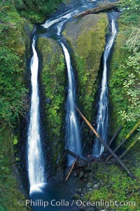
Triple Falls, in the upper part of Oneonta Gorge, fall 130 feet through a lush, beautiful temperate rainforest.
Location: Triple Falls, Columbia River Gorge National Scenic Area, Oregon
Image ID: 19326
Location: Triple Falls, Columbia River Gorge National Scenic Area, Oregon
Image ID: 19326
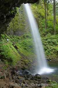
Ponytail Falls, where Horsetail Creeks drops 100 feet over an overhang below which hikers can walk.
Location: Ponytail Falls, Columbia River Gorge National Scenic Area, Oregon
Image ID: 19337
Location: Ponytail Falls, Columbia River Gorge National Scenic Area, Oregon
Image ID: 19337
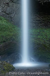
Latourelle Falls, in Guy W. Talbot State Park, drops 249 feet through a lush forest near the Columbia River.
Location: Latourelle Falls, Columbia River Gorge National Scenic Area, Oregon
Image ID: 19347
Location: Latourelle Falls, Columbia River Gorge National Scenic Area, Oregon
Image ID: 19347
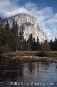
El Capitan and Merced River, Yosemite Valley.
Location: El Capitan, Yosemite National Park, California
Image ID: 05413
Location: El Capitan, Yosemite National Park, California
Image ID: 05413
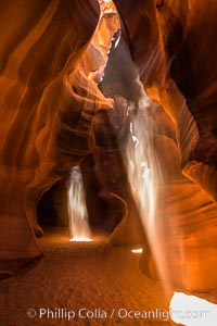
Light Beam in Upper Antelope Slot Canyon. Thin shafts of light briefly penetrate the convoluted narrows of Upper Antelope Slot Canyon, sending piercing beams through the sandstone maze to the sand floor below.
Location: Navajo Tribal Lands, Page, Arizona
Image ID: 28561
Location: Navajo Tribal Lands, Page, Arizona
Image ID: 28561
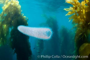
Pyrosome drifting through a kelp forest, Catalina Island. Pyrosomes are free-floating colonial tunicates that usually live in the upper layers of the open ocean in warm seas. Pyrosomes are cylindrical or cone-shaped colonies made up of hundreds to thousands of individuals, known as zooids.
Location: Catalina Island, California
Image ID: 37166
Location: Catalina Island, California
Image ID: 37166
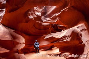
A hiker admiring the striated walls and dramatic light within Antelope Canyon, a deep narrow slot canyon formed by water and wind erosion.
Location: Navajo Tribal Lands, Page, Arizona
Image ID: 18009
Location: Navajo Tribal Lands, Page, Arizona
Image ID: 18009
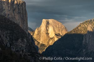
Half Dome at Sunset, Yosemite National Park.
Location: Yosemite National Park, California
Image ID: 34545
Location: Yosemite National Park, California
Image ID: 34545
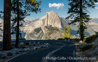
Half Dome and the Glacier Point Road, Yosemite National Park.
Location: Yosemite National Park, California
Image ID: 36380
Location: Yosemite National Park, California
Image ID: 36380
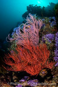
Red gorgonian Leptogorgia chilensis. The lower sea fan has its polyps retracted while the upper sea fan has all of its polyps extended into the current. Farnsworth Banks, Catalina Island, California.
Species: Red gorgonian, Leptogorgia chilensis, Lophogorgia chilensis
Location: Catalina Island, California
Image ID: 37266
Species: Red gorgonian, Leptogorgia chilensis, Lophogorgia chilensis
Location: Catalina Island, California
Image ID: 37266
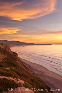
Sunset falls upon Torrey Pines State Reserve, viewed from the Torrey Pines glider port. La Jolla, Scripps Institution of Oceanography and Scripps Pier are seen in the distance.
Location: La Jolla, California
Image ID: 26436
Location: La Jolla, California
Image ID: 26436
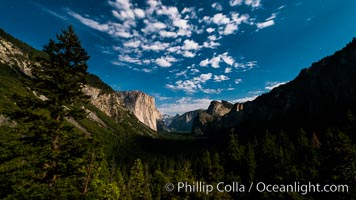
Yosemite Valley and stars lit by full moon, evening.
Location: Yosemite National Park, California
Image ID: 28697
Location: Yosemite National Park, California
Image ID: 28697
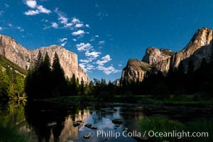
Yosemite Valley and stars lit by full moon, evening.
Location: Yosemite National Park, California
Image ID: 28702
Location: Yosemite National Park, California
Image ID: 28702
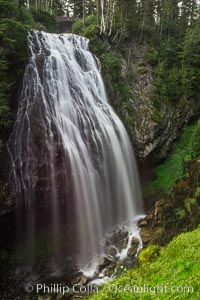
Narada Falls cascades down a cliff, with the flow blurred by a time exposure. Narada Falls is a 188 foot (57m) waterfall in Mount Rainier National Park.
Location: Narada Falls, Mount Rainier National Park, Washington
Image ID: 28720
Location: Narada Falls, Mount Rainier National Park, Washington
Image ID: 28720
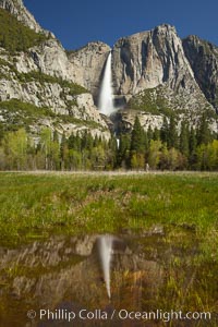
Yosemite Falls reflected in a meadow pool, spring.
Location: Yosemite Falls, Yosemite National Park, California
Image ID: 27745
Location: Yosemite Falls, Yosemite National Park, California
Image ID: 27745
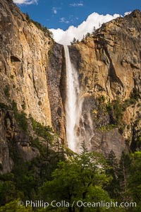
Bridalveil Falls at sunset, with clouds and blue sky in the background. Bridalveil Falls in Yosemite drops 620 feet (188 m) from a hanging valley to the floor of Yosemite Valley.
Location: Bridalveil Falls, Yosemite National Park, California
Image ID: 34540
Location: Bridalveil Falls, Yosemite National Park, California
Image ID: 34540
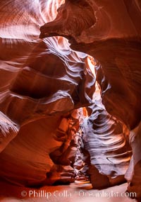
Upper Antelope Canyon, a deep, narrow and spectacular slot canyon lying on Navajo Tribal lands near Page, Arizona.
Location: Navajo Tribal Lands, Page, Arizona
Image ID: 35931
Location: Navajo Tribal Lands, Page, Arizona
Image ID: 35931
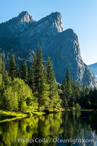
Three Brothers and Merced River in spring, Yosemite National Park.
Location: Yosemite National Park, California
Image ID: 36354
Location: Yosemite National Park, California
Image ID: 36354
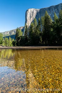
El Capitan and the Merced River, early morning, Yosemite National Park.
Location: Yosemite National Park, California
Image ID: 36355
Location: Yosemite National Park, California
Image ID: 36355
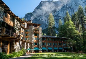
The Ahwahnee Hotel in Yosemite Valley, Yosemite National Park.
Location: Yosemite National Park, California
Image ID: 36356
Location: Yosemite National Park, California
Image ID: 36356
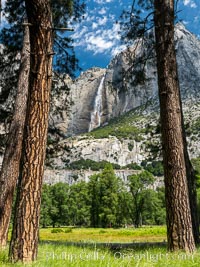
Yosemite Falls framed by Pine Trees, Cook's Meadow, Yosemite National Park.
Location: Yosemite National Park, California
Image ID: 36360
Location: Yosemite National Park, California
Image ID: 36360
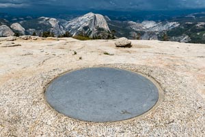
Sentinel Dome summit compass marker, with Half Dome in the distance, Yosemite National Park.
Location: Yosemite National Park, California
Image ID: 36363
Location: Yosemite National Park, California
Image ID: 36363
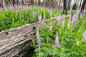
Lupine bloom in burned area after a forest fire, near Wawona, Yosemite National Park.
Location: Yosemite National Park, California
Image ID: 36367
Location: Yosemite National Park, California
Image ID: 36367
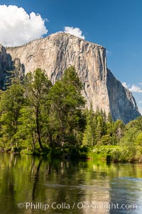
El Capitan and the Merced River in spring, Yosemite National Park.
Location: Yosemite National Park, California
Image ID: 36377
Location: Yosemite National Park, California
Image ID: 36377
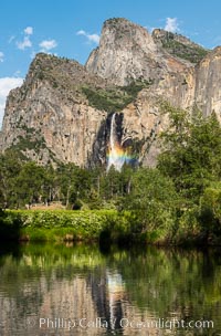
Rainbow in Bridalveil Falls, Yosemite National Park.
Location: Yosemite National Park, California
Image ID: 36378
Location: Yosemite National Park, California
Image ID: 36378
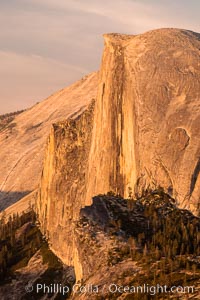
Sunset light on the face of Half Dome, Yosemite National Park.
Location: Yosemite National Park, California
Image ID: 36381
Location: Yosemite National Park, California
Image ID: 36381
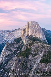
Pastel sunset light on Half Dome, Yosemite National Park.
Location: Yosemite National Park, California
Image ID: 36384
Location: Yosemite National Park, California
Image ID: 36384